Right now
Right now as of Oct 29, 2026
- Permit None needed.
Status note (Oct 29, 2026): Open year-round, per GFP's nature area page (checked Oct 25, 2026). We found no 2026 full closure of US 14A; a July 5, 2025 rockslide closed part of it until July 6. Check sd511.org before you drive. What the status labels mean
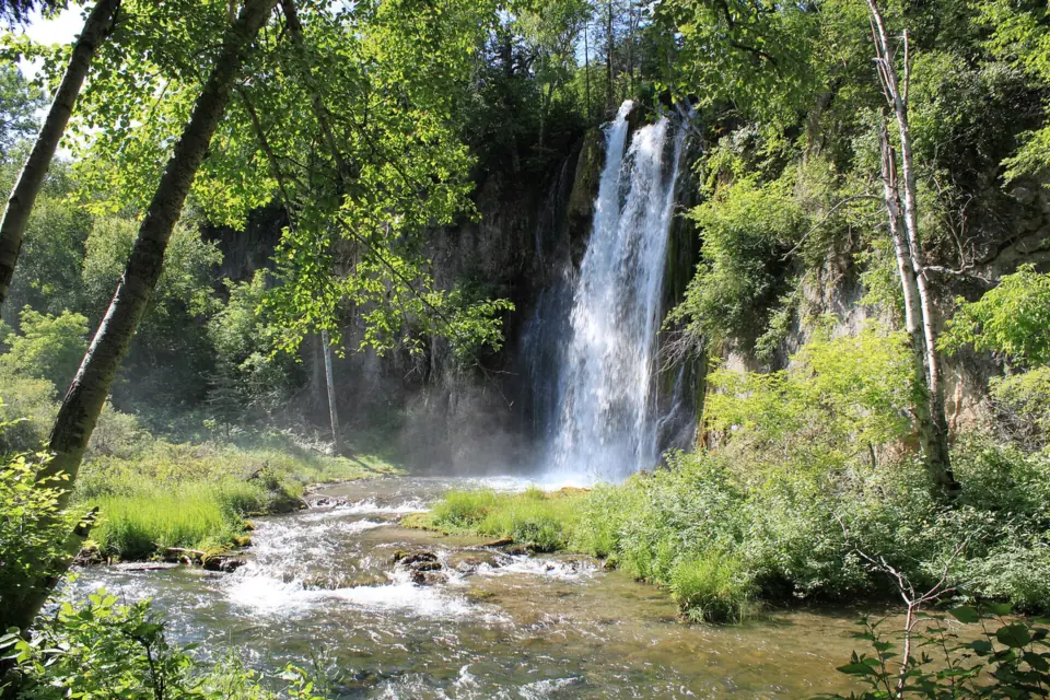
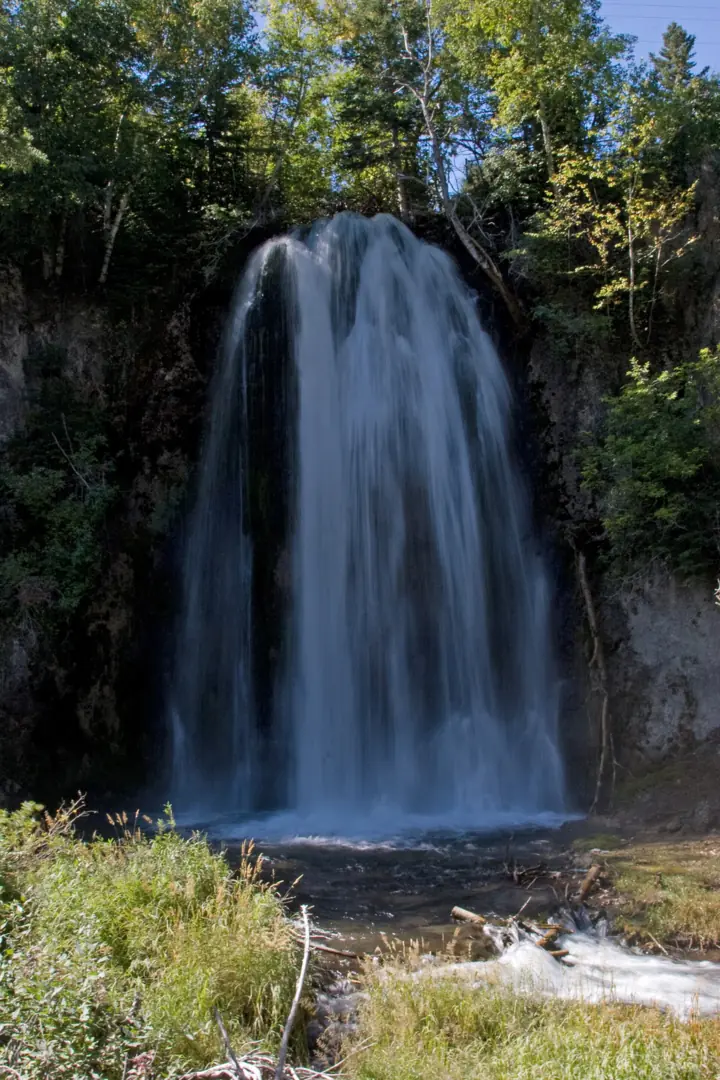
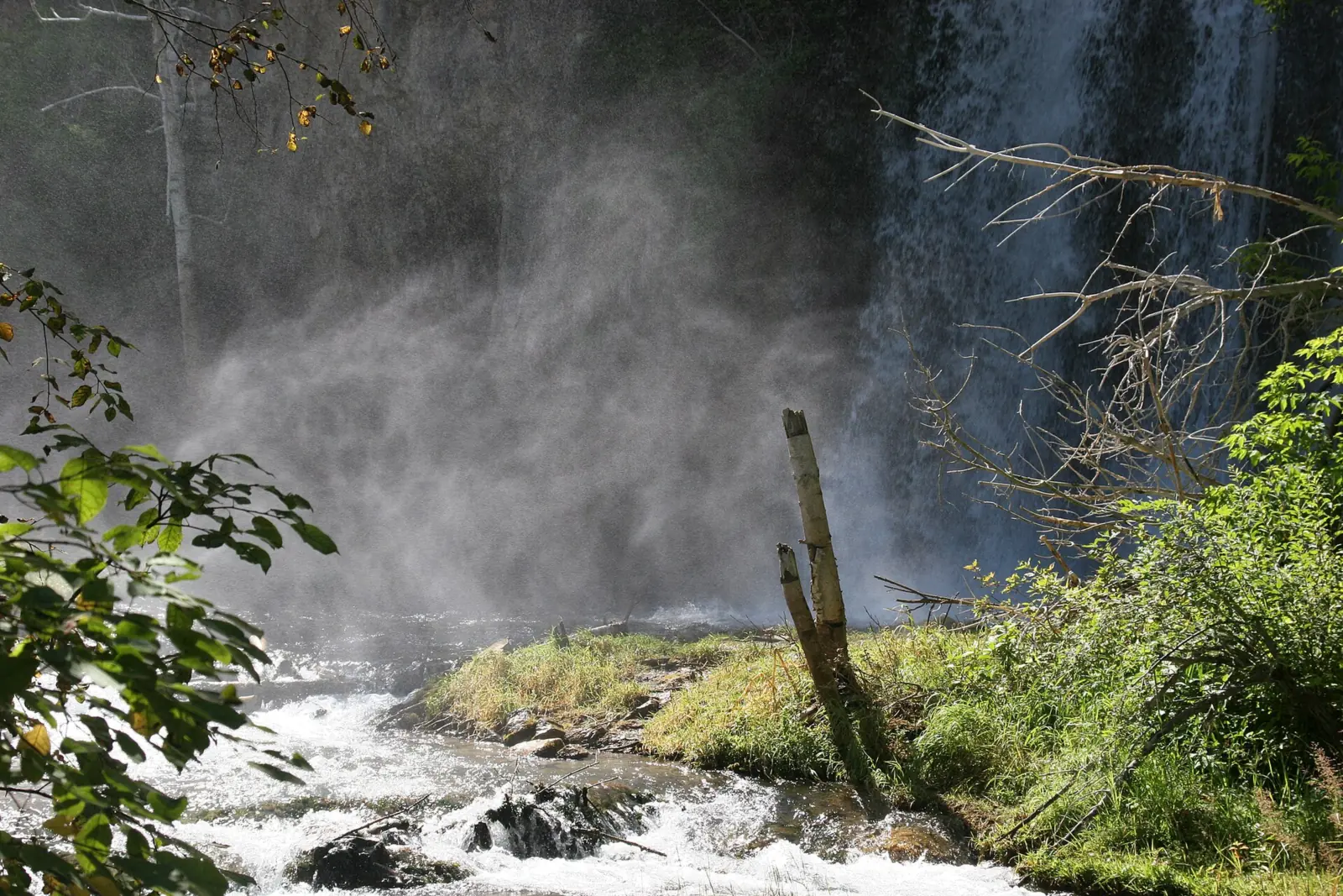
Spearfish Falls is a waterfall about 47 feet high, according to Travel South Dakota, where Little Spearfish Creek drops into Spearfish Canyon at Savoy. South Dakota Game, Fish and Parks (GFP) lists the trail at 0.7 mile one-way, rated easy to moderate. As of October 25, 2026, GFP listed the Spearfish Canyon Nature Area as open year-round, with no entrance fee. Roadside Bridal Veil Falls, about 60 feet per Travel South Dakota, is a second stop on US 14A.
About Spearfish Falls
Travel South Dakota describes 'the 47-foot waterfall that is Spearfish Falls.' We found no height from GFP or the Forest Service. Treat 47 feet as a tourism figure.
Spearfish Falls is where Little Spearfish Creek drops into Spearfish Canyon, at Savoy. South Dakota Game, Fish and Parks (GFP) manages the falls within the Spearfish Canyon Nature Area, which lies inside the Black Hills National Forest. Recreation.gov notes the trails are 'maintained by the State of South Dakota.'
Per the Forest Service, the byway follows an old railroad grade 'abandoned after massive flooding in 1933,' and Savoy was among the old rail stops and mining camps. The Forest Service calls the Spearfish Canyon byway 'the best place in the Black Hills to see waterfalls, including Bridal Veil, Little Spearfish & Roughlock Falls.'
Don't mix up Spearfish Falls with Little Spearfish Falls. GFP's current map labels a separate Little Spearfish Falls Trailhead near Little Spearfish Pond, so the two names point to different places.
For decades Spearfish Falls was often dry. Homestake Mining diverted Little Spearfish Creek through a flume to its Hydro Plant #2, according to third-party histories; we found no agency page on it. Third-party sources date the diversion to 1916 or 1917, which we could not confirm.
GFP's trail map also describes the diversion. It says Savoy Pond 'was originally created to divert water to an aqueduct that stretched 5 miles to the Maurice Hydro Plant further down the canyon.'
Flow has since returned. We read this line from DENR's 2003 mining report only as a search excerpt. The report says the aqueduct was closed and 'in November, year round flows returned to Spearfish Falls for the first time in many years.'
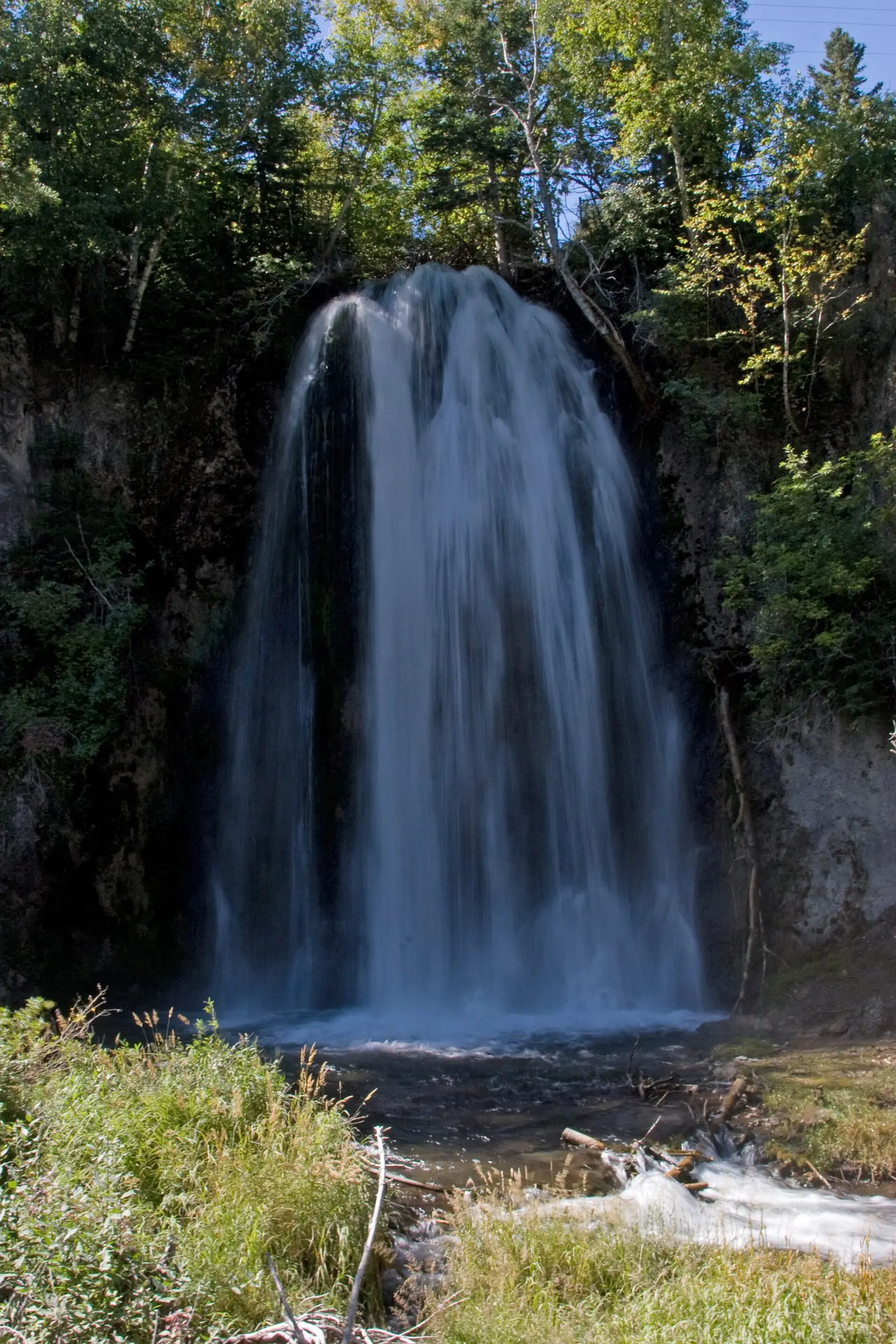
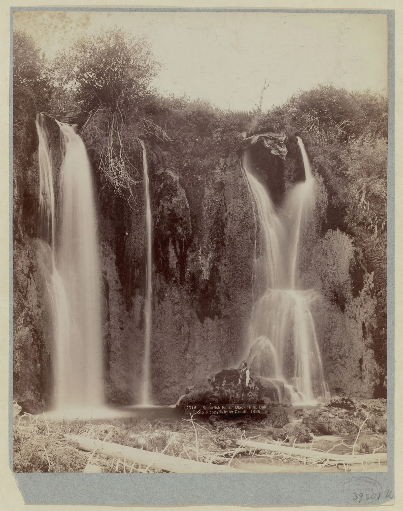
Geologists Fogarty and Stevens call Spearfish Falls 'the premier waterfall in Spearfish Canyon due to its persistent flow.' John C. H. Grabill photographed the falls in 1889, and that Library of Congress print is in the photo set on this page.
Getting there and parking
Drive US 14A through Spearfish Canyon to Savoy. Visit Spearfish says, 'Use the parking area near the restaurant for easy access to the Spearfish Falls trail.' GFP's map shows the trailhead beside the Latchstring Restaurant.
No permit applies, and GFP states 'No entrance fee required' for the nature area. GFP also lists vault toilets open year-round, but we could not confirm which lot they serve.
Plan this as a day trip with your own water. The Forest Service says 'Dispersed camping is not allowed in Spearfish Canyon' and that potable water is not available. Its Northern Hills Ranger District in Spearfish answers at (605) 642-4622.
Roughlock Falls is the other GFP falls at Savoy. You reach its trailheads on FS Road 222, about 1 mile west, but that road is closed December 15 through March 31. GFP says the trail from Spearfish Canyon Lodge to Roughlock stays open year-round.
For a waterfall in a city park, see Falls Park in Sioux Falls. Our South Dakota waterfalls guide compares it with both Spearfish Canyon falls.
Bridal Veil Falls in Spearfish Canyon
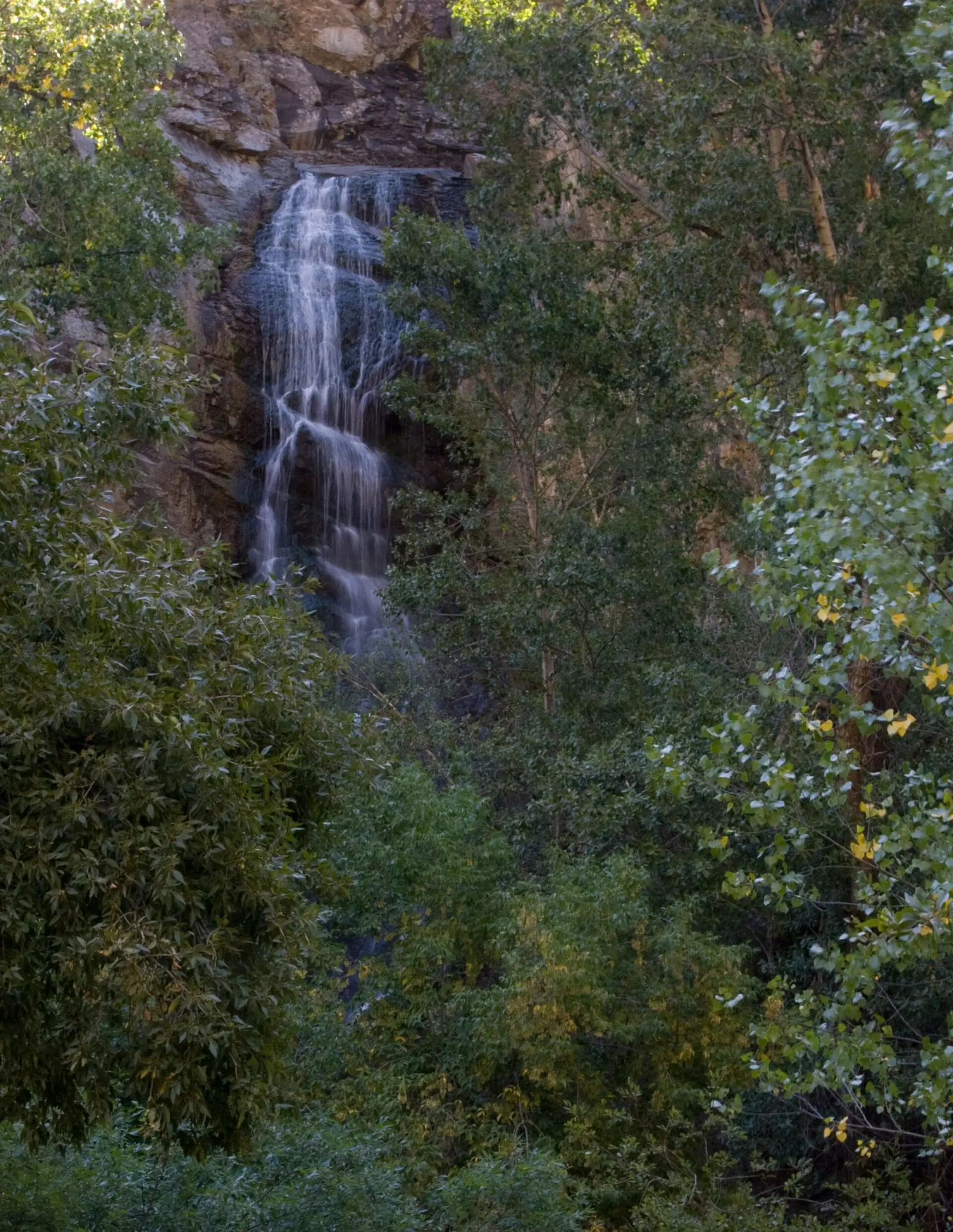
Bridal Veil Falls needs no hike. Travel South Dakota says it 'cascades down a sheer 60-foot cliff right alongside the road,' meaning US 14A. Visit Spearfish puts the height at 'approximately 60 feet' and says the falls sit next to a large parking lot.
The Forest Service built a viewing platform there for safety and erosion control, according to a search excerpt of its project decision dated July 2, 2012. The falls are on Black Hills National Forest land, and we found no fee.
Timing matters at Bridal Veil. Visit Spearfish says the flow is strong in spring and slower in late summer and fall. The September photo on this page shows how little water can be left. Wikipedia's Spearfish Canyon article says mountain goats are commonly seen near Bridal Veil Falls, so give them room.
Map and nearby falls
Map loads as you scroll. Open in OpenStreetMap
OpenPartly open / seasonalUnconfirmedClosedLarger map
The hike
GFP's current map describes the Spearfish Falls route like this: 'This trail descends into Spearfish Canyon and then follows Spearfish Creek to Spearfish Falls. LENGTH: 0.7 miles (one-way). DIFFICULTY: Easy-Moderate.' Plan on about 1.4 miles round trip.
Other figures run slightly longer. An older GFP sheet gave 0.75 mile one-way, rated moderate. Travel South Dakota describes 'a moderate (1.5 miles roundtrip) path.' We found no official walking time.
Because the trail goes down into the canyon, the return leg climbs back up. GFP gives the route no accessible designation.
GFP's map marks upper and lower observation areas at the falls.
Dog rules here follow ARSD 41:03:01:13 and depend on the date. April 1 through September 30, the exception is a dog under control and over 200 feet from people. Otherwise, keep your dog 'under immediate control on a leash not more than ten feet long.'
Pick up after your dog, as the state rule requires. October 1 through March 31, the rule reads 'leashes are not mandatory; however, the person shall keep the pet under immediate control.'
When to visit
GFP lists the nature area as open year-round. We could not confirm whether the Spearfish Falls trail is kept clear in winter, so ask the park at 605.584.3896 before a snowy-season visit.
We found no official best month for Spearfish Falls. For Bridal Veil Falls, Visit Spearfish points to spring for the strongest flow.
September brings color. The Forest Service says the byway 'is a favorite fall color drive when the aspens change in Sept.'
As of October 25, 2026, we found no 2026 full closure of US 14A through Spearfish Canyon. A rockslide on July 5, 2025, closed the highway between Long Valley Lane and Victoria Lane, and it reopened July 6, KOTA reported, citing SDDOT.
From January 19, 2026, SDDOT ran one lane with signals at a landslide buttress about 0.5 mile north of Cheyenne Crossing. SDDOT said that work was 'anticipated to be complete by July 2026,' with overall completion set for December 18, 2026.
We could not confirm the current status of that project. Check sd511.org for US 14A before you drive.
| Height | 47 ftNote: about 47 ft, per Travel South Dakota; we found no GFP or Forest Service figure |
|---|---|
| Trail | 0.7 mi one-way, rated Easy-Moderate on GFP's current map; the trail descends into Spearfish Canyon and follows Spearfish Creek to the falls. An older GFP sheet said 0.75 mi, Moderate; Travel South Dakota says 1.5 mi round trip |
| Difficulty | Easy to moderate |
| Entry fee | No entrance fee: GFP lists 'No entrance fee required' for the Spearfish Canyon Nature Area (checked Oct 25, 2026) |
| Permit / reservation | None needed; GFP lists no entrance fee |
| Parking | Near the Latchstring Restaurant, Savoy |
| Hours / season | Open year-round for day use (GFP, Spearfish Canyon Nature Area). Winter trail conditions not confirmed |
| Dogs | Allowed under ARSD 41:03:01:13. Apr 1 to Sep 30: under immediate control on a leash of 10 ft or less, or under control more than 200 ft from others. Oct 1 to Mar 31: leash optional but under immediate control |
| Swimming | We found no agency swimming rule for Spearfish Falls, and GFP does not list swimming among the nature area's activities |
| Wheelchair / stroller | No. The trail descends into the canyon and has no accessible designation |
| Restrooms | The nature area has vault toilets open year-round (GFP); we could not confirm one at the Spearfish Falls trailhead |
| Managed by | South Dakota Game, Fish and Parks (Spearfish Canyon Nature Area) |
Safety and swimming
We found no agency swimming rule for Spearfish Falls, and swimming is not among the activities GFP lists for the nature area. Do not assume the water below the falls is a swim spot; ask the park first.
Stay in the observation areas and on the trail. Keep off wet rock near the falls, keep children close, and save some energy for the climb out of the canyon.
At Bridal Veil Falls, view from the Forest Service platform, and watch for traffic on US 14A as you walk from the lot. Our waterfall safety guide covers slick rock near falls.
Conditions change: confirm trail and road status with GFP and sd511.org before you go.
Where to stay near Spearfish Falls
Compare hotels, cabins and rentals close to the falls around Savoy.
See places to stay nearbyAffiliate link: we may earn a commission at no cost to you. Partners do not see or change our waterfall facts. Disclosure.
Photos
Spearfish Falls FAQ
How long is the Spearfish Falls trail?
About 1.4 miles round trip. GFP's current trail map lists 0.7 mile one-way, rated easy to moderate. Travel South Dakota calls it a moderate path of 1.5 miles round trip. The trail descends into the canyon, so the climb comes on the way back.
How tall is Spearfish Falls?
About 47 feet, according to Travel South Dakota. We found no height from GFP or the Forest Service.
Is Spearfish Canyon closed?
Not as of October 25, 2026, as far as we found. A July 5, 2025 rockslide closed part of US 14A until July 6, and SDDOT's 2026 landslide work near Cheyenne Crossing ran one lane with signals. Inside the canyon, GFP closes FS Road 222 to Roughlock Falls from December 15 through March 31. Check sd511.org before you drive.
How many waterfalls are in Spearfish Canyon?
Three are well known: Bridal Veil Falls, Spearfish Falls and Roughlock Falls. Travel South Dakota counts four, and the Forest Service's Spearfish Canyon page names Bridal Veil, Little Spearfish and Roughlock Falls among the byway's waterfalls. GFP's map shows a separate Little Spearfish Falls Trailhead.
Where do you park for Spearfish Falls?
At Savoy on US 14A. Visit Spearfish says to use the parking area near the restaurant, and GFP's map puts the trailhead beside the Latchstring Restaurant. GFP lists no entrance fee.
When does Bridal Veil Falls in Spearfish Canyon flow best?
In spring, according to Visit Spearfish, which says the flow slows in late summer and fall. Bridal Veil Falls is a roadside stop on US 14A, so no hike is needed. The Forest Service built a viewing platform there, per a search excerpt of its 2012 project decision.
Why was Spearfish Falls dry for years?
Because Homestake Mining diverted Little Spearfish Creek through a flume to a hydro plant for decades. According to a search excerpt, a 2003 South Dakota DENR report says the aqueduct was closed and year-round flows returned 'for the first time in many years.'
Nearby waterfalls
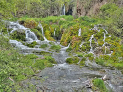


More waterfalls to explore
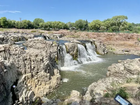 Falls ParkSouth Dakota · 363 mi straight-lineOpen100FT
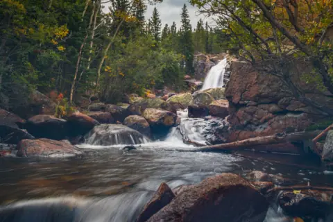 Alberta FallsColorado · 293 mi straight-lineOpen
All waterfalls in South Dakota
On these lists: Dog-friendly waterfalls · Free waterfalls
Sources
The 2003 SD DENR mining report could not be read. The Forest Service's 2012 Bridal Veil Falls platform decision was seen only in search results. Facts from those two sources come from search-result excerpts. Other Forest Service facts were read on its Spearfish Canyon page. Confirm details with the official source.
- SD Game, Fish and Parks: Spearfish Canyon Nature Area (checked Oct 25, 2026)
- SD Game, Fish and Parks: Spearfish Canyon Nature Area trail map (PDF, current edition)
- South Dakota Administrative Rules: ARSD 41:03:01:13, pets (effective May 1, 2023)
- Travel South Dakota: Known and Unknown Fall Beauty in South Dakota
- Visit Spearfish: Self-guided tour of Spearfish Canyon Scenic Byway
- Recreation.gov: listing 10381955 (Spearfish Canyon trails maintained by the State of South Dakota)
- SD DENR: 2003 mining report, Homestake aqueduct closure (via search excerpt; PDF not readable)
- USFS Black Hills NF: Spearfish Canyon (updated Jan 29, 2026)
- Spearfish Canyon Geology (Fogarty & Stevens): Old Faithful, Spearfish Falls
- SDDOT: Repair project scheduled on US Highway 14A near Cheyenne Crossing (Jan 14, 2026)
- KOTA Territory News: Rockslide causes road closure in Spearfish Canyon (Jul 6, 2025)
- SD511: live road conditions map (US 14A)
- Wikipedia: Spearfish Canyon (mountain goats near Bridal Veil Falls)
Last verified Oct 29, 2026 by The Waterfall Guide editorial team. Conditions change: confirm with South Dakota Game, Fish and Parks (Spearfish Canyon Nature Area) before you go. Spotted something out of date? Report a correction.