California & Hawaii
Waterfalls in California
This site covers 23 California waterfalls. Sixteen are in Northern California and the Sierra Nevada, from Siskiyou County to Sequoia and Big Sur. Seven are in Southern California, from Los Angeles County to San Diego County. NPS says Yosemite's falls peak in spring. Eaton Canyon Falls and the Pfeiffer Falls trail are closed (checked Oct 2026).
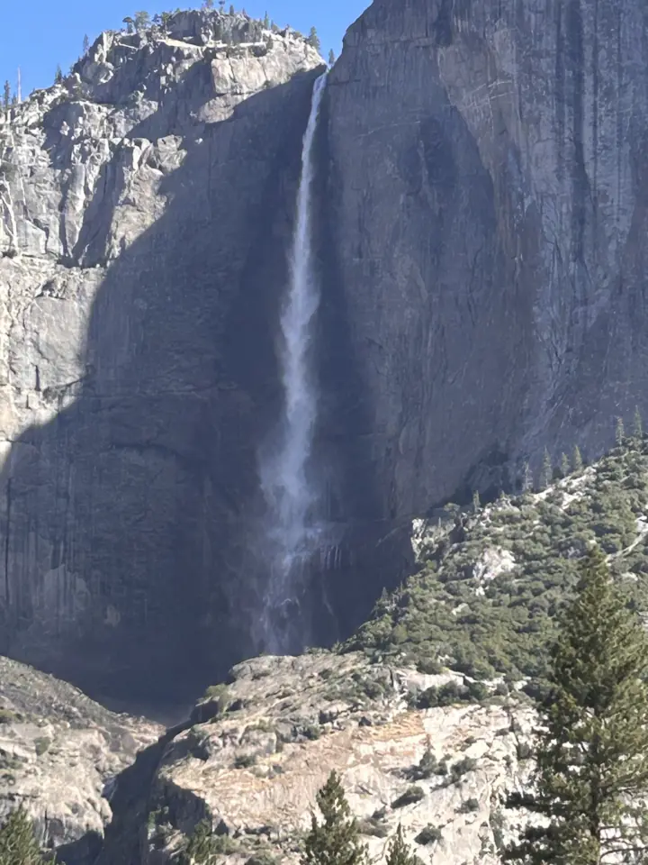
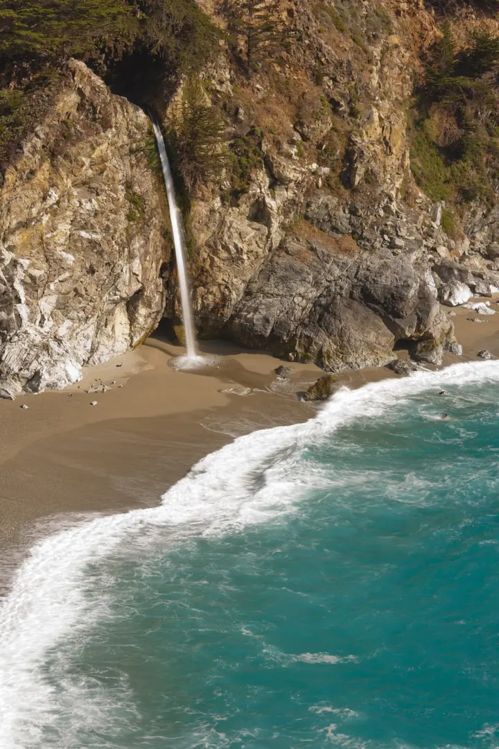
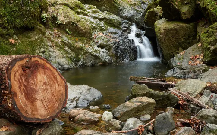
California waterfalls on this site
Each card shows the height where a source gives one, and the status as far as we can tell, from our checks of October 27, 2026 to November 13, 2026.
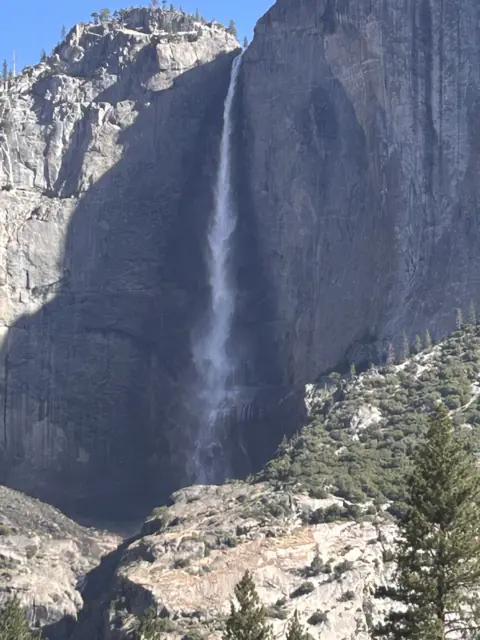
A 2,425-ft, three-part fall with a paved 1-mile loop; usually dry by late summer.
Yosemite Falls1 mi loop (Lower) · EasyOpen2,425FT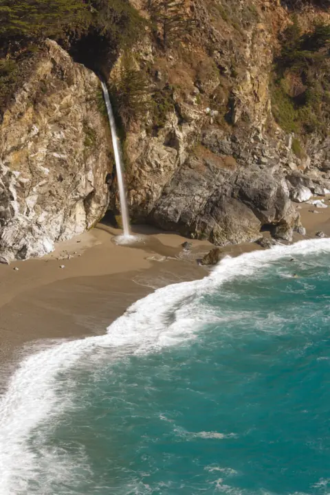
An 80-ft tidefall onto a sealed-off Big Sur beach; the overlook trail is listed closed.
McWay Falls0.5 mi round trip (closed) · EasyPartly open80FT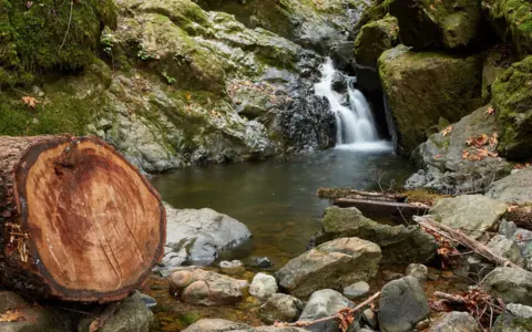
A chain of creekside cascades on Mt. Tam, reached by a steep climb from Alpine Lake.
Cataract Falls6.5 mi loop from Rock Spring · ModerateOpen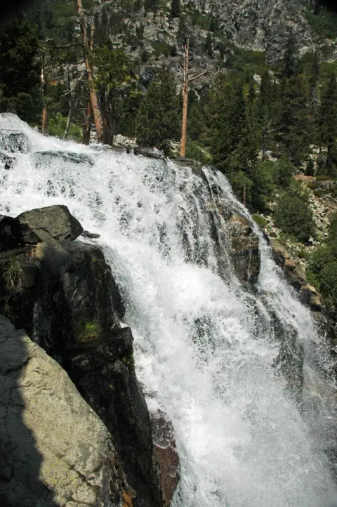
Two-part falls on Eagle Creek above Emerald Bay; a short walk from Highway 89.
Eagle Falls0.5 mi round trip (upper falls) · Easy (upper) / steep (lower)Seasonal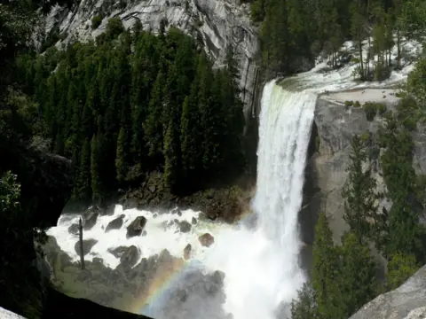
A 317-ft year-round fall on the Mist Trail, 1.6 mi round trip to the footbridge view.
Vernal Fall1.6 mi round trip (footbridge) · ModeratePartly open317FT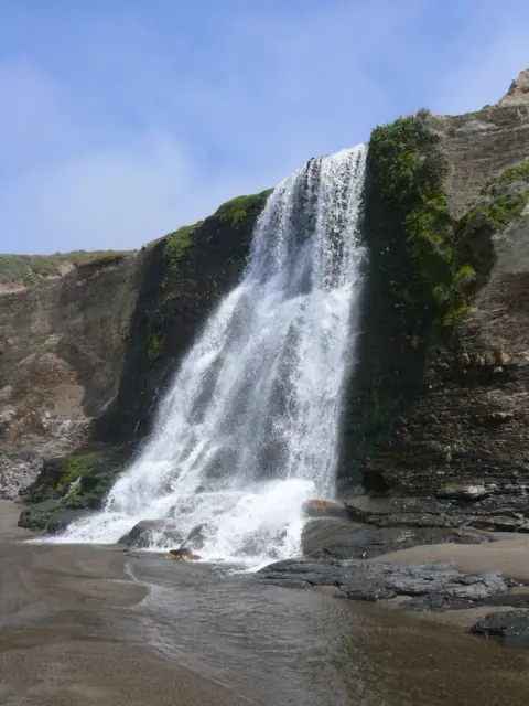
A 40-ft falls onto Wildcat Beach, 13.2 miles round trip with a low-tide beach walk.
Alamere Falls13.2 mi round trip · HardOpen40FT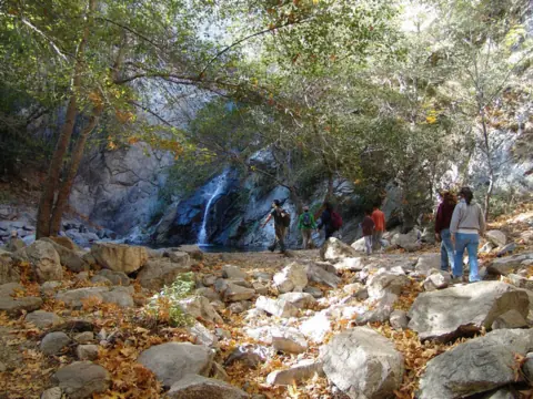
A 55-ft falls in Big Santa Anita Canyon, hiked from Chantry Flat above Arcadia.
Sturtevant FallsAbout 3.3-3.7 mi round trip (guides)Open55FT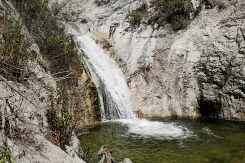
About 4 miles round trip on the Gabrielino Trail to the lower falls on the Arroyo Seco.
Switzer FallsAbout 4 mi round trip (3.66-4.5 mi in guides) · ModerateOpen50FT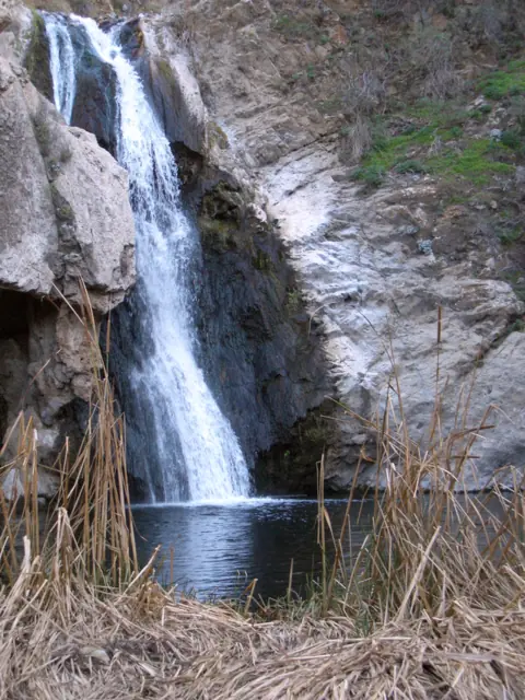
A 40-ft falls on the Arroyo Conejo in Wildwood Park, with no parking fee listed and short hikes.
Paradise FallsAbout 2 mi round trip; 3.2 mi loop · EasyOpen40FT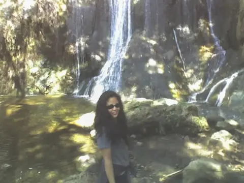
A 150-ft multi-tier falls in Malibu; only the lower tier is on public land.
Escondido FallsAbout 4 mi round tripOpen150FT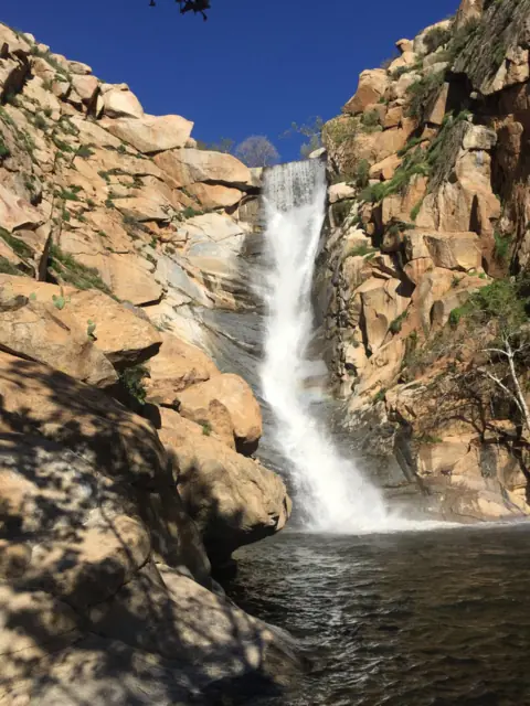
A permit-only falls in the San Diego River Gorge; 6 miles round trip, with heat closures.
Cedar Creek Falls6 mi round trip · Moderate to strenuousOpen80FT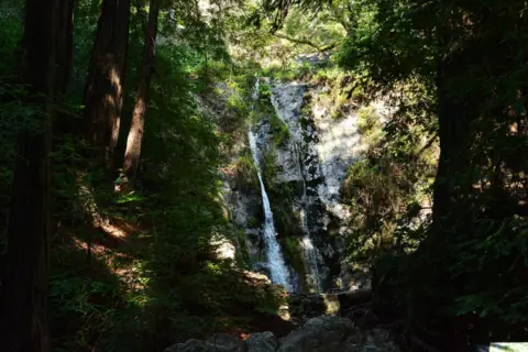
A 60-ft falls in a Big Sur redwood gorge; the trail is closed after the Timber Fire.
Pfeiffer Falls1.5 mi loop (closed)Closed60FT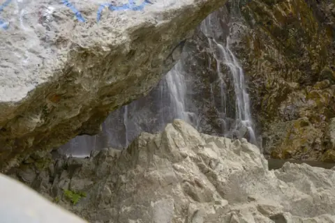
A tall multi-tier falls up a Lytle Creek wash, with a 2026 rockfall warning.
Bonita FallsAbout 1.5 mi round trip, unmarkedOpen400FT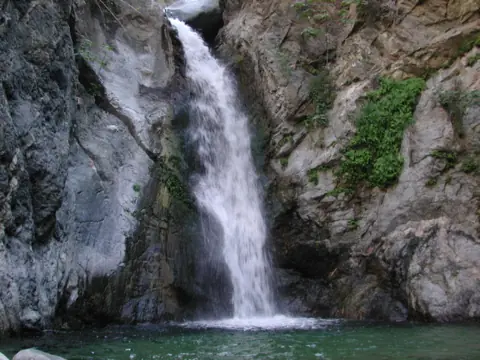
Closed until the end of 2027 after the Eaton Fire; nearby Angeles NF falls listed.
Eaton Canyon FallsClosed until end of 2027 · ModerateClosed50FT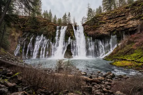
A 129-ft spring-fed falls that flows all year, with a $10 fee and no reservation now.
Burney FallsFalls Loop (no official length) · Not listedOpen129FT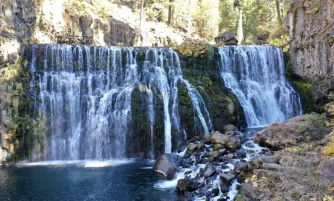
Three falls on the Upper McCloud River, about 3.5 miles round trip on foot or reached by a paved loop road.
McCloud Falls3.5 mi round trip · Easy to moderateOpenUPPER END OF RANGE 50FT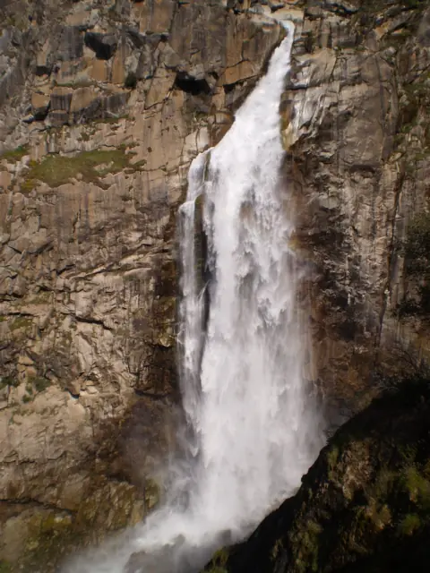
Feather Falls, California: a 410 ft drop on the Fall River, reached by the Feather Falls Trail in Plumas National Forest northeast of Oroville.
Feather FallsUpper trail 4.5 mi, lower trail 3.5 mi; 4 to 6 hr loop · Not ratedOpen410FT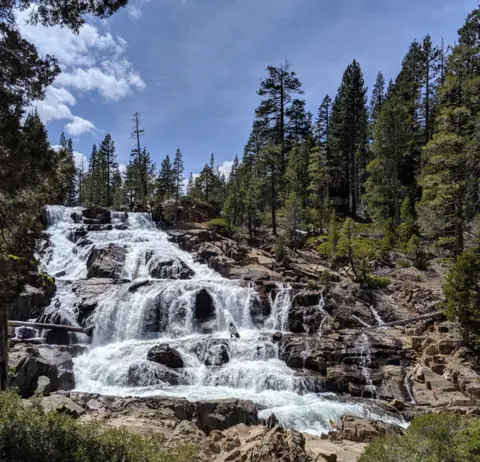
A wide cascade on Glen Alpine Creek, beside the road above Fallen Leaf Lake near South Lake Tahoe.
Glen Alpine FallsLower falls roadside; upper falls about 1 mi round trip · Not rated for the falls walkOpenABOUT 60FT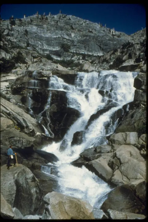
A 1,200-foot falls on the Marble Fork, 3.4 miles round trip from Lodgepole Campground.
Tokopah Falls3.4 mi round trip · No NPS ratingOpen1,200FT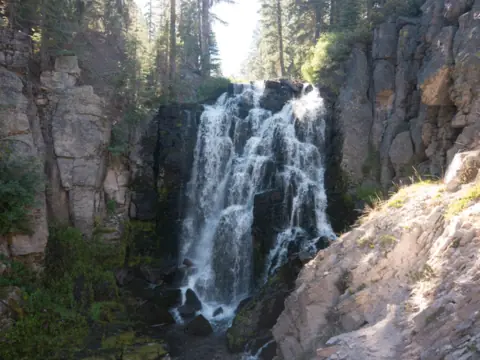
A moderate 2.8-mile round trip (NPS) to a falls on Kings Creek in Lassen Volcanic National Park, with steep sections in full sun.
Kings Creek Falls2.8 mi round trip (NPS) · Moderate (NPS)Seasonal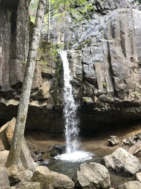
A 35-foot falls over a basalt cliff in Dunsmuir, a short trail from I-5, with a shallow cave behind it.
Hedge Creek FallsAbout 1 mi round trip (Mount Shasta Trail Assn.) · Easy (Mount Shasta Trail Assn.)OpenABOUT 35FT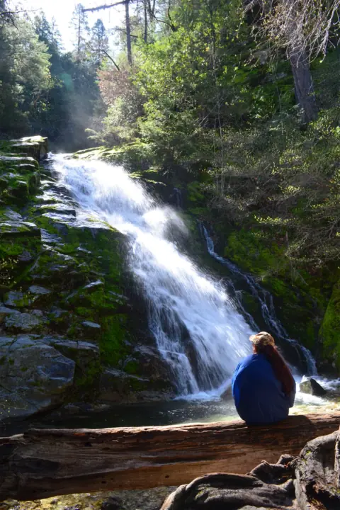
A 220-foot, three-tiered falls in Whiskeytown National Recreation Area, reached by a steep 3.4-mile round trip.
Whiskeytown Falls3.4 mi round trip (NPS) · Strenuous (NPS)Open220FT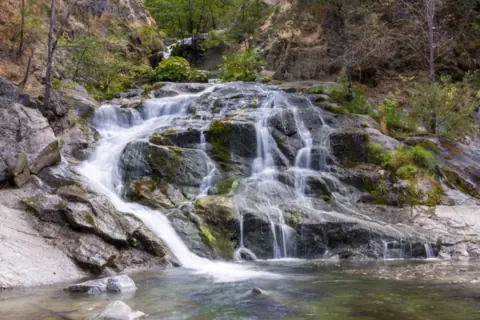
A cascade on Crystal Creek in Whiskeytown, reached by a short, flat, paved path with an accessible viewpoint.
Crystal Creek Falls0.4 mi paved path one way (NPS) · Easy (NPS)Open
Map of California waterfalls
The map shows where each of the 23 California waterfalls in this guide is located.
Map loads as you scroll. Open in OpenStreetMap
OpenPartly open / seasonalUnconfirmedClosedLarger map
| Waterfall | Status | Area | Height | Trail | Difficulty | Fee / permit | Swimming |
|---|---|---|---|---|---|---|---|
| Yosemite Falls | Open | Yosemite Valley | 2,425 ft | 1 mi loop (Lower) | Easy | $35/vehicle park fee (2026) | No (creek above the fall) |
| McWay Falls | Partly open | Big Sur coast | 80 ft | 0.5 mi round trip (closed) | Easy | $10/vehicle | No (beach off limits) |
| Cataract Falls | Open | Mt. Tamalpais, Marin | Not listed | 6.5 mi loop from Rock Spring | Moderate | No trailhead fee listed | No |
| Eagle Falls | Seasonal | Emerald Bay, Lake Tahoe | Not listed | 0.5 mi round trip (upper falls) | Easy (upper) / steep (lower) | $5/vehicle | No rule listed |
| Vernal Fall | Partly open | Yosemite Valley | 317 ft | 1.6 mi round trip (footbridge) | Moderate | $35/vehicle park fee (2026) | No (illegal above the fall) |
| Alamere Falls | Open | Point Reyes coast, Marin | 40 ft | 13.2 mi round trip | Hard | Free | No rule found |
| Sturtevant Falls | Open | San Gabriel Mountains, Angeles NF | 55 ft | About 3.3-3.7 mi round trip (guides) | $5 Adventure Pass to park | No rule found | |
| Switzer Falls | Open | San Gabriel Mountains, Angeles NF | 50 ft | About 4 mi round trip (3.66-4.5 mi in guides) | Moderate | Adventure Pass ($5/day) | No rule found |
| Paradise Falls | Open | Wildwood Park, Thousand Oaks | 40 ft | About 2 mi round trip; 3.2 mi loop | Easy | No fee listed (COSCA) | No |
| Escondido Falls | Open | Santa Monica Mountains, Malibu | 150 ft | About 4 mi round trip | $12 parking | No rule found | |
| Cedar Creek Falls | Open | San Diego River Gorge, Cleveland NF | 80 ft | 6 mi round trip | Moderate to strenuous | $6 permit (Recreation.gov) | No ban; no jumping or diving |
| Pfeiffer Falls | Closed | Big Sur coast | 60 ft | 1.5 mi loop (closed) | $10/vehicle | No rule found | |
| Bonita Falls | Open | Lytle Creek, San Bernardino NF | 400 ft | About 1.5 mi round trip, unmarked | $5 Adventure Pass to park | No rule found | |
| Eaton Canyon Falls | Closed | Eaton Canyon, Pasadena | 50 ft | Closed until end of 2027 | Moderate | Area closed | Closed |
| Burney Falls | Open | Burney, Shasta County | 129 ft | Falls Loop (no official length) | Not listed | $10/vehicle | No pool rule found |
| McCloud Falls | Open | Upper McCloud River, near McCloud | 50 ft (upper end of range) | 3.5 mi round trip | Easy to moderate | No fee (picnic area) | No posted rule; jumping spots dangerous |
| Feather Falls | Open | Feather Falls Trail, Plumas National Forest | 410 ft | Upper trail 4.5 mi, lower trail 3.5 mi; 4 to 6 hr loop | Not rated | No fee listed by the Forest Service | No official rule; swift water warning |
| Glen Alpine Falls | Open | Fallen Leaf Lake, Lake Tahoe | about 60 ft | Lower falls roadside; upper falls about 1 mi round trip | Not rated for the falls walk | No fee listed in the text we read | No official rule found |
| Tokopah Falls | Open | Lodgepole, Sequoia National Park | 1,200 ft | 3.4 mi round trip | No NPS rating | $35 per vehicle (park entry) | No rule posted; strong currents (NPS) |
| Kings Creek Falls | Seasonal | Lassen Volcanic National Park | Not listed | 2.8 mi round trip (NPS) | Moderate (NPS) | $30 per vehicle in summer (NPS) | No official swimming rule found |
| Hedge Creek Falls | Open | Dunsmuir, Siskiyou County | about 35 ft | About 1 mi round trip (Mount Shasta Trail Assn.) | Easy (Mount Shasta Trail Assn.) | No fee listed | No official swimming rule found |
| Whiskeytown Falls | Open | Whiskeytown National Recreation Area, west of Redding | 220 ft | 3.4 mi round trip (NPS) | Strenuous (NPS) | Entrance pass required, $25 per vehicle for 7 days (NPS) | No official swimming rule found |
| Crystal Creek Falls | Open | Whiskeytown National Recreation Area, west of Redding | Not listed | 0.4 mi paved path one way (NPS) | Easy (NPS) | Entrance pass required, $25 per vehicle for 7 days (NPS) | NPS describes careful swimming at the base |
Overview of waterfalls in California
Sierra Nevada snowmelt falls on this site include Yosemite Falls and Vernal Fall. Coastal and Bay Area falls include McWay Falls in Big Sur and Cataract Falls on Mount Tamalpais. Eagle Falls tumbles toward Emerald Bay at Lake Tahoe. Also near Tahoe, the lower Glen Alpine Falls sits next to the road above Fallen Leaf Lake.
Burney Falls is a 129-foot spring-fed falls in McArthur-Burney Falls Memorial State Park, and Alamere Falls pours off a cliff onto Wildcat Beach at Point Reyes. Feather Falls, in Plumas National Forest northeast of Oroville, has a measured height of 410 feet, per Wikipedia. In Big Sur, Pfeiffer Falls is closed after the 2026 Timber Fire. In Lassen Volcanic National Park, NPS lists a 2.8-mile round trip to Kings Creek Falls.
In Dunsmuir, Hedge Creek Falls drops about 35 feet over a basalt cliff, per the Dunsmuir Chamber of Commerce. The trailhead is at the I-5 Siskiyou Avenue exit, per the Mount Shasta Trail Association. Near Redding, Whiskeytown National Recreation Area has Whiskeytown Falls, 220 feet per the NPS, and the easy, paved walk to Crystal Creek Falls.
Southern California's falls on this site run from Los Angeles County to San Diego County. Sturtevant Falls and Switzer Falls are Angeles National Forest hikes, and Bonita Falls is in the San Bernardino National Forest. Escondido Falls in Malibu is about 150 feet tall, and MRCA calls it the highest in the Santa Monica Mountains.
Paradise Falls in Thousand Oaks is open, as far as we can tell (Nov 11, 2026). COSCA had closed all its trails for rain on October 21. Cedar Creek Falls near Ramona needs a permit, and Black Star Canyon Falls is in Orange County. Eaton Canyon Falls above Pasadena is closed until the end of 2027.
Timing matters here. NPS says Yosemite's waterfalls peak in spring, and Yosemite Falls is often a trickle or dry by August. Each page below gives the season, fees and current closures from the managing agency. For how Yosemite Falls ranks nationally, see our guide to the tallest waterfalls in the US.
When waterfalls in California flow
The National Park Service says spring is the best time to see Yosemite's waterfalls, with peak runoff usually in May or June. Yosemite Falls typically flows from about November to July and is often a trickle or dry by August. NPS listed it as dry on October 23, 2026. Vernal Fall runs all year but narrows by late summer.
We found no official flow season for the coastal falls. Burney Falls is spring-fed, and State Parks says it flows all year.
Yosemite: no reservation in 2026, but an entrance fee
Yosemite has no timed entrance reservation system in 2026. The entrance fee is $35 per private vehicle for 7 days, $30 per motorcycle and $20 per person on foot or bike. In 2026, non-US residents aged 16 and older pay an extra $100 per person unless they enter with an annual or America the Beautiful pass. The park manages busy days with real-time traffic and parking control and recommends weekday visits.
Waterfalls in Northern California
Sixteen of the falls on this site are in Northern California and the Sierra Nevada, from Siskiyou and Butte counties to Sequoia, Lake Tahoe, Marin and Big Sur. Statuses below were checked in October and November 2026, with dates given.
Yosemite Valley
- Yosemite Falls: open, as far as we can tell, as of Oct 27, 2026. The trails are open, but NPS said 'Yosemite Falls is dry' on October 23, 2026. A 1-mile paved loop leads to Lower Yosemite Fall.
- Vernal Fall: partly open. NPS sets the Mist Trail schedule above the footbridge by month. Its October schedule opened the trail above the footbridge Friday to Sunday and holidays, plus Monday to Thursday 3:30pm to 7am when safe. As of November 3, 2026, NPS had posted no November schedule, so check current conditions.
Yosemite Falls and Vernal Fall are both inside Yosemite National Park, so the $35 vehicle entrance fee applies.
Sequoia National Park
- Tokopah Falls: open, as far as we can tell, as of Nov 3, 2026. NPS lists a 3.4-mile round trip from Lodgepole. It says the falls are inaccessible in winter, once Lodgepole Campground closes.
Siskiyou and Shasta counties and Lake Tahoe
- Hedge Creek Falls: open, as far as we can tell, as of Nov 11, 2026. The Mount Shasta Trail Association lists a 1-mile round trip, rated easy, from the I-5 Siskiyou Avenue exit in Dunsmuir. No fee is listed on the pages we read. The Dunsmuir Chamber and Discover Siskiyou describe a shallow cave behind the falls. No agency publishes a status page for it.
- McCloud Falls: open, as far as we can tell, as of Nov 3, 2026. USFS lists three falls on the Upper McCloud River. They are about 3.5 miles round trip from a no-fee picnic area.
- Burney Falls: open, as far as we can tell, as of Oct 28, 2026. Day use is $10 per vehicle. A 2026 pilot required day-use reservations on Fridays to Sundays and holidays from May 15 to September 27. No reservation is needed from October to December.
- Eagle Falls: seasonal. The Forest Service lot charges $5 per vehicle and is typically open mid-May through mid-October. State Parks charges $10 a day or $3 an hour at the Vikingsholm lot, with special rates possible on peak days.
- Glen Alpine Falls: open, as far as we can tell, as of Nov 6, 2026. The lower falls are next to the road above Fallen Leaf Lake. Visit Lake Tahoe calls the walk to the upper falls "a one mile, round trip hike." Winter road access is not confirmed, so call 530-543-2600 first.
- Camping: Burney Falls has two campground loops, Rim Camp and Pioneer Camp, per the park's camp map. Sites cost $35 a night, per State Parks (as of Oct 2026).
At Burney, a January 1, 2026 State Parks notice closes the Burney Creek and PSEA trails north of Rainbow Bridge for storm erosion. It doesn't name the Falls Loop Trail. Parking along Highway 89 within a mile of the park is illegal. Past Eagle Falls, a free, self-issued Desolation Wilderness day permit is needed for Eagle Lake from Memorial Day weekend through September 30.
Whiskeytown National Recreation Area
- Whiskeytown Falls: open, as far as we can tell, as of Nov 13, 2026. NPS gives it 220 feet in three tiers. The James K. Carr Trail is 3.4 miles round trip, and NPS calls it strenuous and steep.
- Crystal Creek Falls: open, as far as we can tell, as of Nov 13, 2026. NPS describes a flat, paved, accessible path of about 0.4 mile one way. It calls it the only man-made waterfall in the park.
Both need a Whiskeytown entrance pass, $25 per private vehicle for 7 days, per NPS. An NPS road page from November 2025 says Crystal Creek Road can close for winter weather. See waterfalls near Redding.
Lassen Volcanic National Park
- Kings Creek Falls: seasonal, not reachable by car, as far as we can tell (Nov 11, 2026). NPS lists a 2.8-mile round trip, rated moderate, with sun exposure and steep sections. On Oct 30, 2026, NPS closed the park highway to through travel for ice and fallen rock. On Nov 11 it listed the trail as "Unknown status." Pets are not allowed on park trails.
Plumas National Forest
- Feather Falls: open, as far as we can tell, as of Nov 7, 2026. The Forest Service lists an upper trail of 4.5 miles and a lower trail of 3.5 miles to the overlook. It allows 4 to 6 hours for the loop. Wikipedia gives a measured height of 410 feet. The trailhead campground is closed indefinitely after damage from the 2020 North Complex Fire.
Marin and the Bay Area
- Alamere Falls: open, as far as we can tell, as of Oct 28, 2026. Point Reyes National Seashore charges no entrance or parking fee. The official route from Palomarin Trailhead is 13.2 miles round trip. NPS strongly advises against the unofficial bluff shortcut and says to walk Wildcat Beach only at low tide.
- Cataract Falls: open, as far as we can tell (October 2026). Marin Water lists hours of 7am to sunset daily. It is on Marin Water land, where a vehicle fee applies only at the Sky Oaks entrance.
Big Sur
- McWay Falls: partly open. Julia Pfeiffer Burns State Park charges $10 per vehicle. State Parks lists the McWay Falls Overlook Trail as closed for a retaining-wall project, with no reopening date as of October 27, 2026.
- Pfeiffer Falls: closed. Pfeiffer Big Sur State Park reopened October 16, 2026 after the Timber Fire. State Parks says the Pfeiffer Falls and Valley View trails stay closed until further notice, and entering a closed trail can bring a citation.
Northern California road closures (as of Oct 2026)
Big Sur's Highway 1 reopened through Regent's Slide on January 14, 2026, then closed again for the Timber and Plaskett fires. It fully reopened through Big Sur on September 14, 2026, the SF Chronicle reported.
Highway 89 around Emerald Bay can close during winter storms. Winter access on Fallen Leaf Road to Glen Alpine Falls is not confirmed. In Yosemite, El Capitan Bridge work causes weekday delays through December 2026. In Lassen Volcanic National Park, NPS closed the park road (also Hwy 89) to through travel on Oct 30, 2026. Cars can reach Sulphur Works, 1 mile from the southwest entrance. Check Caltrans QuickMap and each park's current conditions page before you drive.
Waterfalls in Southern California
Seven of the falls on this site are in Southern California, from Los Angeles County to San Diego County. Most Forest Service trailheads here need an Adventure Pass to park.
Adventure Pass: the Forest Service lists $5 a day or $30 a year. It covers posted fee sites on the Angeles, Cleveland, Los Padres and San Bernardino national forests. America the Beautiful passes are accepted wherever it's required.
Waterfalls near Los Angeles
- Sturtevant Falls, Arcadia: the Forest Service's Chantry Flat page requires an Adventure Pass or America the Beautiful pass to park.
- Switzer Falls, La Cañada Flintridge: the Forest Service's Switzer Picnic Site page requires the same passes to park.
- Escondido Falls, Malibu: parking at the Winding Way lot is $12, per MRCA. The upper falls are off-limits.
- Eaton Canyon Falls, above Pasadena: closed until December 31, 2027, per LA County.
Ventura, San Bernardino and San Diego counties
- Paradise Falls, Thousand Oaks: open, as far as we can tell (Nov 11, 2026), after a rain closure that began October 21. COSCA's pages we read list no parking fee. The Conejo Open Space Foundation, a nonprofit partner, calls the parking free.
- Bonita Falls, Lytle Creek: in the San Bernardino National Forest. The Forest Service's Adventure Pass ($5 a day) applies at posted fee sites there. Wikipedia says parking along Lytle Creek Road needs one.
- Cedar Creek Falls, near Ramona: a permit is required year-round and must be booked on Recreation.gov. Recreation.gov lists $6 per permit for the holder and up to 4 others, while a Forest Service page lists $10. No permits are sold at the trailhead.
OC Parks says parking is free in Irvine Ranch Open Space near Black Star Canyon.
Southern California closures and conditions (checked Oct and Nov 2026)
Eaton Canyon Falls is closed. Paradise Falls is open, as far as we can tell (Nov 11, 2026), after an October rain closure. The other Southern California falls on this site were open as of October 28, 2026, some with cautions or permits.
- Eaton Canyon Falls: closed. LA County says the Eaton Canyon Natural Area and its trails, including the waterfall, stay closed until December 31, 2027.
- Sturtevant and Switzer Falls: open, as far as we can tell, as of Oct 28, 2026. Their Forest Service site pages (Chantry Flat and Switzer Picnic Site) showed Site Open in 2026. Neither is named in the 2026-2027 Eaton Fire closure order or on LA County's closure list. The Forest Service says the Chantry Flat road can close to vehicles at any time.
- Cedar Creek Falls: open with a permit, as far as we can tell (Oct 28, 2026). The Forest Service closed the area March 16-20, August 4-31 and October 2-8, 2026; the October closure was for extreme heat.
- Bonita Falls: open, as far as we can tell (Oct 28, 2026), with a rockfall warning. A Forest Service safety alert about falling rocks runs from July 24 to December 31, 2026; it is a caution, not a closure. It followed the June death of a hiker struck by a falling rock near the falls. Call the Front Country Ranger District at 909-382-2851 before you go.
- Escondido Falls: open, as far as we can tell (Oct 28, 2026). MRCA closes its parks during Red Flag Warnings, and its October 2026 closure ran October 15-17. The upper falls are off-limits.
- Paradise Falls: open, as far as we can tell (Nov 11, 2026). COSCA closed all its trails and open spaces for rain on October 21, 2026. On November 11, its trail-closures page said "No current weather-related closures" and listed no closure for Wildwood Park. Check that page after any storm.
- Black Star Canyon Falls: open as far as official sources show (checked October 28, 2026). Black Star Canyon Falls is not one of the 21 falls in this guide. OC Parks says Black Star Canyon Road is always open for public access to Cleveland National Forest. The 2026 Airport Fire closure covers the Santiago Peak and Trabuco area to the south, outside the canyon, per the Order 02-26-09 map.
California waterfall hikes by length
Most of these waterfall walks are 4 miles round trip or less, but Upper Yosemite Fall and Alamere Falls are full-day hikes. Distances are round trip, with statuses checked Oct and Nov 2026.
| Waterfall | Distance | Per | Status |
|---|---|---|---|
| Lower Yosemite Fall | 1-mile paved loop | NPS | Open (falls dry Oct 23) |
| Crystal Creek Falls | About 0.8 mi, paved | NPS | Open, as far as we can tell (Nov 13) |
| Upper Eagle Falls | About 0.5 mi | Visit Lake Tahoe | Seasonal lot |
| McWay Falls Overlook | 0.5 mi | State Parks | Trail closed |
| Upper Glen Alpine Falls | About 1 mi | Visit Lake Tahoe | Open, as far as we can tell (Nov 6) |
| Hedge Creek Falls | 1 mi, rated easy (other guides list 0.4 to 0.7 mi) | Mount Shasta Trail Association | Open, as far as we can tell (Nov 11) |
| Bonita Falls | About 1.5 mi (3/4 mi each way), unmarked | Wikipedia | Open, rockfall warning |
| Pfeiffer Falls | 1.5-mi loop | State Parks | Closed |
| Vernal Fall | 1.6 mi to the footbridge; 2.4 mi to the top | NPS | Partly open |
| Cataract Falls | 2.7 mi, or a 6.5-mi loop from Rock Spring | Parks Conservancy; One Tam | Open |
| Kings Creek Falls | 2.8 mi | NPS | Seasonal (park road closed Oct 30; checked Nov 11) |
| Whiskeytown Falls | 3.4 mi, strenuous | NPS | Open, as far as we can tell (Nov 13) |
| Paradise Falls | 3.2-mi loop from Canna Street | Conejo Open Space Foundation | Open, as far as we can tell (Nov 11) |
| Sturtevant Falls | About a 1.75-mile hike per a Forest Service brochure; Hikespeak and other trail guides list 3.3 to 3.7 mi round trip | Forest Service; Hikespeak and other trail guides | Open |
| Switzer Falls | Trail guides list about 4 mi (3.66 to 4.5 mi) | Trail guides | Open |
| Escondido Falls | About 4 mi | MRCA | Open |
| Cedar Creek Falls | 6 mi, permit required | Recreation.gov | Open |
| Upper Yosemite Fall | 7.2 mi | NPS | Open |
| Alamere Falls | 13.2 mi | NPS | Open |
State Parks gives no official length for the Burney Falls Loop. The Forest Service lists Feather Falls' upper trail at 4.5 miles and lower trail at 3.5 miles, without saying round trip. Eaton Canyon Falls is closed until the end of 2027. Cedar Creek's return climbs more than 2 miles at an average 8% grade, per Recreation.gov.
Waterfalls you can see without a long hike
The lower Glen Alpine Falls sits next to the road, and Lower Yosemite Fall, Burney Falls and Crystal Creek Falls have paved or accessible routes. Upper Eagle Falls, McWay Falls and Hedge Creek Falls are short walks, but McWay's trail is closed.
- Lower Glen Alpine Falls: Visit Lake Tahoe says there is "virtually no hike to get there." It warns that roadside parking is limited, with no designated spots.
- Lower Yosemite Fall: a 1-mile paved loop that NPS says takes about 30 minutes. The eastern half is wheelchair accessible when free of ice and snow.
- Burney Falls: State Parks lists accessible parking and restrooms at the Falls Overlook, and the Headwaters Trail is accessible. The Falls Loop down to the pool is not listed as accessible.
- Upper Eagle Falls: about 0.5 mile round trip, per Visit Lake Tahoe. The Forest Service lot is seasonal.
- McWay Falls: the Overlook Trail is 0.5 mile round trip, but State Parks lists it as closed for a retaining-wall project, with no reopening date.
- Hedge Creek Falls: the Mount Shasta Trail Association lists 1 mile round trip, rated easy, but narrow and uneven in spots. We found no official accessibility information.
- Crystal Creek Falls: NPS describes a paved, wide, accessible path of about 0.4 mile one way to the viewpoint. A steep dirt path continues to the base.
California waterfalls FAQ
What is the tallest waterfall in California?
Yosemite Falls is the tallest California waterfall on this site, at 2,425 feet in three parts. NPS calls Lower Yosemite Fall 'part of North America's tallest waterfall.' Other NPS pages are softer: 'one of North America's tallest waterfalls' and 'one of the world's tallest'.
When is Yosemite Falls flowing?
Yosemite Falls usually flows from about November to July, with its peak in May, per the National Park Service. The Park Service says it's often a trickle or dry by August, and NPS listed it as dry on October 23, 2026.
Do you need a reservation to visit Yosemite's waterfalls in 2026?
No. Yosemite has no timed entrance reservation in 2026. You still pay the entrance fee, $35 per vehicle for 7 days.
Can you go down to the beach at McWay Falls?
No. California State Parks says the beach and falls area are completely off limits, and trespassers can be cited and arrested.
Which California waterfall flows all year?
NPS says Vernal Fall in Yosemite flows year-round, though it narrows in late summer. Burney Falls is fed by springs, and State Parks says it flows all year.
Do you need an Adventure Pass for Southern California waterfalls?
At some trailheads. Parking at Chantry Flat for Sturtevant Falls requires an Adventure Pass ($5 a day or $30 a year) or an America the Beautiful pass. The Forest Service requires the same pass at Switzer Picnic Site for Switzer Falls, and Wikipedia says the same for parking along Lytle Creek Road near Bonita Falls. Cedar Creek Falls uses a separate Recreation.gov permit instead.
Is Eaton Canyon Falls open?
No. LA County says the Eaton Canyon Natural Area, its trails and the waterfall stay closed until December 31, 2027, after the January 2025 Eaton Fire.
Which California waterfalls are closed?
As of our October 2026 checks, two are closed: Eaton Canyon Falls until December 31, 2027, and the Pfeiffer Falls trail until further notice. Paradise Falls is open, as far as we can tell (Nov 11, 2026). The McWay Falls overlook trail is also closed. Vernal Fall's Mist Trail had no November schedule posted as of Nov 3. As far as we can tell (Nov 11, 2026), cars cannot reach Kings Creek Falls since Lassen's road closed on Oct 30.
Can you walk behind a waterfall in California?
At Hedge Creek Falls in Dunsmuir, the Dunsmuir Chamber of Commerce and Discover Siskiyou describe a shallow cave behind the falls. The Mount Shasta Trail Association lists a 1-mile round trip, rated easy.
Sources
- NPS Yosemite: Waterfalls
- NPS Yosemite: Reservations
- NPS Yosemite: Fees
- NPS Yosemite: Current conditions
- California State Parks: Julia Pfeiffer Burns SP
- California State Parks: Emerald Bay SP
- USDA Forest Service Eldorado NF: Desolation day use permits and parking
- Caltrans District 5: Highway 1 reopens at Regent's Slide (Jan 14, 2026)
- Marin Water: Mt. Tam Watershed visitor information
- California State Parks: McArthur-Burney Falls Memorial SP
- California State Parks: Burney Falls day-use reservations, summer 2026
- California State Parks: Burney Falls trail closures (Jan 1, 2026)
- California State Parks: Pfeiffer Big Sur SP to reopen Oct. 16 following Timber Fire
- NPS Point Reyes: Alamere Falls
- NPS Point Reyes: Hike to Alamere Falls
- NPS Point Reyes: Fees
- USDA Forest Service Region 5: Adventure Pass (archived Apr 14, 2026)
- USDA Forest Service San Bernardino NF: Passes (archived Apr 7, 2026)
- USDA Forest Service: Chantry Flat Picnic Area (archived Apr 6, 2026)
- USDA Forest Service: Forest Order 05-01-26-04, Eaton Fire closure (signed Jan 6, 2026)
- LA County Trails: Eaton Canyon and Angeles NF closures
- Wikipedia: Bonita Falls
- Recreation.gov: Cedar Creek Falls permit
- USDA Forest Service: San Diego River Gorge/Cedar Creek Falls closure area (archived; page removed)
- USDA Forest Service Cleveland NF: Extreme heat closure Oct 2-8, 2026
- MRCA: Escondido Canyon Park
- MRCA: Coastal access and Red Flag closures (Oct 2026)
- Conejo Open Space Foundation: Wildwood map (2023)
- COSCA: Trail closures
- OC Parks: Irvine Ranch Open Space
- USDA Forest Service: Airport Fire burned area closure (archived Jul 18, 2026)
- SF Chronicle: Highway 1 reopens through Big Sur after weeks of wildfire closures (Sep 14, 2026)
- USDA Forest Service: Switzer Picnic Site (updated Apr 23, 2026; read Oct 28, 2026)
- USDA Forest Service SBNF: Safety alert, falling rocks at Bonita Falls (Jul 24-Dec 31, 2026; read Oct 28, 2026)
- USFS Lake Tahoe Basin: Eagle Falls Picnic Area and Trailhead (updated Jun 1, 2026; read Oct 28, 2026)
- NPS Yosemite: Lower Yosemite Fall Trail
- NPS Yosemite: Yosemite Falls Trail
- NPS Yosemite: Vernal and Nevada Falls Trail
- California State Parks: McArthur-Burney Falls accessible features
- California State Parks: Pfeiffer Big Sur SP (trail closure notice dated Oct 9, 2026)
- California State Parks: Julia Pfeiffer Burns SP trails
- Visit Lake Tahoe: Waterfall guide
- One Tam: Cataract Trail
- Golden Gate National Parks Conservancy: Cataract Trail
- Conejo Open Space Foundation: Moonridge Trail, Paradise Falls and Two Springs loop
- USDA Forest Service: Big Santa Anita Canyon brochure
- Hikespeak: Sturtevant Falls
- Wikipedia: Arroyo Seco (Los Angeles County)
- California State Parks: McArthur-Burney Falls camp map and handout (Rev. 2018)
- USFS Lake Tahoe Basin: Glen Alpine Trailhead (conditions; updated Oct 9, 2026; read Nov 6, 2026)
- Visit Lake Tahoe: Lake Tahoe waterfalls, Glen Alpine Falls (roadside lower falls, parking; read Nov 6, 2026)
- Visit Lake Tahoe: Glen Alpine Trail (upper falls walk; read Nov 6, 2026)
- USFS Wildflowers: Feather Falls Scenic Area and Recreation Trail (trail lengths; read Nov 7, 2026)
- USFS Plumas National Forest: Feather Falls Trailhead Campground (closed indefinitely; updated Nov 4, 2026; read Nov 7, 2026)
- USFS Plumas National Forest: Alerts list (read Nov 7, 2026)
- Wikipedia: Feather Falls (measured height; read Nov 4, 2026)
- USFS Lake Tahoe Basin: Alerts list (no Glen Alpine Trailhead or Fallen Leaf Road closure; read Nov 6, 2026)
- NPS: Lassen Volcanic Trail Conditions (Kings Creek Falls; Southwest Area updated Nov 11, 2026)
- NPS: Lassen Volcanic Alerts & Conditions (highway closure posted Oct 30, 2026; read Nov 11, 2026)
- NPS: Lassen Volcanic Pets (last updated Apr 21, 2023; read Nov 11, 2026)
- Mount Shasta Trail Association: Hedge Creek Falls (trail, land agency, cautions; read Nov 11, 2026)
- Dunsmuir Chamber of Commerce: Adventure (35-foot height; read Nov 11, 2026)
- Discover Siskiyou: Hedge Creek Falls (a Siskiyou County tourism site; read Nov 11, 2026)
- NPS Whiskeytown: James K. Carr Trail to Whiskeytown Falls (updated Jan 15, 2026; read Nov 13, 2026)
- NPS Whiskeytown: Crystal Creek Falls (updated Jan 15, 2026; read Nov 13, 2026)
- NPS Whiskeytown: Fees and passes (updated Mar 13, 2026)
- NPS Whiskeytown: Current conditions (road status; page updated Nov 25, 2025)
City guides: Waterfalls near Los Angeles, CA · Waterfalls near Redding, CA
More California waterfalls are being added. Each one is checked against its managing agency before it goes live.
Photos: EF5, CC0; King of Hearts, CC BY-SA 3.0; Frank Schulenburg, CC BY-SA 4.0. Photo credits