Right now
Right now as of Nov 3, 2026
- Status NPS conditions (updated Oct 30, checked Nov 3, 2026) still list the Mist Trail schedule only 'through October (subject to change)'.
- Permit No permit needed. Entry fee: $35/vehicle park fee (2026).
Status note (Nov 3, 2026): NPS conditions (updated Oct 30, checked Nov 3, 2026) still list the Mist Trail schedule only 'through October (subject to change)'. That window has passed, and NPS has posted no November schedule. In October it opened the trail above the footbridge Fri to Sun and holidays, plus Mon to Thu 3:30pm to 7am when safe. At other times, NPS points hikers to the John Muir Trail via Clark Point. Check NPS conditions before you go. In winter, NPS closes the lower Mist Trail for falling ice and rock. What the status labels mean
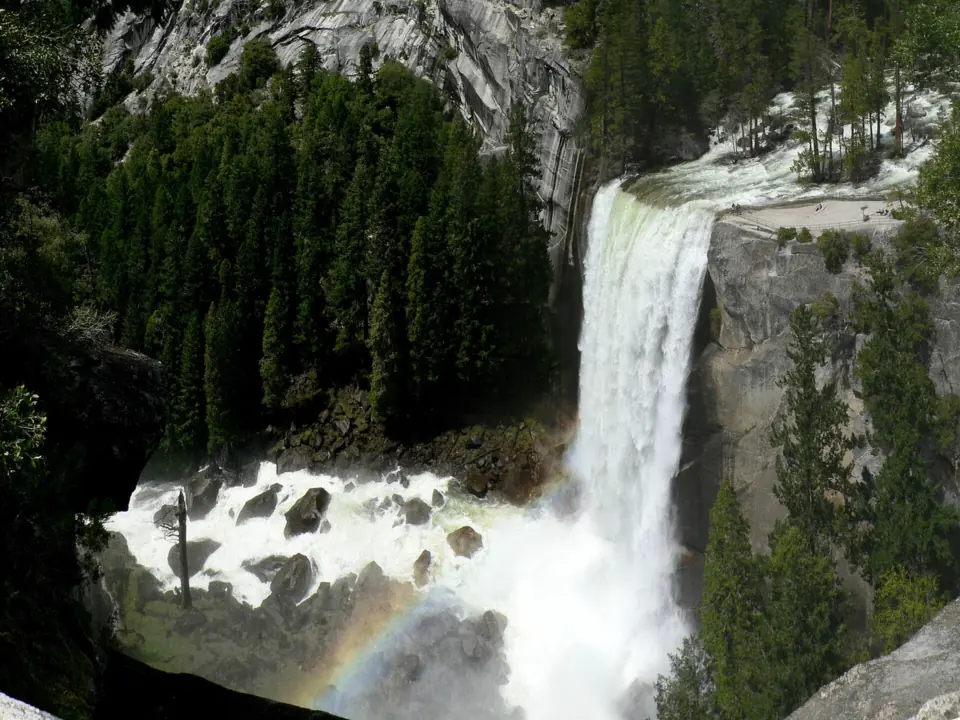
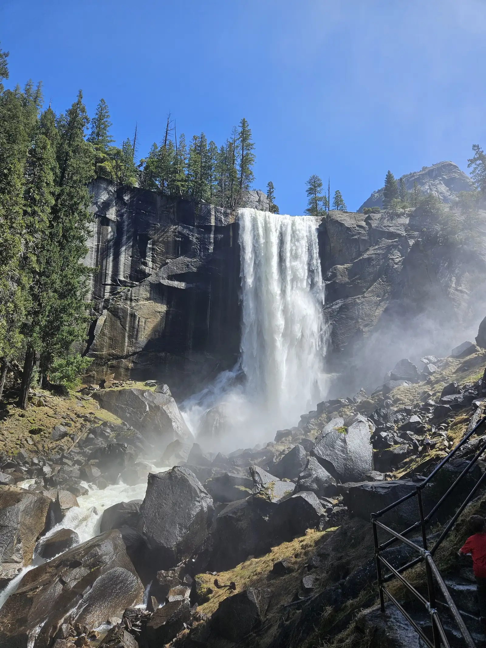
Vernal Fall is a 317-foot waterfall on the Merced River in Yosemite Valley, often searched as Vernal Falls. From Happy Isles, NPS lists the Mist Trail at 1.6 miles round trip to the footbridge and 2.4 miles round trip to the top, with over 600 steps. NPS's October trail schedule has ended, and it had posted no November schedule as of November 3, 2026, so check NPS conditions. The trail continues to 594-foot Nevada Fall.
About Vernal Fall
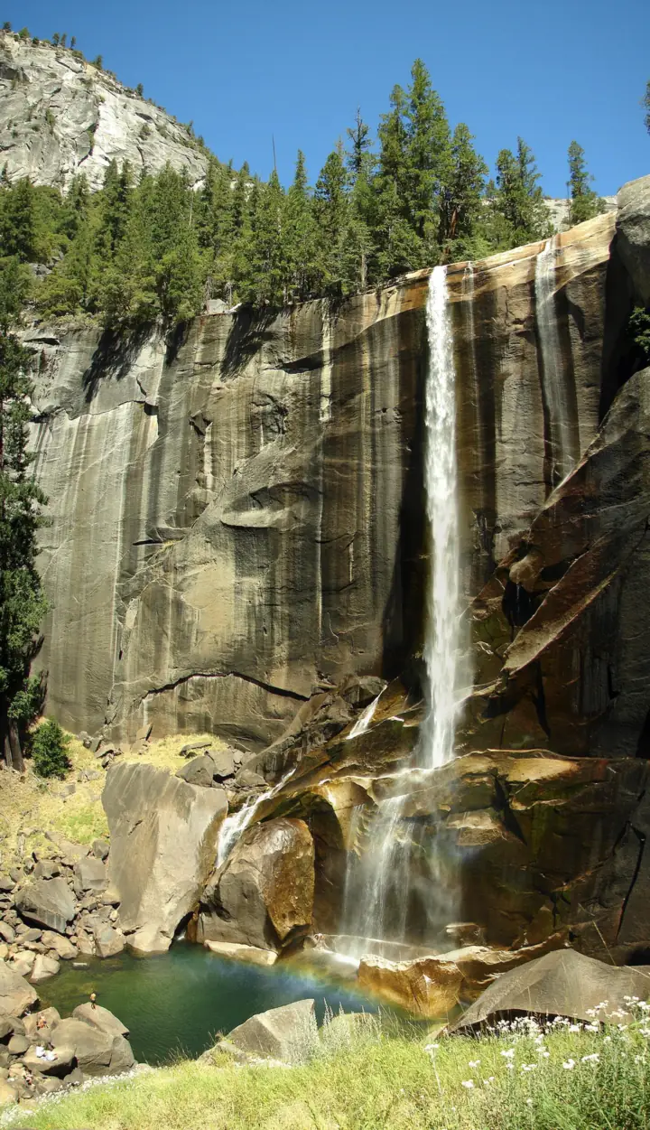
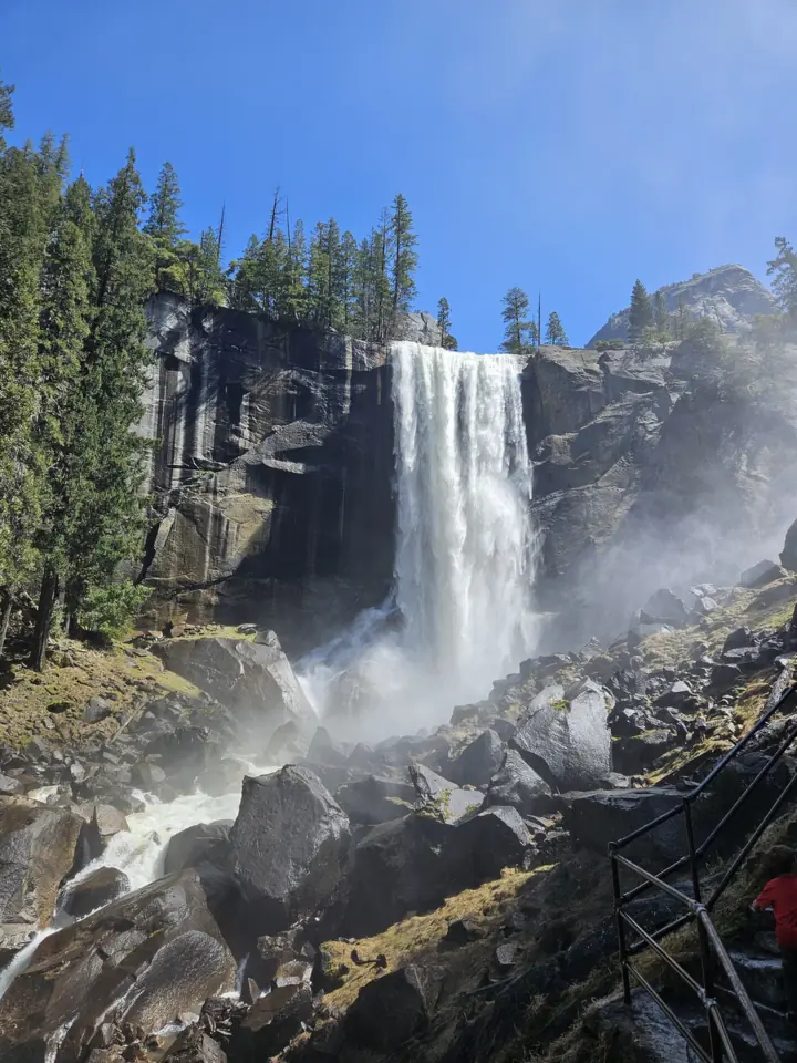
Vernal Fall drops 317 feet on the Merced River in Yosemite National Park. Unlike Yosemite Falls, which is often dry by August, NPS says Vernal Fall flows all year.
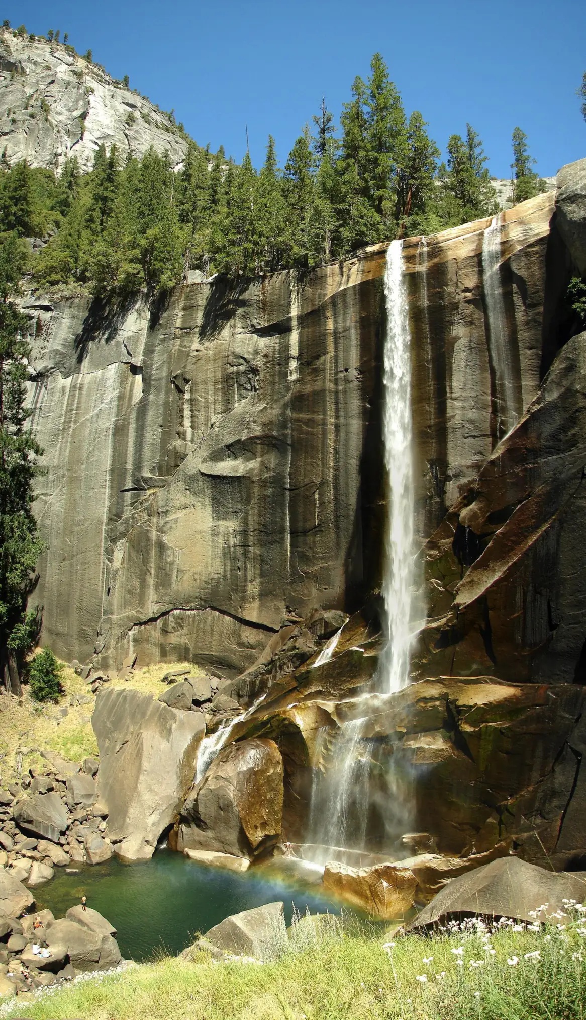
Vernal Fall's shape changes with the seasons. NPS says flow peaks in late May or June. By mid- to late summer it narrows, and NPS says it can split into one, two or three separate strands.
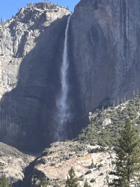
Nevada Fall, the next fall upstream, is the taller of the two. NPS gives it 594 feet, compared with 317 feet for Vernal Fall. Neither comes close to Yosemite Falls; see our guide to the tallest waterfalls in the US for how they rank.
The Mist Trail climbs beside Vernal Fall to its top and then keeps going to Nevada Fall. A second route, the John Muir Trail by way of Clark Point, also reaches the top of Vernal Fall. NPS says the JMT is about 4 miles one way to the top of Nevada Fall, compared with 2.5 miles on the Mist Trail.
Getting there and parking
The trail begins at Happy Isles, but there is no parking there. Leave your car at Curry Village, which is less than a mile from the trailhead, and walk over. Or ride the Valleywide or East Valley shuttle to stop #16.
Yosemite has no entrance reservation in 2026, so you only pay the entrance fee at the gate, $35 per private vehicle. NPS suggests weekdays for lighter traffic. In October 2026, though, NPS listed a Monday to Thursday daytime Mist Trail closure. NPS had posted no November schedule as of November 3, so check NPS conditions before you plan your route.
On weekdays through December 2026, NPS warns of 15-minute road delays between 7am and 7pm because of El Capitan Bridge work. Give yourself extra time to reach Curry Village.
Map and nearby falls
Map loads as you scroll. Open in OpenStreetMap
OpenPartly open / seasonalUnconfirmedClosedLarger map
The Mist Trail hike
The Mist Trail to Vernal Fall starts at Happy Isles. NPS lists the footbridge view at 1.6 miles round trip and the top of the fall at 2.4 miles round trip.
To the Vernal Fall footbridge
From Happy Isles, it's 1.6 miles round trip to the footbridge with 400 feet of gain. NPS rates it moderate and says to allow 1 to 1.5 hours. The bridge gives a view of the fall without the steep steps.
To the top of Vernal Fall
Via the Mist Trail, the top of the fall is 2.4 miles round trip with 1,000 feet of gain. NPS rates it strenuous and suggests about 3 hours. NPS says the climb includes over 600 granite steps beside the fall, so it is not wheelchair accessible.
Fill up before you climb. NPS says drinking water is available only at Happy Isles and at the footbridge (May to October), and it suggests 2 quarts per person to the top. Pets, bicycles and strollers are not allowed on the trail.
On to Nevada Fall
Past the top of Vernal Fall, the Mist Trail climbs on to the top of 594-foot Nevada Fall. NPS lists that hike at 5.4 miles round trip from Happy Isles, with 2,000 feet of gain and 5 to 6 hours.
The John Muir Trail via Clark Point is the other route between Happy Isles and the top of Nevada Fall. NPS puts it at about 4 miles one way, compared with 2.5 miles on the Mist Trail.
Mist Trail closures
NPS conditions listed a repair schedule 'through October (subject to change)'. Under it, the Mist Trail above the footbridge was open Friday to Sunday and holidays, plus Monday to Thursday from 3:30pm to 7am when safe. At other times, NPS pointed hikers to the John Muir Trail via Clark Point. On November 3, 2026, the page (updated October 30) still showed only that October schedule. Check NPS conditions before you go.
In winter, NPS closes the lower Mist Trail because of the risk of falling ice and rock. It also closes the JMT from Clark Point to the top of Nevada Fall for icy conditions. NPS does not publish fixed dates, so check the conditions page before you go.
When to visit
Late May and June bring the strongest flow, according to NPS. The park calls spring the best waterfall season because that is when most snowmelt happens.
Summer and fall still have water, just less of it. NPS listed the fall as low on October 30, 2026. NPS's October 2026 schedule opened the Mist Trail above the footbridge Friday to Sunday, on holidays, and Monday to Thursday after 3:30pm. That schedule has ended, and NPS had posted no November one as of November 3, so check NPS conditions.
In winter, NPS closes the lower Mist Trail along Vernal Fall because of falling ice and rock. It also closes the JMT from Clark Point to the top of Nevada Fall for icy conditions. Drinking water and restrooms at the footbridge are only listed for May to October.
For more falls in the state, see our California waterfalls list.
When is the water highest?
At a USGS stream gauge about 0.9 mi from the falls, the flow averages highest in May and lowest in September, based on 30 years of records (1996 to 2025).
Show the numbers
| Month | Average flow (cfs) |
|---|---|
| January | 135 |
| February | 144 |
| March | 256 |
| April | 674 |
| May | 1,340 |
| June | 1,152 |
| July | 458 |
| August | 97 |
| September | 33 |
| October | 43 |
| November | 60 |
| December | 75 |
| Height | 317 ft |
|---|---|
| Trail | Footbridge: 1.6 mi RT. Top of Vernal: 2.4 mi RT. Top of Nevada: 5.4 mi RT (all from Happy Isles). |
| Difficulty | Moderate |
| Time needed | 1 to 1.5 hours to the footbridge; about 3 hours to the top (NPS) |
| Entry fee | Yosemite entrance fee (2026): $35 per private vehicle (7 days); non-US residents 16+ pay an extra $100 per person |
| Permit / reservation | No entrance reservation in 2026 and no day-hike permit for Vernal Fall; park entrance fee applies |
| Parking | Curry Village lot or shuttle stop #16; none at Happy Isles |
| Hours / season | Open 24 hours. NPS's Mist Trail repair schedule ran through October 2026. As of Nov 3, 2026, NPS had posted no November schedule, so check NPS conditions. |
| Dogs | Not allowed (pets, bicycles and strollers prohibited) |
| Swimming | No. NPS says it is illegal and dangerous to swim at Emerald Pool and the Silver Apron above the fall because of the hazardous current. |
| Wheelchair / stroller | No; steep granite steps |
| Walk behind the falls | No |
| Restrooms | At Happy Isles, at the Vernal Fall footbridge (May to October), and vault toilets above Vernal Fall and at the top of Nevada Fall |
| Best time to visit | Late May to June for peak flow |
| Managed by | National Park Service, Yosemite National Park |
Safety and swimming
Do not swim or wade above the fall. NPS says it is illegal and dangerous to swim at Emerald Pool and the Silver Apron because of the extremely hazardous current. Stay on the trail and behind any barriers near the top.
NPS describes the route as steep granite steps. Wear shoes with good grip and take the descent slowly. Strollers are banned on this trail, so plan to carry small children.
Bring enough water for the climb; NPS suggests 2 quarts per person to the top. In winter, falling ice and rock make the lower Mist Trail unsafe, which is why the park closes it.
Deaths and accidents on the Mist Trail
The river above the fall has been deadly. On July 19, 2011, three visitors went over Vernal Fall. In a release the next day, July 20, NPS said they were presumed dead and had crossed a metal guardrail. Stay behind every railing, even when the water looks calm. For general tips, see our waterfall safety guide.
Where to stay near Vernal Fall
Compare hotels, cabins and rentals close to the falls around Yosemite Valley.
See places to stay nearbyAffiliate link: we may earn a commission at no cost to you. Partners do not see or change our waterfall facts. Disclosure.
Photos
Vernal Fall FAQ
How long is the Mist Trail to Vernal Fall?
From Happy Isles, it's 1.6 miles round trip to the Vernal Fall footbridge, with 400 feet of gain and 1 to 1.5 hours of hiking. Going to the top of the fall is 2.4 miles round trip with 1,000 feet of gain, about 3 hours, according to NPS.
How hard is the Vernal Fall hike, and how many steps are there?
NPS rates the footbridge hike moderate and the climb to the top strenuous. The section beside the fall has over 600 granite steps. Wear shoes with good grip and take the descent slowly.
Which is higher, Vernal Fall or Nevada Fall?
Nevada Fall. NPS gives it 594 feet, compared with 317 feet for Vernal Fall. The top of Nevada Fall is 5.4 miles round trip from Happy Isles via the Mist Trail, with 2,000 feet of gain.
Is the Mist Trail open right now?
We can't confirm a November schedule. Through October 2026, NPS opened the trail above the footbridge Friday to Sunday and holidays, plus Monday to Thursday 3:30pm to 7am when safe. On November 3, 2026, the NPS conditions page (updated October 30) still showed only that October schedule. Check the page before you go. In winter, NPS closes the lower Mist Trail for falling ice and rock.
Where do I park for Vernal Fall?
Happy Isles has no parking. Park at Curry Village, under a mile away, or ride the Valleywide or East Valley shuttle to stop #16.
Can I bring my dog on the Mist Trail?
No. NPS prohibits pets, bicycles and strollers on the Vernal and Nevada Fall trails.
How tall is Vernal Fall?
Vernal Fall is 317 feet tall. NPS says it flows all year and is strongest in late May or June.
Do I need a permit to hike to Vernal Fall?
No day-hike permit is needed, and Yosemite has no entrance reservation in 2026. You do pay the park entrance fee, which is $35 per private vehicle for 7 days.
Nearby waterfalls
More waterfalls to explore


Sources
- NPS: Vernal and Nevada Falls Trail
- NPS: Yosemite waterfalls
- NPS: Yosemite current conditions (updated Oct 30, 2026; read Nov 3, 2026)
- NPS: Yosemite reservations (2026)
- NPS: Yosemite entrance fees (read Oct 27, 2026)
- NPS news release: Three visitors presumed dead after going over Vernal Fall (July 20, 2011)
Last verified Nov 3, 2026 by The Waterfall Guide editorial team. Conditions change: confirm with National Park Service, Yosemite National Park before you go. Spotted something out of date? Report a correction.