Right now
Right now as of Nov 6, 2026
- Permit No permit needed. Fee: no fee listed in the text we read.
Status note (Nov 6, 2026): Open, as far as we can tell: the Forest Service alerts list named no closure for Glen Alpine Trailhead or Fallen Leaf Road. The trailhead page lists "Seasonal Parking; No restrooms/trash service in winter." Winter road access is not confirmed, so call 530-543-2600 first. What the status labels mean
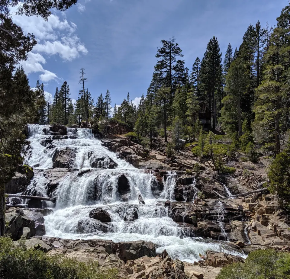
Glen Alpine Falls is a wide cascade on Glen Alpine Creek near the south end of Fallen Leaf Lake, close to South Lake Tahoe. The lower falls are next to the road, with "virtually no hike to get there," per Visit Lake Tahoe. Nearby is the Forest Service's Glen Alpine Trailhead, an entry point for Desolation Wilderness. Its parking and services are seasonal.
About Glen Alpine Falls
Glen Alpine Falls is on Glen Alpine Creek above the south end of Fallen Leaf Lake near South Lake Tahoe. The nearby Glen Alpine Trailhead is run by the Forest Service's Lake Tahoe Basin Management Unit (LTBMU).
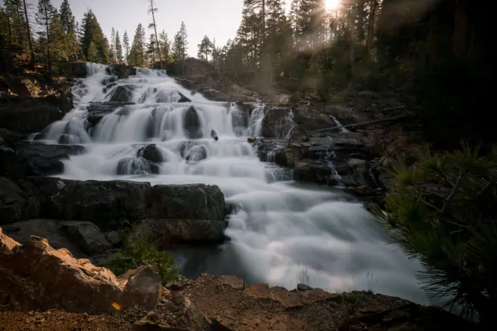
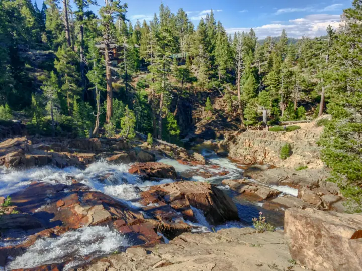
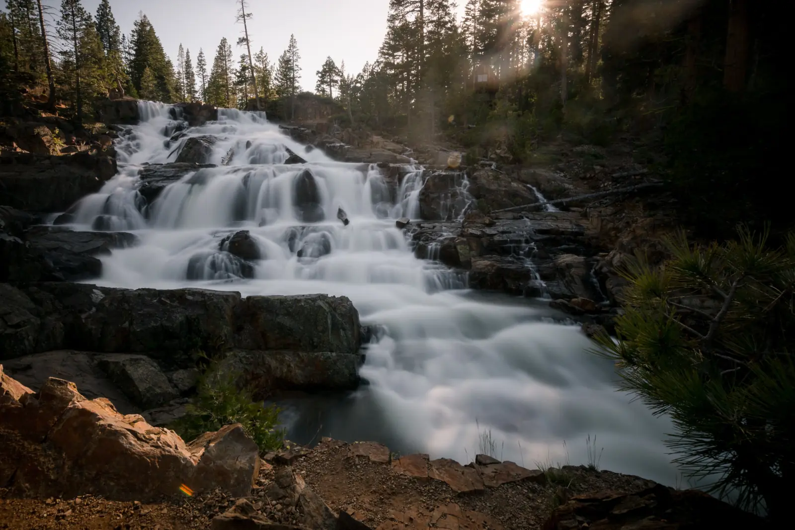
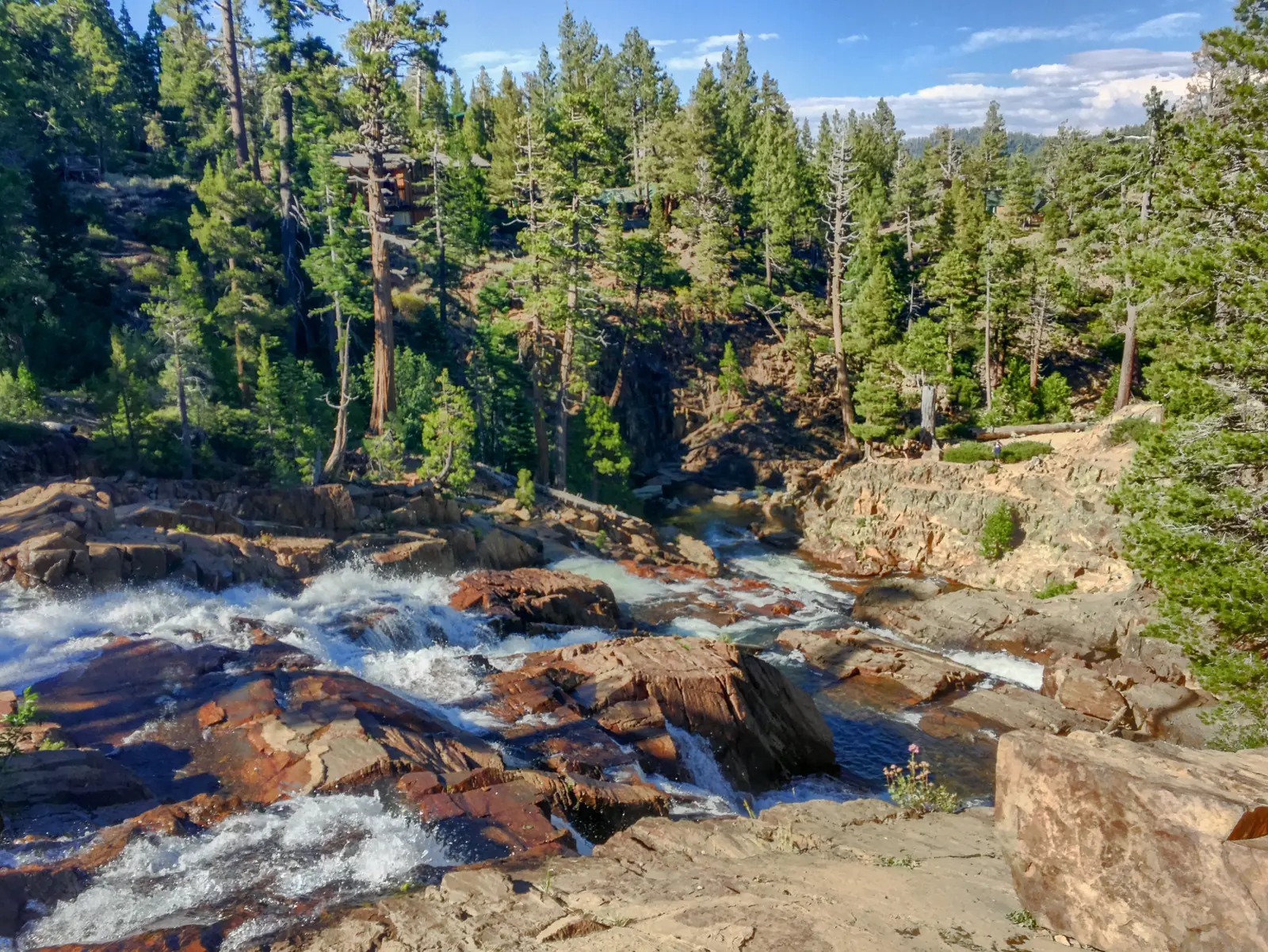
There are two sets of falls. The lower falls are next to the road and drop "about 60 feet down the step-like rocks," per Visit Lake Tahoe. The upper falls drop about 30 feet.
No agency publishes a height, so the figures above are Visit Lake Tahoe's. The Forest Service trailhead page covers parking, permits and rules, but it does not name the falls.
The map pin marks the Glen Alpine Trailhead, using the Forest Service's coordinates. We found no official coordinates for the falls themselves.
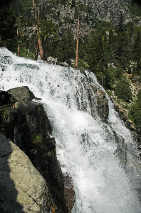
For another Lake Tahoe falls beside a Desolation Wilderness trailhead, see Eagle Falls at Emerald Bay.
Getting there and parking
Glen Alpine Falls is reached by Fallen Leaf Road, off Highway 89 on the south side of the Lake Tahoe Basin.
Directions from South Lake Tahoe
From South Lake Tahoe, take Highway 89 north approximately three miles to Fallen Leaf Road, per the Forest Service. Keep going around the south end of Fallen Leaf Lake.
Then turn left before the bridge and continue toward Lily Lake to the trailhead. Visit Lake Tahoe puts the trailhead about 4.5 miles along Fallen Leaf Road (it calls it Fallen Leaf Lake Road).
A narrow, one-lane road
Fallen Leaf Road is narrow and one lane, and the Forest Service asks drivers to "watch for bicyclists, pedestrians and other cars." Drive slowly and expect to pull over for oncoming traffic.
Visit Lake Tahoe says the road is two lanes as far as the campground. After that it is one lane with pullouts, past the general store and fire station.
Parking
For the lower falls, Visit Lake Tahoe describes roadside parking along the right side of the road. It warns that "parking is limited and difficult as there are no designated spots."
Trailhead parking is across from Lily Lake, per Visit Lake Tahoe. The Forest Service lists it as seasonal parking. Don't block the road or its pullouts.
Fees and hours
The Forest Service trailhead text we read lists no fee, but the page's fee and hours sections were not available to us. A Forest Service summary we saw on Nov 4, 2026 showed no fee and 24-hour access.
Call the Forest Supervisor's Office at 530-543-2600 to confirm before you go. We found no official drive time from South Lake Tahoe, so we don't give one.
Map and nearby falls
Map loads as you scroll. Open in OpenStreetMap
OpenPartly open / seasonalUnconfirmedClosedLarger map
Glen Alpine Falls trail: lower and upper falls
The lower falls need almost no walking: Visit Lake Tahoe says there is "virtually no hike to get there." It calls the walk to the upper falls "a one mile, round trip hike."
Lower Glen Alpine Falls
The lower falls sit next to the road, with parking along the right side of the road, per Visit Lake Tahoe.
Upper falls
Visit Lake Tahoe gives about one mile round trip for the upper falls. It does not say exactly where the walk starts, or give an elevation gain or difficulty for it.
Its "Moderate to Strenuous" rating and its 6,560 and 9,735 foot elevations describe the full Glen Alpine Trail, not the falls walk. We found no source that says whether the upper falls are inside Desolation Wilderness.
Longer hikes from the Glen Alpine Trailhead
Many hikes start at the trailhead, an entry point for Desolation Wilderness. The Forest Service suggests the southern spur "three miles to Grass Lake," or six miles all the way to Lake Aloha.
Another spur leads to Half Moon or Alta Morris lakes, and a third to Gilmore Lake and Dicks Pass. From Gilmore Lake, a trail up the backside of Mt. Tallac offers what the Forest Service calls a moderate approach to the summit.
Desolation Wilderness permits
Entering Desolation Wilderness requires a wilderness permit. Day hikers may pick one up at the trailhead kiosk, and overnight hikers should get theirs before arriving, per the Forest Service.
Day permits are free. The Eldorado National Forest says they are required only Memorial Day weekend through September 30, and not in winter, roughly October to March.
Overnight permits are issued through Recreation.gov, and hard-sided bear canisters are required for all overnight visits. Portable stoves with on/off valves are allowed with a valid permit. The wilderness covers 63,960 acres and is co-managed by the Eldorado National Forest and the LTBMU.
Dogs
The Forest Service pages we read do not state a pet rule for this trailhead or for Desolation Wilderness. Call the Forest Supervisor's Office at 530-543-2600 before you bring a dog.
Accessibility
We found no accessibility information for the falls or the trailhead. The trailhead has vault toilets but no potable water, per the Forest Service.
When to visit
An undated Visit Lake Tahoe page says "The snow is melting quickly" and calls the weeks before June "the best times to see them." The May 2019 photo above shows the creek in heavy runoff. For other falls in the state, see our California waterfalls list.
November and winter
The trailhead page lists "Seasonal Parking" and "No restrooms/trash service in winter." The text we read gives no closing date.
We found no current Forest Service notice on whether Fallen Leaf Road past the lake is plowed or gated in winter. No closure alert listed on Nov 6, 2026 named the road or the trailhead.
The LTBMU Current Conditions page asks visitors to contact the Forest Supervisor's Office before venturing out. Call 530-543-2600, and check Caltrans for highway conditions, which that page links to.
Campfires and camping
"National Forest lands in the Lake Tahoe Basin are under year-round campfire restrictions," under Order 19-24-04. Campfires using wood, charcoal or other solid fuels are not permitted at the trailhead or in Desolation Wilderness.
Elsewhere in the basin, campfires are only permitted in open, designated campgrounds, per the LTBMU Current Conditions page. There is no camping or overnighting at the trailhead.
| Height | about 60 ftNote: Visit Lake Tahoe gives about 60 ft for the lower falls and about 30 ft for the upper falls; no agency publishes a height |
|---|---|
| Trail | The lower falls are next to the road, with "virtually no hike to get there" (Visit Lake Tahoe). Visit Lake Tahoe calls the walk to the upper falls "a one mile, round trip hike" |
| Difficulty | Not rated for the falls walk. Visit Lake Tahoe's "Moderate to Strenuous" rating is for the full Glen Alpine Trail, not the walk to the falls |
| Entry fee | The Forest Service trailhead text we read lists no fee, but the page's fee section was not available to us. A Forest Service summary we saw on Nov 4, 2026 showed no fee. Call 530-543-2600 to confirm |
| Permit / reservation | Not for the lower falls. Desolation Wilderness day permits are free and required Memorial Day weekend through September 30 (Eldorado National Forest); overnight visits need a Recreation.gov permit |
| Parking | Seasonal trailhead lot; limited roadside spots |
| Dogs | The Forest Service pages we read do not state a pet rule for the trailhead or Desolation Wilderness. Call the Forest Supervisor's Office at 530-543-2600 before you bring a dog |
| Swimming | We found no official swimming rule for Glen Alpine Creek. Stay back from moving water, especially during spring snowmelt |
| Wheelchair / stroller | We found no accessibility information for the falls or the trailhead |
| Walk behind the falls | No |
| Restrooms | Vault toilet(s) at the trailhead; potable water is not available; no restrooms or trash service in winter (Forest Service) |
| Best time to visit | Before June, while snow is melting (undated Visit Lake Tahoe page) |
| Crowds | No crowd figure is published; Visit Lake Tahoe says roadside parking at the lower falls is limited |
| Managed by | USDA Forest Service, Lake Tahoe Basin Management Unit (Glen Alpine Trailhead) |
Safety and swimming
We found no official swimming rule for Glen Alpine Creek. Visit Lake Tahoe warns there is "no gate or fence that keeps you from the falls," so stay back from the moving water and off the rock beside it.
Plague advisory
Glen Alpine Trailhead is one of 30 sites on the LTBMU's standing Bubonic Plague alert, which began January 1, 2010 and has no end date. It is an advisory, not a closure.
"Bubonic Plague is naturally occurring in the Sierra Nevada," the alert reads. "Visitors should always take precautions when visiting areas where active plague has been found."
For general precautions and symptoms, the alert points to the Forest Service's Bubonic Plague at Lake Tahoe webpage. Questions go to the Forest Supervisor's Office at 530-543-2600.
Algal blooms and food storage
The LTBMU alerts list also carries a Harmful Algal Blooms alert, in place since January 1, 2010. Separate alerts cover food and refuse storage (Order 19-24-03) and bear canisters in Desolation Wilderness (Order 19-25-06).
Road and phone signal
Drive slowly on the one-lane road and watch for bicyclists and pedestrians. The Forest Service notes there is little to no cell reception in the backcountry.
For general tips, see our waterfall safety guide. Conditions change: confirm with the official source before you go.
Where to stay near Glen Alpine Falls
Compare hotels, cabins and rentals close to the falls around South Lake Tahoe.
See places to stay nearbyAffiliate link: we may earn a commission at no cost to you. Partners do not see or change our waterfall facts. Disclosure.
Photos
Glen Alpine Falls FAQ
Where is Glen Alpine Falls?
On Glen Alpine Creek above the south end of Fallen Leaf Lake, near South Lake Tahoe. From South Lake Tahoe, take Highway 89 north about three miles to Fallen Leaf Road.
How long is the walk to Glen Alpine Falls?
The lower falls are next to the road, with "virtually no hike to get there," per Visit Lake Tahoe. It calls the walk to the upper falls "a one mile, round trip hike."
Can you drive to Glen Alpine Falls?
Yes, to the lower falls. Fallen Leaf Road is narrow and one lane, and Visit Lake Tahoe says roadside parking there is limited, with no designated spots.
Do I need a permit for Glen Alpine Falls?
Not for the lower falls. Entering Desolation Wilderness from the Glen Alpine Trailhead requires a wilderness permit. Day permits are free and, per the Eldorado National Forest, required only Memorial Day weekend through September 30.
Is there a fee at the Glen Alpine Trailhead?
The Forest Service trailhead text we read lists no fee. A Forest Service summary we saw on Nov 4, 2026 showed none. We could not see the page's fee section, so call 530-543-2600 to confirm.
Is Glen Alpine Falls open in November?
As far as we can tell, yes: on Nov 6, 2026 no Forest Service closure alert named the trailhead or Fallen Leaf Road. Parking is seasonal, with no restrooms or trash service in winter. Winter road access is not confirmed.
Are dogs allowed at Glen Alpine Falls?
The Forest Service pages we read do not state a pet rule for the trailhead or Desolation Wilderness. Call the Forest Supervisor's Office at 530-543-2600 before you bring a dog.
How tall is Glen Alpine Falls?
About 60 feet for the lower falls and about 30 feet for the upper falls, per Visit Lake Tahoe. No agency publishes a height.
Nearby waterfalls
More waterfalls to explore
Sources
The no-fee and 24-hour access lines come from a Forest Service summary we saw on Nov 4, 2026. We could not read those sections on Nov 6, 2026. Status, directions, conditions, permits, campfire rules, amenities and the plague advisory were read on Nov 6, 2026.
- USFS Lake Tahoe Basin: Glen Alpine Trailhead (directions, conditions, permits, amenities, coordinates; updated Oct 9, 2026; read Nov 6, 2026)
- USFS Lake Tahoe Basin: Alerts list (campfire Order 19-24-04, food storage, harmful algal blooms; read Nov 6, 2026)
- USFS Lake Tahoe Basin: Bubonic Plague alert (updated Mar 20, 2026; read Nov 6, 2026)
- USFS Lake Tahoe Basin: Current Conditions (updated Oct 29, 2026; read Nov 6, 2026)
- USFS Lake Tahoe Basin: Desolation Wilderness (updated Jun 1, 2026; read Nov 6, 2026)
- USFS Eldorado NF: Desolation day use permits and parking (updated Sep 28, 2026; owner paste)
- Visit Lake Tahoe: Glen Alpine Trail (directions, Lily Lake parking, upper falls walk; read Nov 6, 2026)
- Visit Lake Tahoe: Lake Tahoe waterfalls, Glen Alpine Falls (road, roadside parking, best season; read Nov 6, 2026)
- Visit Lake Tahoe: Waterfall guide (upper and lower Glen Alpine Falls heights; read Nov 6, 2026)
Last verified Nov 6, 2026 by The Waterfall Guide editorial team. Conditions change: confirm with USDA Forest Service, Lake Tahoe Basin Management Unit (Glen Alpine Trailhead) before you go. Spotted something out of date? Report a correction.