Pacific Northwest
Waterfalls in Oregon
This guide covers 12 waterfalls in Oregon, eight of them in the Columbia River Gorge and Oregon City near Portland. Multnomah Falls, about 620 feet in two tiers, is the tallest we cover. In 2026, Multnomah Falls kept a summer timed-use parking permit, and the Latourell Falls Trailhead began charging day-use parking.
Oregon waterfalls on this site
This guide covers 12 waterfalls in Oregon. Each card shows the status as of October 28, 2026 and the height where a source gives one.
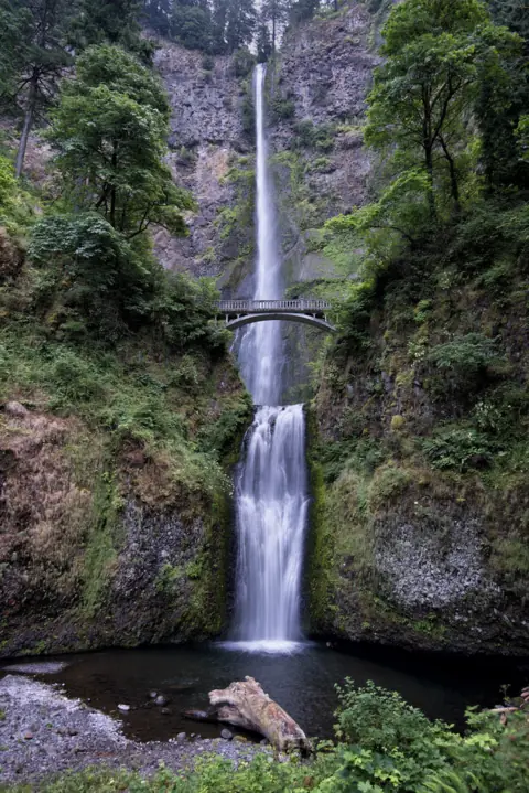
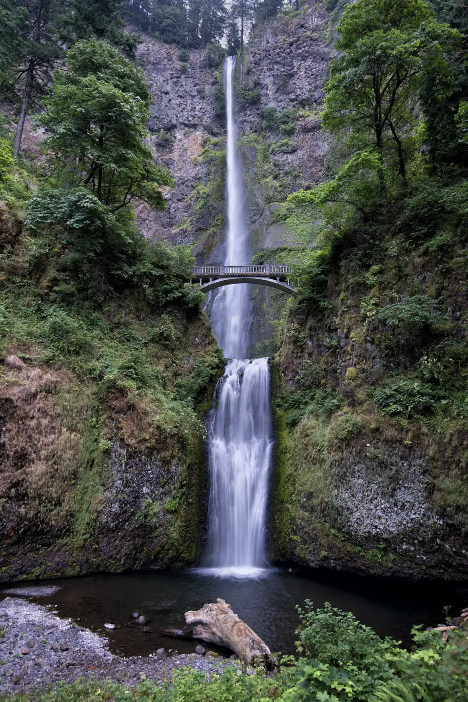
Often called Oregon's tallest: 620 ft, Benson Bridge and a steep 2.4-mile trail to the top.
Multnomah Falls0.5 to 2.4 mi · Easy (bridge) / steep (top)Open620FT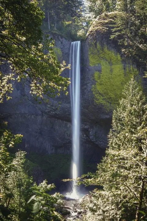
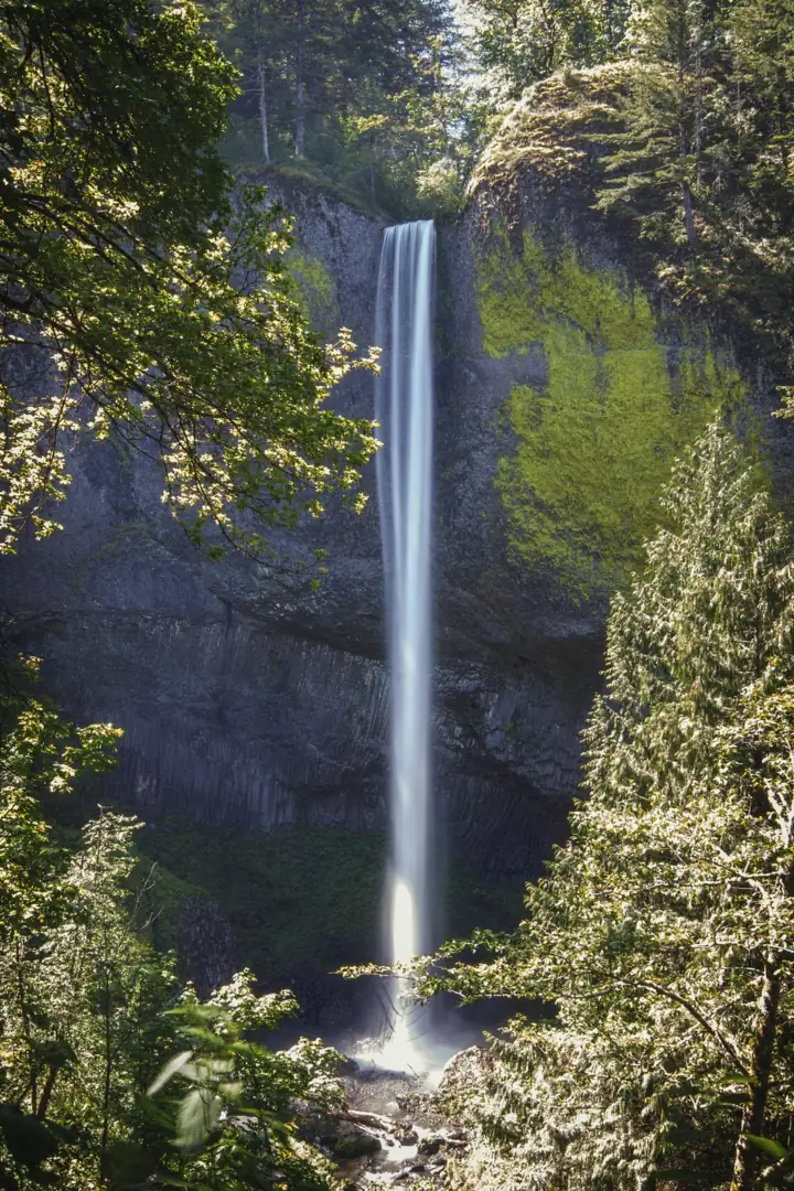
A 224-ft plunge over yellow-lichen basalt, a short walk from the Historic Highway.
Latourell FallsShort walk / 2 mi loop · Easy to moderateOpen224FT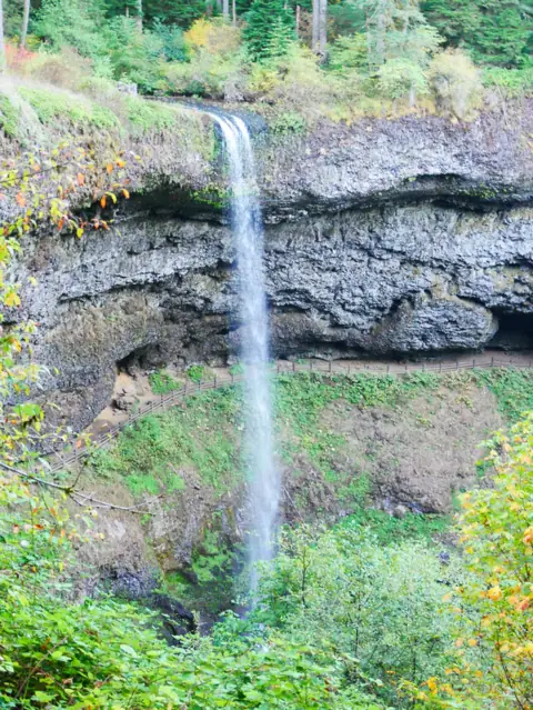
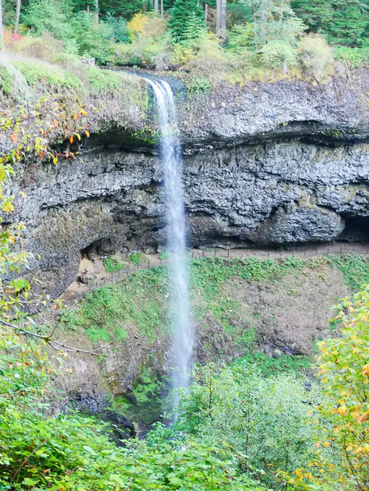
A 177-ft curtain you can walk behind, on Oregon's 7.2-mile Trail of Ten Falls.
South Falls (Silver Falls)1.0 mi / 7.2 mi loop · ModerateOpen177FT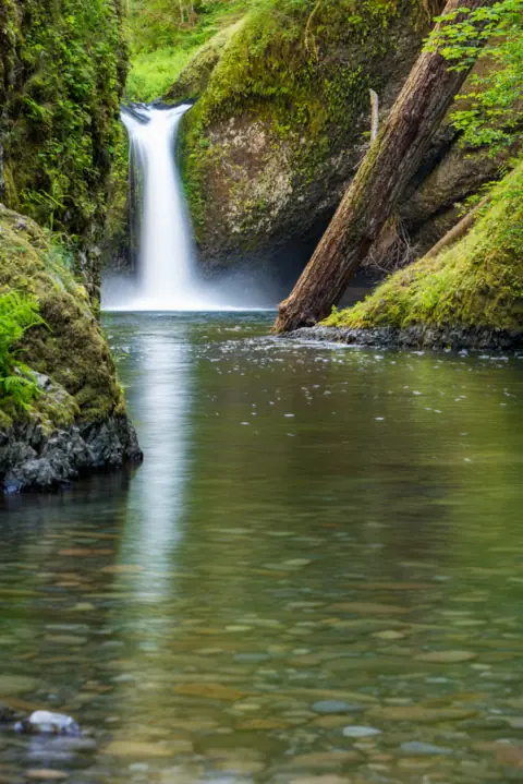
The falls that named the punchbowl type, on Eagle Creek. Trail open again after 2025 storms.
Punch Bowl Falls3.8 mi round trip · ModerateOpen35FT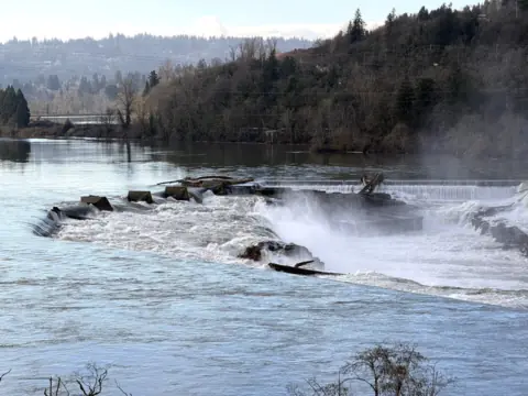
The Northwest's biggest falls by volume, seen from public Oregon City viewpoints.
Willamette FallsViewpoints only · EasyPartly open40FT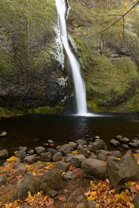
A free roadside falls on the Historic Highway, with a short climb behind Ponytail Falls.
Horsetail FallsRoadside / 0.8 mi / 3.6 mi · EasyOpen176FT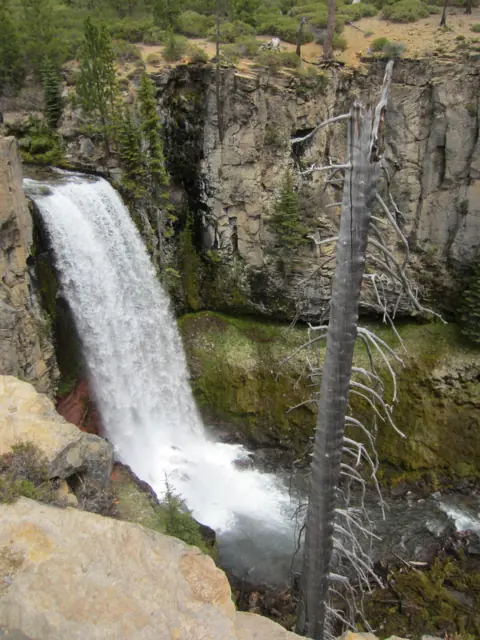
A 97-ft plunge near Bend, steps from the lot when the seasonal road is open.
Tumalo FallsNear lot / 0.25 mi to top · EasySeasonal97FT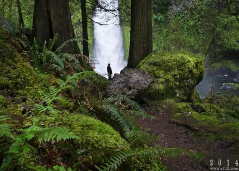
A two-tier falls on Tanner Creek near Bonneville; trail open again after 2025 storms.
Wahclella Falls2.4 mi round trip · Easy to moderateOpen60FT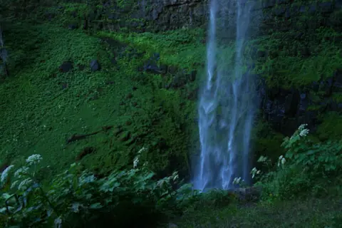
A two-tier falls in columnar basalt on the North Umpqua, 0.4 mi from the trailhead.
Toketee Falls0.8 mi round trip · EasyOpen120FT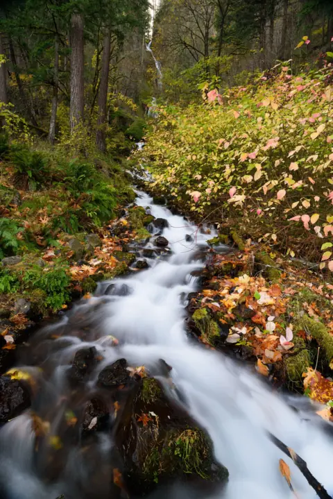
A 242-ft tiered falls half a mile from Multnomah, with no fee listed and no permit.
Wahkeena Falls0.4 mi / 4.9 mi loop · Easy (bridge) / steep (loop)Open242FT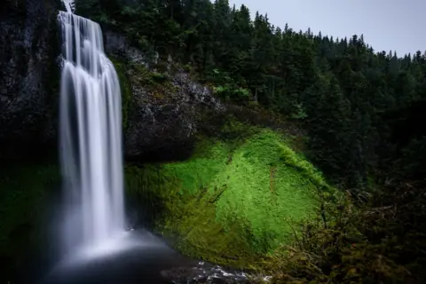
A 286-foot drop with an accessible platform 50 yards from the lot; normally closed in winter.
Salt Creek Falls50 yd to the viewpoint · Easy (platform)Seasonal286FT SINGLE DROP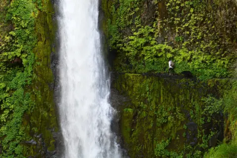
The trail passes behind the falls about 7 miles up Eagle Creek, past sheer cliffs without handrails.
Tunnel FallsAbout 14 mi round trip · Long, with cliff exposureOpen
Map of Oregon waterfalls
The map shows where each of the 12 Oregon waterfalls in this guide is located.
Map loads as you scroll. Open in OpenStreetMap
OpenPartly open / seasonalUnconfirmedClosedLarger map
| Waterfall | Status | Area | Height | Trail | Difficulty | Fee / permit | Swimming |
|---|---|---|---|---|---|---|---|
| Multnomah Falls | Open | Columbia River Gorge | 620 ft | 0.5 to 2.4 mi | Easy (bridge) / steep (top) | No entry fee listed | No |
| Latourell Falls | Open | Columbia River Gorge | 224 ft | Short walk / 2 mi loop | Easy to moderate | $10 to 12 parking | No |
| South Falls (Silver Falls) | Open | Silver Falls State Park | 177 ft | 1.0 mi / 7.2 mi loop | Moderate | $10-12 parking | Designated area only |
| Punch Bowl Falls | Open | Columbia River Gorge | 35 ft | 3.8 mi round trip | Moderate | Day pass or NW Forest Pass | No cliff diving (WTA) |
| Willamette Falls | Partly open | Oregon City | 40 ft | Viewpoints only | Easy | No fee listed | No |
| Horsetail Falls | Open | Columbia River Gorge | 176 ft | Roadside / 0.8 mi / 3.6 mi | Easy | Free | No |
| Tumalo Falls | Seasonal | Central Oregon | 97 ft | Near lot / 0.25 mi to top | Easy | $5 day pass or NW Forest Pass | No rule listed |
| Wahclella Falls | Open | Columbia River Gorge | 60 ft | 2.4 mi round trip | Easy to moderate | $5 day pass or NW Forest Pass | No rule listed |
| Toketee Falls | Open | North Umpqua | 120 ft | 0.8 mi round trip | Easy | No fee listed | No |
| Wahkeena Falls | Open | Columbia River Gorge | 242 ft | 0.4 mi / 4.9 mi loop | Easy (bridge) / steep (loop) | No fee listed | No |
| Salt Creek Falls | Seasonal | Highway 58, near Willamette Pass | 286 ft (single drop) | 50 yd to the viewpoint | Easy (platform) | $5 per vehicle or a pass | No rule posted; viewing only |
| Tunnel Falls | Open | Columbia River Gorge, Mark O. Hatfield Wilderness | Not listed | About 14 mi round trip | Long, with cliff exposure | $5 per vehicle or a pass | No rule posted at Tunnel Falls |
Overview of waterfalls in Oregon
Other gorge falls on this site include Wahkeena Falls, about half a mile west of Multnomah, and Latourell Falls, farther west. Horsetail Falls, on the Historic Columbia River Highway 2.75 miles east of Multnomah Falls, drops 176 feet beside the road, per Wikipedia, and is free to see.
Punch Bowl Falls on Eagle Creek and Wahclella Falls near Cascade Locks are hikes of about 3.8 and 2.4 miles round trip. December 2025 storms closed both trails, and as of October 2026 the Forest Service lists both trails as open (see Roads and closures). Tunnel Falls is about 7 miles up the same Eagle Creek trail, per the Forest Service.
Beyond the gorge, South Falls in Silver Falls State Park near Silverton is a 177-foot curtain you can walk behind. Tumalo Falls drops 97 feet west of Bend. Toketee Falls is a two-tier falls on the North Umpqua River, and Willamette Falls is a wide horseshoe falls seen from public viewpoints in Oregon City. Salt Creek Falls drops 286 feet off Highway 58 near Willamette Pass, per the Forest Service.
In 2026 there was no Historic Highway timed-use permit, but Multnomah Falls kept its own summer timed-use permit. Oregon State Parks also began charging day-use parking at the Latourell Falls Trailhead. The details are below and on each waterfall page.
Waterfalls near Portland
Seven of the Oregon falls on this site are in the Columbia River Gorge east of Portland, and an eighth is in Oregon City. Multnomah Falls is about 30 miles east of downtown Portland, off I-84 at Exit 31. Latourell Falls is the first big falls you reach on the Historic Columbia River Highway heading east from Portland.
Along the same road, Wahkeena Falls is about half a mile west of Multnomah. The Forest Service puts the Horsetail Falls lot 2.75 miles east of Multnomah Falls. Farther east near Cascade Locks, Wahclella Falls starts at I-84 Exit 40 and Punch Bowl Falls and Tunnel Falls at the Eagle Creek Trailhead off Exit 41.
Willamette Falls is in Oregon City. Wikipedia says a hydro plant there sent power about 14 miles to Portland in 1889. The falls are free to see, but industrial land blocks public access to the falls themselves (as of Oct 2026). The views are from the McLoughlin Promenade, reached by the free Municipal Elevator, and a Highway 99E viewpoint. A riverwalk at tumwata village is in design, with no opening date set.
Permits and fees in the Columbia River Gorge (2026)
Most Columbia River Gorge falls need no timed-use permit; in 2026, only the Multnomah Falls I-84 lot required one in summer.
Multnomah Falls: a timed-use permit is required to park at the I-84 Exit 31 lot in summer. In 2026 it ran May 22 to September 7, 9am to 6pm, booked on Recreation.gov with a $2 transaction fee. Bike, shuttle and transit riders are exempt. See the Multnomah Falls permit and parking guide.
The Historic Highway corridor: there was no timed-use permit for the rest of the Historic Columbia River Highway in 2026.
Oregon State Parks trailheads: from March 30, 2026, Oregon State Parks requires a day-use parking permit at the Latourell Falls Trailhead. The Latourell permit costs $10 a day for Oregon residents, $12 for non-residents, or $60 for a 12-month permit. Walk-in, bike-in and transit visitors don't pay.
Forest Service sites vary. The Forest Service lists no day-use fee at Wahkeena, and Friends of the Columbia Gorge says Horsetail Falls needs no permit or trailhead pass. The Eagle Creek (Punch Bowl Falls) and Wahclella trailheads need a Northwest Forest Pass ($30 a year), a $5 day pass or an America the Beautiful pass.
Passes don't cross over. The Northwest Forest Pass isn't valid at Oregon State Parks such as Silver Falls. Oregon State Parks permits aren't valid at Forest Service sites. The Forest Service's 2026 fee-free days list includes Veterans Day, November 11.
Columbia River Gorge roads and closures
As of October 2026, all seven Columbia River Gorge falls on this site are open. The Oneonta Gorge corridor next to Horsetail Falls stays closed, and occasional single-lane closures are expected near Multnomah Falls.
The Historic Columbia River Highway (US-30) is narrow, and shoulder parking is not allowed; ODOT tickets or tows illegally parked cars. The East Multnomah Falls Viaduct reopened on May 15, 2026 after repairs, for vehicles under 35 feet. Occasional single-lane closures are expected on the Historic Highway near Multnomah Falls through fall 2026. As of October 2026, the Multnomah Falls Lodge restrooms are closed for renovation through November 2026.
Much of the area around Multnomah and Wahkeena burned in the 2017 Eagle Creek Fire. The Forest Service warns of landslide and falling-tree risk in the burn scar. December 2025 storms closed some trails for months, including Eagle Creek Trail #440 and Wahclella Trail #436. The Forest Service advises against hiking burn-scar areas during heavy rain or snow or within 48 hours after.
Both trails are open again by the Forest Service's account, as of October 2026. Its Eagle Creek page, updated September 16, 2026, shows Site Open, and the Wahclella trail page lists no closure. Its alerts list had no closure for either trail on October 23, 2026. Check Forest Service alerts before any gorge hike.
Next to Horsetail Falls, the Oneonta Gorge creek corridor stays closed under the Eagle Creek Fire area forest order. The Forest Service alerts list, checked October 23, 2026, still shows that order (06-22-01-26-04) closing Oneonta Gorge. The Forest Service lists the Wahkeena Falls site as open, on a page updated May 1, 2026.
Silver Falls State Park and the Trail of Ten Falls
Silver Falls State Park near Silverton is the Oregon park with ten waterfalls on one loop. The 7.2-mile Trail of Ten Falls loop links the Canyon and Rim trails, and Oregon State Parks rates it moderate, with stairs and steep sections.
South Falls drops 177 feet, and a 1-mile out-and-back on the Canyon Trail passes behind it. Oregon State Parks says four of the park's falls let you walk behind the water. Dogs aren't allowed on the trail behind the falls, and the walk-behind trail is not wheelchair accessible.
Parking takes an Oregon State Parks day-use permit, $10 a day for Oregon residents or $12 for non-residents. Oregon State Parks lists the park as open for day use and camping year-round (park page read October 28, 2026). Check the park's alerts for trail closures before you go, or call 503-873-8681. The North Gateway campground has been put on hold.
Central and southern Oregon: Tumalo and Toketee Falls
Tumalo Falls near Bend and Toketee Falls near Roseburg are two of the Oregon falls on this site outside the Portland area and Silver Falls State Park.
Tumalo Falls (Deschutes National Forest): the Forest Service puts the lot about 14.2 miles from Bend, at the end of Forest Road 4603. Parking needs a recreation pass, such as a $5 day pass, a Northwest Forest Pass or an America the Beautiful pass. The falls are visible near the lot.
The Forest Service closes Forest Road 4603 to motor vehicles from about November to May because of snow. Its day-use page showed no closure on October 28, 2026, so check that page for the 2026-27 gate date. The road stays open to skiers, snowshoers, fatbikers and hikers, which adds about 2.5 miles each way.
Toketee Falls (Umpqua National Forest): about 58 miles east of Roseburg off OR-138. Trail #1495 is 0.4 miles each way with nearly 200 steps, ending at a viewing platform. The Forest Service trail page lists no fee, and the trailhead isn't on the Umpqua National Forest's cashless fee-site list.
The Toketee trail page, updated August 17, 2026, shows no closure, and we found no 2026 closure notice. In winter and fire season, call the North Umpqua Ranger Station at 541-496-3532.
Oregon waterfalls without a long hike
Seven of the Oregon falls on this site can be seen without a long hike.
- Multnomah Falls: the lodge and lower viewing plaza are wheelchair accessible, per the Forest Service. Benson Bridge is 0.5 miles round trip.
- Horsetail Falls: seen across the Historic Highway from the lot. You must cross the road to reach the viewing area.
- Latourell Falls: about 15 minutes' walk to the lower falls.
- Wahkeena Falls: 0.4 miles round trip to the stone bridge, with an accessible viewing platform, per the Forest Service.
- Tumalo Falls: visible near the lot, with about 0.25 miles of climbing to a platform above the falls.
- Willamette Falls: viewpoints only. The free Municipal Elevator gives step-free access to the McLoughlin Promenade.
- Salt Creek Falls: an accessible platform 50 yards from the lot, per the Forest Service, though the site is normally closed in winter.
Tallest waterfalls on this site
Multnomah Falls is the tallest Oregon falls on this site, at about 620 feet. Wikipedia calls it the tallest waterfall in Oregon. The World Waterfall Database lists it at 632 feet and ranks it second in the state, behind an unnamed fall it marks unconfirmed.
Heights of the falls on this site, from the falls pages:
| Waterfall | Height | Source |
|---|---|---|
| Multnomah Falls | About 620 ft (542-ft upper, 69-ft lower) | Falls page |
| Wahkeena Falls | 242 ft over several tiers | Falls page |
| Latourell Falls | 224 ft | Oregon State Parks |
| South Falls | 177 ft (nearby Double Falls, 178 ft, is the park's tallest) | Oregon State Parks, Wikipedia |
| Horsetail Falls | 176 ft | Forest Service, Wikipedia |
| Salt Creek Falls | 286 ft single drop | Forest Service |
| Toketee Falls | About 120 ft (40-ft upper, 80-ft lower) | Forest Service |
| Tumalo Falls | 97 ft | Wikipedia |
Getting to Oregon waterfalls without a car
The Columbia Gorge Express bus runs from Gateway Transit Center in Portland to Multnomah Falls, and gorge shuttles also serve the falls. Transit and bike riders don't need the Multnomah Falls permit.
When to visit Oregon waterfalls
Multnomah Falls flows all year, and spring (March to June) brings the most water as snow melts on Larch Mountain. Summer is the busiest season there, which is why the permit runs then. In winter cold snaps Multnomah can partly freeze. The Forest Service says ice on the upper Wahkeena switchbacks can be dangerous, so carry traction devices if you hike in icy weather.
Oregon waterfalls FAQ
Do you need a permit to see waterfalls in the Columbia River Gorge?
In 2026, only to park at the Multnomah Falls I-84 Exit 31 lot in summer (May 22 to September 7, 9am to 6pm). There was no permit for the rest of the Historic Highway. The Latourell Falls Trailhead needs an Oregon State Parks day-use parking permit if you drive.
What is the tallest waterfall in Oregon?
Of the Oregon falls on this site, Multnomah Falls is the tallest, at about 620 feet in two tiers: a 542-foot upper falls and a 69-foot lower falls. Wikipedia calls it Oregon's tallest. The World Waterfall Database ranks it second, behind an unconfirmed unnamed fall.
Which Oregon waterfalls are free?
Multnomah Falls lists no entry fee, and its I-84 lot is free apart from the $2 online permit transaction fee in summer. The Forest Service lists no day-use fee at Wahkeena, Horsetail Falls needs no pass, and the Willamette Falls viewpoints in Oregon City list no fee. Latourell Falls and Silver Falls need a state park parking permit if you drive.
Does the Northwest Forest Pass work at Silver Falls State Park?
No. Silver Falls is an Oregon State Parks site, so you need its day-use permit ($10 a day for residents, $12 for non-residents). The Northwest Forest Pass covers Forest Service sites such as Eagle Creek, Wahclella and Tumalo Falls.
Which Oregon park has 10 waterfalls?
Silver Falls State Park near Silverton. Its 7.2-mile Trail of Ten Falls loop, on the Canyon and Rim trails, passes ten waterfalls. Oregon State Parks rates the full loop moderate, with stairs and steep sections, and parking takes a day-use permit.
Which Oregon waterfall can you walk behind?
South Falls in Silver Falls State Park. A 1-mile out-and-back on the Canyon Trail passes behind it, and Oregon State Parks says four of the park's falls let you walk behind the water. The walk-behind trail is not wheelchair accessible, and dogs aren't allowed on it.
Is the trail to Punch Bowl Falls open?
Yes. The Forest Service Eagle Creek page, updated September 16, 2026, shows Site Open, and its alerts list had no Eagle Creek closure on October 23, 2026. The trail had closed after December 2025 storms.
Can you see several Columbia River Gorge waterfalls in one day?
Yes. Latourell, Wahkeena and Multnomah Falls are all on the Historic Columbia River Highway, and a trail links Wahkeena and Multnomah Falls, about half a mile apart. The Forest Service lists the Wahkeena site as open, but check its alerts before you go.
Sources
- Recreation.gov: Multnomah Falls (I-84) Timed Use Permit
- ODOT: Waterfall Corridor permits
- USDA Forest Service: Multnomah Falls
- KOIN: ODOT reopens Historic Highway east of Multnomah Falls
- ODOT: I-84 Columbia River Gorge 2026 projects (PDF)
- Wikipedia: Multnomah Falls
- Oregon State Parks: Latourell Falls Trailhead (Guy W. Talbot State Park)
- Oregon Parks and Recreation: More state parks will require day-use parking permits (Feb 20, 2026)
- USDA Forest Service: Wahkeena Falls
- USDA Forest Service: Wahkeena Trail #420
- USDA Forest Service: Columbia River Gorge trail closures (Dec 2025)
- USDA Forest Service Region 6: Passes (updated Oct 5, 2026)
- WTA: Eagle Creek
- USDA Forest Service: Eagle Creek Trailhead & Trail #440
- USDA Forest Service: Wahclella Falls Trail #436
- Central Oregon Daily: Oregon's most iconic hikes hammered by storms
- USDA Forest Service: Horsetail Falls Trailhead & Day Use
- Friends of the Columbia Gorge: Horsetail, Ponytail & Triple Falls
- Wikipedia: Horsetail Falls (Oregon)
- USDA Forest Service: Eagle Creek Fire area closure (archived Apr 11, 2026)
- Oregon State Parks: Silver Falls State Park
- OPRD: Silver Falls Trail of Ten Falls map (2/25)
- USDA Forest Service: Tumalo Falls Day Use Area
- Wikipedia: Tumalo Falls
- USDA Forest Service: Toketee Falls Trail
- Wikipedia: Toketee Falls
- City of Oregon City: McLoughlin Promenade (read Oct 29, 2026)
- City of Oregon City: Grand Ronde and City advance next phase of public access (Jul 30, 2026)
- USDA Forest Service: Columbia River Gorge alerts (read Oct 23, 2026)
- KATU: Umpqua National Forest sites go cashless April 1, 2026 (Feb 3, 2026)
- Wikipedia: Wahkeena Falls
- Wikipedia: Silver Falls State Park
- World Waterfall Database: tallest waterfalls in Oregon (read Oct 24, 2026)
- Wikipedia: Willamette Falls
- Multnomah Falls Lodge: Restroom renovation notice (read Oct 27, 2026)
City guides: Waterfalls near Portland, OR
More Oregon waterfalls are being added. Each one is checked against its managing agency before it goes live.
Photos: John Fowler, CC BY 2.0; Steven Pavlov, CC BY-SA 4.0; Rick Obst, CC BY 4.0. Photo credits