Waterfalls near a city
Waterfalls near Portland, Oregon
Start 13 miles straight-line south of Portland at Willamette Falls in Oregon City, the nearest falls in this guide. It is only partly open: the viewpoints are open, but there is no public access to the falls itself (checked October 18, 2026). Latourell Falls, 21 straight-line miles out, drops 224 ft a short walk from its trailhead lot. Multnomah Falls, 26 straight-line miles away, is 620 ft tall and lists no entry fee.
10 waterfalls within 50 miles of Portland
Distances are straight-line miles from the US Census Gazetteer internal point of Portland, OR, not driving distances, so check a route before you go. Each card links to a full guide with fees, parking and current status.
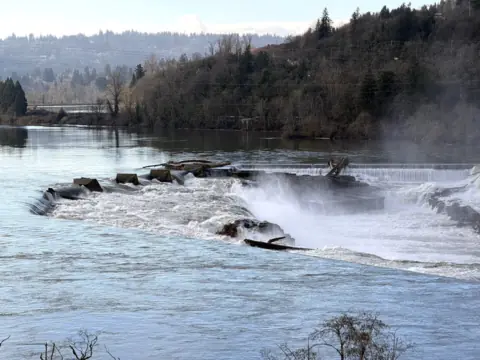
The Northwest's biggest falls by volume, seen from public Oregon City viewpoints.
Willamette Falls13 mi straight-line · EasyPartly open40FT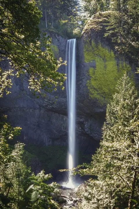
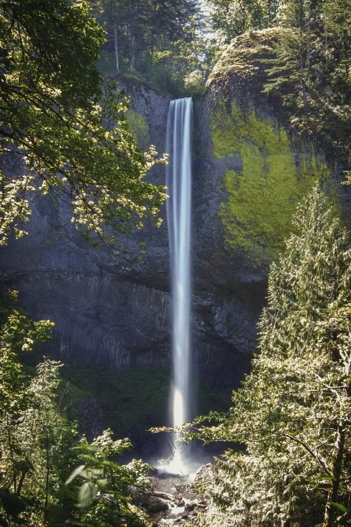
A 224-ft plunge over yellow-lichen basalt, a short walk from the Historic Highway.
Latourell Falls21 mi straight-line · Easy to moderateOpen224FT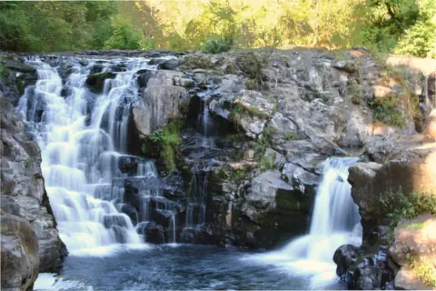
A small river falls near Yacolt with an arch bridge and summer swimming at your own risk.
Moulton Falls24 mi straight-line · EasyOpen10FT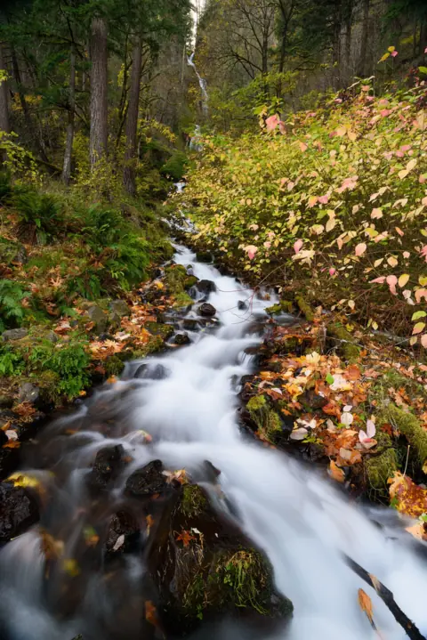
A 242-ft tiered falls half a mile from Multnomah, with no fee listed and no permit.
Wahkeena Falls25 mi straight-line · Easy (bridge) / steep (loop)Open242FT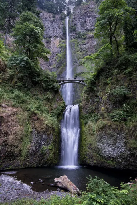
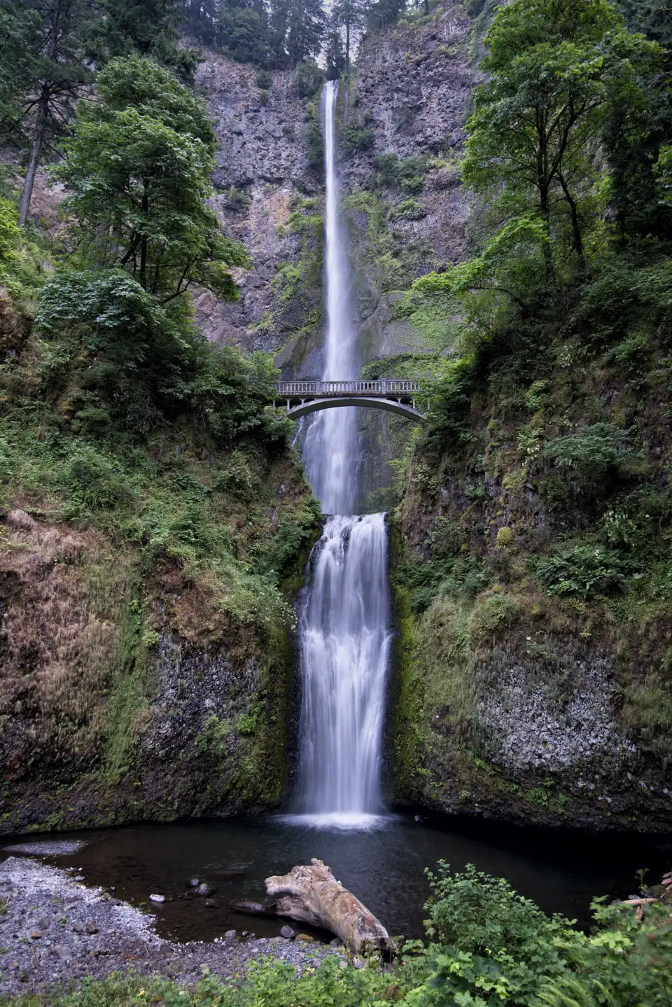
Often called Oregon's tallest: 620 ft, Benson Bridge and a steep 2.4-mile trail to the top.
Multnomah Falls26 mi straight-line · Easy (bridge) / steep (top)Open620FT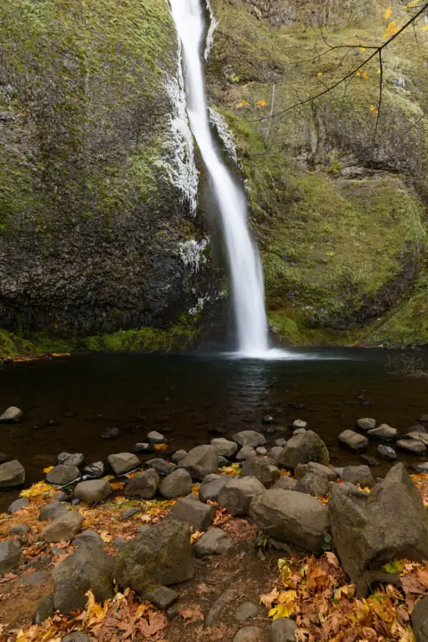
A free roadside falls on the Historic Highway, with a short climb behind Ponytail Falls.
Horsetail Falls28 mi straight-line · EasyOpen176FT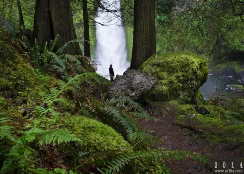
A two-tier falls on Tanner Creek near Bonneville; trail open again after 2025 storms.
Wahclella Falls34 mi straight-line · Easy to moderateOpen60FT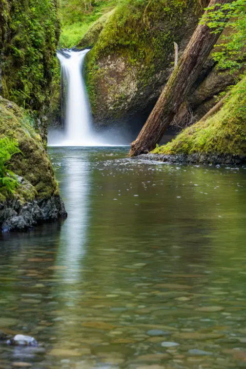
The falls that named the punchbowl type, on Eagle Creek. Trail open again after 2025 storms.
Punch Bowl Falls37 mi straight-line · ModerateOpen35FT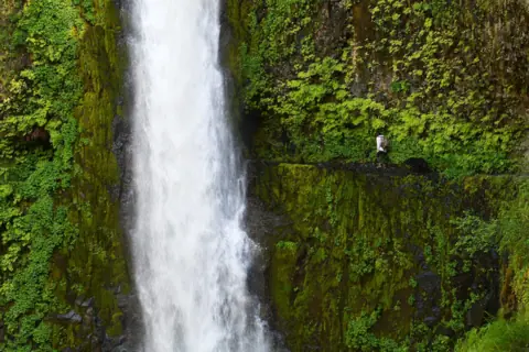
The trail passes behind the falls about 7 miles up Eagle Creek, past sheer cliffs without handrails.
Tunnel Falls39 mi straight-line · Long, with cliff exposureOpen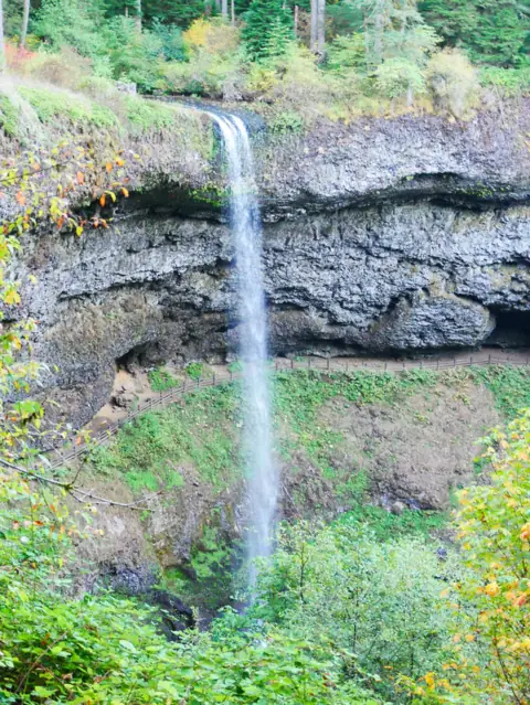
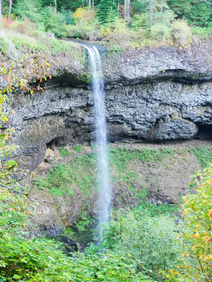
A 177-ft curtain you can walk behind, on Oregon's 7.2-mile Trail of Ten Falls.
South Falls (Silver Falls)45 mi straight-line · ModerateOpen177FT
Map of waterfalls near Portland
Map loads as you scroll. Open in OpenStreetMap
OpenPartly open / seasonalUnconfirmedClosedLarger map
Compare the waterfalls near Portland
| Waterfall | Distance | Status | State | Height | Trail | Difficulty | Fee / permit | Swimming |
|---|---|---|---|---|---|---|---|---|
| Willamette Falls | 13 mi | Partly open | OR | 40 ft | Viewpoints only | Easy | No fee listed | No |
| Latourell Falls | 21 mi | Open | OR | 224 ft | Short walk / 2 mi loop | Easy to moderate | $10 to 12 parking | No |
| Moulton Falls | 24 mi | Open | WA | 10 ft | Short walk; 4.0 mi full hike | Easy | No fee listed | Yes, at your own risk |
| Wahkeena Falls | 25 mi | Open | OR | 242 ft | 0.4 mi / 4.9 mi loop | Easy (bridge) / steep (loop) | No fee listed | No |
| Multnomah Falls | 26 mi | Open | OR | 620 ft | 0.5 to 2.4 mi | Easy (bridge) / steep (top) | No entry fee listed | No |
| Horsetail Falls | 28 mi | Open | OR | 176 ft | Roadside / 0.8 mi / 3.6 mi | Easy | Free | No |
| Wahclella Falls | 34 mi | Open | OR | 60 ft | 2.4 mi round trip | Easy to moderate | $5 day pass or NW Forest Pass | None listed |
| Punch Bowl Falls | 37 mi | Open | OR | 35 ft | 3.8 mi round trip | Moderate | Day pass or NW Forest Pass | No cliff diving (WTA) |
| Tunnel Falls | 39 mi | Open | OR | Not listed | About 14 mi round trip | Long, with cliff exposure | $5 per vehicle or a pass | No rule posted at Tunnel Falls |
| South Falls (Silver Falls) | 45 mi | Open | OR | 177 ft | 1.0 mi / 7.2 mi loop | Moderate | $10-12 parking | Designated area only |
Where to stay near Portland
Base yourself in Portland, OR for a waterfall day. Open the map to compare hotels, cabins and rentals, or switch to tours and activities.
Or open the full stays map in a new tab
Affiliate links and map: we may earn a commission at no cost to you. The map loads from Stay22 only when you open it. Partners do not see or change our waterfall facts. Disclosure.
How the list breaks down
Seven of the 10 falls sit in the Columbia River Gorge, from Latourell at 21 straight-line miles to Tunnel Falls at 39. The other three point in different directions. Willamette Falls is in Oregon City, Moulton Falls is in Clark County, Washington, and South Falls is in Silver Falls State Park, 45 straight-line miles out.
Only falls with their own page in this guide make the list, so treat these 10 as a starting set, not a full count. Nine were listed open and Willamette partly open on checks from October 17 to November 3, 2026. Storms have closed Gorge trails before, so open each falls page before you go.
Statewide, the Oregon waterfalls guide covers every Oregon falls on the site.
Which pass or permit each falls needs
Falls near Portland fall under different fee systems, and a pass for one does not always work at another. Check which one applies before you leave.
- No fee listed: Multnomah, Wahkeena and Horsetail Falls list no entry fee. The Willamette Falls viewpoints list no fee either, though downtown street parking may be metered. Clark County lists no parking fee at Moulton Falls.
- Forest Service day pass: Wahclella Falls and the Eagle Creek Trailhead (Punch Bowl and Tunnel Falls) charge $5 per vehicle per day. A valid recreation pass also works. Wahclella does not accept cash or checks.
- Oregon State Parks permit: Latourell Falls and Silver Falls charge $10 a day for Oregon residents and $12 for non-residents.
The systems don't mix. Northwest Forest Pass and America the Beautiful passes are not valid at Silver Falls. WTA says Oregon State Parks permits are not valid at Eagle Creek.
Multnomah adds a summer rule. In 2026, the I-84 Exit 31 lot needed a timed-use permit from May 22 to September 7, with a $2 online fee. ODOT says 2027 details will be posted later; see the Multnomah Falls permit guide. Wahkeena is not part of that permit.
Tunnel Falls also needs a free, self-issued wilderness permit from Memorial Day weekend through October 31. The 2026 season ended October 31.
Short stops and long hikes
The falls nearest a parking lot are not always the falls nearest Portland, so sort by walk as well as distance.
- Roadside or viewpoint: Horsetail Falls is seen across the Historic Columbia River Highway from its lot. Willamette Falls is seen from the McLoughlin Promenade, the Highway 99E viewpoint or the Oregon City Bridge.
- Under a mile round trip: Wahkeena Falls is 0.4 miles round trip to the stone bridge. Benson Bridge at Multnomah Falls is about a quarter mile each way. Latourell's lower falls and Moulton Falls are short walks from their lots.
- 1 to 4 miles: the walk behind South Falls is 1.0 mile out and back. Wahclella Falls is 2.4 miles round trip with about 300 ft of gain. The trail to the top of Multnomah is also 2.4 miles, with about 600 ft of climbing. Punch Bowl Falls is about 3.8 miles round trip.
- Long days: the Trail of Ten Falls loop at Silver Falls is 7.2 miles. Tunnel Falls is about 14 miles round trip on Eagle Creek Trail #440.
The Forest Service says parts of the Eagle Creek Trail have sheer cliffs without handrails. It does not recommend the trip to Tunnel Falls for children or anyone afraid of heights. The Punch Bowl section also has narrow cliff-edge stretches.
Swimming, diving and dogs
Most falls on this list have no designated swimming. Two places allow it, with limits.
- Moulton Falls: Clark County allows swimming at your own risk, with no lifeguards. Diving and jumping from the arch bridge are prohibited.
- Silver Falls State Park: swimming is allowed only in the designated area in the South Falls day-use area, not at the falls.
The Forest Service prohibits jumping or diving off Punch Bowl Falls, and WTA says cliff diving is banned along the Eagle Creek Trail. Multnomah, Wahkeena, Latourell and Horsetail have no designated swimming. There is no public river access at Willamette Falls.
Dog rules split the list too. Silver Falls bans dogs on the Canyon Trail, so they can't go behind South Falls or on the full loop. On Eagle Creek Trail, the Forest Service requires a leash no longer than 6 ft. It warns that unleashed dogs fall off the cliffs every year.
Notes from the latest checks
A few falls carry notes worth reading before you set out.
- Multnomah Falls: the lodge restrooms are closed for renovation through November 2026, with limited portable toilets on site. ODOT reports construction on the Historic Highway (US-30) near the falls.
- Horsetail Falls: the trail is open, but a hiker died in a fall on it on August 28, 2026. The Forest Service asks hikers to use caution around cliffs.
- Punch Bowl Falls: on August 1, 2026, a 19-year-old man died after falling an estimated 50 to 80 feet from a cliff above the falls. The Hood River County Sheriff's Office said he had left the trail and tried to climb down to the base. Stay on the trail.
- South Falls: on August 10, 2026, a 20-year-old visitor died after entering a closed-off area at the top of South Falls to take photos, KPTV reported. Stay out of closed-off areas.
- Eagle Creek (Punch Bowl and Tunnel Falls): the Forest Service lists the site open, with the restrooms at Big John closed for the season. Connecting trails toward Ruckel Creek and Tanner Butte remain closed.
- Wahclella Falls: storms closed this trail in December 2025, so check Forest Service alerts after heavy rain.
Waterfalls near Portland: FAQ
What is the most famous waterfall near Portland?
By visitor numbers, Multnomah Falls. The Forest Service calls it the most visited natural recreation site in the Pacific Northwest, with more than 2 million visitors a year. It drops 620 ft in two tiers, 26 miles straight-line from Portland. See the Multnomah Falls guide.
How far is Multnomah Falls from Portland?
Multnomah Falls is 26 miles straight-line from Portland's center point in the US Census Gazetteer. That is not a driving distance. The main lot is off I-84 at Exit 31, and the falls guide covers directions, parking and shuttles.
Is Multnomah Falls worth seeing?
Judge by the facts. No entry fee is listed, it flows all year, and Benson Bridge is about a quarter mile from the lodge on a paved path. The trade-offs are crowds of more than 2 million visitors a year, a summer parking permit and a lot that closes when full. Wahkeena Falls, 242 ft tall, lists no fee and needs no permit.
Which waterfalls near Portland need little or no hiking?
Horsetail Falls is visible from across the Historic Highway, and Willamette Falls is seen from viewpoints in Oregon City, with no public access to the falls itself. There, the Municipal Elevator gives step-free access to the McLoughlin Promenade. Wahkeena Falls is 0.4 miles round trip, Benson Bridge at Multnomah is about a quarter mile each way, and Latourell's lower falls is a short walk.
Do I need a pass for waterfalls near Portland?
Only at some. Multnomah, Wahkeena and Horsetail list no entry fee. Latourell and Silver Falls need an Oregon State Parks permit, $10 for residents or $12 for non-residents. Wahclella and the Eagle Creek Trailhead need a $5 day pass or a recreation pass. Each falls page lists the passes it accepts.
Sources
Facts for each waterfall come from its own guide, where every source is listed. The city sources are below.
- City of Oregon City: McLoughlin Promenade (read Oct 29, 2026)
- Oregon State Parks: Latourell Falls Trailhead (Guy W. Talbot State Park)
- Clark County: Moulton Falls Regional Park (read Oct 28, 2026)
- USDA Forest Service: Wahkeena Falls (Site Open, updated May 1, 2026)
- USDA Forest Service: Multnomah Falls (updated Apr 15, 2026; owner paste Oct 27, 2026)
- ODOT: Waterfall Corridor permits (read Oct 27, 2026)
- USDA Forest Service: Horsetail Falls Trailhead & Day Use (archived Apr 11, 2026; Site Open)
- USDA Forest Service: Wahclella Falls Trail #436 (updated May 1, 2026; read Oct 28, 2026)
- USDA Forest Service: Eagle Creek Trailhead & Trail #440 (Site Open, updated Sept 16, 2026; read Nov 3, 2026)
- Oregon State Parks: Silver Falls State Park (read Oct 28, 2026)
- US Census Bureau: 2024 Gazetteer Files (places)
State guides: Oregon waterfalls, Washington waterfalls. More cities.
Photos: John Fowler, CC BY 2.0; Steven Pavlov, CC BY-SA 4.0; Rick Obst, CC BY 4.0. Photo credits