Right now
Right now as of Oct 28, 2026
- Permit None needed.
Status note (Oct 28, 2026): As of October 28, 2026, NPS listed no alerts for Palomarin, Mesa Road, the Coast Trail or Wildcat Beach. The beach walk is safe only at low tide, and NPS strongly advises against the unofficial bluff shortcut. What the status labels mean
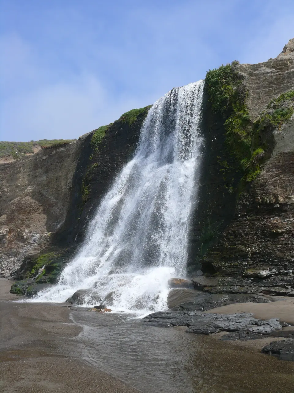
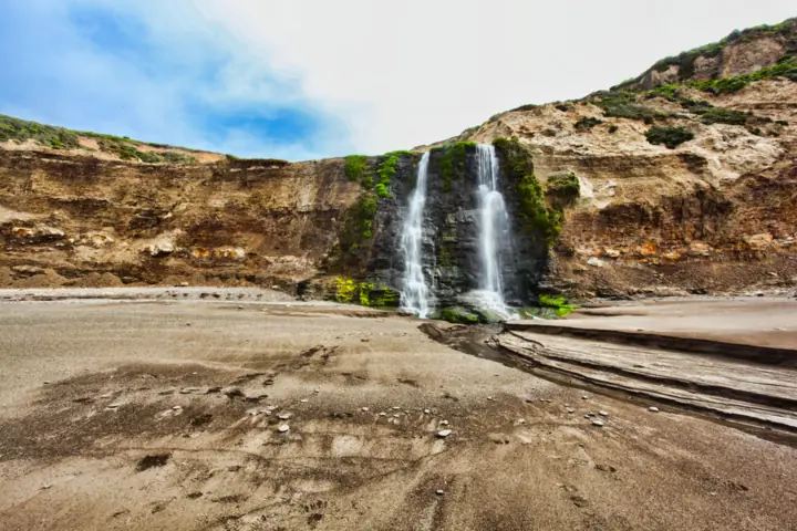
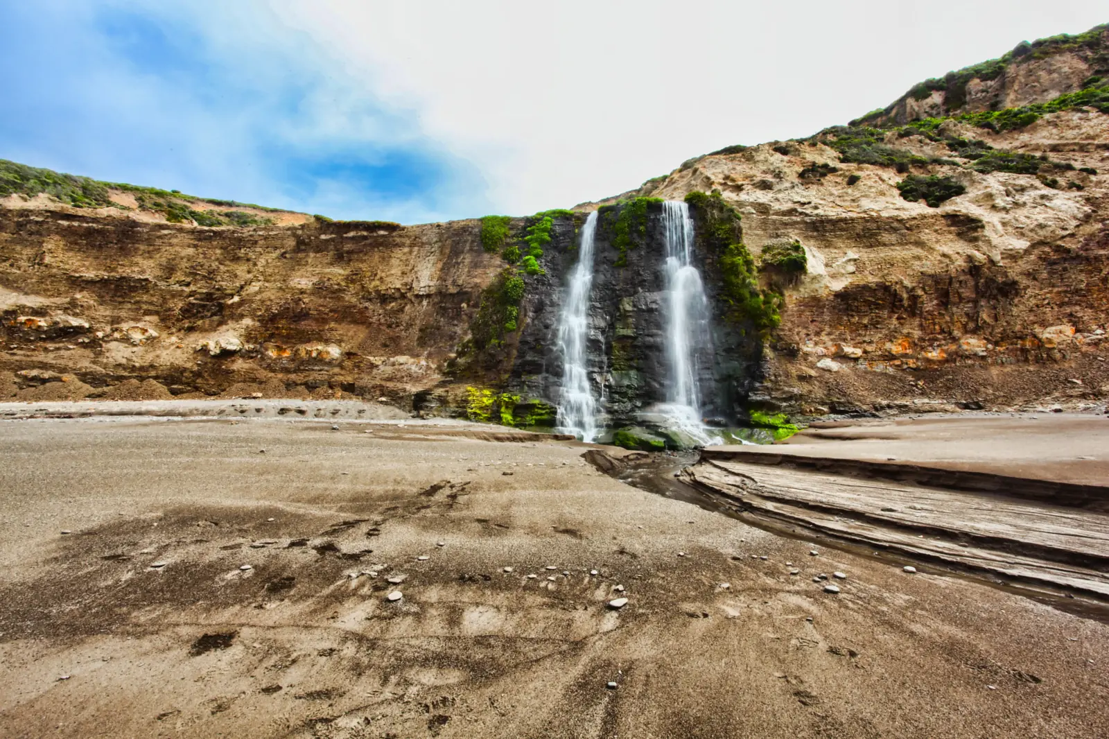
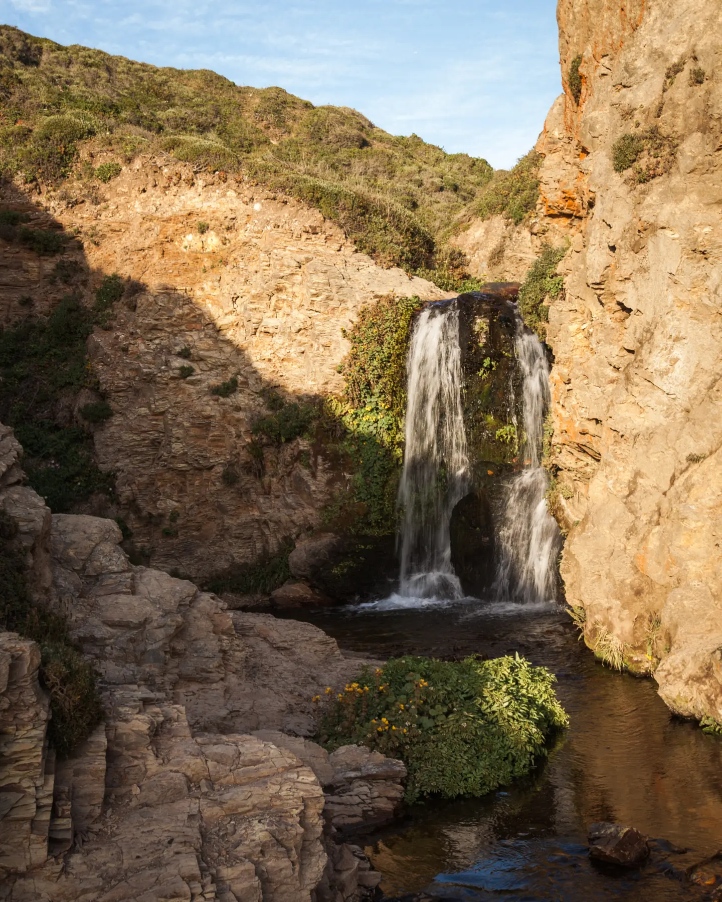
Alamere Falls drops about 40 feet off a coastal cliff onto Wildcat Beach in Point Reyes National Seashore. The official route from Palomarin Trailhead is 13.2 miles round trip, and NPS says to walk the final 1.1 miles of beach only at low tide. There is no fee and dogs are not allowed. NPS strongly advises against the unofficial bluff shortcut.
About Alamere Falls
Alamere Creek pours over a cliff and lands directly on the south end of Wildcat Beach, the National Park Service says. Like McWay Falls in Big Sur, which the California Conservation Corps calls one of only two tidefalls in the state, it falls straight onto the shore. State Parks still lists the McWay overlook trail as closed.
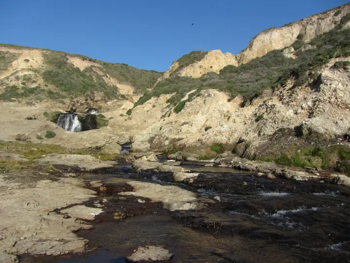
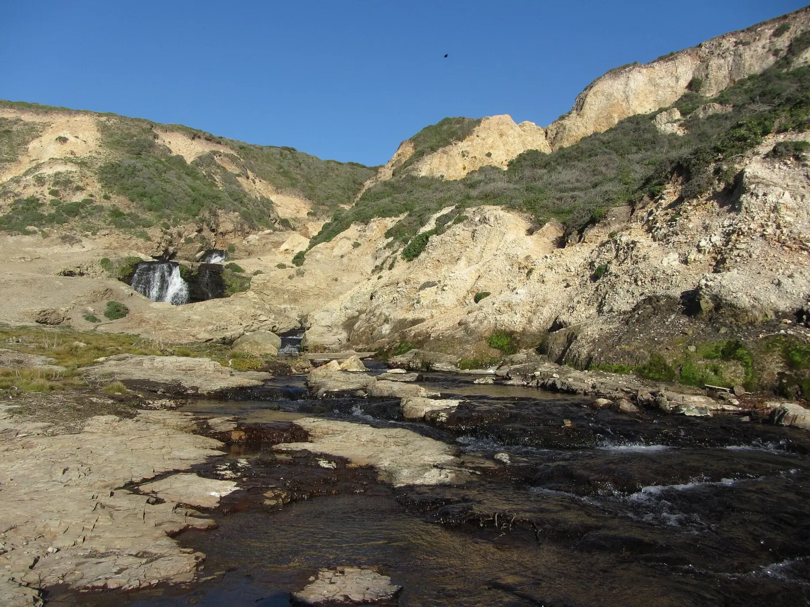
The height depends on who you ask. NPS calls the falls about 40 feet tall in its introduction, but a photo caption on the same page says about 30 feet. Wikipedia describes four drops, with a 40-foot longest drop and upper cascades of about 20 to 30 feet.
NPS is clear about one thing: there is no park-sanctioned "Alamere Falls Trail". The route people call by that name is an unmaintained shortcut down the bluffs. This page covers the official route only, because that is the one NPS recommends.
The falls are at the south end of Wildcat Beach in Point Reyes National Seashore, in Marin County. The usual start, Palomarin Trailhead, is about 5 miles northwest of Bolinas, according to NPS.
Alamere is one of two Marin County falls on this site. The other is Cataract Falls, if you want to compare options before you commit to a full-day hike.
Getting there and parking
Most hikers start at Palomarin Trailhead, at the end of Mesa Road. The lot has about 75 spaces. NPS says it fills early on weekends and on many summer weekdays.
From San Francisco and Bolinas
NPS places Palomarin about 5 miles (8 km) northwest of Bolinas. The last 1.2 miles of Mesa Road are unpaved and often severely potholed and washboarded. From Bear Valley Visitor Center, the park says, the drive takes about 35 minutes. We found no official drive time from San Francisco.
When the lot is full, the park may close the Palomarin area to new entry, sometimes for several hours. Arrive early or come midweek, and obey every "No Parking" sign.
Fees and permits
Point Reyes charges no entrance fee, and day use, parking and visitor centers are free. NPS charges fees only for camping and special-use permits. You need no permit for a day hike, but leaving a car overnight requires a backcountry camping permit.
Palomarin has four vault toilets but no drinking water, so carry everything you need for a full day. NPS lists day-hiking hours as 6am to midnight.
Map and nearby falls
Map loads as you scroll. Open in OpenStreetMap
OpenPartly open / seasonalUnconfirmedClosedLarger map
The hike from Palomarin
The official hike follows the Coast Trail from Palomarin to Wildcat Campground, then 1.1 miles of beach, 13.2 miles round trip per NPS.
Palomarin to Bass Lake
The Coast Trail heads northwest along the clifftop for about 1 mile, then turns inland past a string of ponds. You reach Bass Lake at 2.8 miles, then pass Pelican Lake.
To Wildcat Campground
Past Pelican Lake, stay on the Coast Trail or take the Ocean Lake Loop. The two rejoin after about 1.1 miles. A 0.2-mile descent then brings you to Wildcat Campground, about 5.5 miles from Palomarin.
The beach walk at low tide
From the campground, walk about 1.1 miles south along Wildcat Beach to the falls. That makes the minimum distance 6.5 miles each way, or 13.2 miles round trip, according to NPS.
NPS calls this "a long challenging day of hiking" and suggests 6 to 8 hours. Allow at least 6.5 hours from Palomarin. Other starts are longer: 14.8 miles round trip from Bear Valley, or 15.6 miles from Five Brooks.
NPS publishes no elevation gain for the Palomarin route. The Five Brooks route crosses a ridge about 1,300 feet tall, it notes.
The route is not wheelchair accessible. NPS describes narrow, rutted old ranch roads with roots and rocks, and the last stretch is sand. Wildcat Campground has vault toilets, but there are none near Bass Lake or at the falls.
When to visit
The park is open year-round, but the tide decides your day. NPS says to walk Wildcat Beach only at low tide, because at higher tides the beach can be fully underwater.
Tides and weather
NPS links NOAA tide predictions for station 9415020, Point Reyes, from its Alamere Falls page. Plan backward from that table: with about 5.5 miles to Wildcat Campground, start early enough to reach the beach while the tide is low.
NPS also links National Weather Service advisories for the Coastal North Bay. Check them, and the surf forecast, the day before.
NPS lists the hike as year-round and says the heaviest rainfall comes in the winter months. It also notes more sand on the beach in summer and fall than in winter and spring, which affects how passable the beach is.
Crowds
NPS says the Palomarin lot fills early on weekends and on many summer weekdays, and the area can close to new cars for hours. NPS suggests arriving early or coming midweek. NPS names no best month for water flow.
| Height | 40 ftNote: about 40 ft per NPS, which also captions a photo about 30 ft; Wikipedia lists a 40-ft longest drop over four drops |
|---|---|
| Trail | 13.2 mi round trip from Palomarin Trailhead on the official route via Bass Lake and Wildcat Campground, ending with 1.1 mi on Wildcat Beach (low tide only) |
| Difficulty | Long and challenging (NPS); no formal rating |
| Time needed | 6-8 hours; allow at least 6.5 hours from Palomarin |
| Entry fee | Free. Point Reyes National Seashore charges no entrance or parking fee (NPS) |
| Permit / reservation | None for a day hike; overnight parking needs a backcountry camping permit |
| Parking | Palomarin lot, about 75 spaces, fills early |
| Hours / season | Day hiking 6am to midnight (NPS) |
| Dogs | Not allowed on any route to the falls; working service dogs only |
| Swimming | No official swimming rule found |
| Wheelchair / stroller | No. Narrow, rutted old ranch roads with roots and rocks, then 1.1 miles of sandy beach |
| Walk behind the falls | No |
| Restrooms | Four vault toilets at Palomarin and vault toilets at Wildcat Campground; none near Bass Lake or the falls. No drinking water at Palomarin |
| Best time to visit | NPS lists the hike as year-round, with the heaviest rain in winter; it says there is more sand on the beach in summer and fall |
| Crowds | Palomarin lot fills early on weekends and many summer weekdays (NPS) |
| Managed by | National Park Service, Point Reyes National Seashore |
Safety and swimming
Use only the official route via Wildcat Campground and the beach. NPS says the unofficial bluff shortcut is unmaintained, with crumbling cliffs, heavy poison oak and ticks. Injuries and search-and-rescue calls there are frequent.
NPS also says to stay away from cliff edges and not to climb the cliffs. NPS notes there is no cell service on the shortcut.
On the beach, watch the tide. NPS says not to attempt the walk if the ocean waves are reaching the base of the coastal bluffs. Turn back early rather than risk being cut off by rising water.
We could not find an official swimming rule for the pool or the surf below the falls. Pets are prohibited on every route to Alamere Falls, though working service dogs are allowed. For general tips, see our waterfall safety guide.
Where to stay near Alamere Falls
Compare hotels, cabins and rentals close to the falls around Bolinas.
See places to stay nearbyAffiliate link: we may earn a commission at no cost to you. Partners do not see or change our waterfall facts. Disclosure.
Photos
Alamere Falls FAQ
How long is the hike to Alamere Falls?
On the official route from Palomarin Trailhead, it's 13.2 miles round trip via Bass Lake and Wildcat Campground, ending with 1.1 miles on Wildcat Beach. NPS suggests 6 to 8 hours. Starts at Bear Valley (14.8 miles) and Five Brooks (15.6 miles) are longer.
Is the Alamere Falls shortcut safe?
No. NPS says there is no park-sanctioned Alamere Falls Trail. The unmaintained bluff route has crumbling cliffs, poison oak and ticks, and injuries and rescues there are frequent. Use the official route via Wildcat Campground and the beach.
Do I need low tide to see Alamere Falls?
Yes, for the beach walk. NPS says to walk Wildcat Beach only at low tide, because at higher tides it can be fully underwater. If waves reach the base of the bluffs, don't go. NPS links NOAA tide station 9415020 (Point Reyes).
Is there a fee to visit Alamere Falls?
No. Point Reyes National Seashore charges no entrance or parking fee, and a day hike needs no permit. Only overnight parking requires a backcountry camping permit.
Where do I park for Alamere Falls?
At Palomarin Trailhead, at the end of Mesa Road. It has about 75 spaces and fills early on weekends. When it's full, the park may close the area to new cars. The last 1.2 miles of road is unpaved.
Can I bring my dog to Alamere Falls?
No. NPS prohibits pets on every route to Alamere Falls. Only working service dogs are allowed.
Is Alamere Falls a hard hike?
Yes. NPS calls it "a long challenging day of hiking" and no easy trek. It is 13.2 miles round trip from Palomarin and takes 6 to 8 hours, with a beach walk timed to low tide.
Where is Alamere Falls?
In Point Reyes National Seashore in Marin County, at the south end of Wildcat Beach. The usual start, Palomarin Trailhead, is about 5 miles northwest of Bolinas, per NPS.
Nearby waterfalls


More waterfalls to explore
 Pfeiffer FallsCalifornia · 130 mi straight-lineClosed60FT
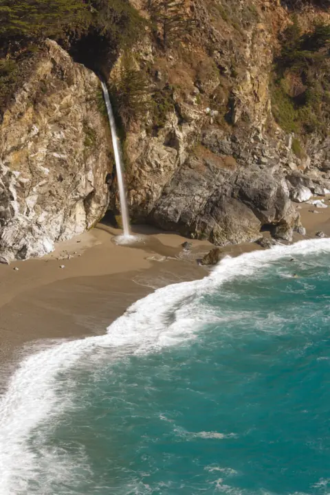 McWay FallsCalifornia · 138 mi straight-linePartly open80FT
On these lists: Free waterfalls
Sources
- California State Parks: Julia Pfeiffer Burns SP (McWay Falls overlook trail status)
- NPS: Alamere Falls
- NPS: Hike to Alamere Falls
- NPS: Point Reyes Fees
- NPS: Point Reyes Current Conditions and park alerts (read Oct 28, 2026)
- California Conservation Corps: McWay Falls Overlook (two tidefalls)
- Wikipedia: Alamere Falls
- NOAA Tides & Currents: tide predictions, station 9415020 Point Reyes (linked by NPS)
Last verified Oct 28, 2026 by The Waterfall Guide editorial team. Conditions change: confirm with National Park Service, Point Reyes National Seashore before you go. Spotted something out of date? Report a correction.