Waterfalls near a city
Waterfalls near Los Angeles, California
Malibu and the foothills above Pasadena hold the two closest falls in this guide, both 21 miles from Los Angeles as the crow flies. Escondido Falls is about 150 ft over several tiers, per MRCA, with $12 parking and roughly 4 miles round trip on foot. Eaton Canyon Falls is closed until December 31, 2027, LA County says. Switzer Falls, 22 straight-line miles away off Angeles Crest Highway, is open and needs a $5 Adventure Pass to park.
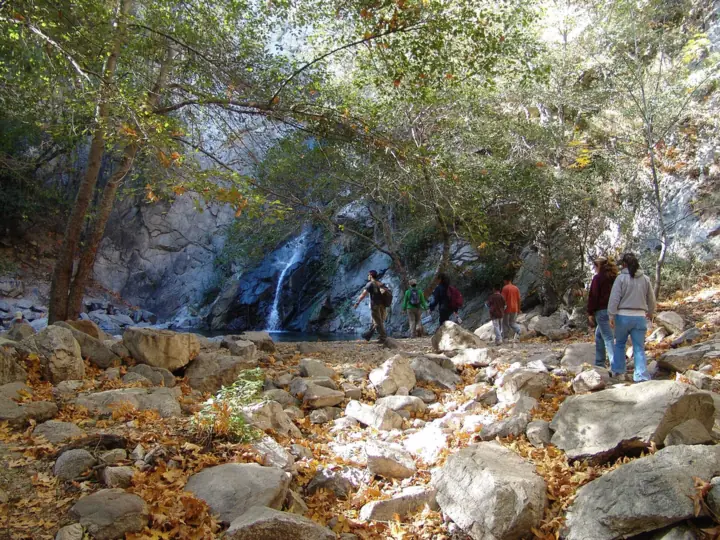
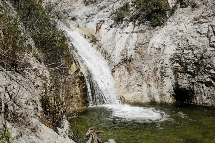
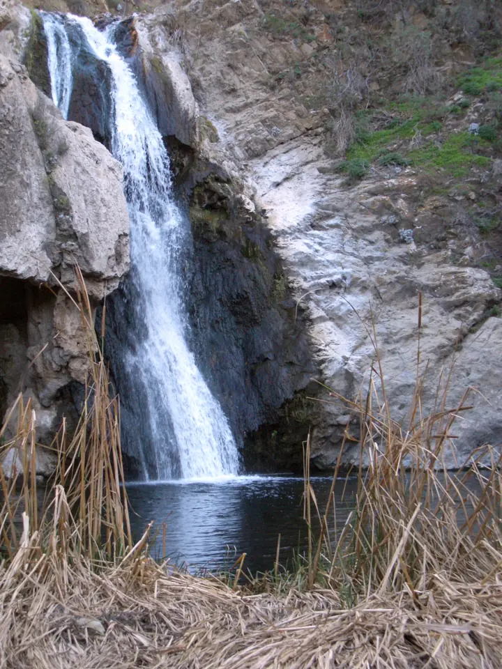
6 waterfalls within 75 miles of Los Angeles
Distances are straight-line miles, by our math, from the US Census internal point of Los Angeles, CA, not driving distances, so check a route before you go. Each card links to a full guide with fees, parking and current status.
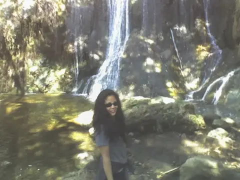
A 150-ft multi-tier falls in Malibu; only the lower tier is on public land.
Escondido Falls21 mi straight-lineOpen150FT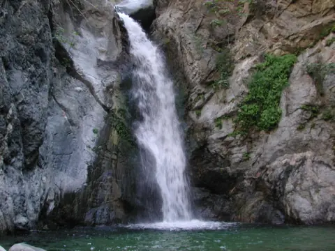
Closed until the end of 2027 after the Eaton Fire; nearby Angeles NF falls listed.
Eaton Canyon Falls21 mi straight-line · ModerateClosed50FT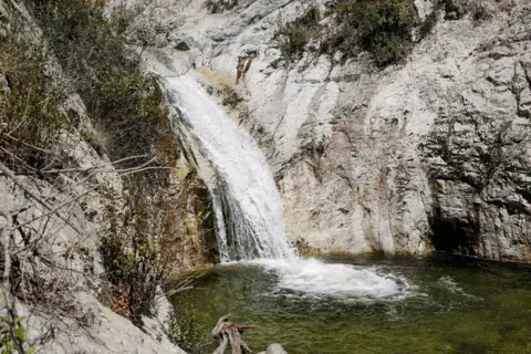
About 4 miles round trip on the Gabrielino Trail to the lower falls on the Arroyo Seco.
Switzer Falls22 mi straight-line · ModerateOpen50FT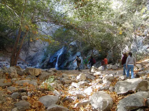
A 55-ft falls in Big Santa Anita Canyon, hiked from Chantry Flat above Arcadia.
Sturtevant Falls26 mi straight-lineOpen55FT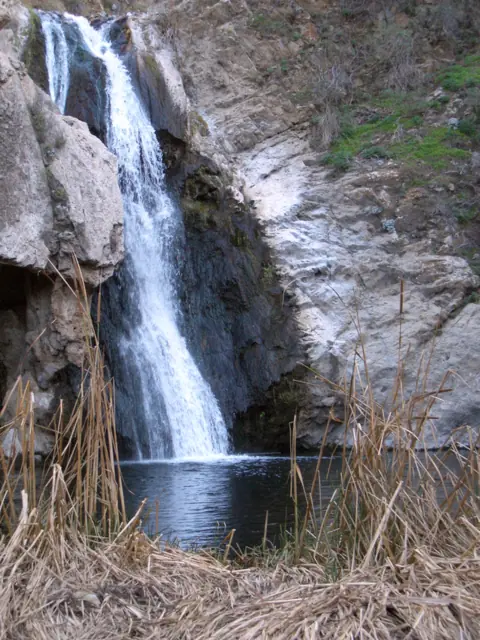
A 40-ft falls on the Arroyo Conejo in Wildwood Park, with no parking fee listed and short hikes.
Paradise Falls32 mi straight-line · EasyOpen40FT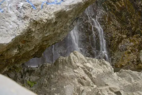
A tall multi-tier falls up a Lytle Creek wash, with a 2026 rockfall warning.
Bonita Falls54 mi straight-lineOpen400FT
Map of waterfalls near Los Angeles
Map loads as you scroll. Open in OpenStreetMap
OpenPartly open / seasonalUnconfirmedClosedLarger map
Compare the waterfalls near Los Angeles
| Waterfall | Distance | Status | State | Height | Trail | Difficulty | Fee / permit | Swimming |
|---|---|---|---|---|---|---|---|---|
| Escondido Falls | 21 mi | Open | CA | 150 ft | About 4 mi round trip | $12 parking | No rule found | |
| Eaton Canyon Falls | 21 mi | Closed | CA | 50 ft | Closed until end of 2027 | Moderate | Area closed | Closed |
| Switzer Falls | 22 mi | Open | CA | 50 ft | About 4 mi round trip (3.66-4.5 mi in guides) | Moderate | Adventure Pass ($5/day) | No rule found |
| Sturtevant Falls | 26 mi | Open | CA | 55 ft | About 3.3-3.7 mi round trip (guides) | $5 Adventure Pass to park | No rule found | |
| Paradise Falls | 32 mi | Open | CA | 40 ft | About 2 mi round trip; 3.2 mi loop | Easy | No fee listed (COSCA) | No |
| Bonita Falls | 54 mi | Open | CA | 400 ft | About 1.5 mi round trip, unmarked | $5 Adventure Pass to park | No rule found |
Where to stay near Los Angeles
Base yourself in Los Angeles, CA for a waterfall day. Open the map to compare hotels, cabins and rentals, or switch to tours and activities.
Or open the full stays map in a new tab
Affiliate links and map: we may earn a commission at no cost to you. The map loads from Stay22 only when you open it. Partners do not see or change our waterfall facts. Disclosure.
How the list breaks down
Five of the six lie within 32 straight-line miles of the city's Census point. Sturtevant Falls above Arcadia is 26 straight-line miles away, and Paradise Falls in Thousand Oaks is 32 miles off as the crow flies. The sixth, Bonita Falls near Lytle Creek, is 54 straight-line miles out, so this page draws its circle at 75 straight-line miles instead of 50.
These six are every Southern California falls with a published page here as of November 2026. Falls in the region that we have not yet researched don't appear on the map or in the table.
As of our October 28, 2026 checks, Eaton Canyon was shut. Eaton Canyon's closure follows the January 2025 Eaton Fire and has no set reopening date (LA County trail alert, checked Oct 28, 2026). On October 21, 2026, COSCA shut all its trails for rain, Paradise Falls included. Paradise is open, as far as we can tell (Nov 11, 2026), when COSCA's closures page listed no weather-related closure.
What is shut, and what can shut at short notice
Eaton Canyon is closed to all entry, including the waterfall from any access point. The Forest Service's Eaton Fire closure area also runs through December 31, 2027. On forest land, its closure orders carry fines of up to $5,000 for individuals, up to six months in prison, or both.
Paradise Falls shuts whenever COSCA closes its trails after rain. The agency says it will post again when conditions are dry enough to reopen, so check its trail-closures page after any storm.
The other four open falls carry their own caveats. MRCA closes Escondido Canyon Park during Red Flag Warnings, most recently from October 15 to 17, 2026. At Sturtevant, the Forest Service says the Chantry Flat road can close to vehicles at any time. Switzer's site page showed Site Open on a Forest Service update of April 23, 2026, but Caltrans is the place to check SR-2.
Bonita Falls is open with a Forest Service rockfall alert that runs through December 31, 2026. The alert is a caution, not a closure.
Switzer, Sturtevant and Bonita: the Adventure Pass group
Three falls on this list are in national forests where parking takes an Adventure Pass, at $5 a day or $30 a year. An America the Beautiful pass also works. For Bonita, the pass rule comes from Wikipedia; we found no Forest Service page stating it for the Lytle Creek Road turnout.
Switzer Falls (22 straight-line miles): the Gabrielino Trail from Switzer Picnic Site is about 4 miles round trip, per Wikipedia. Trail guides range from 3.66 to 4.5 miles. The Forest Service lists vault toilets but no piped water, so carry all you need.
Sturtevant Falls (26 straight-line miles): a Forest Service brochure gives 55 ft, and Wikipedia says 60. Trail guides put the walk from Chantry Flat at about 3.3 to 3.7 miles round trip. The trail drops into the canyon first, so the climbing comes on the way back. Chantry Flat has flush and vault toilets and drinking fountains.
Bonita Falls (54 straight-line miles): Wikipedia describes an unmarked route of roughly 1.5 miles round trip up a wash. It puts the lower falls at roughly 370 to 400 ft. In June 2026 a hiker was killed by a falling rock near the falls, the Victorville Daily Press reported. Do not stand or rest under the cliffs.
Escondido and Paradise: outside the national forests
Escondido Falls is run by the Mountains Recreation and Conservation Authority (MRCA). You park at the Winding Way lot, 27200 Winding Way in Malibu, for $12. The first mile follows paved Winding Way, where MRCA warns of blind curves. The Edward Albert Trail then crosses the creek several times on the last mile to the lower falls.
Only that lower tier is on public parkland. MRCA says the upper falls are not open to the public and asks hikers not to climb. Leashed dogs are allowed, and the only restrooms are at the lot.
Paradise Falls is in Wildwood Park in Thousand Oaks, managed by COSCA. It is open, as far as we can tell (Nov 11, 2026), after an October 21 rain closure. COSCA's pages list no parking fee and sunrise-to-sunset hours. The Conejo Open Space Foundation gives about 40 ft for the falls and maps a 3.2-mile loop with about 550 ft of climbing. Dogs need a leash no longer than 6 ft.
Rain, flow and water rules
Rain decides how much water you see at two of the open falls. MRCA says Escondido Falls is minimal or non-existent in dry weather. The Outbound suggests Switzer in winter and spring after rain, and the Forest Service warns its stream may run low after dry winters.
We found no official best season for Sturtevant, Bonita or Paradise. At Paradise, rain is also what triggers COSCA's trail closures.
Paradise is the only falls here with a clear swimming answer, and it is no. The Conejo Open Space Foundation says the stream is urban runoff and tells visitors to stay out of the falls and the pool. The other open falls have no official swimming rule. Expect slick rock at every creek crossing.
Our California waterfalls guide covers falls elsewhere in the state.
Waterfalls near Los Angeles: FAQ
Are any waterfalls near Los Angeles open right now?
Yes, five of the six in this guide. Escondido, Switzer, Sturtevant and Bonita Falls were listed open on checks dated October 28, 2026. Paradise Falls is open, as far as we can tell (Nov 11, 2026), after an October 21 rain closure. Bonita carries a Forest Service rockfall alert through December 31, 2026. Eaton Canyon is closed until December 31, 2027.
Is the most beautiful waterfall in California near LA?
That's a matter of taste, and this list holds only six Southern California falls. What we can report is sourced height. MRCA calls Escondido the highest waterfall in the Santa Monica Mountains, at about 150 ft over several tiers. Bonita's lower falls is roughly 370 to 400 ft, per Wikipedia, with no official figure.
What's the biggest waterfall within reach of Los Angeles?
By height on this list, Bonita Falls, 54 straight-line miles away in the San Bernardino National Forest. Wikipedia gives the lower falls as 370 to 400 ft, and up to 495 ft counting two poorly documented upper drops. No agency publishes a figure. A Forest Service rockfall alert covers the site through December 31, 2026.
Is an Adventure Pass needed for these falls?
For three of them. The Forest Service requires an Adventure Pass or an America the Beautiful pass to park for Switzer and Sturtevant, and Wikipedia says the same for Bonita. The Adventure Pass costs $5 a day or $30 a year. Escondido charges $12 at its MRCA lot instead, and COSCA's pages we read list no parking fee for Paradise Falls.
Is swimming allowed at waterfalls around LA?
Only Paradise Falls has a clear rule, and it says no: the Conejo Open Space Foundation calls the stream urban runoff. We found no official swimming rule for Escondido, Switzer, Sturtevant or Bonita. Eaton Canyon is closed to all entry until December 31, 2027.
Sources
Facts for each waterfall come from its own guide, where every source is listed. The city sources are below.
- MRCA: Escondido Canyon Park (read Oct 28, 2026)
- MRCA: Press releases, including the Oct 15-17, 2026 Red Flag closure
- LA County Trails: Eaton Canyon & ANF closures
- USDA Forest Service: Forest Order 05-01-26-04, Eaton Fire closure (signed Jan 6, 2026)
- USDA Forest Service: Switzer Picnic Site (updated Apr 23, 2026; read Oct 28, 2026)
- Wikipedia: Arroyo Seco (Los Angeles County)
- The Outbound: Swimming holes and a day hike to Switzer Falls
- Hikespeak: Switzer Falls
- USDA Forest Service: Chantry Flat Picnic Area (updated Apr 23, 2026; read Oct 28, 2026)
- USFS: Big Santa Anita Canyon brochure
- USDA Forest Service Region 5: Adventure Pass (archived Apr 14, 2026)
- COSCA: Trail closures (rain closure posted Oct 21, 2026; no weather closure listed when read Nov 11, 2026)
- Conejo Open Space Foundation: Wildwood map (2023)
- Conejo Open Space Foundation: trail rules
- USDA Forest Service SBNF: Safety alert, falling rocks at Bonita Falls (Jul 24-Dec 31, 2026; read Oct 28, 2026)
- Wikipedia: Bonita Falls
- Victorville Daily Press via AOL: Bonita Falls rockfall warning (July 28, 2026)
- US Census Bureau: 2024 Gazetteer Files (places)
State guides: California waterfalls. More cities.
Photos: U.S. Department of Agriculture, CC BY 2.0; Region 5 Photography (USDA Forest Service), Public domain; Holly Cheng, CC BY-SA 3.0. Photo credits