State guide
Waterfalls in Arkansas
This guide covers 7 waterfalls in Arkansas. They are run by the National Park Service, Arkansas State Parks and the Forest Service, and one has no agency page.
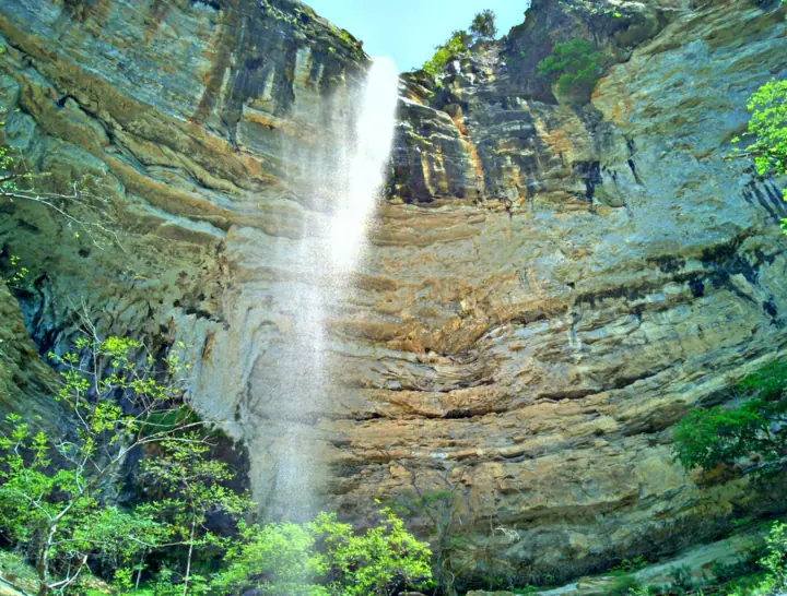
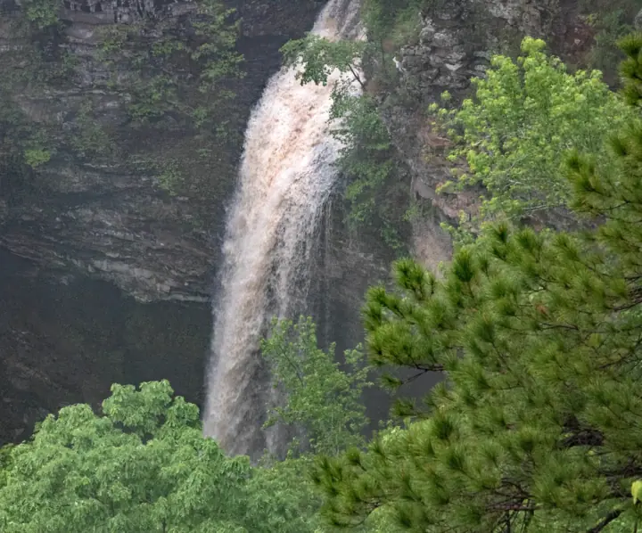
Arkansas waterfalls on this site
Each card shows the height where a source gives one, and the status as far as we can tell, from our checks of November 8, 2026 to November 13, 2026.
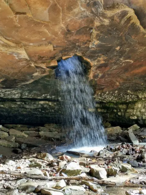
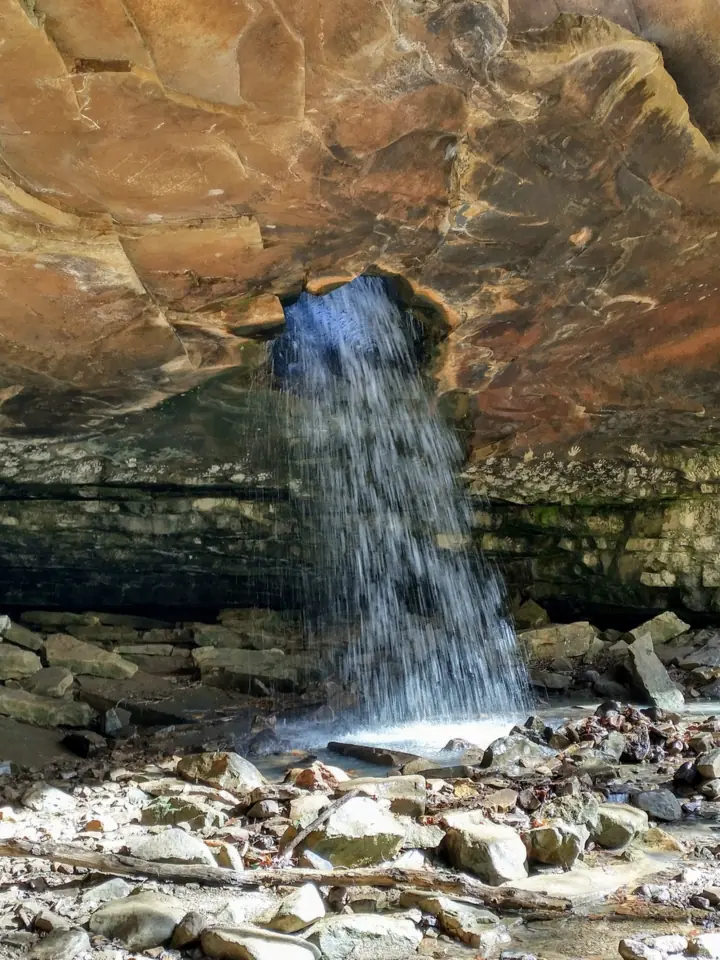
A waterfall that pours through a hole in the roof of a bluff shelter, reached by an unmarked path in Ozark National Forest.
Glory Hole FallsAbout 2 mi round trip; unmarked final path (USFS, archived) · Moderate (our reading)Open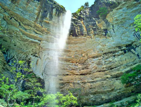
A cascade NPS puts at nearly 210 feet, flowing only after considerable rain, at the end of a steep Ponca Wilderness trail.
Hemmed-in Hollow FallsAbout 5 mi round trip, 1,400 ft climb out · Hard (NPS: extremely steep and strenuous)Open209FT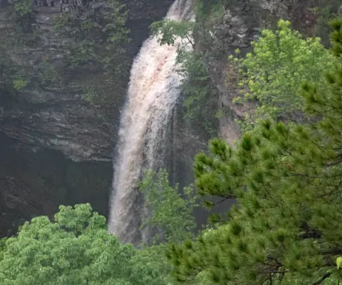
A 90-foot waterfall at the end of a 2-mile round-trip canyon hike from Mather Lodge.
Cedar Falls2 mi round trip from Mather Lodge, 1 1/2 to 2 hours · Moderate / Strenuous (both listed)Open90FT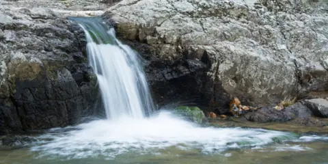
A stairstep falls on a wild and scenic river in the Ouachita National Forest, with a picnic area and overlook trail.
Little Missouri FallsShort trail to an overlook (USFS) · No official ratingOpen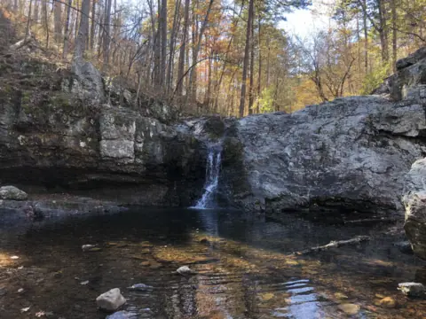
A seasonal waterfall on Falls Creek in Lake Catherine State Park, on the 2-mile Falls Branch Trail near Hot Springs.
Falls Creek Falls2 mi Falls Branch Trail · Moderate (Arkansas State Parks)Open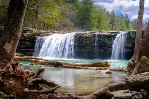
A wide ledge falls beside gravel Forest Service Road 1205 near Ben Hur, viewable from the road.
Falling Water FallsViewable from the road (Arkansas Tourism) · Easy (Arkansas Tourism)Open10FT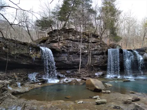
A double waterfall in the Richland Creek Wilderness, reached over rough gravel roads with no developed trail.
Twin FallsNo developed trail (USFS) · No official ratingOpen
Map of Arkansas waterfalls
The map shows where each of the 7 Arkansas waterfalls in this guide is located.
Map loads as you scroll. Open in OpenStreetMap
OpenPartly open / seasonalUnconfirmedClosedLarger map
| Waterfall | Status | Area | Height | Trail | Difficulty | Fee / permit | Swimming |
|---|---|---|---|---|---|---|---|
| Glory Hole Falls | Open | Ozark National Forest, west of Deer | Not listed | About 2 mi round trip; unmarked final path (USFS, archived) | Moderate (our reading) | No fee listed | No official rule found |
| Hemmed-in Hollow Falls | Open | Buffalo National River, Ponca Wilderness | 209 ft | About 5 mi round trip, 1,400 ft climb out | Hard (NPS: extremely steep and strenuous) | No fee (NPS) | No NPS statement |
| Cedar Falls | Open | Petit Jean State Park | 90 ft | 2 mi round trip from Mather Lodge, 1 1/2 to 2 hours | Moderate / Strenuous (both listed) | No entry fee listed | No rule listed |
| Little Missouri Falls | Open | Ouachita National Forest, north of Langley | Not listed | Short trail to an overlook (USFS) | No official rating | No fee (USFS) | No official swimming rule found |
| Falls Creek Falls | Open | Lake Catherine State Park, near Hot Springs | Not listed | 2 mi Falls Branch Trail | Moderate (Arkansas State Parks) | No entrance fee listed (Arkansas State Parks) | No official swimming rule for the falls |
| Falling Water Falls | Open | Forest Service Road 1205, Ozark-St. Francis National Forest area | 10 ft | Viewable from the road (Arkansas Tourism) | Easy (Arkansas Tourism) | No fee listed | No official swimming rule found |
| Twin Falls | Open | Richland Creek Wilderness, Ozark-St. Francis National Forest | Not listed | No developed trail (USFS) | No official rating | No day-use fee listed; campground $10 (USFS) | No official swimming rule found |
Overview of waterfalls in Arkansas
Hemmed-in Hollow Falls on the Buffalo National River is the tallest we cover. The NPS says it "cascades nearly 210 feet" and flows only after considerable rain.
Cedar Falls is a 90-foot falls in Petit Jean State Park near Morrilton, on a 2-mile round-trip trail from Mather Lodge. Glory Hole Falls in Ozark National Forest pours through a hole in the roof of a bluff shelter. Little Missouri Falls has a no-fee picnic area and overlook trail in the Ouachita National Forest, north of Langley. Near Hot Springs, the seasonal Falls Creek Falls sits on the Falls Branch Trail at Lake Catherine State Park.
Up gravel Forest Service Road 1205 near Ben Hur, Falling Water Falls can be viewed from the road. Twin Falls lies beyond it in the Richland Creek Wilderness, with no developed trail.
All seven were open, as far as we can tell, from our checks of Nov 8 to Nov 13, 2026. Rain matters most at Hemmed-in Hollow and the Glory Hole, so read the flow notes below before you drive. For a city view, see waterfalls near Hot Springs.
Arkansas waterfalls at a glance
Heights and trails come from each falls page and its official source.
| Waterfall | Where | Height | Trail (round trip) | Fee |
|---|---|---|---|---|
| Hemmed-in Hollow Falls | Buffalo National River (NPS), Newton County | Nearly 210 ft (NPS) | About 5 mi, 1,400 ft climb out, 4 to 6 hours (NPS) | No fee (NPS) |
| Cedar Falls | Petit Jean State Park, Conway County | 90 ft (Arkansas State Parks) | 2 mi, 1 1/2 to 2 hours | No entry fee listed |
| Glory Hole Falls | Ozark National Forest, Newton County | No USFS height | About 2 mi, unmarked final path | No fee listed |
| Little Missouri Falls | Ouachita National Forest, north of Langley | No official height | Short trail to an overlook; no USFS length | No fee (USFS) |
| Falls Creek Falls | Lake Catherine State Park, Hot Spring County | No official height | 2 mi Falls Branch Trail, moderate (Arkansas State Parks) | No entrance fee listed |
| Falling Water Falls | FR 1205, Pope County | 10 ft (Arkansas Tourism) | Viewable from the road | No fee listed |
| Twin Falls | Richland Creek Wilderness, Newton County | No official height | No developed trail (USFS) | No day-use fee listed |
Hemmed-in Hollow Falls (Buffalo National River)
Hemmed-in Hollow Falls is in the Ponca Wilderness of the Buffalo National River. The NPS says the trail from Compton Trailhead is about 2.5 miles each way, with about 1,400 feet of climbing on the way back.
The NPS calls it "an extremely steep and strenuous trail" and says the average hiker takes 4 to 6 hours. It does not recommend the hike for children under 12.
The NPS says "Buffalo National River does not charge an entry fee or day use fee." Pets are not allowed on trails in the Ponca Wilderness; service animals are permitted.
The NPS lists the season as year round, but says the falls only flow after a considerable amount of rain. Hemmed-in Hollow is open, as far as we can tell: on Nov 8, 2026, the NPS alerts page showed no alert for it or Compton Trailhead.
Cedar Falls (Petit Jean State Park)
Cedar Falls is in Petit Jean State Park near Morrilton. Arkansas State Parks calls it "one of the tallest continuously flowing waterfalls in the state." The Cedar Falls Trail, a National Recreation Trail, starts behind the breezeway at Mather Lodge.
The park lists the trail as 2 miles round trip, 1 1/2 to 2 hours, and rates it both Moderate and Strenuous. It follows Cedar Creek into Cedar Creek Canyon, with orange blazes.
No entry fee is listed on the park or trail pages we read. On Nov 8, 2026, the park notice listed closures only on parts of the Boy Scout Trail and the CCC Hike and Bike Trail. The Cedar Falls Trail was not among them, so it is open, as far as we can tell.
Glory Hole Falls (Ozark National Forest)
Glory Hole Falls is in the Dismal Creek Special Interest Area of Ozark National Forest. An archived 2016 USFS page says a vortex is believed to have drilled into the roof of a bluff shelter. The water now plummets to its floor.
That page puts the falls about 12 miles west of Deer, off Hwy 16/21. The path is about two miles round trip, and the last part is user-created and not marked. The current USFS site has no Glory Hole page, so details may have changed.
Glory Hole Falls is open, as far as we can tell: no Ozark-St. Francis alert named Glory Hole, Dismal Creek or Hwy 16 on Nov 8, 2026. The USFS text we read lists no fee.
Little Missouri Falls (Ouachita National Forest)
Little Missouri Falls is on the Little Missouri River, which the Forest Service calls a designated wild and scenic river. The Forest Service describes a forested picnic area with a trail to a waterfall overlook.
Its directions start on Highway 84 west of Glenwood, then run north on Highway 369 at Langley. Forest Service Roads 73, 43 and 25 lead to Road 539, where the directions end. The trailhead page lists no fee, and the 2026 fee schedule lists no charge.
The site is open all year for day use, with no water or electricity. It is open, as far as we can tell. On Nov 11, 2026, the Forest Service listed it as "Site Open," and no Ouachita alert named it.
Falls Creek Falls (Lake Catherine State Park)
Falls Creek Falls is the seasonal waterfall at Lake Catherine State Park, 8.8 straight-line miles from Hot Springs by our math. Arkansas State Parks calls it "a seasonal scenic waterfall on Falls Creek."
The Falls Branch Trail, a National Recreation Trail, is 2 miles, moderate, taking 1 1/2 to 2 hours. It crosses Little Canyon Creek several times. No entrance fee is listed on the park pages we read.
As far as we can tell (Nov 13, 2026), the park and trail pages listed no closure or alert.
Falling Water Falls and Twin Falls (Forest Service Road 1205)
Falling Water Falls sits beside gravel FR 1205 near Ben Hur, in Pope County. Arkansas Tourism gives it a 10-foot drop and says it can be viewed from the road. It is not the Falling Water Falls in Tennessee.
Twin Falls is in the Richland Creek Wilderness, reached from Richland Creek Campground 9 miles up FR 1205. The Forest Service says the wilderness has no developed trails, only old logging roads.
The Forest Service lists the campground at $10 for 2026, with no day-use fee. Its wilderness page, last updated March 28, 2025, warns that the road from Falling Water Falls is prone to landslides.
As far as we can tell (Nov 13, 2026), no Ozark-St. Francis alert named either falls or FR 1205.
When to see Arkansas waterfalls: rain matters at several
Two of the seven falls depend on rain, by their official sources' own accounts. The NPS says Hemmed-in Hollow flows only after considerable rain.
The archived USFS page says the best time for the Glory Hole is spring and early summer, when the ground is saturated. Any rain that produces runoff also works. Arkansas State Parks calls Cedar Falls one of the state's tallest continuously flowing falls, and it publishes no best season. No official page names a best season for Little Missouri Falls.
Wet weather brings its own risks. The USFS warns of fast moving water at the Glory Hole drainage crossing, and high rock ledges with slippery footing at the falls. The Forest Service also warns that high water is dangerous after rain storms at Little Missouri Trail stream crossings. Our waterfall safety guide has more general tips.
Arkansas State Parks also calls the Lake Catherine falls seasonal, without giving flow months.
Fees and dogs at Arkansas waterfalls
None of the seven falls has a listed entry fee. The NPS states that Buffalo National River charges no entry or day use fee, and the Forest Service lists no fee at Little Missouri Falls. For Cedar Falls and the Glory Hole, the official pages we read list no fee, so confirm with the agency.
Dogs: pets are not allowed on Ponca Wilderness trails, which include the Hemmed-in Hollow route (NPS). We found no dog rule on the Petit Jean, Glory Hole or Little Missouri pages we read; see each falls page for who to call. At Little Missouri Falls, federal rules for developed Forest Service sites, if they apply there, require pets to be leashed (6 feet maximum) or otherwise controlled.
We found no official dog rule for Falls Creek, Falling Water or Twin Falls.
Arkansas waterfalls FAQ
What is the tallest waterfall in Arkansas?
Of the Arkansas falls on this site, Hemmed-in Hollow Falls is the tallest. The NPS says it "cascades nearly 210 feet" and calls it "the highest waterfall between the Rockies and the Appalachians."
Are the Arkansas waterfalls open?
As far as we can tell, all seven on this site were open in our checks of Nov 8 to Nov 13, 2026. No NPS, Arkansas State Parks or Forest Service notice we read listed them as closed.
Do Arkansas waterfalls charge a fee?
Not the seven on this site, as far as we can tell. The NPS says Buffalo National River has no entry or day use fee, and the Forest Service lists no fee at Little Missouri Falls. No entrance fee is listed for the others on the pages we read.
When is the best time to see waterfalls in Arkansas?
For Hemmed-in Hollow and the Glory Hole, after rain. The NPS says Hemmed-in Hollow flows only after considerable rain. An archived USFS page says the Glory Hole is best in spring and early summer, or after runoff. Arkansas State Parks calls Cedar Falls one of the state's tallest continuously flowing falls. No official page names a best time for Little Missouri Falls.
How long is the Cedar Falls Trail at Petit Jean?
Arkansas State Parks lists 2 miles round trip, 1 1/2 to 2 hours, starting behind the breezeway at Mather Lodge.
Can you bring dogs to Hemmed-in Hollow?
No. The NPS says pets are not allowed on trails in the Ponca Wilderness. Service animals are permitted.
What is the closest waterfall to Hot Springs, Arkansas?
Falls Creek Falls at Lake Catherine State Park, 8.8 straight-line miles from Hot Springs by our math. Arkansas State Parks calls it a seasonal waterfall.
Sources
- NPS: Hike to Hemmed-in Hollow (trail, climb, season, pets)
- NPS: Hemmed-in Hollow Falls (height, flow)
- Arkansas State Parks: Petit Jean State Park (notice, read Nov 8, 2026)
- Arkansas State Parks: Cedar Falls Trail (National Recreation Trail)
- USDA Forest Service: The Glory Hole Waterfall (archived page, Wayback Machine capture of May 13, 2016)
- USDA Forest Service: Ozark-St. Francis National Forests alerts (read Nov 8, 2026)
- NPS: Buffalo National River fees & passes (no entry or day use fee; read Nov 8, 2026)
- NPS: Buffalo National River current conditions and alerts (read Nov 8, 2026)
- USDA Forest Service: Little Missouri Falls Trailhead (Site Open, no fee, directions; read Nov 11, 2026)
- USDA Forest Service: Ouachita National Forest alerts (read Nov 11, 2026)
- USDA Forest Service: Caddo/Womble Ranger District Recreation Schedule and Fees for 2026 (file titled May 2026; read Nov 11, 2026)
- USDA Forest Service: Little Missouri Trail (designated wild and scenic river; read Nov 11, 2026)
- Arkansas State Parks: Falls Branch Trail, National Recreation Trail (read Nov 13, 2026)
- Arkansas Tourism: Waterfalls (Falling Water Falls; read Nov 13, 2026)
- USDA Forest Service: Richland Creek Wilderness (updated Mar 28, 2025; read Nov 13, 2026)
- USDA Forest Service: Ozark-St. Francis Recreation Schedule and Fees 2026 (file updated Jan 5, 2026)
City guides: Waterfalls near Hot Springs, AR
More Arkansas waterfalls are being added. Each one is checked against its managing agency before it goes live.
Photos: amanderson2, CC BY 2.0; My Blue Van, CC BY-SA 2.0; ksblack99, Public Domain Mark 1.0. Photo credits