Right now
Status note (Nov 13, 2026): Open, as far as we can tell (checked Nov 13, 2026). The Forest Service lists the wilderness and campground as "Site Open," and no forest alert names them. Its wilderness page, last updated March 28, 2025, warns the access road is prone to landslides. What the status labels mean
Twin Falls is in the Richland Creek Wilderness, Ozark-St. Francis National Forest, in Arkansas. The Forest Service says the wilderness has no developed trails, only old logging roads. The usual access is Richland Creek Campground, 9 miles up gravel Forest Service Road 1205.
About Twin Falls
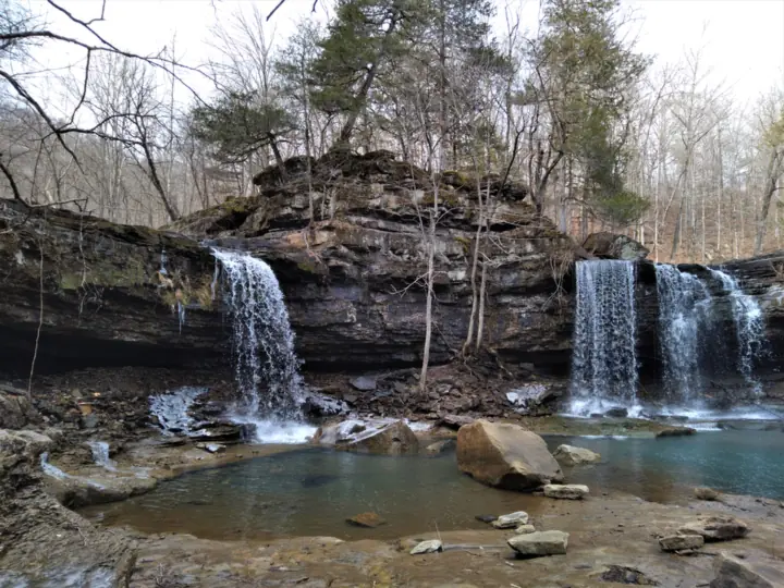
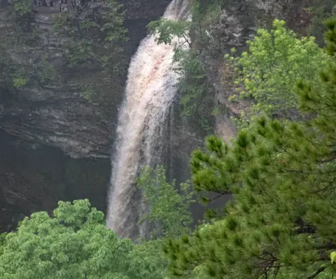
Twin Falls is a double waterfall in the Richland Creek Wilderness, part of the Ozark-St. Francis National Forest. A Forest Service photo is described as "Richland Creek Wilderness Twin Falls in the Ozark-St. Francis National Forest."
The Forest Service pages we read do not name the falls or give a height. They say the wilderness "is known for its crystal clear creeks and waterfalls."
The Forest Service says the wilderness was created by the 1984 Arkansas Wilderness Act and covers 11,801 acres in the Boston Mountains. Rock bluffs over 100 feet high line Richland Creek for more than a mile.
About our map pin
We found no USGS GNIS record for Twin Falls, so its exact spot is not official. Our pin is the GNIS mouth of Long Devils Fork, an approximate point. Directions use the Forest Service campground point.
For more Arkansas falls, see Glory Hole Falls in the same national forest, or browse all Arkansas waterfalls.
Getting there and parking
The Forest Service gives this route. From Russellville, take Arkansas 7 north 37 miles to Pelsor, then turn east on Arkansas 16 for 10 miles.
Turn north on gravel Forest Service Road 1205 near Ben Hur, and go 9 miles to Richland Creek. One Forest Service page puts the turn 1.5 miles south of Ben Hur, another about one mile east.
"Due to very rough roads, visitors are not encouraged to take camping trailers," the Forest Service says.
A northern route runs from Highway 74 east of Jasper through Bass. It follows FR 1200 (Newton County Road 37) for 4.5 miles to FR 1205, then 9 miles to Richland Creek.
The Forest Service warns that "the crossing at Bass, Arkansas might become impassable" in rainy weather.
Fees
The Forest Service 2026 fee schedule lists no day-use fee for Richland Creek. It lists the campground at $10, open all year, with vault toilets and no water. It says Senior and Access passes apply there, but annual passes do not.
Facilities
The Forest Service says the recreation area has vault toilets but no potable water.
Contact
The Ozark-St. Francis supervisor's office in Russellville lists (501) 802-0287.
Map and nearby falls
Map loads as you scroll. Open in OpenStreetMap
OpenPartly open / seasonalUnconfirmedClosedLarger map
Twin Falls hike: no developed trail in the wilderness
"There are no developed trails located in the wilderness," the Forest Service says. It says old logging roads run through the area and receive sporadic use.
The Forest Service names Richland Creek Campground as the most popular way into the wilderness. About half a mile north on FR 1205, it lists a pullout with a visitor registration box.
A 2022 forest order (#08-10-00-22-138) covers wilderness areas in this forest. We did not read its text, so ask the office which rules apply.
Wilderness.net, a wilderness information site run with federal agencies, describes hiking up the creek from the campground to Devil's Fork, then bushwhacking. It gives about three miles in total, without saying whether that is one way.
Plan for an off-trail route along the creek, and carry a map and navigation tools.
Dogs
We found no dog rule on the Forest Service pages we read for this wilderness.
When to visit
No official page names a best season. The Forest Service says kayakers float Richland Creek after rains have raised the water level.
Status checks
On Nov 13, 2026, the Forest Service listed the Richland Creek Wilderness and Recreation Area as "Site Open." No Ozark-St. Francis alert named them or FR 1205.
The wilderness page, last updated March 28, 2025, warns that the road from Falling Water Falls "is prone to landslides." It says the road is one lane in places and the county may close it for repairs.
That warning is over 19 months old, so ask the office about the road now.
Call the supervisor's office at (501) 802-0287 before you go.
| Trail | The Forest Service says there are no developed trails in the Richland Creek Wilderness. It says old logging roads run through the area and get sporadic use. |
|---|---|
| Difficulty | No official rating. The Forest Service says the wilderness has no developed trails. |
| Entry fee | No day-use fee is listed in the Forest Service 2026 fee schedule. It lists the Richland Creek campground at $10, with no water. |
| Permit / reservation | No permit listed. The Forest Service notes a visitor registration box at a pullout north of the campground. |
| Parking | Richland Creek Campground on FR 1205 (USFS) |
| Dogs | We found no dog rule on the Forest Service pages we read for this wilderness. |
| Wheelchair / stroller | Not suited to wheelchairs. The Forest Service says the wilderness has no developed trails. |
| Best time to visit | No official best month. The Forest Service says kayakers float Richland Creek after rains raise the water. |
| Crowds | No official visitor figure found. |
| Managed by | USDA Forest Service, Ozark-St. Francis National Forest (Richland Creek Wilderness) |
Safety and swimming
"Remember to take drinking water or a filtration device with you," the Forest Service says. There is no potable water at the site.
The forest alerts page lists a Be Bear Aware notice (Oct 9, 2025) and a wildfire risk alert for Arkansas and Oklahoma (Aug 28, 2026).
There is no developed trail, so this is an off-trail trip. The Forest Service calls the land near Richland and Long Devil's Fork creeks "quite rugged and scenic."
We found no official swimming rule for Twin Falls.
In an emergency, call 911. Our waterfall safety guide has more on staying safe near falls.
Conditions change: confirm with the official source before you go.
Where to stay near Twin Falls
Compare hotels, cabins and rentals close to the falls around Ben Hur.
See places to stay nearbyAffiliate link: we may earn a commission at no cost to you. Partners do not see or change our waterfall facts. Disclosure.
Twin Falls FAQ
Is there a trail to Twin Falls in Arkansas?
Not a developed one. The Forest Service says the Richland Creek Wilderness has no developed trails, only old logging roads that get sporadic use.
How do you get to Twin Falls on Richland Creek?
The usual start is Richland Creek Campground. The Forest Service route takes Arkansas 7 and 16 to gravel FR 1205, then 9 miles north to the campground.
Is there a fee at Richland Creek?
The Forest Service 2026 fee schedule lists no day-use fee. It lists the Richland Creek campground at $10.
Can you drive a trailer to Richland Creek?
The Forest Service says visitors are not encouraged to take camping trailers, because of very rough roads.
Is Twin Falls open?
As far as we can tell, yes (checked Nov 13, 2026). The Forest Service lists the wilderness as "Site Open." Its wilderness page, last updated March 28, 2025, warns the access road is prone to landslides.
Nearby waterfalls
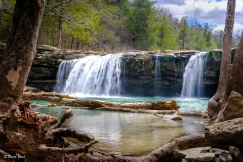 Falling Water Falls6 mi straight-line, by our mathOpen10FT
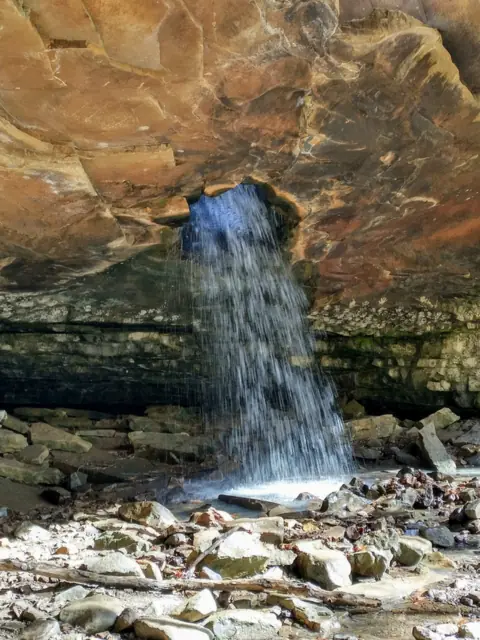 Glory Hole Falls24 mi straight-line, by our mathOpen
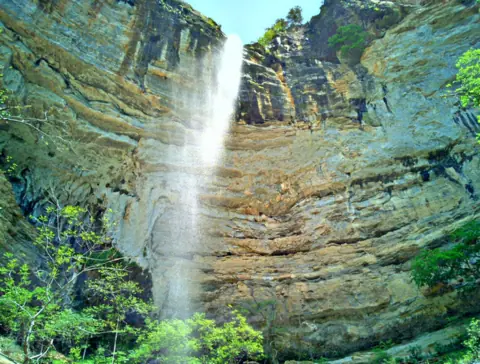 Hemmed-in Hollow Falls27 mi straight-line, by our mathOpen209FT
 Cedar Falls48 mi straight-line, by our mathOpen90FT
City guides: Waterfalls near Hot Springs, AR
Sources
- USDA Forest Service: Richland Creek Wilderness (conditions, no developed trails, access; updated Mar 28, 2025; read Nov 13, 2026)
- USDA Forest Service: Richland Creek Recreation Area (Site Open, directions, facilities; updated Jun 9, 2026; read Nov 13, 2026)
- USDA Forest Service: Ozark-St. Francis alerts (read Nov 13, 2026)
- USDA Forest Service: Ozark-St. Francis Recreation Schedule and Fees 2026 (file updated Jan 5, 2026)
- Wilderness.net: Richland Creek Wilderness (access description; no date shown; read Nov 13, 2026)
- USGS GNIS: Long Devils Fork, feature ID 72473 (stream, Newton County; data refreshed Oct 2026; read Nov 13, 2026)
Last verified Nov 13, 2026 by The Waterfall Guide editorial team. Conditions change: confirm with USDA Forest Service, Ozark-St. Francis National Forest (Richland Creek Wilderness) before you go. Spotted something out of date? Report a correction.