Right now
Right now as of Nov 8, 2026
- Permit None needed.
Status note (Nov 8, 2026): Open, as far as we can tell: the NPS Buffalo National River alerts page showed no alert for Hemmed-in Hollow or Compton Trailhead as of Nov 8, 2026. The trail page lists the season as "Year Round." What the status labels mean
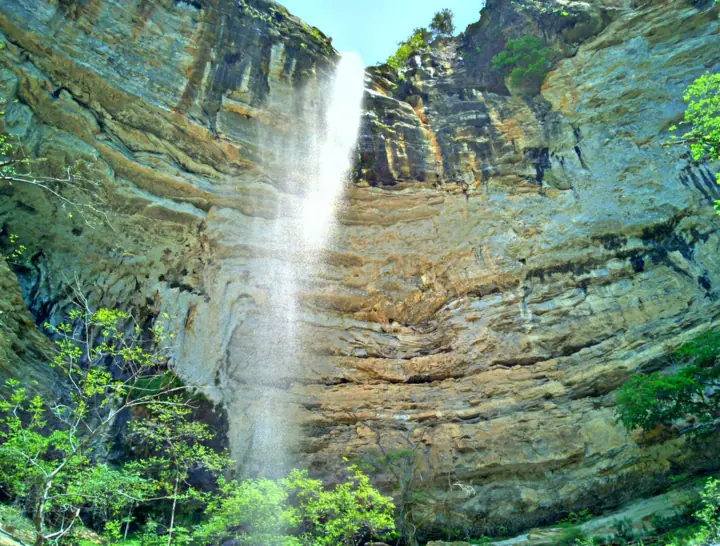
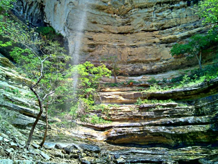
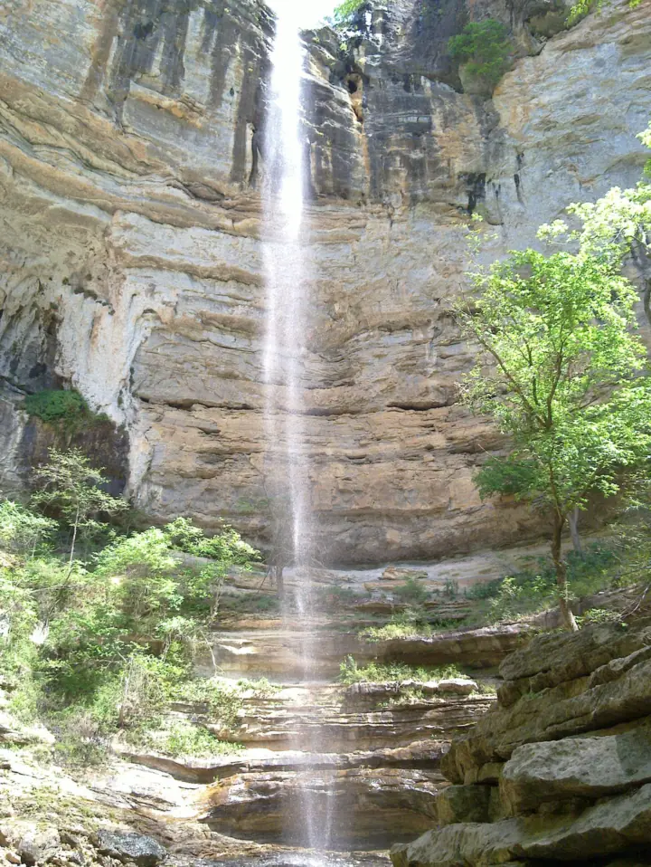
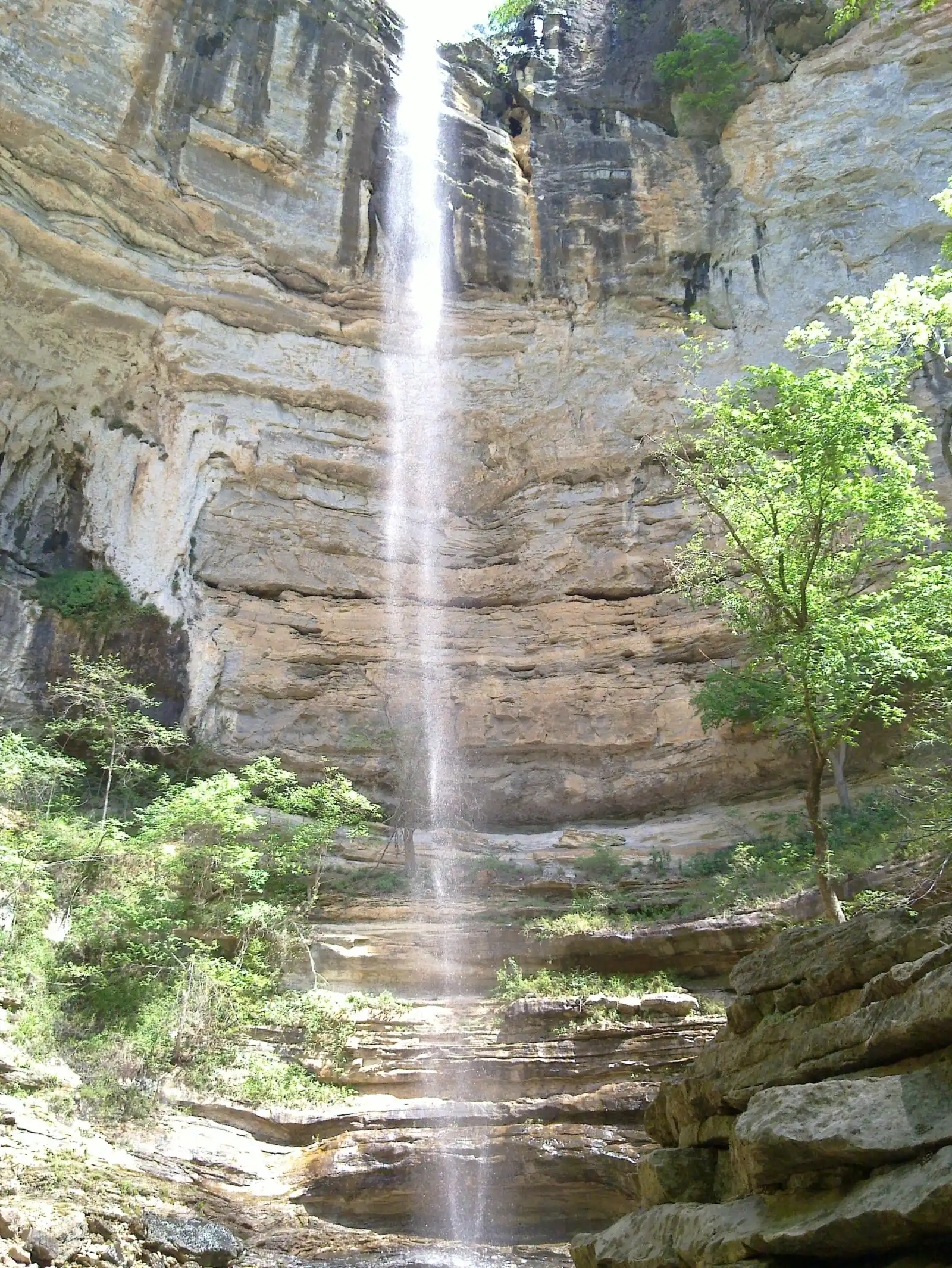
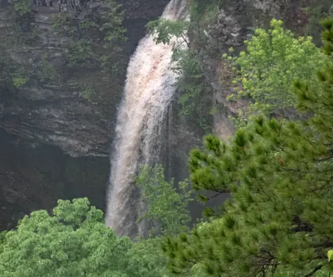
Hemmed-in Hollow Falls is in the Ponca Wilderness of Buffalo National River in Arkansas. NPS says it "cascades nearly 210 feet" and flows only after considerable rain. The trail from Compton Trailhead is about 5 miles round trip, with about 1,400 feet of climbing on the return. There is no fee, and pets are not allowed.
About Hemmed-in Hollow Falls
Hemmed-in Hollow Falls is in the Ponca Wilderness of Buffalo National River, in Newton County, Arkansas. The National Park Service manages the area.
NPS says the falls "cascades nearly 210 feet over the rugged Ozark bluffs." It calls Hemmed-in Hollow "the highest waterfall between the Rockies and the Appalachians."
Height: two published figures
NPS gives "nearly 210 feet." Wikipedia lists 209 feet, citing Tim Ernst's Arkansas Waterfalls Guidebook (2002). We show 209 feet, which fits both sources.
Wikipedia quotes NPS as calling the falls the "tallest" in that span. The NPS pages we read on Nov 8, 2026 say "highest," so we use the NPS word.
The falls need rain
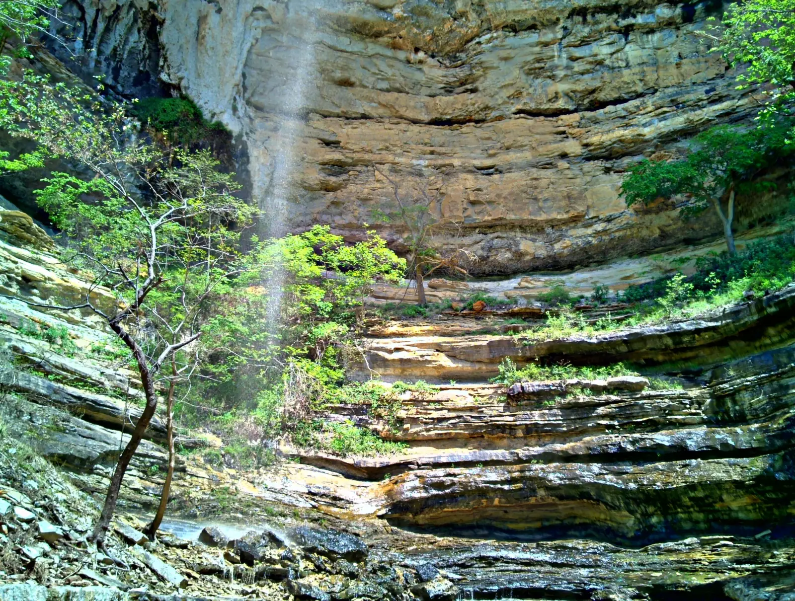
This is not a waterfall that runs all the time. NPS warns: "This waterfall only flows after a considerable amount of rain, so please be mindful of recent precipitation before you attempt this difficult hike."
About our map pin
We found no NPS coordinates for the falls. Our pin uses the Wikipedia coordinates (36.0721, -93.3074), so treat it as approximate.
Our sources give no coordinates for Compton Trailhead, so we show no trailhead marker. Use the NPS driving directions to reach the parking area.
Getting there and parking
Most hikers start at Compton Trailhead. NPS directions follow Hwy. 43 to the community of Compton.
In Compton, turn left on the dirt road across from the Compton Post Office. NPS says to travel 1 mile and follow the signs to the trailhead parking area.
Our directions button points to the approximate falls location, not the trailhead. Use the NPS directions above to reach the parking area.
At Compton Trailhead
NPS notes there is no restroom at Compton Trailhead. Plan for that before you arrive.
Two trails leave from this trailhead. The Hemmed-in Hollow Trail uses white blazes, and the Sneeds Creek Trail uses yellow blazes. NPS asks hikers: "Please be careful to take your intended trail."
Centerpoint Trailhead option
NPS says the falls "can also be accessed via the Centerpoint Trailhead located on Hwy. 43." It adds that this option "is not quite as strenuous as Compton Trailhead."
The NPS pages we read give no distance for the Centerpoint route. Pets are not allowed on that trail either.
Other alerts in the park
On Nov 8, 2026, NPS listed a South Woolum Road closure in the park's Middle District, with an alternate route available. It also noted reservations only at Buffalo Point starting March 15, 2027. Check the NPS conditions page before you go.
Map and nearby falls
Map loads as you scroll. Open in OpenStreetMap
OpenPartly open / seasonalUnconfirmedClosedLarger map
Hemmed-in Hollow Trail: 2.5 miles down, 1,400 feet back up
The Hemmed-in Hollow Trail starts at Compton Trailhead, in the heart of the Ponca Wilderness. NPS says it winds down the mountainside, descending nearly 1,400 feet to sandstone bluffs along the Buffalo River.
The hard part comes last. NPS says the walk back "requires approximately 1,400 feet in elevation gain over 2.5 miles." That makes the round trip about 5 miles.
An older NPS page from 2021 gives "approximately 5 miles round-trip" with 1,200 feet of gain on the return. We lead with the 1,400-foot figure from the trail page updated in 2026.
Difficulty and time
NPS calls this "an extremely steep and strenuous trail that will humble even the most experienced hiker." It says visitors should plan to take the entire day.
The 2026 trail page says "The average hiker takes 4 to 6 hours to complete this out-and-back hike." An older NPS falls page, from 2020, says "4-12 Hours."
Finding your way
Follow the "white, rectangular trail blazes that read 'HIH.'" Spur trails connect to the Sneeds Creek, Centerpoint, Bench and Old River trails.
With that many junctions, NPS says "it's essential to have a detailed topographic map."
Dogs
Pets are not allowed. NPS says "Pets are not allowed on trails in the Ponca Wilderness. Service animals are permitted."
The NPS pets page says pets are not permitted in any of the park's three wilderness areas: Upper Buffalo, Ponca and Lower.
Swimming
The NPS pages we read make no statement about swimming at Hemmed-in Hollow Falls, so we make no claim either way.
Camping
NPS says "A backcountry permit is not required within the Buffalo National River." It allows backcountry camping on the Buffalo River Trail and some other park trails.
The NPS pages we read do not say whether the Hemmed-in Hollow Trail is one of them. NPS rules ban camping in caves and rock shelters.
Accessibility
The trail is not accessible. NPS calls it "a steep and highly strenuous hike that traverses uneven and rocky terrain."
When to visit
NPS lists the trail season as "Year Round" and the time of day as "Any Time." No reservation is needed.
Rain matters more than the calendar here. NPS says the falls only flow after a considerable amount of rain, so check recent rainfall before you go. NPS gives no best month.
NPS says to plan for the entire day. If you begin this hike in the afternoon, it says to take a light source.
No crowd figure is published.
For another Arkansas falls, see Cedar Falls.
| Height | 209 ftNote: NPS says "nearly 210 feet"; Wikipedia gives 209 ft, citing Tim Ernst's Arkansas Waterfalls Guidebook (2002) |
|---|---|
| Trail | About 2.5 miles each way from Compton Trailhead (about 5 miles round trip), with about 1,400 feet of climbing on the way back (NPS) |
| Difficulty | NPS calls it "an extremely steep and strenuous trail that will humble even the most experienced hiker." It says the average hiker takes 4 to 6 hours |
| Entry fee | No fee. NPS says "Buffalo National River does not charge an entry fee or day use fee." It adds: "There are no fees or permits required for backcountry camping." The trail page lists "Activity Fee: No" |
| Permit / reservation | No entry fee, day-use fee or backcountry camping permit at Buffalo National River (NPS) |
| Parking | Compton Trailhead lot, no restroom |
| Dogs | Not allowed. NPS says "Pets are not allowed on trails in the Ponca Wilderness. Service animals are permitted." The NPS pets page names Centerpoint and Compton among the affected trails |
| Swimming | The NPS pages we read make no statement about swimming at the falls |
| Wheelchair / stroller | Not accessible. NPS calls it "a steep and highly strenuous hike that traverses uneven and rocky terrain" |
| Best time to visit | NPS lists the season as "Year Round" but says the waterfall only flows after a considerable amount of rain |
| Crowds | No crowd figure is published |
| Managed by | National Park Service, Buffalo National River |
Safety and swimming
Take this hike seriously. NPS warns: "The hike to Hemmed-in Hollow is one of the most frequent Search & Rescue (SAR) locations at Buffalo National River."
NPS says "This hike is not recommended for children under the age of 12."
The climb out
The trail descends first, so the hardest work comes on the way back. NPS puts the return at about 1,400 feet of elevation gain over 2.5 miles. Save energy and water for it.
The average hiker needs 4 to 6 hours for the round trip, per NPS. An older NPS page says 4 to 12 hours.
What to carry
NPS says "Day hikers should be prepared with at least 2 liters of water, plenty of salty snacks, appropriate footwear/clothing, and a detailed trail map."
If you start in the afternoon, NPS says to take a light source. There is no restroom at Compton Trailhead.
Calling for help
NPS says "cell phone service is unreliable in the park." The park's 24-hour dispatch number is 1-888-692-1162.
Stay on the white "HIH" blazes and carry a topographic map, because several spur trails branch off. Our waterfall safety guide has more on steep trails.
Conditions change: confirm with the official source before you go.
Where to stay near Hemmed-in Hollow Falls
Compare hotels, cabins and rentals close to the falls around Compton (Compton Trailhead).
See places to stay nearbyAffiliate link: we may earn a commission at no cost to you. Partners do not see or change our waterfall facts. Disclosure.
Photos
Hemmed-in Hollow Falls FAQ
Is Hemmed-in Hollow Falls open?
As far as we can tell, yes. On Nov 8, 2026, NPS listed no alert for Hemmed-in Hollow or Compton Trailhead. The trail page lists the season as "Year Round."
How long is the hike to Hemmed-in Hollow Falls?
From Compton Trailhead it is about 2.5 miles each way, or about 5 miles round trip. NPS says the average hiker takes 4 to 6 hours.
How tall is Hemmed-in Hollow Falls?
NPS says it "cascades nearly 210 feet" and calls it "the highest waterfall between the Rockies and the Appalachians." Wikipedia lists 209 feet.
Is there a fee to hike to Hemmed-in Hollow?
No. NPS says Buffalo National River does not charge an entry fee or day use fee. The trail page lists no activity fee.
Can I bring my dog to Hemmed-in Hollow?
No. NPS says pets are not allowed on trails in the Ponca Wilderness, which includes this trail. Service animals are permitted.
When does Hemmed-in Hollow Falls flow?
NPS says the waterfall "only flows after a considerable amount of rain." Check recent rainfall before you make the hike.
Is the Hemmed-in Hollow hike safe for kids?
NPS does not recommend it for children under 12. It also says the trail is one of the park's most frequent search-and-rescue locations.
Nearby waterfalls
Sources
- NPS: Hike to Hemmed-in Hollow (trail, height, flow, safety, pets; updated March 9, 2026; read Nov 8, 2026)
- NPS: Hemmed-in Hollow Falls (updated Nov 6, 2020; read Nov 8, 2026)
- NPS: Full Day Adventure, Upper District (updated June 30, 2021; read Nov 8, 2026)
- NPS: Buffalo National River Hiking Trails (updated Feb 22, 2026; read Nov 8, 2026)
- NPS: Buffalo National River Fees & Passes (read Nov 8, 2026)
- NPS: Buffalo National River Pets (updated Nov 4, 2026; read Nov 8, 2026)
- NPS: Buffalo National River Backcountry Camping (read Nov 8, 2026)
- NPS: Buffalo National River Current Conditions and alerts (read Nov 8, 2026)
- Wikipedia: Hemmed-in Hollow Falls (coordinates, county, 209 ft height; read Nov 8, 2026)
- Wikipedia: Compton, Arkansas (Newton County; read Nov 8, 2026)
Last verified Nov 8, 2026 by The Waterfall Guide editorial team. Conditions change: confirm with National Park Service, Buffalo National River before you go. Spotted something out of date? Report a correction.