Right now
Status note (Nov 8, 2026): Open, as far as we can tell (Nov 8, 2026). No Ozark-St. Francis alert names Glory Hole, Dismal Creek or Hwy 16. The USFS no longer has a Glory Hole page, so check the alerts page or call the forest before you go. What the status labels mean
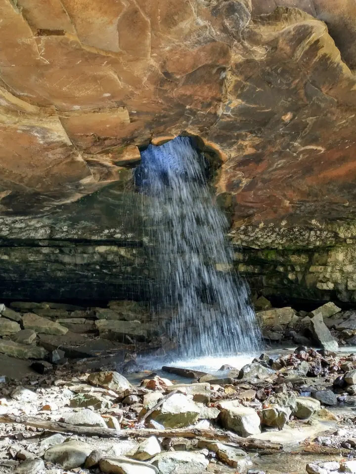
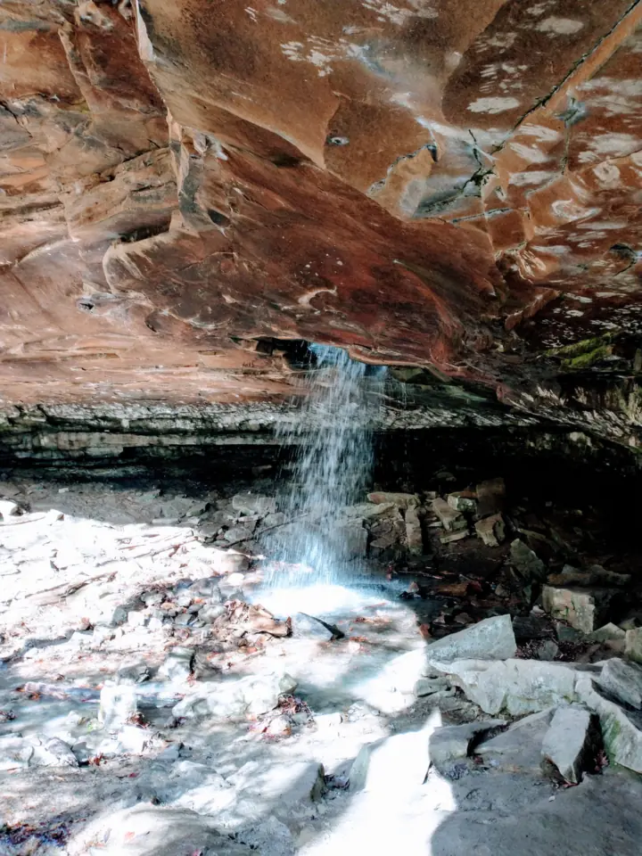
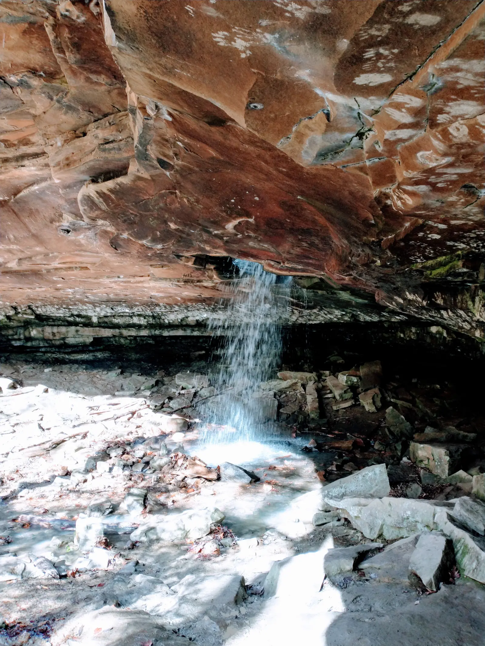
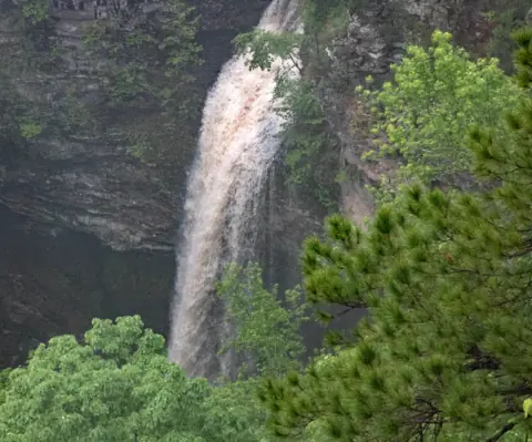
Glory Hole Falls is in the Dismal Creek Special Interest Area of Ozark National Forest, in Newton County, Arkansas. An archived 2016 USFS page describes water drilling into the roof of a bluff shelter and plunging to its floor. The path is about two miles round trip and is not marked. Go in spring, early summer or after rain.
About Glory Hole Falls
Glory Hole Falls is in Ozark National Forest, run by the Ozark-St. Francis National Forests. The archived USFS page says the falls are in the Dismal Creek Special Interest Area, about 245 acres in size.
The USFS says that area was designated mainly for its unique botanical features, from the moist habitat of its bluff lines and slopes. It called the Glory Hole the area's most widely noted feature, popular with visitors.
How the Glory Hole formed
The archived USFS page says "it is believed that the Glory Hole was created by an obstacle creating a hydrological vortex." That vortex drilled into the roof of a bluff shelter, and the water now plummets to the shelter floor.
The USFS publishes no height for the falls, so we list none.
About our sources
The USFS no longer has a Glory Hole page on its current site; searches on Nov 8, 2026 found none. The route details here come from its older Glory Hole page, as archived in May 2016. Roads, forks and landmarks may have changed since then.
Census TIGERweb places the falls point in Newton County. Our map pin is the OpenStreetMap point for the falls. We have no trailhead pin.
Getting there and parking
The archived USFS page says the falls are "approximately 12 miles west of Deer AR." Its directions start at the Hwy 16/21 junction, which it calls Edwards Junction.
From Edwards Junction, travel west on Hwy 16/21 for about 2.3 miles. About 0.7 mile past the Cassville Baptist Church, look for an old woods road on the left side of the highway.
Our directions button points to the falls, not the parking area. Use the USFS directions above to find the woods road on Hwy 16/21.
Parking
The USFS described "an undeveloped parking" area there, "large enough for a number of vehicles." The USFS text we read lists no facilities.
Fees
We found no fee for Glory Hole on the USFS's archived page or its current alerts page.
Contact
The Ozark-St. Francis Supervisor's Office is at 605 W Main St, Russellville, AR 72801, (501) 802-0287. Call to confirm conditions, since the USFS no longer has a page for the falls.
Map and nearby falls
Map loads as you scroll. Open in OpenStreetMap
OpenPartly open / seasonalUnconfirmedClosedLarger map
Glory Hole trail: old woods road, a drainage crossing and an unmarked path
The archived USFS page says the trail is "about two miles round trip from the parking area." It gives no time or difficulty rating.
Woods road and fork
Start on the old woods road. It forks at about 0.4 mile, and the right fork ends shortly and becomes the trail.
The drainage crossing
The trail then crosses a drainage, and the USFS says to "be wary of fast moving water." Upstream the stream is narrow and V-shaped; downstream it has eroded to base rock.
Trail or stream to the falls
From the crossing you can follow the trail or the stream down to the falls. The USFS says the trail is "user created" and not marked. It leaves the drainage and curves back to the Glory Hole.
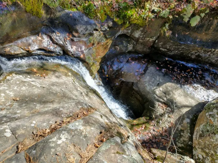
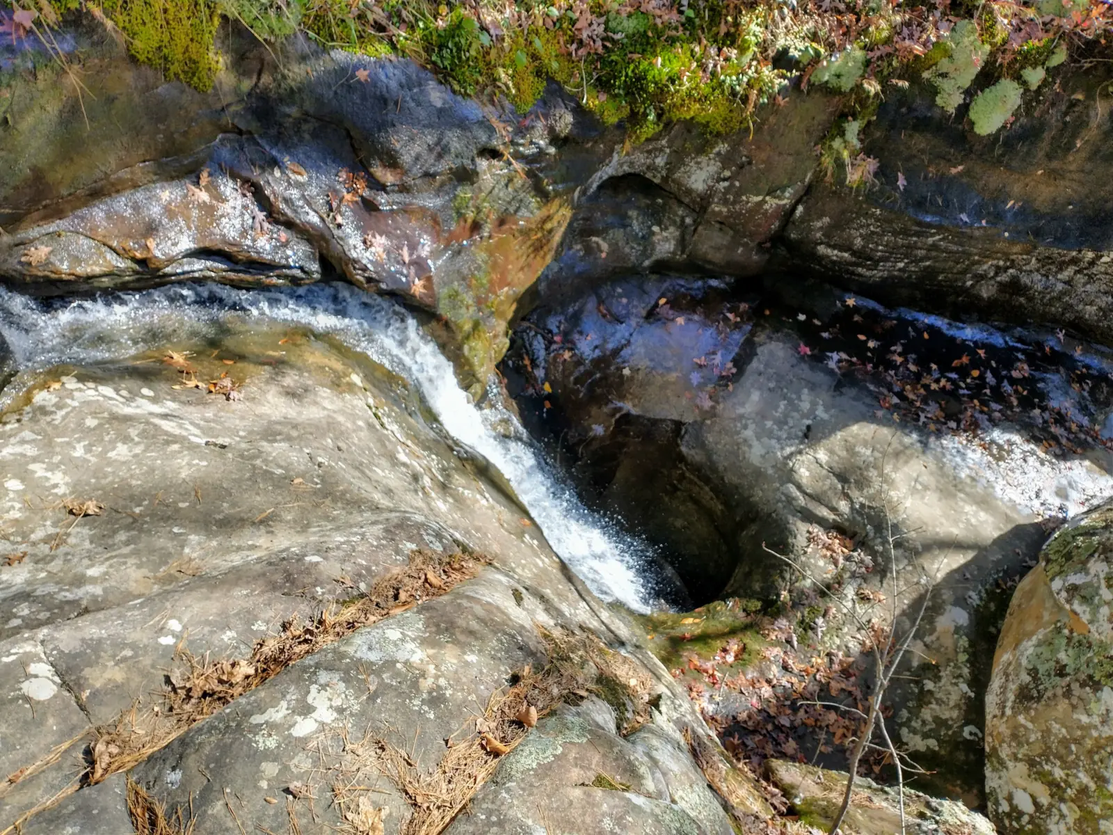
Following the stream is harder going, the USFS says, but you pass small falls and an eroded rock channel before the Glory Hole.
The climb back
The USFS says the hike is easier going in than coming out. A short steep section on the way back "may take their breath" for hikers who don't get out often.
Dogs and accessibility
We found no official pet rule for Glory Hole. The route is not suited to wheelchairs, by our reading: it is unmarked and has a drainage crossing, a steep section and rock ledges.
When to visit
The archived USFS page says "the best time to view the Glory Hole is spring and early summer when the ground is saturated and streams are flowing." Any rain big enough to produce runoff also works.
Even during low water, the USFS says, the boulders, bluffs and small waterfalls make the hike worthwhile.
After heavy rain
The archived USFS page warns of fast moving water where the trail crosses the drainage. After heavy rain, turn back if the crossing looks unsafe.
Status checks
On Nov 8, 2026, no Ozark-St. Francis alert named Glory Hole, Dismal Creek or Hwy 16. The forest posts closures and Forest Orders on its alerts page.
For other Arkansas falls on this site, see Hemmed-in Hollow Falls on the Buffalo National River and Cedar Falls in Petit Jean State Park.
| Trail | About two miles round trip from an undeveloped parking area on Hwy 16/21, per the USFS's archived Glory Hole page. Follow an old woods road; at a fork about 0.4 mile in, the right fork soon becomes the trail. The final path is user-created and not marked |
|---|---|
| Difficulty | No official rating. We call it moderate because the archived USFS page warns of a steep section on the way back, high rock ledges and slippery footing |
| Entry fee | No fee is listed on the USFS's archived Glory Hole page or its current alerts page. |
| Permit / reservation | No permit or fee is listed on the USFS's archived Glory Hole page or its current alerts page |
| Parking | Undeveloped lot off Hwy 16/21 |
| Dogs | No official rule found. The USFS text we read does not mention dogs |
| Swimming | No official rule found. The USFS text we read does not mention swimming |
| Wheelchair / stroller | Not accessible, by our reading: the path is unmarked, crosses a drainage and has a steep section, high rock ledges and slippery footing (USFS archived page) |
| Walk behind the falls | No |
| Best time to visit | Spring and early summer, or after enough rain to produce runoff (USFS archived page) |
| Crowds | No official visitor figure found |
| Managed by | USDA Forest Service, Ozark-St. Francis National Forests |
Safety and swimming
The archived USFS page warns: "There are high rock ledges and slippery footing." Stay back from the rim of the bluff shelter.
Watch children closely. The USFS asks visitors to do so "so that your entire group can enjoy this natural phenomenon."
Be wary of fast moving water at the drainage crossing, especially after rain. The USFS says following the stream down instead of the trail is more difficult.
The final path is not marked. Note where you left the woods road so you can find your way back.
In an emergency, call 911. Our waterfall safety guide has more on staying safe near falls.
Conditions change: confirm with the official source before you go.
Where to stay near Glory Hole Falls
Compare hotels, cabins and rentals close to the falls around Deer.
See places to stay nearbyAffiliate link: we may earn a commission at no cost to you. Partners do not see or change our waterfall facts. Disclosure.
Photos
Glory Hole Falls FAQ
Is Glory Hole Falls open now?
As far as we can tell, yes (Nov 8, 2026). No Ozark-St. Francis alert names Glory Hole, Dismal Creek or Hwy 16. Call (501) 802-0287 to confirm.
How long is the Glory Hole hike?
About two miles round trip from the parking area, per the USFS's archived Glory Hole page. The last part is a user-created path that is not marked.
Where is the Glory Hole trailhead?
On Hwy 16/21 about 2.3 miles west of Edwards Junction, per the archived USFS page. Look for an old woods road on the left, about 0.7 mile past the Cassville Baptist Church.
How was the Glory Hole formed?
The archived USFS page says it is believed an obstacle created a vortex that drilled into the roof of a bluff shelter. The water now drops through the hole to the shelter floor.
When is the best time to see the Glory Hole?
Spring and early summer, when the ground is saturated, or after rain big enough to produce runoff, per the archived USFS page.
Is there a fee at Glory Hole Falls?
We found no fee on the USFS's archived Glory Hole page or its current alerts page.
Are dogs allowed at Glory Hole Falls?
We found no official rule. The USFS text we read does not mention dogs, so call the Supervisor's Office at (501) 802-0287 to ask.
Nearby waterfalls
 Hemmed-in Hollow Falls18 mi straight-line, by our mathOpen209FT
 Twin Falls24 mi straight-line, by our mathOpen
 Falling Water Falls26 mi straight-line, by our mathOpen10FT
 Cedar Falls55 mi straight-line, by our mathOpen90FT
City guides: Waterfalls near Hot Springs, AR
Sources
- USDA Forest Service: The Glory Hole Waterfall (archived Ozark-St. Francis page, Wayback Machine capture of May 13, 2016; directions, trail, formation, best time)
- USDA Forest Service: Ozark-St. Francis National Forests alerts (no Glory Hole alert; read Nov 8, 2026)
- USDA Forest Service: Big Piney Ranger District (counties incl. Newton; updated June 9, 2026)
- USDA Forest Service: Ozark-St. Francis National Forest home (Supervisor's Office contact; read Nov 8, 2026)
- OpenStreetMap: Glory Hole waterfall, node 4812609056 (map pin)
- US Census Bureau TIGERweb: county lookup for the falls point (Newton County; Nov 8, 2026)
Last verified Nov 8, 2026 by The Waterfall Guide editorial team. Conditions change: confirm with USDA Forest Service, Ozark-St. Francis National Forests before you go. Spotted something out of date? Report a correction.