Right now
Status note (Nov 11, 2026): Open, as far as we can tell (checked Nov 11, 2026). The Forest Service lists the trailhead as "Site Open" and open all year. No Ouachita National Forest alert named the falls or the roads to it. What the status labels mean
Little Missouri Falls is in the Ouachita National Forest, north of Langley, Arkansas. The Forest Service describes a forested picnic area with a trail to a waterfall overlook. It is open all year, with no fee, water or electricity. The Caddo-Womble Ranger District runs it.
About Little Missouri Falls
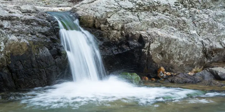
Little Missouri Falls is on the Little Missouri River in the Ouachita National Forest. The Forest Service calls the site a "forested picnic area, with trail leading to waterfall overlook."
The U.S. Fish and Wildlife Service's Wild and Scenic Rivers page describes a stairstep fall that attracts photographers and visitors. It names the Little Missouri Falls and Albert Pike recreation areas along the river.
That page says the river was designated Wild and Scenic on April 22, 1992. It lists 11.3 miles as Scenic and 4.4 miles as Wild, for 15.7 miles in all.
No official source we read gives a height for the falls.
About our map pin
We found no USGS GNIS record for the falls themselves. Our pin uses the Wikipedia and Wikidata coordinates, 34.42167, -93.91889.
These are not official coordinates. A third-party hiking guide gives almost the same point. Driving apps may stop short of it, so follow the Forest Service directions.
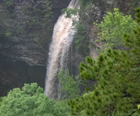
For more Arkansas falls, see Cedar Falls at Petit Jean or browse all Arkansas waterfalls.
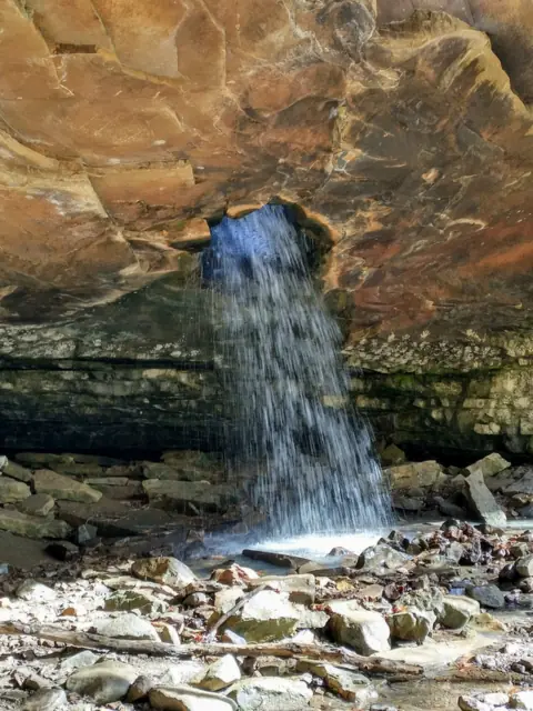
For another national forest falls, see Glory Hole Falls in the Ozark National Forest.
Getting there and parking
The Forest Service gives these directions. Take Arkansas Highway 84 west of Glenwood, then turn north on Highway 369 at Langley for 6 miles.
Continue north 3 miles on Forest Service Road 73 to FR 43. Turn left (northwest) for 4 miles to FR 25. Turn left (west) for half a mile to FR 539.
The directions end at Forest Service Road 539. The Forest Service lists a picnic area at the trailhead but gives no parking details.
Fees
The Forest Service lists "No fee" for the trailhead. Its 2026 Caddo/Womble fee schedule (file titled May 2026) also lists Little Missouri Falls as day use only, all year, with no charge.
Facilities
The Forest Service says no water or electricity is available. It says restroom information is not available for the site.
It lists picnicking, river fishing and day hikes as activities.
Contact
The Forest Service lists the Caddo-Womble Ranger District at 870-867-2101.
Map and nearby falls
Map loads as you scroll. Open in OpenStreetMap
OpenPartly open / seasonalUnconfirmedClosedLarger map
Little Missouri Falls trail: the overlook path and river trail
The Forest Service describes a trail from the picnic area to a waterfall overlook. It gives no length or difficulty for that walk.
The Little Missouri Trail
The Little Missouri Trail follows part of the river, which the Forest Service calls a designated wild and scenic river. It says the trail passes cascading waterfalls, old-growth pine and fall color.
The trail page gives no length and does not say where the trail meets the falls picnic area.
"This trail is fairly level with a few steep inclines," the Forest Service says. It crosses the Little Missouri River eight times, and Crooked, Brier, Long and Blaylock creeks once each.
The trail is open to foot traffic and mountain bikes only. Horses, pack animals and vehicles are prohibited, per the Forest Service.
Dogs
We found no site-specific dog rule. In developed Forest Service recreation sites, federal rules require pets to be crated, caged, on a leash no longer than 6 feet, or otherwise under physical control. We could not confirm how the Forest Service classes this site.
When to visit
The Forest Service says the site is open all year, for picnics and day use only.
No official page we read names a best season. Wikipedia says flow is greatest in winter and spring. It cites the Forest Service but gives no link.
Status checks
On Nov 11, 2026, the Forest Service listed the trailhead as "Site Open." No Ouachita alert named the falls, FR 73, FR 43 or FR 25.
The same alerts page listed a Sept 28, 2026 closure of Forest Service Roads W15 and CO2E on the Caddo-Womble district, due to washouts. Neither is on the route above.
The alerts page also lists a June 26, 2026 forest order for day use areas. We did not read its text, so check it for hours and rules.
Check the Ouachita alerts page or call 870-867-2101 before you go.
| Trail | The Forest Service describes a forested picnic area with a trail leading to a waterfall overlook. It gives no length for that walk. |
|---|---|
| Difficulty | No official rating. The Forest Service gives no length or grade for the overlook trail. |
| Entry fee | No fee, per the Forest Service's Little Missouri Falls Trailhead page. |
| Permit / reservation | No permit listed. The Forest Service pages we read list no permit or reservation for day use here. |
| Parking | No USFS parking details |
| Dogs | We found no site-specific dog rule. In developed Forest Service recreation sites, federal rules require pets to be crated, caged, on a leash no longer than 6 feet, or otherwise under physical control. We could not confirm how the Forest Service classes this site. |
| Wheelchair / stroller | No official accessibility information found. |
| Best time to visit | No official best month. Wikipedia, not an official source, says flow is greatest in winter and spring. |
| Crowds | No official visitor figure found. |
| Managed by | USDA Forest Service, Ouachita National Forest (Caddo-Womble Ranger District) |
Safety and swimming
The Forest Service warns hikers to be careful at stream crossings on the Little Missouri Trail. "Rocks in streams can be slick and high water is dangerous after rain storms," it says.
We found no official swimming rule for the falls.
No water is available at the site, so bring your own.
In an emergency, call 911. Our waterfall safety guide has more on staying safe near falls.
Conditions change: confirm with the official source before you go.
Where to stay near Little Missouri Falls
Compare hotels, cabins and rentals close to the falls around Langley.
See places to stay nearbyAffiliate link: we may earn a commission at no cost to you. Partners do not see or change our waterfall facts. Disclosure.
Little Missouri Falls FAQ
Is Little Missouri Falls open?
As far as we can tell, yes (checked Nov 11, 2026). The Forest Service lists the trailhead as "Site Open," all year, and no Ouachita alert named the falls.
Is there a fee at Little Missouri Falls?
No. The Forest Service lists "No fee" for the Little Missouri Falls Trailhead.
How do you get to Little Missouri Falls?
From Langley, the Forest Service says to take Highway 369 north 6 miles, then FR 73 north 3 miles. Turn left on FR 43 for 4 miles, then left on FR 25 for half a mile to FR 539.
Are there restrooms at Little Missouri Falls?
The Forest Service says restroom information is not available for this site. It says there is no water or electricity.
When is the best time to see Little Missouri Falls?
No official source names a best time. Wikipedia, which is not an official source, says flow is greatest in winter and spring.
Nearby waterfalls
 Falls Creek Falls57 mi straight-line, by our mathOpen
 Cedar Falls74 mi straight-line, by our mathOpen90FT
More waterfalls to explore
City guides: Waterfalls near Hot Springs, AR
Sources
- USDA Forest Service: Little Missouri Falls Trailhead (Site Open, hours, no fee, directions, facilities; updated March 13, 2026; read Nov 11, 2026)
- USDA Forest Service: Little Missouri Trail (conditions, crossings, restrictions, phone; updated March 13, 2026; read Nov 11, 2026)
- USDA Forest Service: Ouachita National Forest alerts (read Nov 11, 2026)
- USDA Forest Service: Caddo/Womble Ranger District Recreation Schedule and Fees for 2026 (file titled May 2026; read Nov 11, 2026)
- U.S. Fish and Wildlife Service: Wild and Scenic Rivers, Little Missouri River (designation, mileage; no update date shown; read Nov 11, 2026)
- eCFR via Cornell LII: 36 CFR 261.16, developed recreation sites (pet rule; read Nov 11, 2026)
- Wikipedia: Little Missouri Falls (not an official source; coordinates, seasonal flow; revision 1355270407, read Nov 11, 2026)
Last verified Nov 11, 2026 by The Waterfall Guide editorial team. Conditions change: confirm with USDA Forest Service, Ouachita National Forest (Caddo-Womble Ranger District) before you go. Spotted something out of date? Report a correction.