Waterfalls near a city
Waterfalls near Redding, California
The nearest waterfalls to Redding in this guide are in Whiskeytown National Recreation Area. Whiskeytown Falls is 16.3 straight-line miles away by our math, and Crystal Creek Falls is 16.6.
6 waterfalls within 50 miles of Redding
Distances are straight-line miles, by our math, from the US Census internal point of Redding, CA, not driving distances, so check a route before you go. Each card links to a full guide with fees, parking and current status.
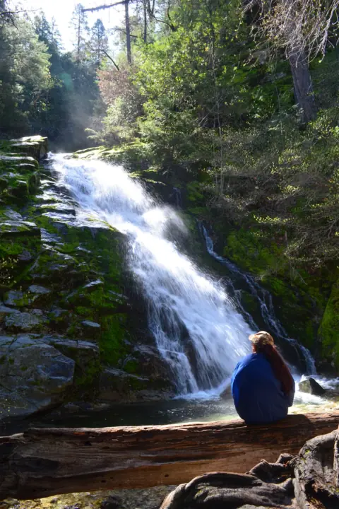
A 220-foot, three-tiered falls in Whiskeytown National Recreation Area, reached by a steep 3.4-mile round trip.
Whiskeytown Falls16 mi straight-line · Strenuous (NPS)Open220FT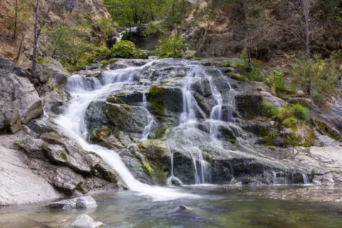
A cascade on Crystal Creek in Whiskeytown, reached by a short, flat, paved path with an accessible viewpoint.
Crystal Creek Falls17 mi straight-line · Easy (NPS)Open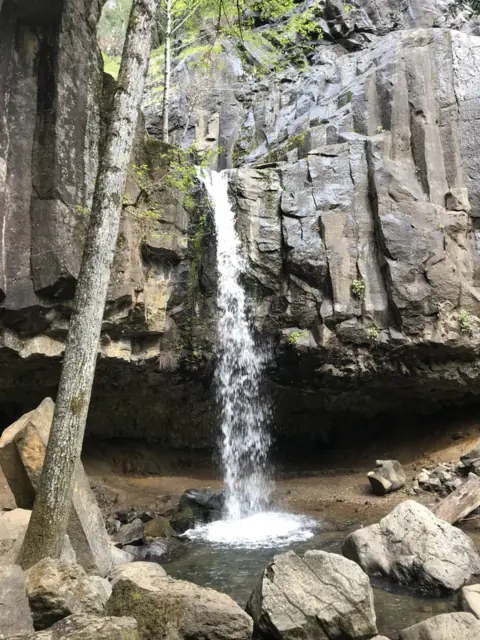
A 35-foot falls over a basalt cliff in Dunsmuir, a short trail from I-5, with a shallow cave behind it.
Hedge Creek Falls46 mi straight-line · Easy (Mount Shasta Trail Assn.)OpenABOUT 35FT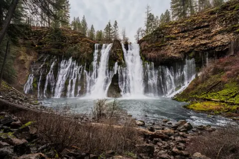
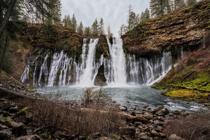
A 129-ft spring-fed falls that flows all year, with a $10 fee and no reservation now.
Burney Falls48 mi straight-line · Not listedOpen129FT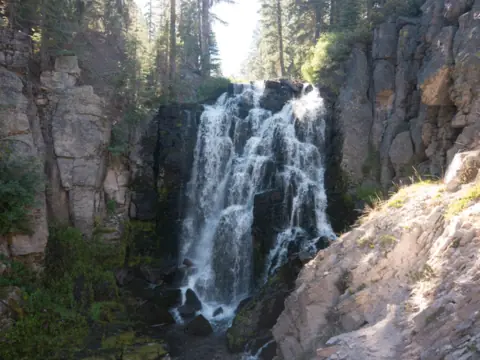
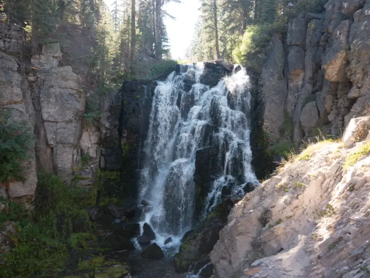
A moderate 2.8-mile round trip (NPS) to a falls on Kings Creek in Lassen Volcanic National Park, with steep sections in full sun.
Kings Creek Falls49 mi straight-line · Moderate (NPS)Seasonal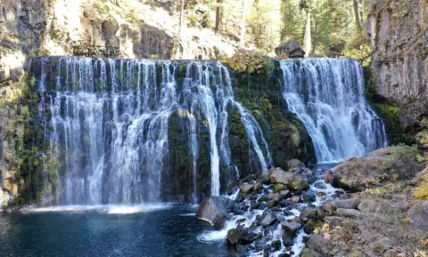
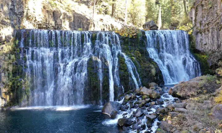
Three falls on the Upper McCloud River, about 3.5 miles round trip on foot or reached by a paved loop road.
McCloud Falls50 mi straight-line · Easy to moderateOpenUPPER END OF RANGE 50FT
Map of waterfalls near Redding
Map loads as you scroll. Open in OpenStreetMap
OpenPartly open / seasonalUnconfirmedClosedLarger map
Compare the waterfalls near Redding
| Waterfall | Distance | Status | State | Height | Trail | Difficulty | Fee / permit | Swimming |
|---|---|---|---|---|---|---|---|---|
| Whiskeytown Falls | 16 mi | Open | CA | 220 ft | 3.4 mi round trip (NPS) | Strenuous (NPS) | Entrance pass required, $25 per vehicle for 7 days (NPS) | No official swimming rule found |
| Crystal Creek Falls | 17 mi | Open | CA | Not listed | 0.4 mi paved path one way (NPS) | Easy (NPS) | Entrance pass required, $25 per vehicle for 7 days (NPS) | NPS describes careful swimming at the base |
| Hedge Creek Falls | 46 mi | Open | CA | about 35 ft | About 1 mi round trip (Mount Shasta Trail Assn.) | Easy (Mount Shasta Trail Assn.) | No fee listed | No official swimming rule found |
| Burney Falls | 48 mi | Open | CA | 129 ft | Falls Loop (no official length) | Not listed | $10/vehicle | No pool rule found |
| Kings Creek Falls | 49 mi | Seasonal | CA | Not listed | 2.8 mi round trip (NPS) | Moderate (NPS) | $30 per vehicle in summer (NPS) | No official swimming rule found |
| McCloud Falls | 50 mi | Open | CA | 50 ft (upper end of range) | 3.5 mi round trip | Easy to moderate | No fee (picnic area) | No posted rule; jumping spots dangerous |
Where to stay near Redding
Base yourself in Redding, CA for a waterfall day. Open the map to compare hotels, cabins and rentals, or switch to tours and activities.
Or open the full stays map in a new tab
Affiliate links and map: we may earn a commission at no cost to you. The map loads from Stay22 only when you open it. Partners do not see or change our waterfall facts. Disclosure.
How the list breaks down
Every mileage here runs in a straight line, by our math, from the point the Census Bureau uses for Redding. Expect longer drives on mountain roads. The 50-mile circle counts only falls we have written up.
Four more falls sit between 46 and 50 miles out. Hedge Creek Falls is in Dunsmuir, 46.4 miles away. Burney Falls is 48.2 miles away, in a state park.
Kings Creek Falls in Lassen is 49.2 miles away, and McCloud Falls is 49.6. As far as we can tell (Nov 11, 2026), the Lassen park highway has been closed to through travel since Oct 30, 2026.
For more falls, see our California waterfalls guide.
Whiskeytown: two falls 16 to 17 miles from Redding
Whiskeytown Falls drops 220 feet in three tiers, per the NPS. The James K. Carr Trail to it is 3.4 miles round trip, and the NPS calls it strenuous and steep. Dogs are allowed on a leash no longer than six feet.
Crystal Creek Falls is the easy one. The NPS describes a flat, paved, accessible path of about 0.4 mile one way to a viewpoint. The NPS calls the falls the only man-made waterfall in the park.
Both need a park entrance pass. The NPS fee page lists $25 for a private vehicle for 7 days. As far as we can tell (Nov 13, 2026), both trails are open. An NPS road page from November 2025 says Crystal Creek Road can close for winter weather.
Hedge Creek Falls and McCloud Falls to the north
Hedge Creek Falls is in Dunsmuir. The Dunsmuir Chamber of Commerce calls it a 35-foot waterfall over a basalt cliff. The Mount Shasta Trail Association lists the trail at 1 mile round trip with 160 feet of gain.
No agency publishes a status page for Hedge Creek. As far as we can tell (Nov 11, 2026), it is open, with no closure notice found. No fee is listed on the pages we read.
McCloud Falls, a set of three falls on the McCloud River, is in Shasta-Trinity National Forest. The Forest Service says the three falls vary from 15 to 50 feet, with Middle Falls the highest. Seeing all three is about 3.5 miles round trip from the Lower Falls Picnic Area.
The Forest Service lists "No fee. Day use only." at the Lower Falls Picnic Area. On Nov 3, 2026, its page showed "Site Open," but that page was last updated Aug 6, 2025. As far as we can tell, the falls are open.
In winter, the Mount Shasta Trail Association says the loop road is gated near Highway 89, and you need snowshoes or skis. The Forest Service listed Fowlers Campground as closed on a page updated Oct 29, 2026.
Burney Falls and Kings Creek Falls to the east
Burney Falls is in McArthur-Burney Falls Memorial State Park. California State Parks gives its height as 129 feet and says it flows year-round. Day use costs $10 per vehicle, and State Parks says special rates may apply on peak days, holidays and weekends.
As far as we can tell (Oct 28, 2026), the park is open. A Jan 1, 2026 notice closes the Burney Creek Trail and PSEA Trail north of Rainbow Bridge, with no end date. It does not name the Falls Loop Trail. Per the park page, dogs are limited to parking lots, paved roads and campgrounds.
Kings Creek Falls is in Lassen Volcanic National Park. The NPS lists the trail at 2.8 miles round trip, rated moderate. Pets are not allowed on any park trail.
As far as we can tell (Nov 11, 2026), it is not reachable by car. The NPS closed the park highway to through travel on Oct 30, 2026, because of ice and fallen rock.
Waterfalls near Redding: FAQ
What is the closest waterfall to Redding?
Whiskeytown Falls is the closest in this guide, 16.3 straight-line miles from Redding's Census point by our math. Crystal Creek Falls, in the same park, is 16.6 miles away. This list covers only falls we have published.
Which waterfall near Redding is the easiest walk?
Crystal Creek Falls. The NPS describes a flat, paved, accessible path of about 0.4 mile one way to its viewpoint.
Which waterfalls near Redding are free?
The Forest Service lists no fee at the McCloud River Lower Falls Picnic Area. No fee is listed for Hedge Creek Falls on the pages we read. Whiskeytown, Burney Falls and Lassen all charge entrance or day-use fees.
Can I see Kings Creek Falls in winter?
Probably not by car. As far as we can tell (Nov 11, 2026), the Lassen park highway has been closed to through travel since Oct 30, 2026, per the NPS. The NPS lists the trail under its May to October conditions. The NPS says it must clear 30 to 40 feet of snow from the main park road every spring.
Can I bring my dog to waterfalls near Redding?
At Whiskeytown, yes, on a leash no longer than six feet, per the NPS. At Burney Falls, dogs are limited to parking lots, paved roads and campgrounds. Lassen does not allow pets on any hiking trail. We found no official dog rule for Hedge Creek Falls or McCloud Falls.
Sources
Facts for each waterfall come from its own guide, where every source is listed. The city sources are below.
- NPS Whiskeytown: James K. Carr Trail to Whiskeytown Falls (updated Jan 15, 2026)
- NPS Whiskeytown: Crystal Creek Falls (updated Jan 15, 2026)
- NPS Whiskeytown: Hiking (trail status; updated Jan 15, 2026; read Nov 13, 2026)
- NPS Whiskeytown: Fees and passes (updated Mar 13, 2026)
- NPS Whiskeytown: Current conditions (road status; page updated Nov 25, 2025)
- Mount Shasta Trail Association: Hedge Creek Falls (read Nov 11, 2026)
- Dunsmuir Chamber of Commerce: Adventure (35-foot height; read Nov 11, 2026)
- USDA Forest Service: Lower Falls Picnic Area, McCloud River (Site Open, no fee; updated Aug 6, 2025; read Nov 3, 2026)
- USDA Forest Service: Fowlers Campground (Site Closed, updated Oct 29, 2026; read Nov 3, 2026)
- Mount Shasta Trail Association: McCloud River Falls trail (winter gate; read Nov 3, 2026)
- California State Parks: McArthur-Burney Falls Memorial SP (read Oct 28, 2026)
- California State Parks: Notice of Trail Closures (Jan 1, 2026)
- NPS Lassen Volcanic: Trail conditions, May to October (read Nov 11, 2026)
- NPS Lassen Volcanic: Alerts and conditions (highway closure posted Oct 30, 2026)
- NPS Lassen Volcanic: Pets (updated Apr 21, 2023; read Nov 11, 2026)
- US Census Bureau TIGERweb: Redding city, GEOID 0659920, internal point (read Nov 13, 2026)
State guides: California waterfalls. More cities.
Photos: JonMallard10, CC BY 4.0; Sergey Yarmolyuk, CC BY-SA 4.0; Bill Ward, CC BY 2.0. Photo credits