Right now
Right now as of Oct 28, 2026
- Status The DNR says vehicle access typically runs mid-May to mid-October, so the 2026 vehicle season has likely ended.
Status note (Oct 28, 2026): Seasonal. The DNR says vehicle access typically runs mid-May to mid-October, so the 2026 vehicle season has likely ended. The hiking trail stays open year-round on foot, but it is not groomed for snow and ice. We found no 2025 or 2026 closure. DNR phone: 906-353-6558. What the status labels mean
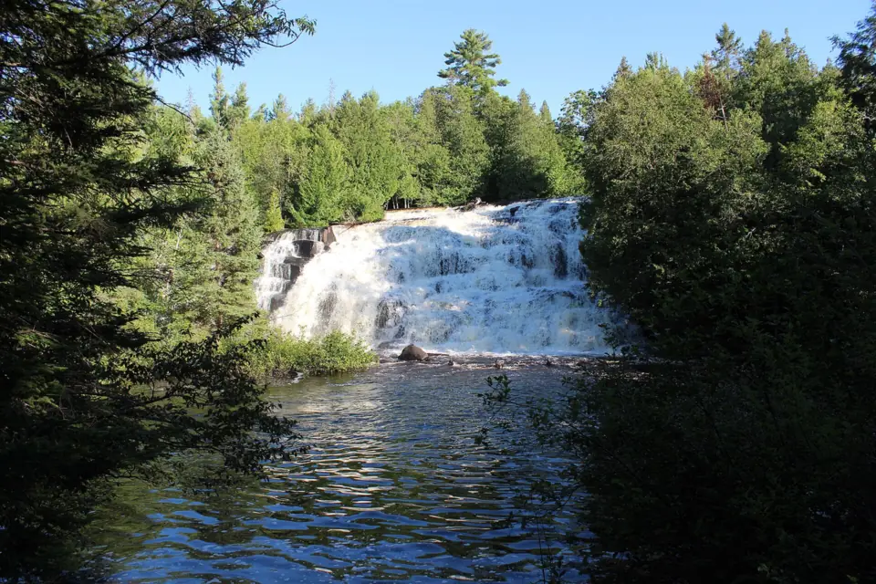
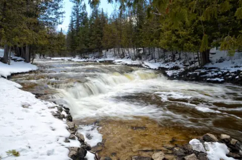
Bond Falls is a set of cascades on the Middle Branch of the Ontonagon River, near Paulding in Michigan's western Upper Peninsula. The Michigan DNR puts the drop at about 50 feet and lists an accessible boardwalk with six viewing locations. Vehicle access usually runs mid-May to mid-October, but the trail stays open on foot all year.
About Bond Falls
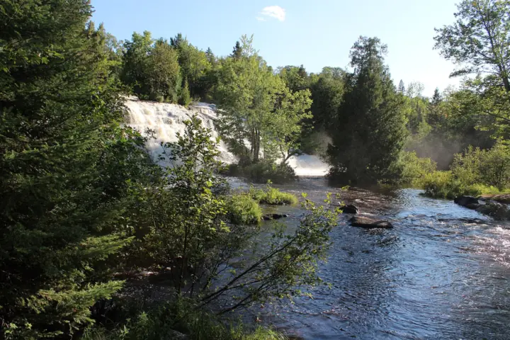
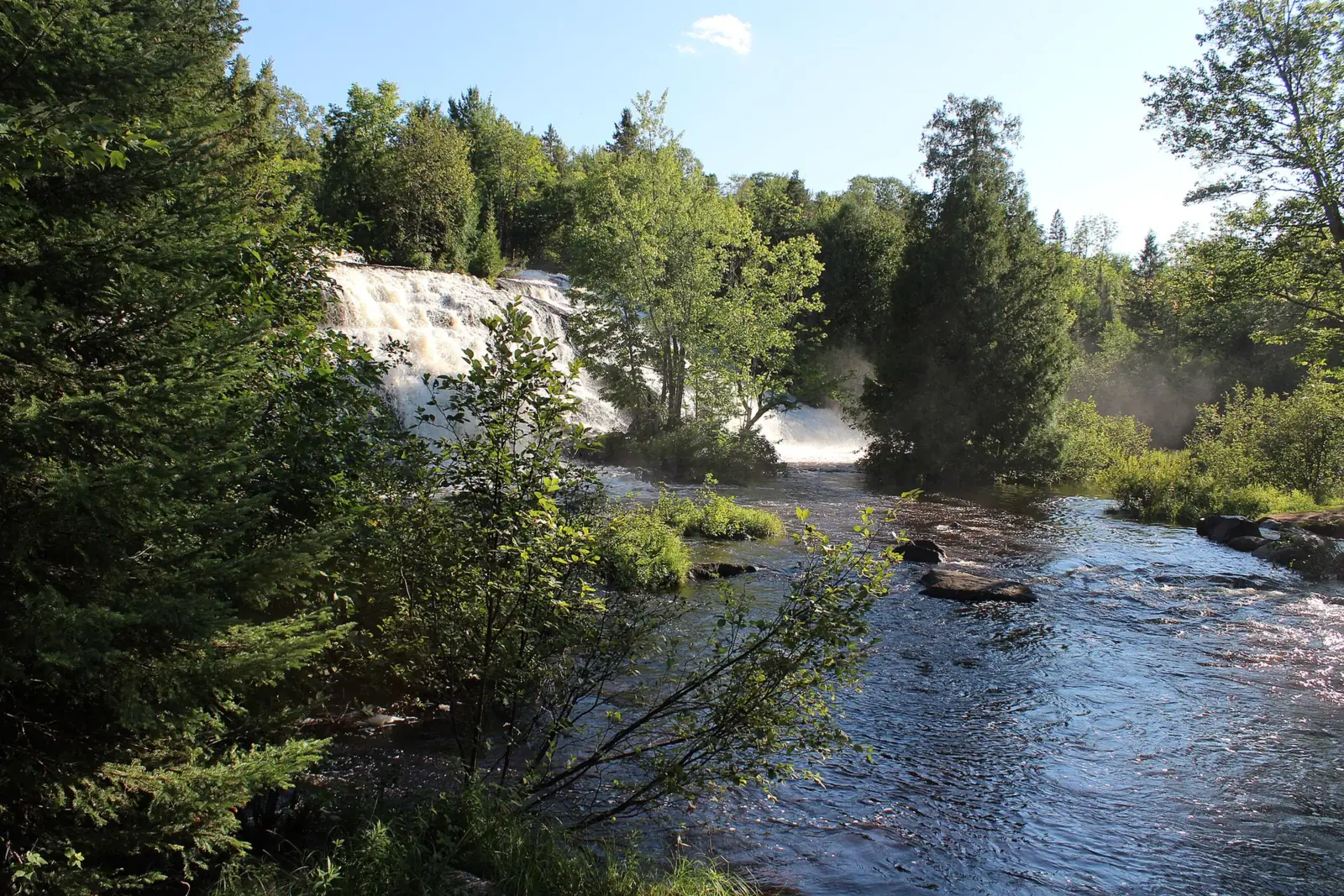
Bond Falls is a series of cascades on the Middle Branch of the Ontonagon River. The Michigan DNR's site page gives a total drop of about 50 feet, and Wikipedia also says 50 feet.
The falls are not entirely natural. Wikipedia notes that the Upper Peninsula Power Company (UPPCO) built a dam upstream, which altered the falls. The reservoir behind that dam is the Bond Falls Flowage.
From the flowage, the river drops 875 feet on its way to Lake Superior, and Bond Falls is the first stage of that descent, according to Wikipedia. Farther downstream, the same river reaches the Agate Falls Scenic Site.
The DNR manages the falls as the Bond Falls Scenic Site. The DNR says they form where the river tumbles over a thick belt of fractured rock in southern Ontonagon County. UPPCO runs the Bond Falls Campground by the flowage.
Getting there and parking
Bond Falls is in Ontonagon County, near Paulding. The DNR lists roadside parking, picnic tables, a vault toilet, an observation platform and an accessible boardwalk with six viewing locations.
Directions from Paulding and US-45
UP Travel says to take Bond Falls Road 3 miles from US-45 to Scenic Overlook Drive, then follow signs to the main parking lot. Bond Falls Road meets US-45 at Paulding.
UP Travel also describes free roadside parking on Bond Falls Road near the Bond Falls Outpost. The roadside parking spot isn't wheelchair friendly, because steps lead to the deck. When the main lot is closed in winter, the roadside parking is the way in.
Recreation Passport
UP Travel says a Recreation Passport is required to park; the Michigan DNR page lists the Passport requirement for state park and forest campgrounds. Check at the site. You can also call the DNR at 906-353-6558.
Michigan residents can add the Passport when they renew their plates. Nonresidents can buy a daily or annual pass. The 2026 prices, from michigan.gov, are in the box above.
Camping near Bond Falls
The Upper Peninsula Power Company (UPPCO) runs Bond Falls Campground by the Bond Falls Reservoir, the DNR says. UPPCO's July 20, 2026 release lists 48 rustic sites and calls it the largest of its three free campgrounds.
Camping is free and first-come, first-served, with no reservations. The west side has campground-style sites, and the east side has more secluded, dispersed sites.
UPPCO lists picnic tables, fire rings, hand-pump water and vault toilets, with no electric hookups or showers. A public boat launch is on site. Pets are welcome on a leash, and the maximum stay is 14 nights per year.
The 2026 season ran May 10 to October 15, so the campground is closed for the year.
Map and nearby falls
Map loads as you scroll. Open in OpenStreetMap
OpenPartly open / seasonalUnconfirmedClosedLarger map
The boardwalk and viewing platforms
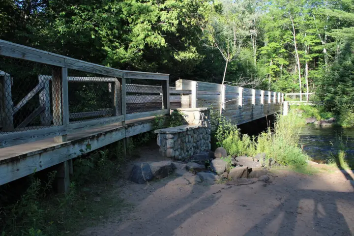
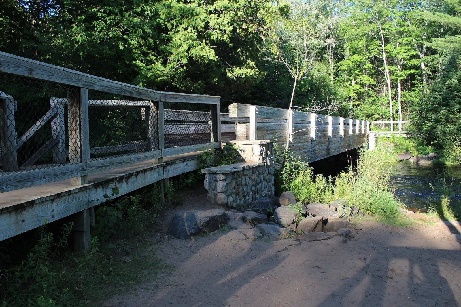
There is no long hike at Bond Falls. The DNR lists an accessible boardwalk with six viewing locations. UP Travel says a short paved trail leads from the main lot to a boardwalk of about 600 feet.
UP Travel says the boardwalk and main viewing deck are wheelchair accessible. The roadside parking near the Bond Falls Outpost needs steps to reach the deck, so use the main lot for step-free access. The DNR also includes the Bond Falls boardwalk on its list of accessible trails and scenic sites.
Wikipedia describes trails that start from a picnic area at the top of the falls. It also mentions a walkway that crosses the river below the base, so you can see the cascades from above and below.
The boardwalk has needed repairs before. On Sept 13 and 14, 2021, parts of the site closed for a volunteer workday. About 30 tourism-industry volunteers helped park staff fix boardwalk decking and bridges, Upper Michigan's Source reported.
When to visit
Bond Falls is open on foot year-round, the DNR says, but vehicle access typically runs only from mid-May to mid-October.
Vehicle season and winter visits
The DNR says vehicle access typically runs from mid-May to mid-October, depending on the weather. By late October 2026, that window has usually closed.
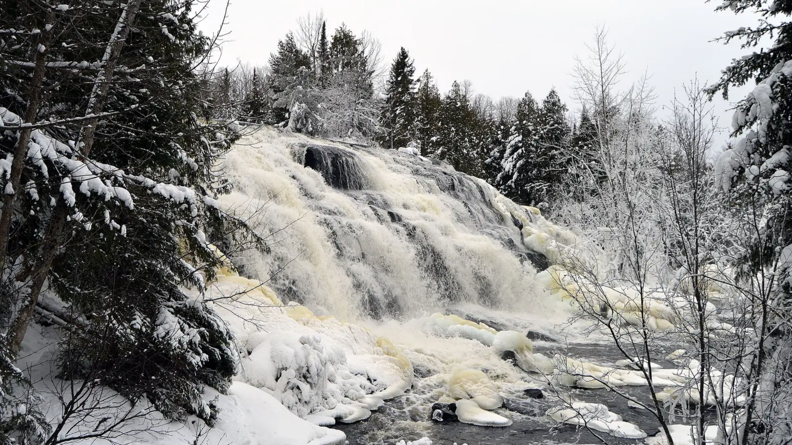
The hiking trail stays open all year. In winter, though, the DNR says trails and boardwalks are not monitored or groomed for snow and ice. A January photo on Wikimedia Commons shows thick ice built up by spray from the falls.
We could not find an official best month for water flow at Bond Falls, and no DNR crowd figures turned up either.
Nearby Agate Falls Scenic Site is a separate DNR site. The DNR reopened it on Sept 4, 2026, after a 2026 closure.
For more Upper Peninsula falls, see Tahquamenon Falls, a year-round state park, or Munising Falls, where the trail is closed for a rebuild. In the Lower Peninsula, the DNR rebuilt Ocqueoc Falls for wheelchair access in 2011-2012, though we could not confirm its 2026 status.
When is the water highest?
At a USGS stream gauge about 4.5 mi from the falls, the flow averages highest in April and lowest in February, based on 30 complete years of records between 1990 and 2025.
Show the numbers
| Month | Average flow (cfs) |
|---|---|
| January | 98 |
| February | 93 |
| March | 136 |
| April | 336 |
| May | 264 |
| June | 156 |
| July | 124 |
| August | 108 |
| September | 126 |
| October | 158 |
| November | 149 |
| December | 124 |
| Height | 50 ftNote: total drop, per the Michigan DNR and Wikipedia |
|---|---|
| Trail | Accessible boardwalk with six viewing locations (Michigan DNR); UP Travel puts the boardwalk at about 600 ft, reached by a short paved trail from the main lot |
| Difficulty | Easy |
| Entry fee | No lot fee listed by the DNR. UP Travel says a Recreation Passport is required to park; the Michigan DNR page lists the Passport requirement for state park and forest campgrounds. Check at the site |
| Permit / reservation | Rule unclear: UP Travel says a Recreation Passport is required, and the DNR lists it for state park and forest campgrounds. Carry one if you drive in. |
| Parking | Main lot in season; roadside parking |
| Wheelchair / stroller | Yes: the DNR lists an accessible boardwalk with six viewing locations. UP Travel says the boardwalk and main deck are wheelchair accessible from the main lot, but the roadside parking needs steps |
| Walk behind the falls | No |
| Restrooms | Vault toilets (Michigan DNR) |
| Managed by | Michigan DNR (Bond Falls Scenic Site) |
Safety and swimming
We found no DNR rule on swimming or wading at Bond Falls. Check the posted signs, and stay on the boardwalk near the fast water.
Stay on the boardwalk and at the viewing spots. Expect wet rock beside the cascades, and give fast water plenty of room. Keep children within reach near the edges.
If you walk in after the vehicle season ends, nobody clears the snow or ice, according to the DNR. Wear traction devices, go slowly on the boardwalk, and tell someone your plans.
Conditions change: confirm access and fees with the Michigan DNR before you go.
For general tips, see our waterfall safety page.
Where to stay near Bond Falls
Compare hotels, cabins and rentals close to the falls around Paulding.
See places to stay nearbyAffiliate link: we may earn a commission at no cost to you. Partners do not see or change our waterfall facts. Disclosure.
Photos
Bond Falls FAQ
Is Bond Falls open now?
On foot, yes: the DNR says the hiking trail is open year-round. Vehicle access typically ends in mid-October, so by late October the main lot is likely closed. We found no 2025 or 2026 closure. Call the DNR at 906-353-6558 to check.
Where is Bond Falls, and how do you get there?
In southern Ontonagon County near Paulding, in Michigan's western Upper Peninsula. UP Travel says to take Bond Falls Road 3 miles from US-45 to Scenic Overlook Drive, then follow signs to the main lot.
How tall is Bond Falls?
About 50 feet in total, according to the Michigan DNR. Wikipedia also says 50 feet.
Do you need a Recreation Passport at Bond Falls?
UP Travel says a Recreation Passport is required to park; the Michigan DNR page lists the Passport requirement for state park and forest campgrounds. Check at the site. In 2026, residents pay $15 at plate renewal, and nonresidents $12 a day or $42 a year. UP Travel says a Passport is required, so plan on one if you drive in.
Is Bond Falls wheelchair accessible?
Yes. The DNR lists an accessible boardwalk with six viewing locations. UP Travel says the boardwalk and main deck are reached step-free from the main lot, but the roadside parking needs steps.
Can you swim at Bond Falls?
We found no DNR swimming or wading rule. Check posted signs, and stay on the boardwalk near the fast water.
Can you visit Bond Falls in winter?
On foot, yes. The DNR says the hiking trail is open year-round, but trails and boardwalks are not groomed for snow and ice. Vehicle access typically runs only from mid-May to mid-October.
Is Bond Falls natural?
Partly. Wikipedia notes that an upstream dam built by the Upper Peninsula Power Company altered the falls. The dam forms the Bond Falls Flowage.
Nearby waterfalls
No other waterfalls within 75 miles are on the site yet.
More waterfalls to explore


Sources
- Michigan DNR: Bond Falls Scenic Site (read Oct 28, 2026)
- UPPCO: Three free waterfront campgrounds (July 20, 2026)
- UP Travel: Bond Falls Scenic Site
- Michigan DNR: Accessible trails and scenic sites (archived Jul 12, 2026)
- Michigan.gov: Recreation Passport (read Oct 29, 2026)
- Michigan DNR: Agate Falls Scenic Site opens Sept 4 (2026)
- Upper Michigan's Source: Portions of Bond Falls closed for volunteer workday (2021)
- Wikipedia: Bond Falls
- OpenStreetMap: Bond Falls map location
Last verified Oct 28, 2026 by The Waterfall Guide editorial team. Conditions change: confirm with Michigan DNR (Bond Falls Scenic Site) before you go. Spotted something out of date? Report a correction.