Right now
Right now as of Oct 29, 2026
- Permit Recreation Passport (vehicle entry).
Status note (Oct 29, 2026): The DNR keeps the Hemlock campground loop open year-round, and the Portage loop opens for hike-in camping in winter. The DNR says the new 1,100-ft accessible boardwalk to the Upper Falls is complete; it opened in May 2026, replacing the 94-step staircase. The 2026 Hunter Shuttle season ended after Labor Day weekend. What the status labels mean
Tahquamenon Falls is two waterfalls in Tahquamenon Falls State Park, near Paradise in Michigan's Upper Peninsula. The Upper Falls drops about 50 feet and is more than 200 feet wide; the Lower Falls are cascades about 4 miles downstream. The DNR keeps one campground loop, Hemlock, open year-round. A 1,100-foot accessible boardwalk to the Upper Falls brink opened in May 2026. Every vehicle needs a Michigan Recreation Passport, and the park has three campgrounds.
About Tahquamenon Falls
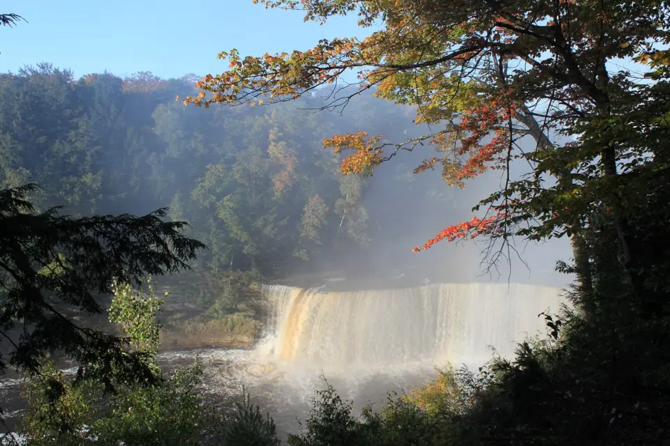
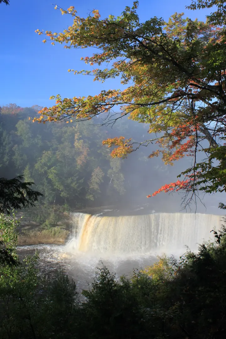
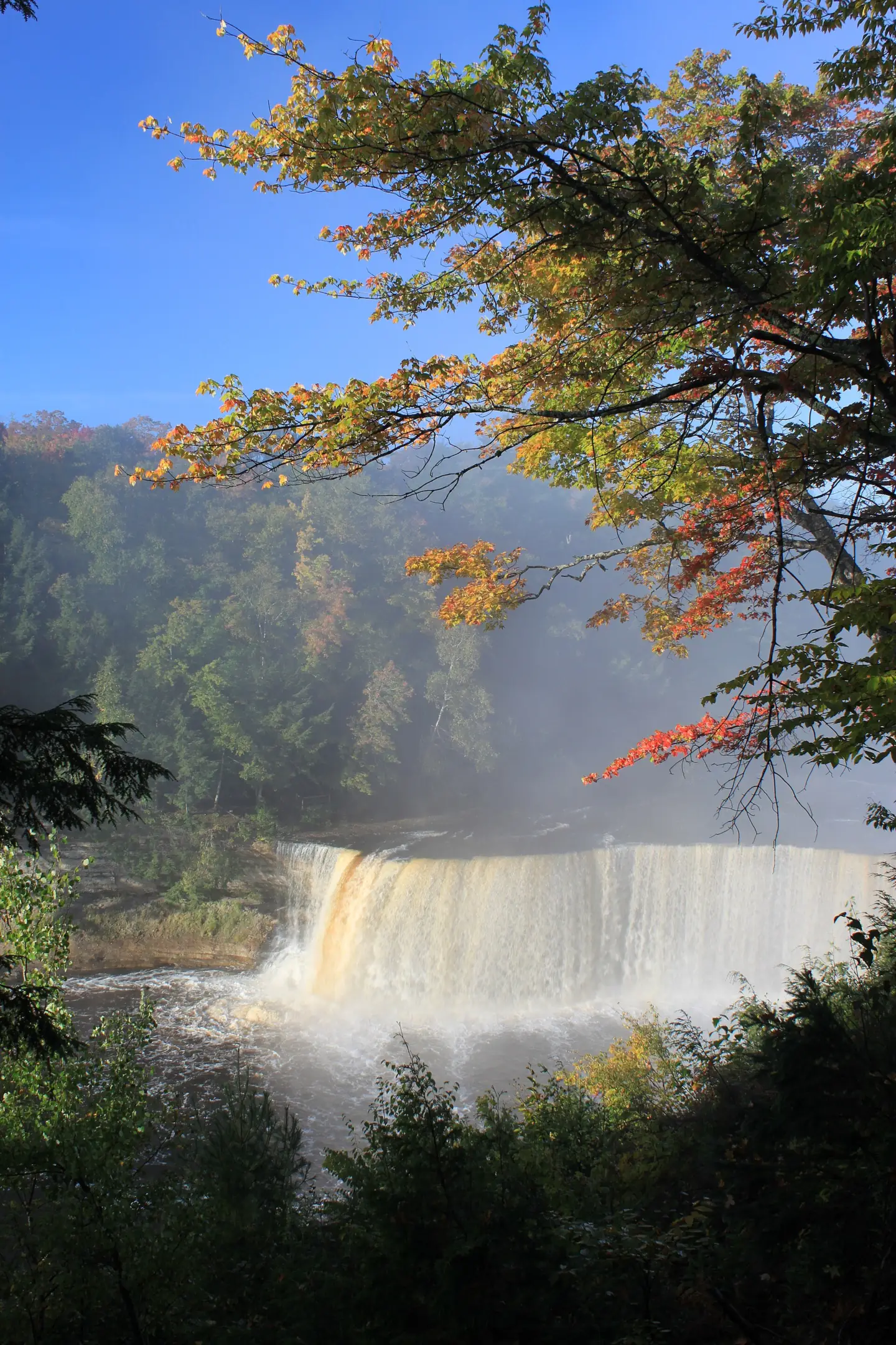
The Upper Falls at Tahquamenon drops about 50 feet and stretches more than 200 feet across, the Michigan DNR says. That size makes it one of the largest waterfalls in the eastern United States. Wikipedia lists the height as 48 feet.
The water looks like root beer, and there is a simple reason. The DNR says the river's amber hue comes from tannins in the surrounding swamps.
The Tahquamenon River averages about 7,000 gallons per second, according to Wikipedia. In spring runoff it can reach 50,000 gallons per second. Longfellow named the river in The Song of Hiawatha with the line "By the rushing Taquamenaw".
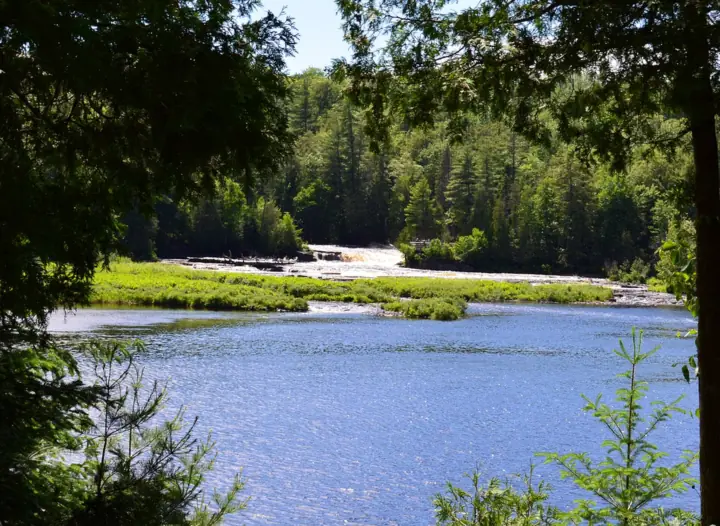
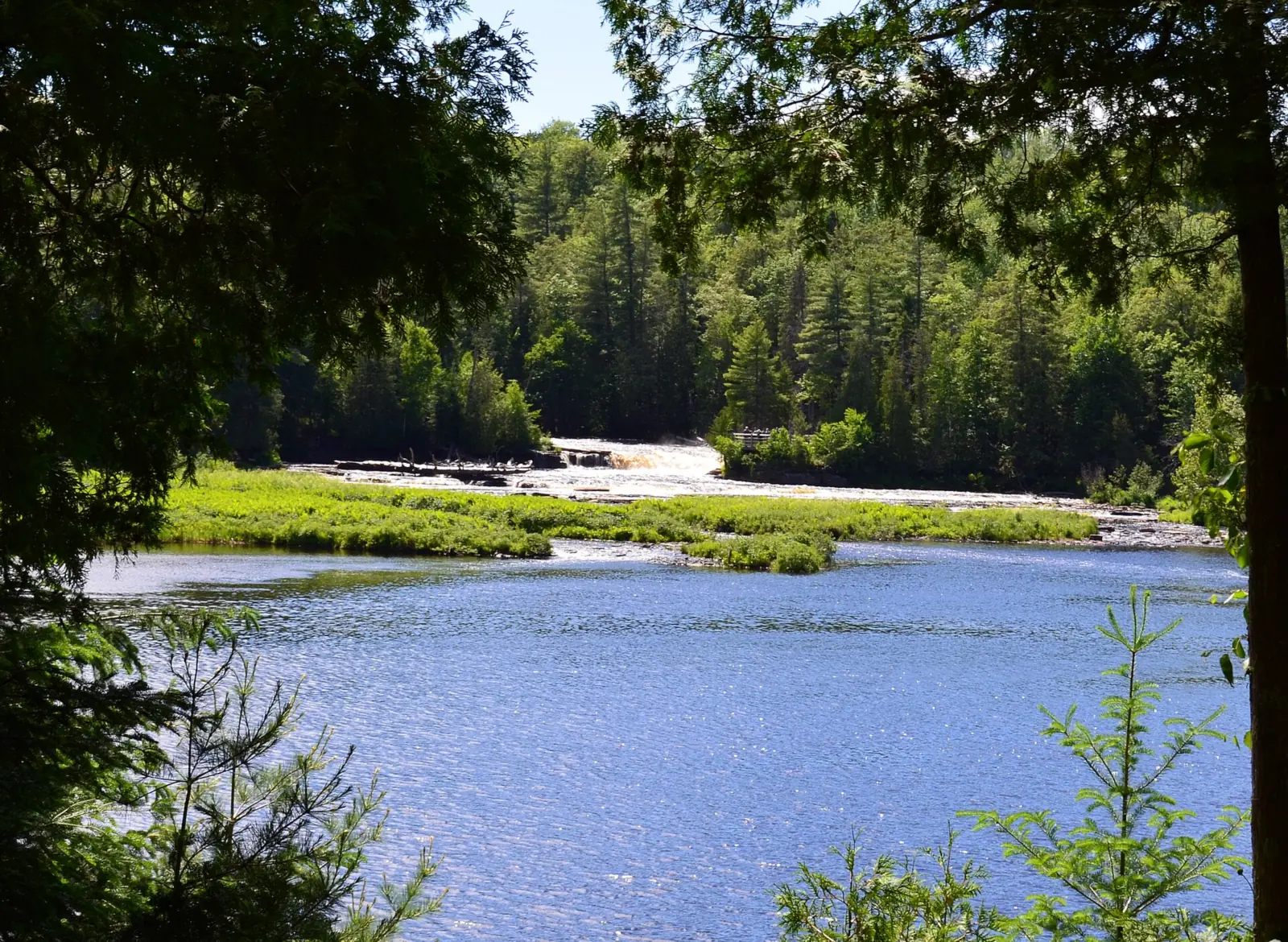
The Lower Falls sit about 4 miles downstream. Here the river splits around an island and drops in a series of smaller cascades. The DNR says you can explore both falls from the riverbank, the island bridge or a rental rowboat.
The state park covers nearly 50,000 acres and stretches more than 13 miles, per the DNR. The DNR's May 2026 boardwalk release says the park was established in 1947. It has more than 35 miles of trails, including 16 miles of the North Country Trail.
The DNR notes that moose can sometimes be seen feeding in the park's wet areas, especially along M-123 between Paradise and the Lower Falls.
Getting there and parking
Tahquamenon Falls State Park is in Luce County in Michigan's Upper Peninsula, near the town of Paradise. The DNR park page mentions M-123 between Paradise and the Lower Falls. The Upper and Lower Falls each have their own day-use lot, about 4 miles apart.
Recreation Passport
You need a Recreation Passport on your vehicle. Michigan residents can add it when renewing their plates. Nonresidents can buy a daily pass ($12) or an annual pass ($42), per michigan.gov prices read October 29, 2026.
Near the Upper Falls lot
Tahquamenon Falls Brewery & Pub is near the Upper Falls lot. Its website says it was built in 1996, next to the Camp 33 gift shop. Its website says it is closed for the fall 2026 season and will reopen on Friday, December 18, 2026, serving daily from 11am to 8:30pm.
Shuttle between the falls
In 2026, Hunter Shuttle Service ran a fee-based shuttle between the Upper and Lower Falls, noon to 8pm, per the DNR. It ran on weekends through June 21, then daily from June 22 through Labor Day weekend.
The 2026 season is over. For 2027, check with Hunter Shuttle at 906-291-3422 or with the DNR.
The park office number is 906-492-3415.
Camping at Tahquamenon Falls State Park
The Michigan DNR lists three campgrounds in the park: Lower Falls Modern, Rivermouth Modern and Rivermouth Rustic. It also lists backcountry camping, the Tahquamenon Falls Lodge, the Rivermouth Pines Camper Cabin and the Rivermouth Pines Group-Use Area.
The DNR says a Recreation Passport is required for vehicle entry into all state park and forest campgrounds.
Lower Falls Modern Campground
The DNR lists 188 sites here in two loops, Hemlock and Portage. All have 30-amp service and some have 50-amp. Portage sits by the river about a quarter-mile from the Lower Falls, with North Country Trail access. Hemlock is about a mile away.
Hemlock is open year-round, and so is its accessible toilet and shower building, the DNR says. In winter, the Portage loop is open for hike-in camping. Call the park about conditions before a winter trip.
Rivermouth campgrounds
The DNR places the Rivermouth Modern Campground, with 72 sites, about 5 miles south of Paradise. Rivermouth Rustic has 36 sites. It is semi-modern while the water spigots run, generally mid-May through the second Sunday in October. After that it is rustic, and water is available at park headquarters between the falls.
Reservations and rates
Book campsites through the DNR reservation system at midnrreservations.com or 800-447-2757, per the DNR park page. The DNR also lists three reservable backcountry sites near the North Country Trail, a 1 to 5 mile hike in. We found no official campsite rates we could confirm, so check the reservation site for current prices.
Map and nearby falls
Map loads as you scroll. Open in OpenStreetMap
OpenPartly open / seasonalUnconfirmedClosedLarger map
Upper Falls boardwalk, Lower Falls and North Country Trail
Tahquamenon Falls has two viewing areas, which the DNR places about 4 miles apart. The Upper Falls has a 1,100-foot accessible boardwalk, and the Lower Falls has riverbank viewpoints and an island bridge.
Upper Falls
The DNR says the new 1,100-foot accessible boardwalk to the Upper Falls is complete. It opened in May 2026, funded by about $1.5 million in federal relief funds. It has five switchback landings with interpretive displays and benches.
The DNR describes it as fully accessible, with over 60 feet of elevation change spread across five switchback landings. The DNR says the walk can take up to a half hour longer than the old stairs.
The Upper Falls boardwalk zigzags down instead of going straight, and it replaced the old 94-step staircase.
Lower Falls
At the Lower Falls you can watch from the riverbank or cross the Ronald A. Olson Island Bridge to the island. The DNR lists paddlesport rentals and rowboats among the park's options; confirm they are running before you plan on one.
North Country Trail between the falls
If you want a real hike, the North Country Trail follows a route between the two falls, which the DNR places about 4 miles apart. The DNR says 16 miles of the North Country Trail run through the park.
Plan your return trip. In 2026 the shuttle ran only through Labor Day weekend.
When to visit
Spring runoff brings the biggest flow, when the river can run several times its average volume. Summer adds the seasonal shuttle between the falls.
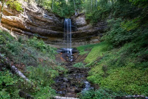
Munising Falls is another UP waterfall, in Pictured Rocks National Lakeshore. Check our Munising Falls guide for its trail status (closed as of Oct 2026) before you add it to a trip.
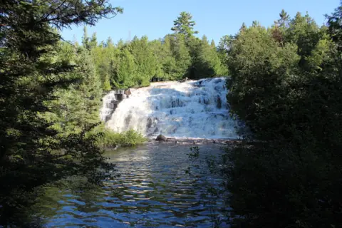
Heading west in the UP? Our Bond Falls guide covers another Recreation Passport falls with an accessible boardwalk.
Winter at the falls
The DNR keeps the Hemlock campground loop open year-round, and the Portage loop opens for hike-in camping in winter. The park page lists no opening hours; call 906-492-3415. Ask about winter access to the new boardwalk before a winter trip.
The DNR lists cross-country skiing and snowshoeing among the park's activities. Dress for the cold. For more winter waterfall trips, see our frozen waterfalls guide.
When is the water highest?
At a USGS stream gauge about 0.6 mi from the falls, the flow averages highest in April and lowest in August, based on 30 years of records (1995 to 2024).
Show the numbers
| Month | Average flow (cfs) |
|---|---|
| January | 584 |
| February | 518 |
| March | 937 |
| April | 2,470 |
| May | 1,533 |
| June | 604 |
| July | 443 |
| August | 381 |
| September | 462 |
| October | 938 |
| November | 1,086 |
| December | 843 |
| Height | 50 ftNote: upper falls, about 50 ft per the Michigan DNR and 48 ft per Wikipedia; the lower falls are cascades about 4 miles downstream |
|---|---|
| Trail | Fully accessible 1,100-ft boardwalk to the Upper Falls brink overlook; riverbank viewpoints and an island bridge at the Lower Falls |
| Difficulty | Easy |
| Entry fee | Michigan Recreation Passport required for vehicle entry. Prices per michigan.gov, read Oct 29, 2026: residents $15 per vehicle at plate renewal; nonresidents $12 daily or $42 annual. The DNR says the 2026 price rose $1 |
| Permit / reservation | Michigan Recreation Passport required for each vehicle |
| Parking | Day-use lots at both falls (Recreation Passport) |
| Hours / season | The park page lists no opening hours; call 906-492-3415. |
| Wheelchair / stroller | Yes: the 2026 Upper Falls boardwalk is fully accessible, per the DNR, with five switchback landings. The Lower Falls have accessible viewpoints and an island bridge. The DNR lists a track chair among park amenities. |
| Walk behind the falls | No |
| Best time to visit | Spring runoff for the biggest flow; summer for the seasonal shuttle; winter for snow; ask the park about winter boardwalk access |
| Managed by | Michigan DNR, Tahquamenon Falls State Park |
Safety and swimming
Stay on the boardwalks, stairs and overlooks. The river averages about 7,000 gallons per second, and wet rock and winter ice make the edges slippery. Do not climb over railings for a closer view.
We could not confirm the DNR's rules on wading or swimming near either falls. Check posted signs or ask park staff. If you rent a rowboat at the Lower Falls, wear a life jacket and keep well away from the drops.
The DNR park page lists black bears among the park's resident wildlife. If you camp or picnic, follow the Michigan DNR's black bear guidance.
The DNR says drone use is permitted, but with restrictions. Ask the park office about the rules before you fly.
Conditions change: confirm fees, closures and winter access with the Michigan DNR before you go. For general tips, read our waterfall safety guide.
Where to stay near Tahquamenon Falls
Compare hotels, cabins and rentals close to the falls around Paradise.
See places to stay nearbyAffiliate link: we may earn a commission at no cost to you. Partners do not see or change our waterfall facts. Disclosure.
Photos
Tahquamenon Falls FAQ
Do you need a pass for Tahquamenon Falls?
Yes. Every vehicle needs a Michigan Recreation Passport, according to the Michigan DNR. Michigan.gov listed 2026 prices of $15 per vehicle for residents at plate renewal, and $12 a day or $42 a year for nonresidents (read Oct 29, 2026). The DNR says the 2026 price rose $1, so confirm current prices before you go.
Can you camp at Tahquamenon Falls State Park?
Yes. The DNR lists three campgrounds: Lower Falls Modern, Rivermouth Modern and Rivermouth Rustic, plus backcountry camping and a camper cabin. The DNR park page says to book through midnrreservations.com or 800-447-2757. A Recreation Passport is required for campground entry.
Is Tahquamenon Falls wheelchair accessible?
Yes. A fully accessible 1,100-foot boardwalk to the Upper Falls brink opened in May 2026, replacing the 94-step staircase. The Lower Falls have accessible viewpoints and an island bridge. The DNR also lists a track chair among park amenities.
Why is Tahquamenon Falls brown?
The DNR says the river's amber hue is due to tannins from the surrounding swamps.
How far apart are the Upper and Lower Tahquamenon Falls?
About 4 miles. Each falls has its own day-use lot. You can drive between them, take the seasonal Hunter Shuttle in summer, or walk the North Country Trail route between them.
How long does it take to see Tahquamenon Falls?
The DNR doesn't give a visit time. Plan for two stops, which the DNR places about 4 miles apart. The new Upper Falls boardwalk zigzags, so allow extra time.
Are there bears at Tahquamenon Falls?
Yes. The DNR park page lists black bears among the park's wildlife, along with coyotes, otters, deer and foxes. If you camp or picnic, follow the Michigan DNR's black bear guidance.
Is Tahquamenon Falls open in winter?
Yes, in part. The DNR keeps the Hemlock campground loop open year-round, and the Portage loop opens for hike-in camping in winter. The park page lists no opening hours; call 906-492-3415. Ask about winter access to the new boardwalk.
Nearby waterfalls
More waterfalls to explore


Sources
Some facts credited to the Michigan DNR come from search-result excerpts of its official pages. Confirm fees and rules on the official site.
- Michigan DNR: Tahquamenon Falls State Park (owner paste, read Oct 29, 2026)
- Michigan DNR: New 1,100-foot accessible boardwalk opens at Tahquamenon Falls (May 2026)
- Michigan DNR: Recreation Passport (read Oct 29, 2026)
- Michigan DNR reservation system (campsite booking; listed on the DNR park page)
- Michigan DNR: Black bears (guidance page; fetch blocked Oct 29, 2026)
- WOOD TV: New boardwalk opens up access to Tahquamenon Falls
- Tahquamenon Falls Brewery & Pub (fall closure and reopening notice)
- Wikipedia: Tahquamenon Falls
Last verified Oct 29, 2026 by The Waterfall Guide editorial team. Conditions change: confirm with Michigan DNR, Tahquamenon Falls State Park before you go. Spotted something out of date? Report a correction.