Right now
Right now as of Oct 28, 2026
- Permit None needed.
Status note (Oct 28, 2026): Open as far as known. The city's North Cheyenne Cañon Park page, checked Oct 28, 2026, lists no closure, only standing notices about winter ice and a ban on buses and RVs. A June 6, 2026 storm closed North Cheyenne Cañon Road and Gold Camp Road; they reopened July 1 and July 2, 2026 (Gazette). Check the city parks site after heavy rain. What the status labels mean
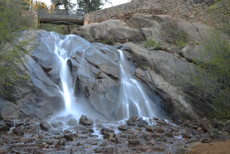
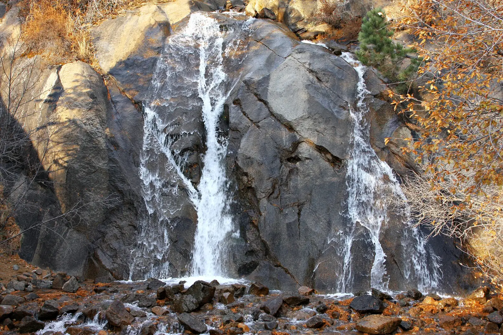
Helen Hunt Falls is a 35-foot single drop in North Cheyenne Cañon Park, a City of Colorado Springs park that lists no entrance fee. You can see it from the base, right beside a small parking lot, and a short walk climbs to a bridge across the top. Silver Cascade Falls is about 0.3 mile farther, per the city. The city's park page listed no closure on Oct 28, 2026.
About Helen Hunt Falls
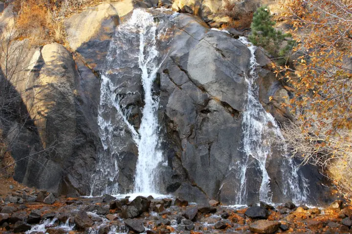
Helen Hunt Falls drops about 35 feet in a single plunge, according to Wikipedia. It sits in North Cheyenne Cañon Park, which the City of Colorado Springs Parks, Recreation & Cultural Services department runs. This is a city park, not a Colorado state park, so Colorado Parks and Wildlife passes don't apply here.
Who Helen Hunt was
The falls are named for Helen Hunt Jackson, a 19th-century writer who is buried in Colorado Springs, Wikipedia notes. The city says the falls were officially designated Helen Hunt Falls in 1966. The stream is North Cheyenne Creek, though Wikipedia's article calls it Cheyenne Creek.
Helen Hunt Falls Visitor Center
A visitor center stands at the base of the falls, at 3440 N Cheyenne Cañon Rd. The nonprofit Friends of Cheyenne Cañon designed, built and furnished it with money the group raised. In summer, the city says, it offers maps, drinking water and portable toilets.
Getting there and parking
Helen Hunt Falls is about 2.5 miles up North Cheyenne Cañon Road from the park entrance, with a small lot right at the base of the falls.
Directions from Colorado Springs
Head for the park entrance on North Cheyenne Cañon Road, by Starsmore Visitor and Nature Center at 2120 S Cheyenne Cañon Rd. From there, the city says the falls are about 2.5 miles up the canyon. The falls visitor center's address is 3440 N Cheyenne Cañon Rd.
The lot sits right at the base of the falls. Wikipedia says it holds about 30 vehicles and fills in summer, so have a backup plan if it's full.
The city does not allow buses, RVs or oversized vehicles on North Cheyenne Cañon Road. There is no cell service at the falls. The city advises against relying on Uber or Lyft, because getting a ride back out is hard.
Neither the city's Helen Hunt Falls page nor its park page lists an entrance or parking fee, as listed Oct 2026. Rock climbing in the park needs a city permit.
Building a longer Colorado trip? Our pages on Seven Falls, Rifle Falls and Box Canyon Falls cover three more Colorado waterfalls, each with its own fees and rules.
Map and nearby falls
Map loads as you scroll. Open in OpenStreetMap
OpenPartly open / seasonalUnconfirmedClosedLarger map
Helen Hunt Falls walk: bridge and Silver Cascade
You don't have to hike at all to see the falls. They are visible from the base, next to the parking area.
Bridge over the top
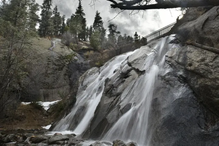
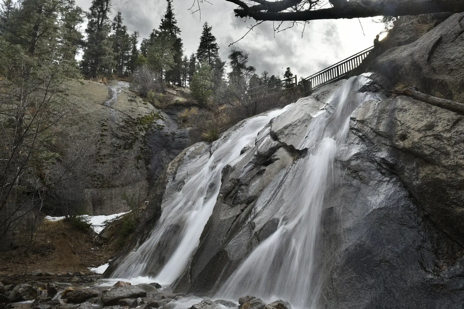
A short walk climbs to a bridge across the top of the falls; the city doesn't give a distance for it. The city asks visitors not to hike beyond the plaza area onto the closed-off part of Gold Camp Road.
Silver Cascade Falls
Past the bridge, the trail keeps climbing to Silver Cascade Falls. The city puts it at about 0.3 mile from the Helen Hunt Falls Visitor Center to the top of the cascade. Wikipedia gives a longer figure, about 2/3 mile, and calls the climb moderately steep.
Columbine Trail
For a longer approach from lower in the canyon, the city says the Columbine Trail runs about 4 miles from Starsmore to the Upper Columbine trailhead. That trailhead is about 350 feet east of Helen Hunt Falls. The trail is open to hikers, cyclists and horse riders; the city gives no difficulty rating.
Leashed dogs are allowed in the park, according to the city.
When to visit
The park is open all year. From May 1 to October 31 the city lists hours of 5am to 10pm. From November 1 to April 30 it closes at 9pm instead. Gates are locked each night.
The falls visitor center keeps a shorter season: daily from 8am to 4pm, Memorial Day to Labor Day only. Starsmore, at the park entrance, opens daily 8am to 4pm in summer and Tuesday to Sunday 9am to 3pm the rest of the year.
Off-season, the city's contact number is (719) 385-6086. The portable toilets are listed with the summer visitor center, so don't count on them in winter. The city also warns that ice and wintry conditions may exist in the park.
Summer is the busy time, and Wikipedia notes that the small lot fills then. No official source gives the best months for water flow, but the USGS gauge chart below shows the creek running highest in May and June.
When is the water highest?
At a USGS stream gauge 2.1 mi downstream of the falls, the flow averages highest in May and lowest in February, based on 30 complete years of records between 1995 and 2025. The gauge sits below the point where North Cheyenne Creek (the falls' stream) and South Cheyenne Creek join, so it also counts South Cheyenne Creek water. Read it as the seasonal pattern only.
Show the numbers
| Month | Average flow (cfs) |
|---|---|
| January | 1.8 |
| February | 1.7 |
| March | 2.2 |
| April | 5.8 |
| May | 21 |
| June | 17 |
| July | 6.9 |
| August | 8.2 |
| September | 6.3 |
| October | 3.0 |
| November | 2.3 |
| December | 1.9 |
| Height | 35 ftNote: single drop, per Wikipedia |
|---|---|
| Trail | Falls visible from the lot; short walk to a bridge over the top. Silver Cascade Falls is about 0.3 mi from the visitor center (city) |
| Entry fee | None listed on the city's Helen Hunt Falls or North Cheyenne Cañon Park pages |
| Permit / reservation | None needed |
| Parking | Small lot at the base, about 30 cars |
| Hours / season | Park 5am-10pm May 1-Oct 31 and 5am-9pm Nov 1-Apr 30; visitor center 8am-4pm, Memorial Day to Labor Day |
| Dogs | Allowed on a leash in North Cheyenne Cañon Park (city) |
| Walk behind the falls | No |
| Restrooms | Portable toilets at the visitor center in summer (city) |
| Crowds | Busy in summer; the small lot fills (Wikipedia) |
| Managed by | City of Colorado Springs Parks, Recreation & Cultural Services |
Safety and swimming
Storms can cut off the falls. A June 6, 2026 storm closed North Cheyenne Cañon Road and Gold Camp Road. The Gazette reported that they reopened on July 1 and July 2, 2026, and the city limited vehicle access over the July 4 weekend.
After heavy rain, check the city parks site before you drive up.
We could not confirm a swimming rule for the falls. Stay on the trail and the bridge, and expect wet or icy rock near the water. You can't call for help from the falls without cell service. Our waterfall safety guide has more general advice.
Where to stay near Helen Hunt Falls
Compare hotels, cabins and rentals close to the falls around Colorado Springs.
See places to stay nearbyAffiliate link: we may earn a commission at no cost to you. Partners do not see or change our waterfall facts. Disclosure.
Photos
Helen Hunt Falls FAQ
Is Helen Hunt Falls open?
Yes, as far as the city lists. The city's park page lists no closure as of Oct 28, 2026. A June 6, 2026 storm closed the canyon roads, but they reopened July 1 and July 2 (Gazette). Storms can close the canyon roads, so check the city parks site after heavy rain.
Why is it called Helen Hunt Falls?
It's named for Helen Hunt Jackson, a 19th-century writer buried in Colorado Springs (Wikipedia). The city says the falls were officially designated Helen Hunt Falls in 1966.
Is there a fee at Helen Hunt Falls?
The city lists none. Neither its Helen Hunt Falls page nor its North Cheyenne Cañon Park page shows an entrance or parking fee.
Can you drive up to Helen Hunt Falls?
Yes. Drive about 2.5 miles up North Cheyenne Cañon Road from the park entrance to the lot at the base (city). Buses, RVs and oversized vehicles aren't allowed on the road.
Is there parking at Helen Hunt Falls?
Yes. A small lot sits at the base of the falls. Wikipedia says it holds about 30 cars and fills in summer.
When is the Helen Hunt Falls Visitor Center open?
Daily from 8am to 4pm, Memorial Day through Labor Day, according to the city. Off-season, call (719) 385-6086.
Can I take an Uber to Helen Hunt Falls?
The city doesn't recommend it. There's no cell service at the falls, so booking a ride back is hard.
What hike starts at Helen Hunt Falls?
A short walk leads to a bridge over the top of the falls. From there, the trail climbs to Silver Cascade Falls, about 0.3 mile from the visitor center per the city (Wikipedia says about 2/3 mile).
Nearby waterfalls
More waterfalls to explore


City guides: Waterfalls near Denver, CO
On these lists: Dog-friendly waterfalls · Roadside waterfalls
Sources
- City of Colorado Springs: Helen Hunt Falls Visitor Center
- Friends of Cheyenne Cañon: Visitor Centers
- Gazette: North Cheyenne Cañon roads reopen (Jul 1, 2026)
- KKTV: Storm damage road closures (Jun 9, 2026)
- Wikipedia: Helen Hunt Falls
- USGS GNIS (via TNM geonames)
- City of Colorado Springs: North Cheyenne Cañon Park
Last verified Oct 28, 2026 by The Waterfall Guide editorial team. Conditions change: confirm with City of Colorado Springs Parks, Recreation & Cultural Services before you go. Spotted something out of date? Report a correction.