Right now
Right now as of Nov 7, 2026
- Permit None needed.
Status note (Nov 7, 2026): Open, as far as we can tell: the NPS road and site status page (updated Nov 3, 2026) lists "No Current Trail or Campground Closures." It lists no closure at milepost 404.7. NPS says temporary closures may occur due to weather, construction or emergencies. What the status labels mean
Jackson Falls is a cascade on Jackson Branch at milepost 404.7 of the Natchez Trace Parkway in Tennessee. A steep concrete trail runs 900 feet down to a clear pool at the base. The Parkway charges no entrance fee, and leashed dogs are allowed on its trails. NPS publishes no height and asks visitors not to climb on the slick falls.
About Jackson Falls
Jackson Falls sits at milepost 404.7 of the Natchez Trace Parkway, in Hickman County, Tennessee. The National Park Service manages the site and calls the falls a "sculptured cascade." NPS publishes no height.
NPS says this is one of two waterfalls along the Parkway. The other is Fall Hollow, at milepost 391.9 near Hohenwald, Tennessee.
How the falls formed
The falls exist because of stream piracy, per NPS. For thousands of years, Jackson Branch flowed into a high valley that was isolated from the Duck River below.
Then the Duck River captured Jackson Branch. Floods and other erosion wore away the bluffs and cut a new channel through faults in the rock. At the falls, the diverted stream slips down into the Duck River Valley.
What you'll find at the site
NPS lists nine amenities here: a grill, exhibits, maps, auto parking, a picnic shelter, a restroom, a scenic view, a trailhead and trash cans.
Our map pin is the NPS place coordinate for Jackson Falls. We use the same point for the trailhead.
Getting there and parking
Jackson Falls is on the Natchez Trace Parkway at milepost 404.7. Our directions button uses the NPS place coordinate for the site.
We give no distance or drive time from nearby cities, because NPS publishes none.
Northern section closure: MP 437 to 440
If you are coming from the north end of the Parkway, plan for a closure. NPS lists mileposts 437 to 440, in Williamson County, as closed for Double Arch Bridge construction.
The closure runs from April 2026 to May 2027, per NPS. Traffic detours via Highway 96 and Highway 100 between MP 437 and the Northern Terminus.
-
Northbound: exit at MP 437 (ramp on the right). Turn left onto Hwy 96 W for 3.5 miles, then right onto Hwy 100 E for 3.5 miles to the Northern Terminus.
-
Southbound: take Hwy 100 W beneath the Northern Terminus for 3.5 miles. Turn left onto Hwy 96 E for 3.5 miles, then right onto the Parkway ramp.
Other closures on the Parkway
NPS also lists a road closure from MP 159.5 to 165 in Attala County, Mississippi, from Nov 2, 2026 to mid-2027. That section is in Mississippi, at mileposts far south of 404.7. Check the NPS road and site status page before a long Parkway drive.
Map and nearby falls
Map loads as you scroll. Open in OpenStreetMap
OpenPartly open / seasonalUnconfirmedClosedLarger map
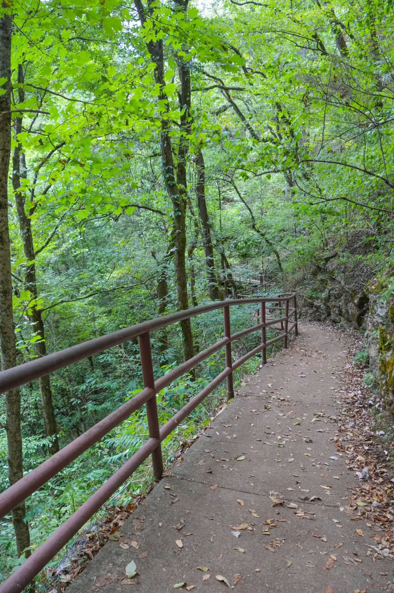
Jackson Falls trail: 900 feet down a concrete path
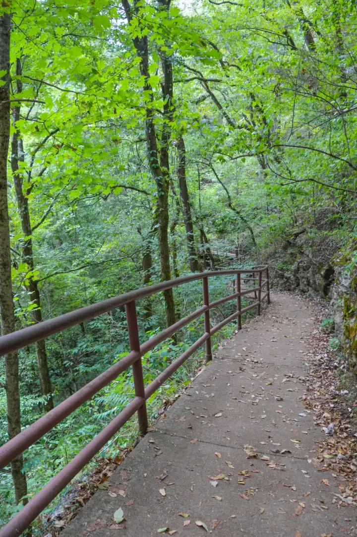
NPS describes one route: "A steep trail (concrete sidewalk) 900 feet long takes you to a clear pool at the base of these falls." That is about 0.2 mile each way, by our math.
NPS gives no difficulty rating. We call it moderate because the trail is steep and descends to the falls, so the return trip is uphill. Take your time on the way back.
At the base
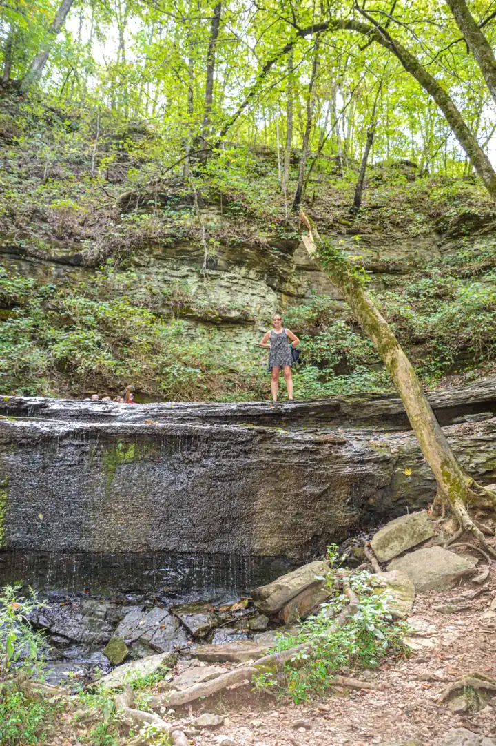
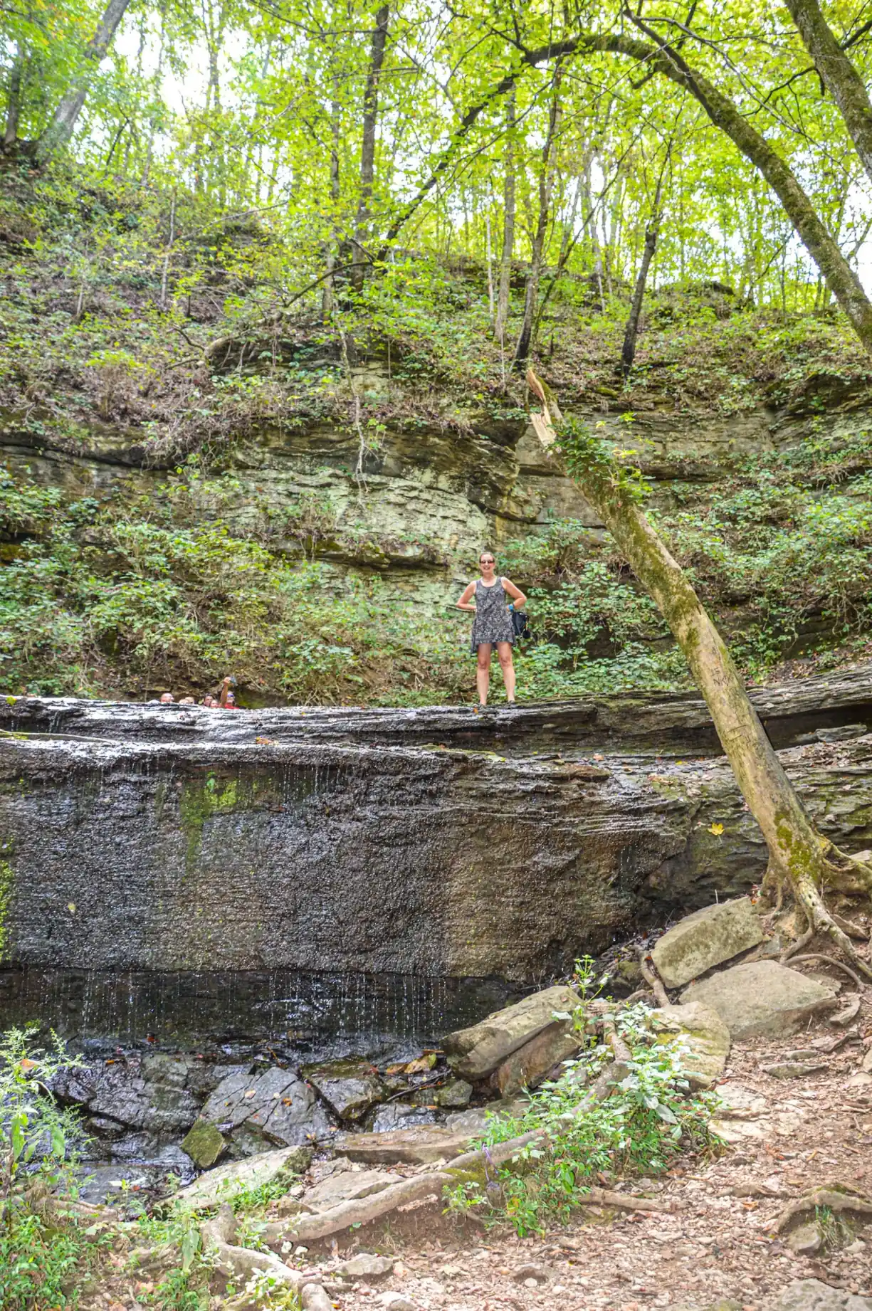
The trail ends at a clear pool below the cascade. NPS asks visitors not to climb on the falls, because the rock is very slick and dangerous.
Dogs
NPS allows pets along Parkway trails and viewpoints on a leash six feet or shorter. Please clean up after your pet. Only service animals are allowed inside Parkway buildings.
NPS suggests carrying water for your dog on hot days. It highly recommends tick repellent during warmer months.
Accessibility
NPS describes the 900-foot path as a steep trail on a concrete sidewalk. It lists no accessibility details for the trail, so call the Parkway at 662 680-4027 with questions.
When to visit
NPS gives no best season for Jackson Falls and publishes no crowd figure.
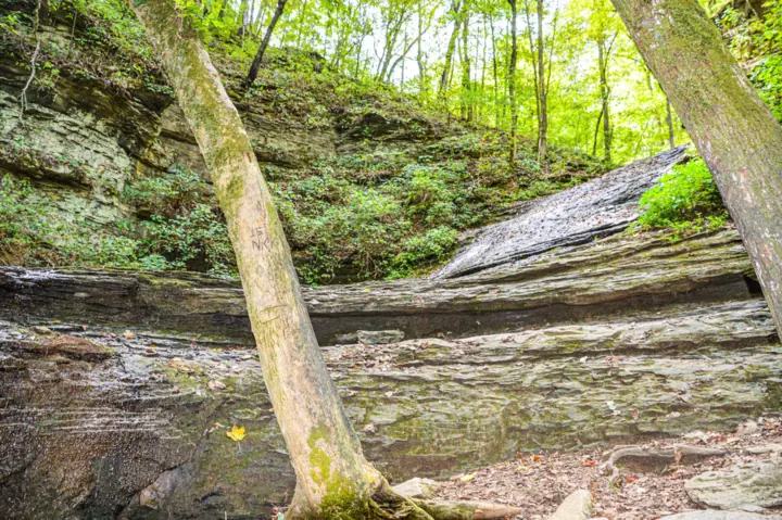
The September 2018 photos on this page show only a thin sheet of water over the rock, so flow can be low.
Check the NPS road and site status page before you go. NPS says temporary closures may occur due to weather, construction projects or other emergency conditions.
For more Tennessee falls, see Burgess Falls, Machine Falls and our waterfalls near Nashville list.
| Trail | A steep concrete sidewalk, 900 feet (about 0.2 mile, by our math) each way, down to a clear pool at the base of the falls (NPS) |
|---|---|
| Difficulty | No official rating: NPS gives no difficulty for this trail. We call it moderate because NPS describes it as a "steep trail" that descends to the falls, so the walk back is uphill |
| Entry fee | Free. NPS says "There are no entrance fees to the Natchez Trace Parkway or any of its facilities." It adds that the Parkway "does not charge an entrance fee, or campground fees." No entrance pass is required |
| Permit / reservation | No entrance pass or permit required; NPS says the Parkway charges no entrance fees |
| Parking | Auto parking at milepost 404.7 |
| Dogs | Allowed along Parkway trails and viewpoints on a leash six feet or shorter (NPS). Clean up after your pet. Only service animals are allowed inside Parkway buildings. NPS suggests water on hot days and tick repellent in warmer months |
| Swimming | No swimming rule listed. NPS mentions a clear pool at the base and says "Please do not climb on the falls it is very slick and dangerous" |
| Wheelchair / stroller | NPS describes the 900-foot path as a steep trail (concrete sidewalk) and lists no accessibility details for it |
| Best time to visit | NPS gives no best season for Jackson Falls |
| Crowds | No crowd figure is published |
| Managed by | National Park Service, Natchez Trace Parkway |
Safety and swimming
Do not climb on the falls. NPS warns the rock "is very slick and dangerous and can lead to significant injuries."
The trail is steep, per NPS. Wear shoes with good grip, and allow extra time for the climb back up.
NPS lists no swimming rule for the pool at the base. Keep children within reach near the water and off the wet rock.
In an emergency on the Parkway, call 1-800-300-PARK (7275). The Parkway's main line is 662 680-4027, and its mailing address is in Tupelo, Mississippi. Our waterfall safety guide has more on slick rock.
Conditions change: confirm with the official source before you go.
Where to stay near Jackson Falls
Compare hotels, cabins and rentals close to the falls around Natchez Trace Parkway, milepost 404.7.
See places to stay nearbyAffiliate link: we may earn a commission at no cost to you. Partners do not see or change our waterfall facts. Disclosure.
Photos
Jackson Falls FAQ
Is Jackson Falls open?
As far as we can tell, yes. The NPS road and site status page, updated Nov 3, 2026, lists no trail or campground closures and no closure at milepost 404.7.
How long is the Jackson Falls trail?
NPS says the steep trail is a concrete sidewalk 900 feet long. That is about 0.2 mile each way by our math, ending at a clear pool at the base of the falls.
Is Jackson Falls free?
Yes. NPS says there are no entrance fees to the Natchez Trace Parkway or any of its facilities, and no entrance pass is required.
Are dogs allowed at Jackson Falls?
Yes. NPS allows pets on Parkway trails and viewpoints on a leash six feet or shorter. Clean up after your pet. Only service animals may enter Parkway buildings.
Can you swim at Jackson Falls?
No swimming rule is listed. NPS mentions a clear pool at the base but warns: "Please do not climb on the falls it is very slick and dangerous."
Is the northern end of the Natchez Trace Parkway closed?
Part of the northern section is. NPS lists mileposts 437 to 440, in Williamson County, as closed for Double Arch Bridge construction from April 2026 to May 2027. The detour uses Highway 96 and Highway 100.
Where is the other waterfall on the Natchez Trace Parkway?
NPS says the Parkway's other waterfall is Fall Hollow, at milepost 391.9 near Hohenwald, Tennessee.
Nearby waterfalls
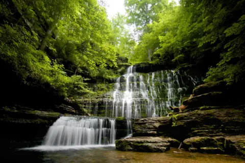 Machine Falls66 mi straight-line, by our mathOpenPLUS 60FT
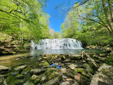 Rutledge Falls68 mi straight-line, by our mathOpen
More waterfalls to explore
City guides: Waterfalls near Nashville, TN
Sources
- NPS: Jackson Falls, Natchez Trace Parkway milepost 404.7 (trail, geology, amenities, climbing warning; read Nov 7, 2026)
- NPS: Natchez Trace Parkway Fees & Passes (read Nov 7, 2026)
- NPS: Natchez Trace Parkway Pets (read Nov 7, 2026)
- NPS: Natchez Trace Parkway Road and Site Status (updated Nov 3, 2026; read Nov 7, 2026)
- NPS: Natchez Trace Parkway Current Conditions (closure alert, phone and emergency line; read Nov 7, 2026)
Last verified Nov 7, 2026 by The Waterfall Guide editorial team. Conditions change: confirm with National Park Service, Natchez Trace Parkway before you go. Spotted something out of date? Report a correction.