Right now
Right now as of Oct 29, 2026
- Permit No permit needed. Fee: no fee listed (USFS).
Status note (Oct 29, 2026): Open, as far as we can tell: on October 29, 2026, the Kootenai National Forest alerts page listed no closure for Kootenai Falls. We found no report of damage here from the December 2025 Lincoln County floods. What the status labels mean
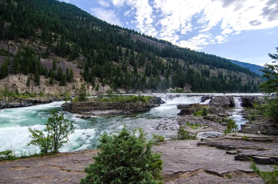
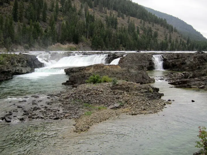
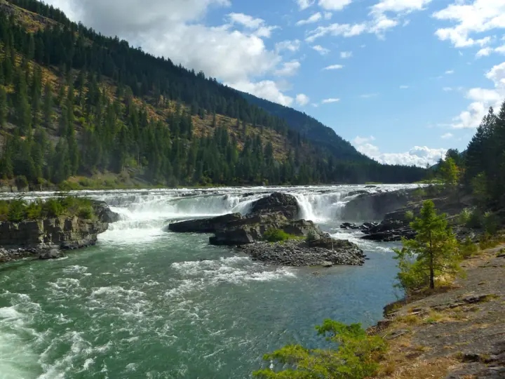
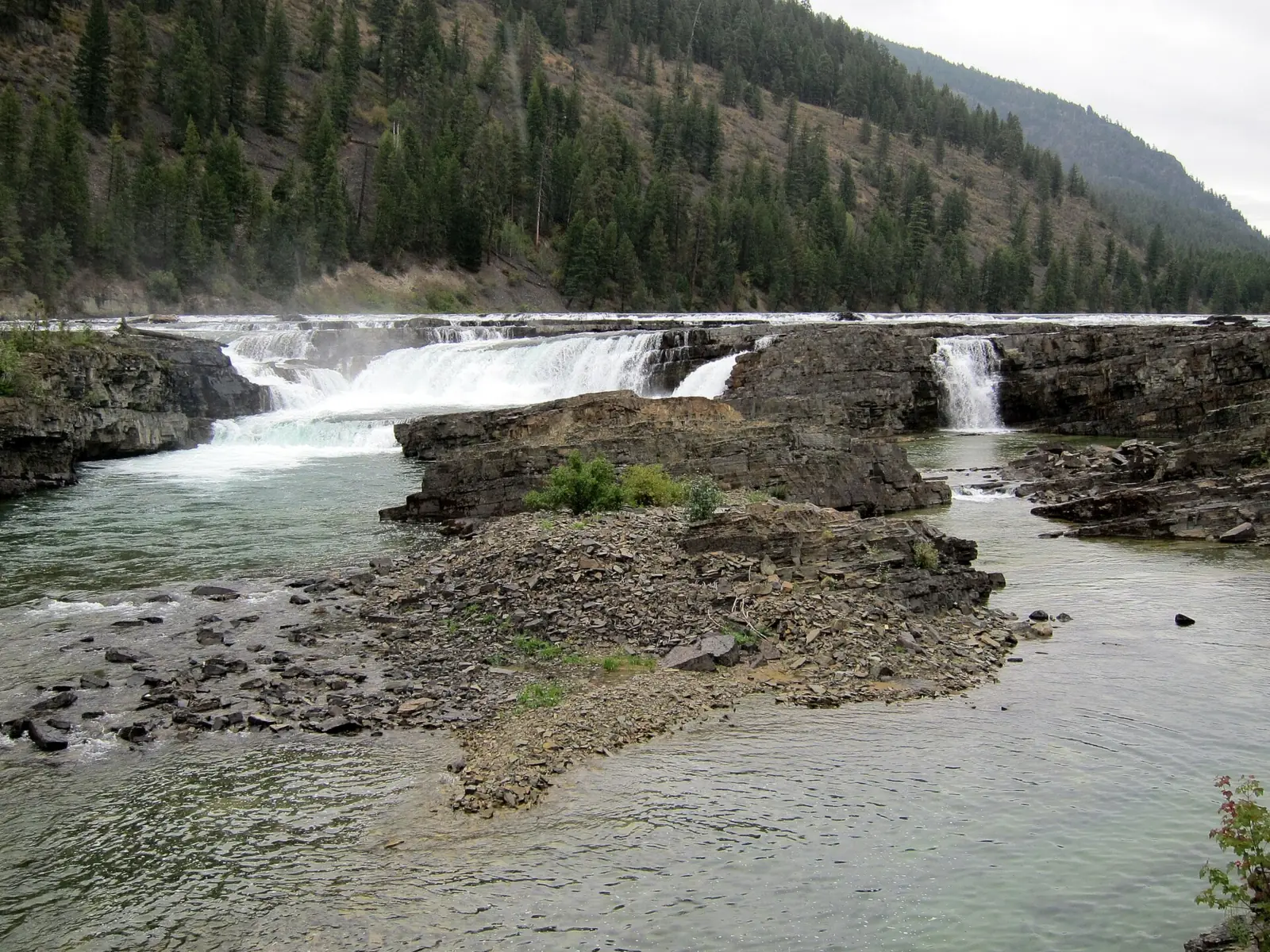
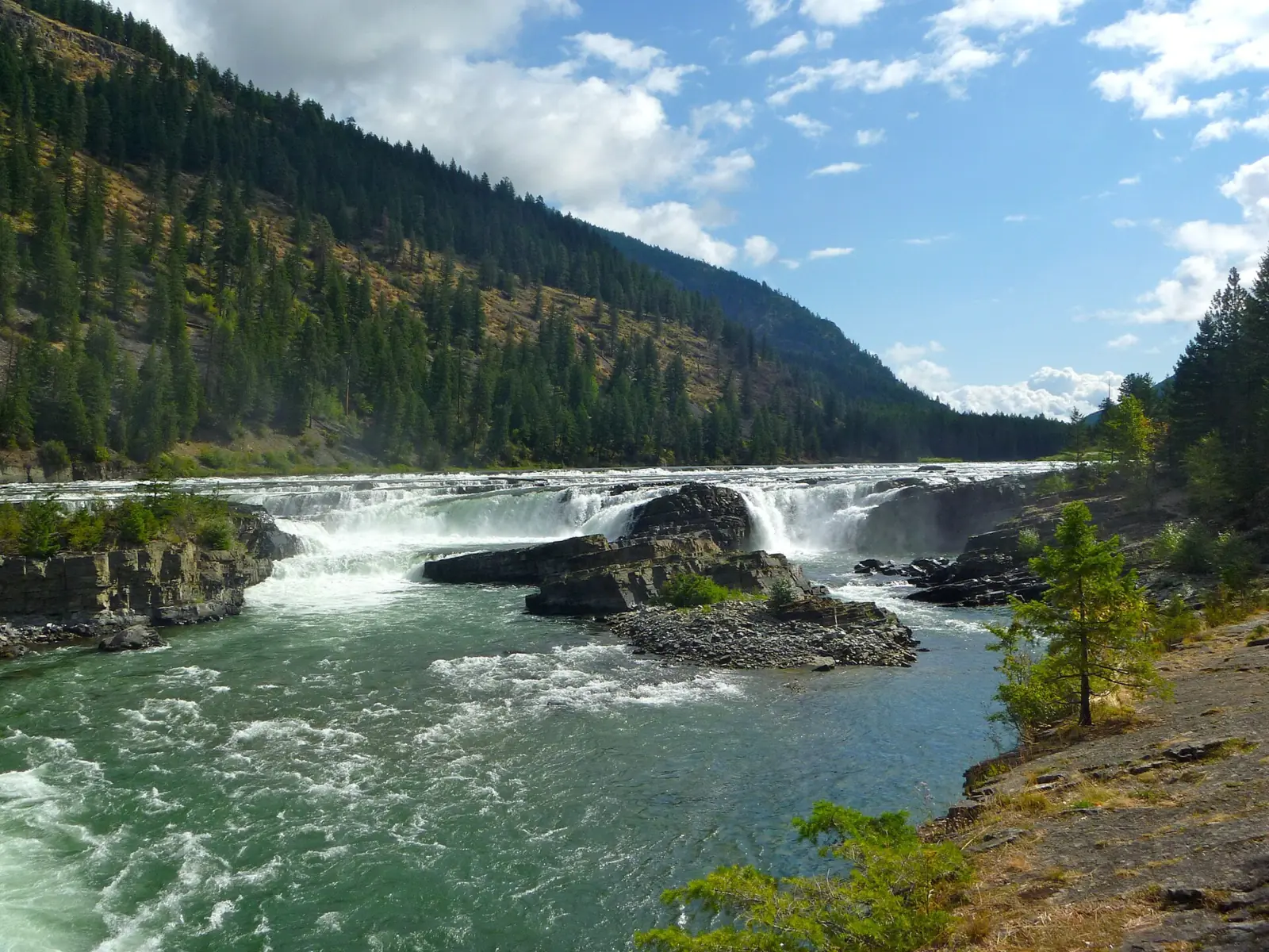
Kootenai Falls is on the Kootenai River in the Kootenai National Forest, between Libby and Troy in northwest Montana. The Forest Service says the main falls are 30 feet high; the river drops 90 feet in under a mile. A trail of about half a mile, with a railroad overpass and 64 metal steps, leads to a swinging bridge over the river. On October 29, 2026, the Kootenai National Forest alerts page listed no closure for Kootenai Falls.
About Kootenai Falls
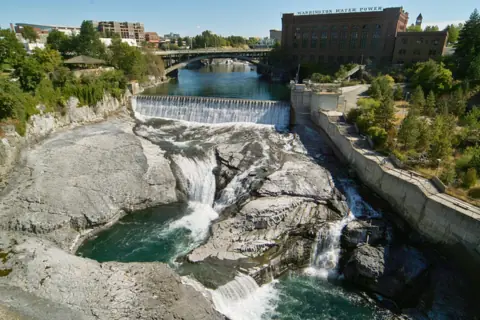
The Forest Service calls Kootenai Falls one of the largest free-flowing waterfalls in the Northwest. It says the river drops 90 feet in less than a mile, and the main falls are 30 feet high. Visit Montana calls it the largest undammed falls in Montana.
Other sources give different figures for Kootenai Falls. Wikipedia lists a total height of 56 feet, a longest single drop of 30 feet and an average width of about 846 feet. Visit Montana says the river falls about 300 feet over a few hundred yards. This page uses the Forest Service numbers.
The falls are sacred to the Kootenai (Kutenai) people, who regard them as the 'centre of the world', according to Wikipedia. Wikipedia also notes that the falls appear in two films: The River Wild (1994) and The Revenant (2015).
Kootenai Falls is on national forest land, so no national park entrance fee or vehicle reservation applies. The Forest Service page lists no fee. Travel sites say parking is free, but we could not confirm that with the agency.
Getting there and parking
The Forest Service places the falls 12 miles west of Libby and 6 miles east of Troy on US Highway 2. The parking area is on the north side of the highway at the 21 mile marker.
The lot is the trailhead. You can't see the falls or the bridge from the parking area, so plan on walking at least to the first overlook.
Lincoln County Parks runs a picnic area just off the parking lot, the Forest Service says. It has picnic tables, barbecue cooking areas and restrooms. A concession at the lot sells food and souvenirs and offers visitor information from May through September.
We found no posted hours for the falls. A Forest Service excerpt says the Kootenai National Forest limits day-use areas, such as picnic sites and swimming areas, to 6 a.m. to 10 p.m. We could not confirm that this rule is posted here.
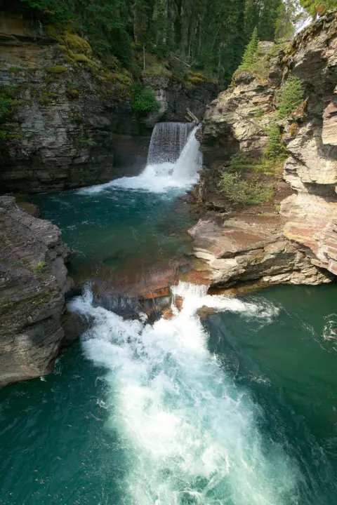
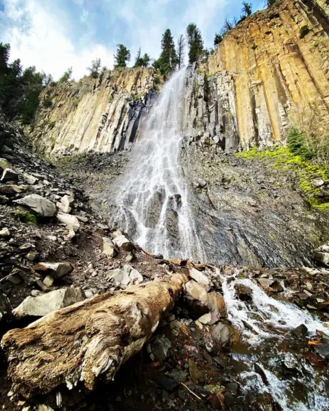
Planning more of the state? Our guide to waterfalls in Montana compares this site with St. Mary Falls in Glacier National Park and Palisade Falls in Hyalite Canyon near Bozeman.
Map and nearby falls
Map loads as you scroll. Open in OpenStreetMap
OpenPartly open / seasonalUnconfirmedClosedLarger map
The hike
The Forest Service gives two distances from the parking lot. The main falls overlook is about a third of a mile away, and the swinging bridge is about half a mile. Both are one way, so a trip to the bridge and back is about a mile.
The first 500 feet are fairly level, according to the Forest Service. That stretch leads to a first, closer overlook with a glimpse of the falls and a shaded picnic area. The agency says it allows for handicapped access to that overlook.
Past the first overlook, the dirt trail can be rough and rocky as it descends to an overpass above the railroad tracks. The overpass exits onto a three-tier metal staircase with 64 expanded metal steps.
After the stairs, the trail forks. Go right for the main falls, or left for the swinging bridge. Because the route descends, the stairs and the rocky stretch come back as a climb on your way out.
We found no official elevation gain, walking time or difficulty rating for this trail.
The Kootenai Falls swinging bridge
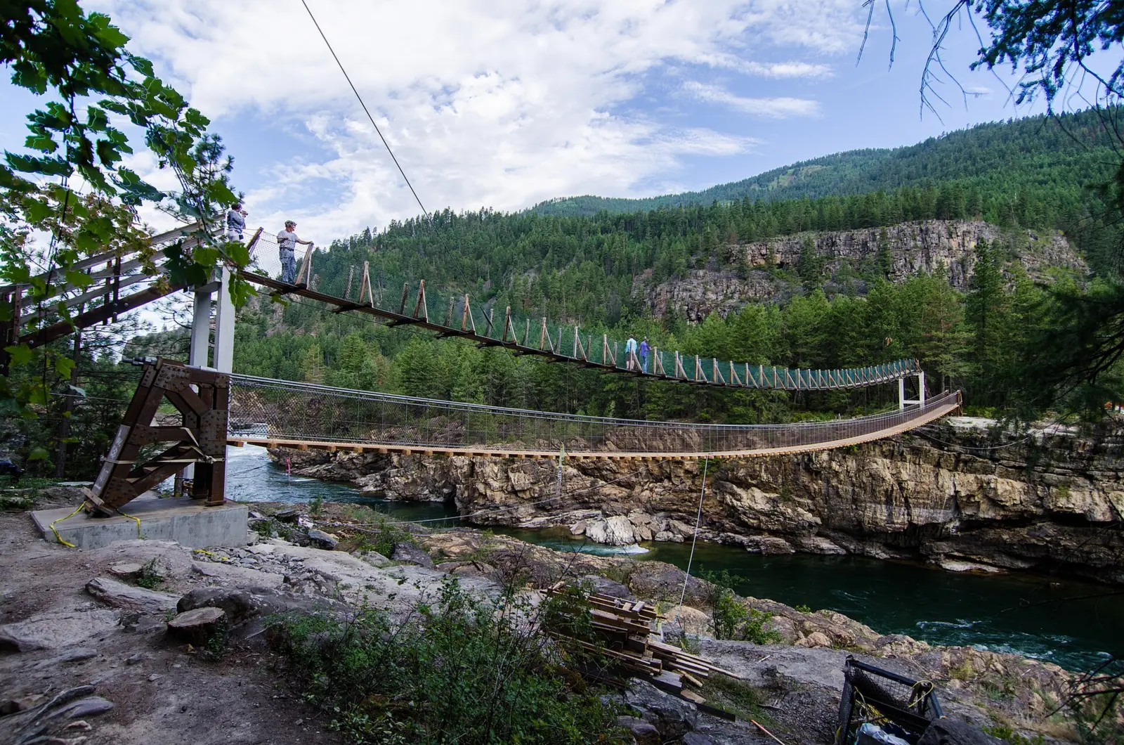
The swinging bridge is a suspension footbridge across the Kootenai River, reached by the left fork after the stairs. The first footbridge here was built in 1937.
According to the Forest Service, the Civilian Conservation Corps built the first bridge in 1937 to give firefighters access. A flood destroyed it in 1948. It was rebuilt on concrete towers in the 1950s, then reconstructed on the existing cables in 1993.
The bridge you cross today dates from 2019. The Flathead Beacon reported that a 2015 inspection found the old span would need replacing to handle growing foot traffic. Wesslen Construction of Spokane began work on March 28, 2019.
The new bridge is about 220 feet long and sits about 15 feet upstream of the old one, the Beacon reported. The Western News reported the bridge open on July 26, 2019. The bridge photo on this page was taken on July 13, 2019, before the new span opened, so it may show the old bridge.
When to visit
We could not confirm a best month for flow or an official season for the trail. Services do follow a season: the Forest Service says the parking lot concession runs from May through September.
Wildlife changes with the seasons too. Visit Montana says bighorn sheep and deer are most visible from fall through spring, and that black bears are regular fall visitors.
Cold weather brings ice. The Lincoln County sheriff has warned that the rocks here can be slippery and icy, so wear shoes with good grip.
On October 29, 2026, the Kootenai National Forest alerts page listed no closure or alert for Kootenai Falls or its US-2 trailhead.
Floods hit Lincoln County in December 2025, and MTPR reported that at least 9 bridges in the county were left unusable. We found no report that the falls trail or the swinging bridge was damaged.
Some 2026 closures in the Kootenai National Forest are at other sites. For example, the Western News listed Timberlane Campground as closed for the 2026 season. The forest's alerts page still listed that closure on October 29, 2026, along with a Ross Creek Cedars road closure from the December 2025 flood.
| Height | 30 ftNote: main falls, per the Forest Service, which says the river drops 90 ft in less than a mile; Wikipedia gives 56 ft total |
|---|---|
| Trail | About 1/3 mi one way to the main falls overlook and about 1/2 mi one way to the swinging bridge (Forest Service). The first 500 ft are fairly level; then a rough, rocky descent, a railroad overpass and 64 metal steps |
| Difficulty | No agency rating; level for the first 500 ft, then a rough descent and 64 metal steps (Forest Service) |
| Entry fee | The Forest Service page lists no fee. Travel sites say parking is free, but we could not confirm that with the agency. No national park entrance fee applies on national forest land. |
| Permit / reservation | No permit or reservation found; national forest site with no park entrance fee |
| Parking | North side of US-2 at mile marker 21 |
| Hours / season | No site hours found. The Kootenai National Forest limits day-use areas forest-wide to 6 a.m. to 10 p.m. (Forest Service excerpt); not confirmed as posted here |
| Dogs | No ban found. The Forest Service says 'the overpass and stairs are not dog friendly' |
| Swimming | No agency swim rule found. The Lincoln County sheriff warns of 'severe undertows' and says 'If you must swim or float the river, wear a life jacket' |
| Wheelchair / stroller | First 500 ft only: the Forest Service says this level stretch allows handicapped access to an overlook. Past it, the route uses a railroad overpass and 64 metal steps |
| Walk behind the falls | No |
| Restrooms | Restroom facilities at the Lincoln County Parks picnic area just off the parking lot (Forest Service) |
| Managed by | USDA Forest Service, Kootenai National Forest (Three Rivers Ranger District) |
Safety and swimming
We found no Forest Service swimming rule for Kootenai Falls. Some visitor guides say swimming is not allowed, but we could not confirm that with an agency.
The river here is dangerous. In July 2024, Lincoln County Sheriff Darren Short warned of 'severe undertows'. He asked people to stay 'back from the edge of the river and watch where they step,' and added, 'The rocks can be slippery and icy.'
Sheriff Short's advice for anyone going in: 'If you must swim or float the river, wear a life jacket.'
People have died here. In June 2024, a kayaker drowned after capsizing below China Rapids, above the falls, the Western News reported. Neither paddler wore a life vest. The sheriff said the river 'has dangerous undertows which can catch people unaware.'
The Western News called the 2024 drowning the first death in the river since 2021. That year, a 17-year-old fell from a cliff while biking on a trail above Kootenai Falls. It warned swimmers never to approach the falls, because strong undercurrents that can't be seen from the surface are common there.
This is bear country. The Kootenai National Forest asks you to store food, garbage and other attractants in a bear-resistant way or container. Forest Service excerpts say a regional storage order applies March 1 to December 31 each year through 2028.
The Forest Service says "the overpass and stairs are not dog friendly." That is a caution, not a ban, so decide before you go whether your dog can manage open metal steps. Our waterfall safety guide covers cold, fast water and slick rock.
Where to stay near Kootenai Falls
Compare hotels, cabins and rentals close to the falls around Libby.
See places to stay nearbyAffiliate link: we may earn a commission at no cost to you. Partners do not see or change our waterfall facts. Disclosure.
Photos
Kootenai Falls FAQ
How long is the Kootenai Falls trail?
About 1 mile round trip to the swinging bridge. The Forest Service puts the main falls overlook about 1/3 mile from the parking lot and the bridge about 1/2 mile, one way. The route includes a railroad overpass and 64 metal steps each way.
Where is the Kootenai Falls swinging bridge?
It spans the Kootenai River about half a mile from the US-2 parking area at mile marker 21. After the overpass and stairs, take the left fork for the bridge; the right fork goes to the main falls.
Can you swim at Kootenai Falls?
We found no posted agency swim rule. The Lincoln County sheriff warns that the river has severe undertows and says to wear a life jacket if you must swim or float. A kayaker drowned above the falls in June 2024.
Are dogs allowed at Kootenai Falls?
We found no ban. The Forest Service warns that the overpass and stairs are not dog friendly, so think about the 64 open metal steps before bringing a dog.
Where do you park for Kootenai Falls?
Park on the north side of US Highway 2 at the 21 mile marker, per the Forest Service. That is 12 miles west of Libby and 6 miles east of Troy. The falls aren't visible from the lot.
What movies were filmed at Kootenai Falls?
Wikipedia lists two: The River Wild (1994) and The Revenant (2015).
Is Kootenai Falls open?
Yes, as far as we can tell. On October 29, 2026, the Kootenai National Forest alerts page listed no closure for Kootenai Falls. We also found no report of damage from the December 2025 floods. Confirm with the forest before you go.
Do you need tickets for the Kootenai Falls swinging bridge?
We found no ticket, permit or reservation for the bridge or the trail. The Forest Service page lists no fee. Travel sites say parking is free, but we could not confirm that with the agency.
Nearby waterfalls
No other waterfalls within 75 miles are on the site yet.
More waterfalls to explore


Sources
We read the Forest Service's Kootenai Falls page through an archived copy from April 2026, and its alerts page on October 29, 2026. Its picnicking and wildlife pages blocked our checks, so facts credited to them come from search-result excerpts. Confirm rules on the official site.
- USFS Kootenai NF: Kootenai Falls and Swinging Bridge (read via archived copy, Apr 10, 2026)
- USFS Kootenai NF: Alerts (read Oct 29, 2026)
- USFS Kootenai NF: Picnicking (day-use hours; via search excerpt)
- USFS Kootenai NF: Respect Wildlife (food storage; via search excerpt)
- Wikipedia: Kootenai Falls
- Visit Montana: Kootenai Falls
- Flathead Beacon: Iconic Kootenai Falls Swing Bridge Being Replaced (Mar 29, 2019)
- Western News: Kootenai River swinging bridge open (Jul 26, 2019)
- Western News: Searchers recover missing woman's body from Kootenai River (Jun 30, 2024)
- Western News: Local officials preach caution for area boaters, swimmers (Jul 12, 2024)
- MTPR: Floods leave at least 9 bridges in Lincoln County unusable, sheriff says (Dec 12, 2025)
- Western News: Forest plans campground improvements, lists temporary closures (Feb 10, 2026)
Last verified Oct 29, 2026 by The Waterfall Guide editorial team. Conditions change: confirm with USDA Forest Service, Kootenai National Forest (Three Rivers Ranger District) before you go. Spotted something out of date? Report a correction.