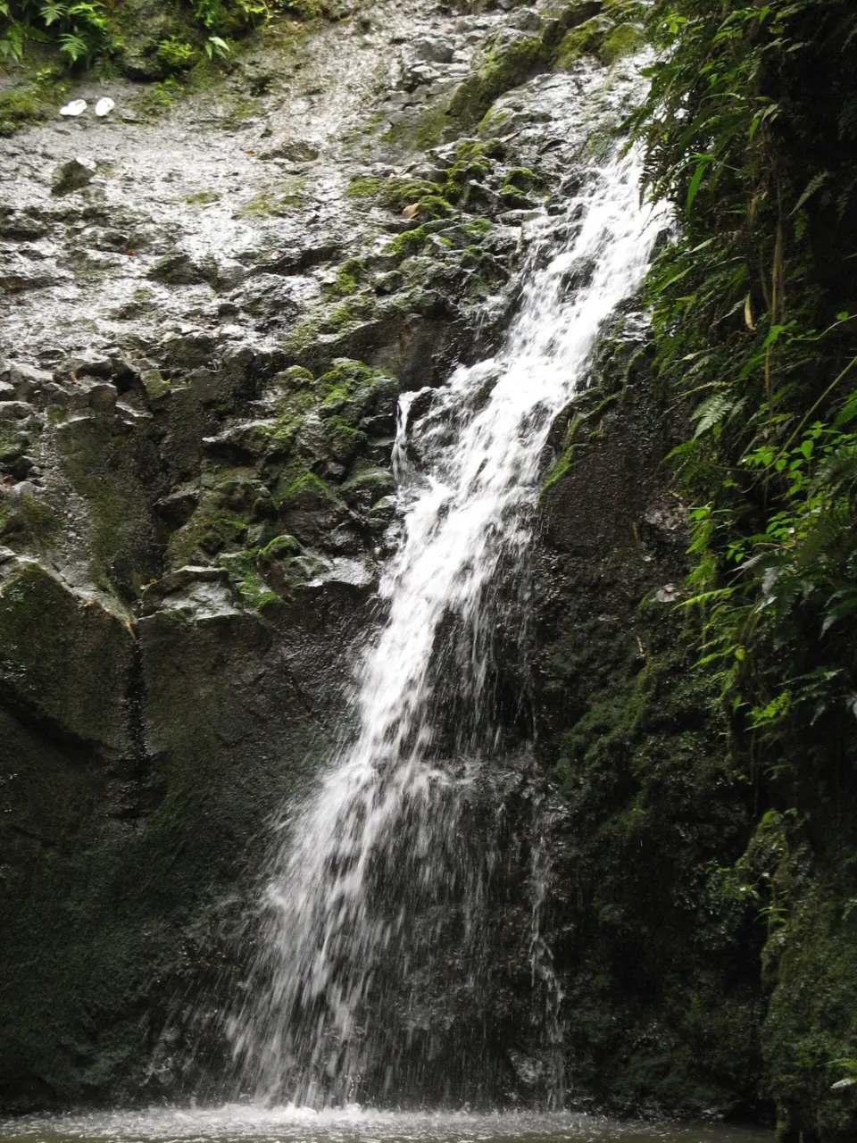
Right now
Right now as of Oct 28, 2026
- Status Na Ala Hele lists the Maunawili Falls Trail as 'Portion of trail on State land is open' (read Oct 28, 2026).
- Permit None needed.
Status note (Oct 28, 2026): Partly open. Na Ala Hele lists the Maunawili Falls Trail as 'Portion of trail on State land is open' (read Oct 28, 2026). The private-land section and the Maunawili Estates trailhead stay closed while the trail is realigned. Reach the falls from the Pali Highway via the Maunawili Trail and Connector, and return the same way. What the status labels mean
Maunawili Falls is near Kailua on Oahu. DLNR closed the trailhead in the Maunawili Estates neighborhood on July 15, 2021, and it is still closed. Na Ala Hele says the part of the trail on state land is open. You reach it from the Pali Highway overlook via the Maunawili Trail and the Maunawili Falls Connector, about 6 miles round trip, out and back.
About Maunawili Falls
Maunawili Falls is in Maunawili, near Kailua on Oahu. We found no official height or stream name. Hawaii Magazine (2023) says the falls flow 20 feet into a pond.
DLNR's Division of Forestry and Wildlife closed the old trailhead near the Maunawili Estates subdivision on July 15, 2021. Its notice said the closure was expected to last two years while a master plan was prepared for the area.
The closure followed advice from a cultural consultant. DLNR said Honua Consulting found heiau, irrigated and dryland farming terraces, and ʻauwai, or irrigation channels, across the valley.
Na Ala Hele, the state trail program, now says work is underway to realign the trail to protect the valley's natural and cultural resources. It gives no reopening date for the private-land section.
Getting there and parking
Reach Maunawili Falls from the Pali Highway overlook, where a drop-off is advised, because Na Ala Hele says the Maunawili Estates trailhead is closed.
The closed Maunawili Estates trailhead
The trailhead at the end of Maunawili Road is closed, Na Ala Hele says. The part of the Maunawili Falls Trail that crosses private land is temporarily closed too. There is no exit through the private land, so you must go back the way you came.
We found no reservation, permit or managed-access system in any official source. If you see a booking system advertised for the falls, check it against DLNR before you rely on it.
Pali Highway overlook (drop-off advised)
Na Ala Hele's open route starts on the Maunawili Trail, also known as the Maunawili Demonstration Trail. The start is the scenic overlook just past the hairpin turn on the Pali Highway.
Official parking guidance conflicts. The Maunawili Falls Trail page says long-term parking is not permitted at the overlook and hikers must be dropped off. The Maunawili Trail page says vehicles may park in this area for only two hours.
The round trip to the falls takes longer than two hours, so plan to be dropped off and picked up.
Waimānalo end of the Maunawili Trail
Na Ala Hele lists a second access point on Waikupanaha Street in Waimānalo, with a gravel parking area. The Maunawili Trail is 10 miles long, though, and the falls junction is near the Pali Highway end.
Map and nearby falls
Map loads as you scroll. Open in OpenStreetMap
OpenPartly open / seasonalUnconfirmedClosedLarger map
Maunawili Trail from the Pali Highway
The open route to Maunawili Falls is about 6 miles round trip, out and back, on the Maunawili Trail and the Maunawili Falls Connector.
Route from the Pali Highway
Na Ala Hele's directions: hike about two miles on the Maunawili Trail to the Maunawili Falls Connector junction. Follow the Connector about one mile to another junction, then take the trail going down to the falls.
At that last junction, do not continue forward, because the trail leads onto closed private land. Na Ala Hele's route notes describe a signed junction where the Maunawili Falls Trail drops down a side ridge to the falls.
Distance and difficulty
Those figures add up to about 3 miles each way, or about 6 miles round trip. Hawaii Magazine's 2023 writer covered about 7 miles out-and-back, taking about 2 hours each way. The writer described slippery mud, steep muddy stairs and slippery stream rocks near the falls.
Na Ala Hele gives no difficulty rating for the falls trail. It calls the 10-mile Maunawili Trail a good family trail, with about 500 feet of elevation. On the falls section, it lists sudden drop-offs, flash floods, stream crossings, narrow trail and slippery rocks.
Leashed dogs are allowed on both trails, and Na Ala Hele asks you to remove dog waste. Camping, hunting, alcohol, open fires and commercial use are prohibited on the falls trail.
Rescues
The Honolulu Fire Department reported two rescues on what it called the Maunawili Falls Trail in 2024. In March, crews airlifted a 15-year-old who fell about 15 feet near the waterfall. In July 2024, HFD airlifted an injured 32-year-old hiker.
If you want a Honolulu falls with an open trailhead, see Mānoa Falls. Lulumahu Falls, also on Oahu, needs a DLNR reservation and permit.
When to visit
There's no seasonal schedule here, because the closure is tied to trail realignment rather than the season. Check the Na Ala Hele trail page for any change before you plan a trip.
Watch the weather over the mountains. Na Ala Hele lists flash floods as a hazard on the falls trail. Its hiking-safety guidance says mountain rain can raise a stream suddenly, even if it looks dry where you are.
Crowds have been reported differently on the two routes. On the Pali Highway route, Hawaii Magazine's writer saw no other hikers for about 90 minutes in 2023. At the old Estates trailhead, a neighborhood association member told Hawaii News Now in 2021 that about 1,000 people came each weekend.
| Height | 20 ftNote: per hawaii magazine, 2023, which says the falls flow 20 feet into a pond; no official height |
|---|---|
| Trail | Old Maunawili Estates trailhead closed since July 15, 2021. From the Pali Highway, Na Ala Hele's route runs about 2 mi on the Maunawili Trail and about 1 mi on the Maunawili Falls Connector. A short drop then reaches the falls: about 6 mi round trip, out and back only. Hawaii Magazine (2023) says about 7 mi |
| Difficulty | No official rating; Na Ala Hele lists sudden drop-offs, flash floods, stream crossings and slippery rocks on the falls trail |
| Entry fee | No fee found in any official source |
| Permit / reservation | No permit or reservation system in any official DLNR source; Na Ala Hele lists none |
| Parking | Pali Hwy overlook: drop-off advised, 2-hour limit |
| Dogs | Allowed on a leash at all times; remove dog waste (Na Ala Hele) |
| Swimming | No official swimming or jumping area; Hawaii DOH advises against freshwater swimming (leptospirosis) |
| Wheelchair / stroller | No |
| Crowds | Very crowded before the closure: about 1,000 people a weekend at the old Estates trailhead, a neighborhood association member told Hawaii News Now (2021). On the Pali Highway route, the Hawaii Magazine writer saw no other hikers for about 90 minutes (2023). |
| Managed by | Hawaii DLNR Division of Forestry and Wildlife (Na Ala Hele) |
Safety and swimming
There's no official swimming or jumping area at Maunawili Falls. Na Ala Hele lists sudden drop-offs and slippery rocks on the falls trail, and the March 2024 rescue followed a fall of about 15 feet near the waterfall. Stay off the rocks around the falls.
The Hawaii Department of Health says not to swim or wade in Hawaii's freshwater streams and ponds, especially with cuts or open sores. Leptospirosis spreads through animal urine and can cause fever, headache and muscle aches.
If a stream crossing looks high or fast, do not cross. DLNR's guidance is to find another route or wait for the water to drop.
Respect the cultural sites DLNR's consultant identified in the valley, including heiau and farming terraces. Stay on the trail and leave rocks and structures as you find them.
Where to stay near Maunawili Falls
Compare hotels, cabins and rentals close to the falls around Kailua (Maunawili).
See places to stay nearbyAffiliate link: we may earn a commission at no cost to you. Partners do not see or change our waterfall facts. Disclosure.
Maunawili Falls FAQ
Is the Maunawili Falls trail open?
Partly. Na Ala Hele lists the Maunawili Falls Trail as 'Portion of trail on State land is open'. The private-land section and the Maunawili Estates trailhead are closed while the trail is realigned. Reach the falls from the Pali Highway overlook and return the same way.
What is the Maunawili Demonstration Trail?
It is another name for the 10-mile Maunawili Trail, which runs from the Pali Highway to Waimānalo, per Na Ala Hele. About two miles from the Pali end, the Maunawili Falls Connector drops about a mile toward the falls.
How long is the hike to Maunawili Falls?
About 6 miles round trip, based on Na Ala Hele's route. That is about 2 miles on the Maunawili Trail, about 1 mile on the Connector, then a short drop to the falls. Hawaii Magazine (2023) says about 7 miles out-and-back.
Is the Maunawili Falls hike hard?
Na Ala Hele gives no rating. The Maunawili Trail is called a good family trail, but the falls section lists sudden drop-offs, flash floods, stream crossings and slippery rocks. Hawaii Magazine's writer took about 2 hours each way.
Where do you park for Maunawili Falls?
Plan to be dropped off at the Pali Highway overlook. Na Ala Hele's falls page says long-term parking isn't permitted there, and its Maunawili Trail page limits parking to two hours. The Maunawili Estates trailhead is closed.
Do you need a reservation for Maunawili Falls?
No. We found no reservation or permit system in any official DLNR source, and Na Ala Hele lists none.
Why was the Maunawili Falls trail closed?
DLNR said the 2021 closure was for a master-plan project, after a cultural consultant found heiau, farming terraces and irrigation channels in the valley. Na Ala Hele now says the trail is being realigned to protect those resources.
Is it safe to jump at Maunawili Falls?
There's no official jumping area, and hikers have been hurt in falls near the waterfall, including a 15-year-old airlifted out in March 2024. The Health Department also advises against freshwater swimming because of leptospirosis.
Nearby waterfalls
 Lulumahu Falls2 mi straight-lineOpen50FT
 Mānoa Falls2 mi straight-lineOpen150FT
 Waimano Falls11 mi straight-lineUnconfirmed
 Waimea Falls27 mi straight-lineOpen40FT
On these lists: Dog-friendly waterfalls
Sources
- DLNR: Maunawili Falls Trail closed for improvement project (7/8/21)
- Na Ala Hele: Maunawili Falls Trail, OA 15 092 (trail record, read Oct 28, 2026)
- Na Ala Hele: Maunawili Trail, OA 13 088 (trail record, read Oct 28, 2026)
- Na Ala Hele: Maunawili Falls Connector (trail record, read Oct 28, 2026)
- HFD: Injured hiker rescued from Maunawili Falls Trail (7/1/24)
- HFD: Injured hiker rescued (3/29/24)
- Hawaii News Now: Maunawili Falls Trail coverage (July 13, 2021)
- Hawaii Magazine: Escape to Maunawili Falls With This Little-Known Trail (Grace Maeda, May 3, 2023)
- Hawaii DOH: Leptospirosis
- DLNR Na Ala Hele: Hiking safety
- OpenStreetMap: Maunawili Falls map location
Last verified Oct 28, 2026 by The Waterfall Guide editorial team. Conditions change: confirm with Hawaii DLNR Division of Forestry and Wildlife (Na Ala Hele) before you go. Spotted something out of date? Report a correction.