Right now
Right now as of Nov 13, 2026
- Permit No permit needed. Fee: no fee listed (roadside).
Status note (Nov 13, 2026): Visible from the highway, as far as we can tell (checked Nov 13, 2026). What the status labels mean
Upper Waikani Falls is a waterfall beside Maui's Hāna Highway (Route 360). Travel guides call it Three Bears Falls, but we found no official source that uses the name. No official source gives a height, a trail, a fee or hours. HDOT bans parking at Waikani Bridge, with a $35 citation plus a $200 surcharge. As far as we can tell, the falls are visible from the highway (checked Nov 13, 2026).
About Upper Waikani Falls
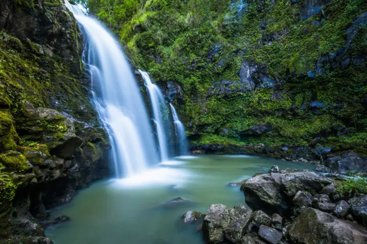
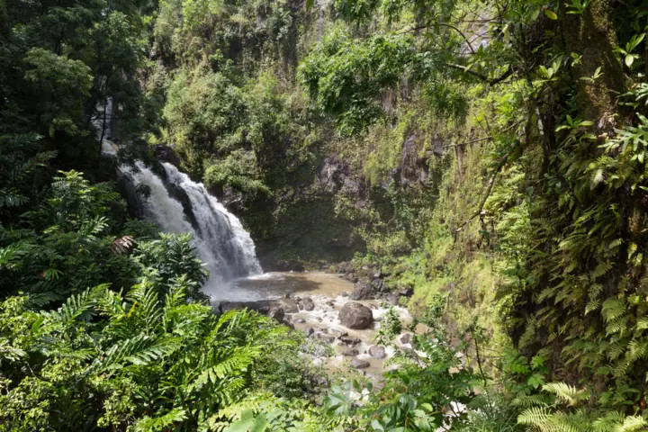
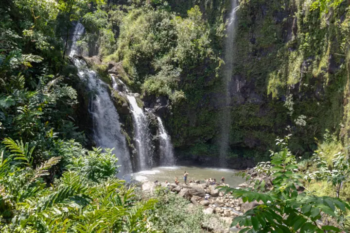
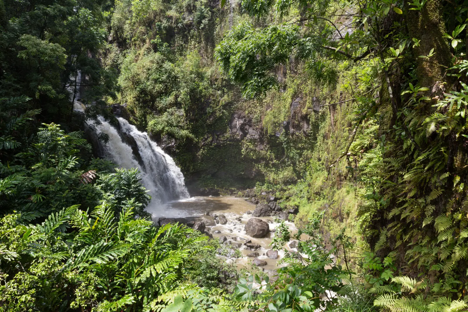
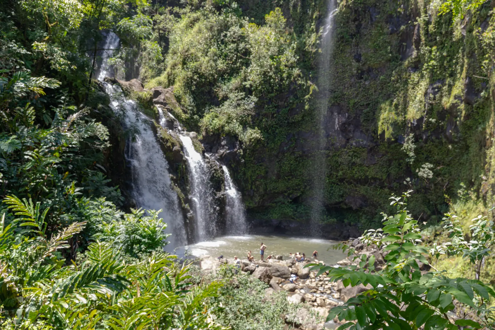
Upper Waikani Falls is a waterfall beside the Hāna Highway (Route 360) on Maui. OpenStreetMap lists it as "Upper Waikani Falls." Travel guides use the name Three Bears Falls for this upper falls. We found no official source that uses it.
No official source we found manages the falls or gives a height. USGS lists only a feature named "Waikani Falls," with no height.
The road beside it is a state highway, run by the Hawaiʻi Department of Transportation (HDOT). So this page is about what you can see from the highway, not about reaching the pool.
What you can see from the road
Wikimedia Commons photos show the falls beside the highway. Ekrem Canli's 2017 photo, for example, shows the falls alongside the Hāna Highway.
Canli's photo is geotagged about 95 meters from our pin, by our math. A 2018 photo by dronepicr is geotagged about 32 meters from it.
Why we don't cover the pool
We found no official source that allows or bans the route down to the pool. We also found no official landowner for the stream banks.
For that reason, we give no directions to the pool. Treat Upper Waikani as a view from the road.
About our map pin
Our pin is the OpenStreetMap node for Upper Waikani Falls (node 4527540268), at 20.8323265, -156.1386255. OSM lists Bing imagery as its source, so treat the pin as approximate.
USGS GNIS has a point named "Waikani Falls" (feature ID 364662). By our math, it sits north-northeast of our pin.
That GNIS point matches a separate OSM node named "Waikani Falls." It likely marks the lower or main falls, not the upper one. Commons photo geotags for Upper Waikani cluster near the OSM point instead.
Getting there and parking
Upper Waikani Falls is on the Hāna Highway, Route 360, which HDOT runs as a state highway. We found no official address, parking lot or pullout for the falls.
Parking rules at Waikani Bridge
HDOT announced no-parking signs at seven Hāna Highway sites in a news release dated June 10, 2021. Waikani Bridge is one of them, with about 10 signs per location.
The release says parking there brings a "$35 no parking citation" plus a "$200 parking violation surcharge," under HRS 291C-111. By our math, that is $235 in total.
That release is more than five years old. We found no newer official notice, so follow the signs posted on the road.
The release does not mention towing, and we found no official tow-away program.
Fees and hours
We found no fee and no hours in any official source. It is a roadside feature beside a public highway.
Nearby falls on the same drive
Twin Falls near Haiku is about 8.7 miles northwest in a straight line, by our math. Road distance on the winding highway will be longer.
Past Hāna, the Pīpīwai Trail in Haleakalā National Park leads to Makahiku Falls and Waimoku Falls. By our math, Makahiku is about 12.9 miles southeast in a straight line.
Map and nearby falls
Map loads as you scroll. Open in OpenStreetMap
OpenPartly open / seasonalUnconfirmedClosedLarger map
Is there a trail?
No official trail leads to Upper Waikani Falls, as far as we found. No official source gives a walking distance, a difficulty or a route.
We don't give directions to the pool, because no official source covers that route. This page treats the falls as a view from the road.
If you want a waterfall hike on an official trail, try the Pīpīwai Trail. NPS says its Makahiku Overlook is about half a mile in, a 1-mile round trip.
NPS adds that the full Pīpīwai Trail, to Waimoku Falls, is 4 miles round trip. Both hikes are in the Kīpahulu District of Haleakalā National Park.
When to visit
No official source names a best season for Upper Waikani Falls. As far as we can tell, it is visible from the highway (checked Nov 13, 2026).
We found no official status page for the falls. Check the posted signs on the day, and plan around the HDOT parking ban at Waikani Bridge.
No official source we read gives flow data or seasonal patterns for the falls.
| Trail | No official trail. This page covers the view from the highway only. |
|---|---|
| Difficulty | No official trail, route or rating. We give no directions to the pool. |
| Entry fee | No fee listed. It is a roadside feature beside a state highway, and we found no fee in any official source. |
| Permit / reservation | No permit listed for the roadside view. HDOT bans parking at Waikani Bridge. |
| Parking | No parking at Waikani Bridge (HDOT) |
| Hours / season | No official hours. It is a roadside view from a public highway. |
| Dogs | No official pet rule found for the falls. |
| Swimming | No official source covers the pool. The Hawaiʻi DOH says not to swim or wade in freshwater streams or ponds, because of leptospirosis. |
| Wheelchair / stroller | No official accessibility information found. |
| Best time to visit | No official best month found. |
| Crowds | No official visitor figure found. |
| Managed by | No official manager found for the falls. The road beside it, Hāna Highway (Route 360), is a state highway run by the Hawaiʻi Department of Transportation (HDOT). |
Safety and swimming
The Hawaiʻi Department of Health (DOH) warns about leptospirosis, a bacterial disease. Its page (last reviewed May 2023) says: "Do not swim or wade in any freshwater streams or ponds in Hawaii."
We found no official flash-flood notice for these falls. Hawaiʻi streams can rise quickly after rain upslope, so stay off the rocks.
Do not stop in the road or on the bridge for photos. HDOT bans parking at Waikani Bridge.
In an emergency, call 911. Our waterfall safety guide explains flash floods and slippery rock.
Conditions change: confirm with official sources before you go.
Where to stay near Upper Waikani Falls
Compare hotels, cabins and rentals close to the falls.
See places to stay nearbyAffiliate link: we may earn a commission at no cost to you. Partners do not see or change our waterfall facts. Disclosure.
Photos
Upper Waikani Falls FAQ
Is Upper Waikani Falls the same as Three Bears Falls?
Travel guides use the name Three Bears Falls for this upper falls. We found no official source that uses it. USGS lists a separate point named Waikani Falls, which likely marks the lower or main falls.
Can you park at Upper Waikani Falls?
HDOT put up no-parking signs at Waikani Bridge, per a June 10, 2021 release. Parking there brings a $35 citation plus a $200 surcharge under HRS 291C-111. We found no official parking area.
Can you swim at Upper Waikani Falls?
No official source covers the pool, and we give no directions to it. The Hawaiʻi DOH says not to swim or wade in any freshwater streams or ponds in Hawaii, because of leptospirosis.
How tall is Upper Waikani Falls?
No official source gives a height. USGS GNIS lists only a feature named Waikani Falls, with no height.
Is there a fee to see Upper Waikani Falls?
We found no fee in any official source. It is a roadside feature beside a state highway.
Is there a trail to Upper Waikani Falls?
Not an official one, as far as we found. No official source covers the route down to the pool, so this page covers the view from the road only.
Nearby waterfalls


Sources
- HDOT news release: no-parking signs on Hāna Highway, including Waikani Bridge (dated June 10, 2021; read Nov 13, 2026)
- Hawaiʻi Department of Health: Leptospirosis (last reviewed May 2023; read Nov 13, 2026)
- OpenStreetMap: Upper Waikani Falls, node 4527540268 (pin; read Nov 13, 2026)
- OpenStreetMap: Waikani Falls, node 9579552796 (read Nov 13, 2026)
- USGS GNIS: Waikani Falls, feature ID 364662 (coordinates)
- Wikimedia Commons: Upper Waikani Falls alongside Hana Highway (Ekrem Canli, 2017; caption and geotag; read Nov 13, 2026)
- NPS: Short hike to Makahiku Falls (nearby official trail; last updated Dec 18, 2020; read Nov 13, 2026)
Last verified Nov 13, 2026 by The Waterfall Guide editorial team. Conditions change: confirm with No official manager found for the falls. The road beside it, Hāna Highway (Route 360), is a state highway run by the Hawaiʻi Department of Transportation (HDOT). before you go. Spotted something out of date? Report a correction.