Waterfalls near a city
Waterfalls near New York City
The nearest waterfall to New York City in this guide is Hemlock Falls, 19.3 miles straight-line by our math, in South Mountain Reservation in Essex County, NJ. Second is Paterson Great Falls, 21.5 miles away, a 77-foot drop per the NPS. Both were open, as far as we can tell, on our checks of Nov 11 and Nov 8, 2026, respectively.
8 waterfalls within 75 miles of New York City
Distances are straight-line miles, by our math, from the US Census internal point of New York City, NY, not driving distances, so check a route before you go. Each card links to a full guide with fees, parking and current status.
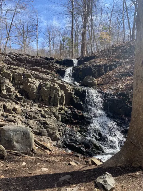
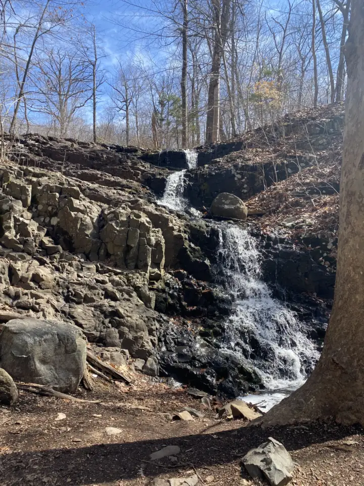
A 25-foot falls on Hemlock Brook in South Mountain Reservation, about a five- to ten-minute walk from nearby lots.
Hemlock Falls19 mi straight-line · No official ratingOpen25FT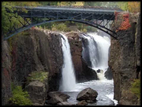
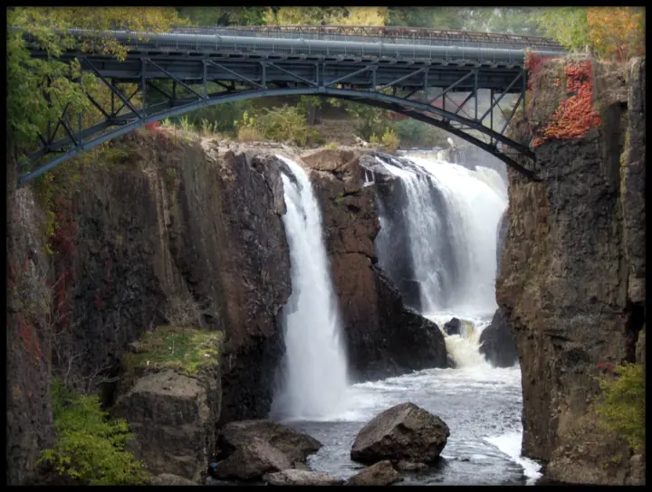
A 77-foot drop on the Passaic River in Paterson, free to view from Overlook Park and Mary Ellen Kramer Park.
Paterson Great Falls22 mi straight-line · Easy (our reading)Open77FT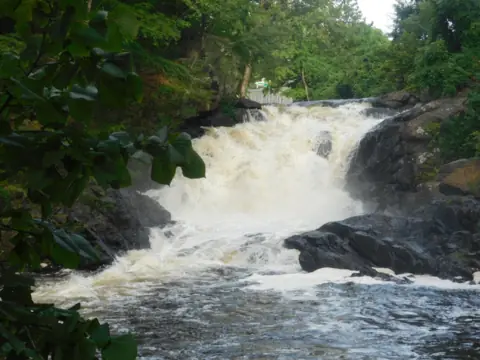
A waterfall on the Rockaway River in Boonton's Grace Lord Park, with a restored 1866 stone arch bridge as an overlook.
Boonton Falls30 mi straight-line · No official ratingOpenABOUT 20FT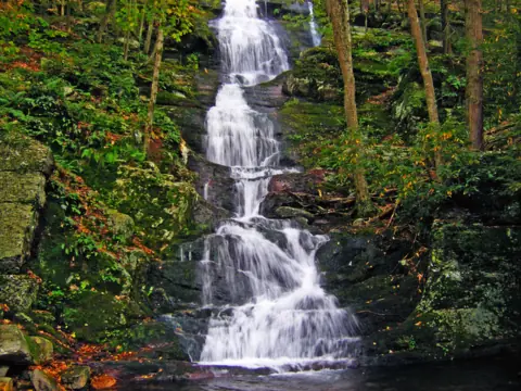
A 75-foot cascade off Mountain Road in Walpack Township, with a staircase trail up to the Appalachian Trail.
Buttermilk Falls59 mi straight-line · Moderate-difficult (NPS)Open75FT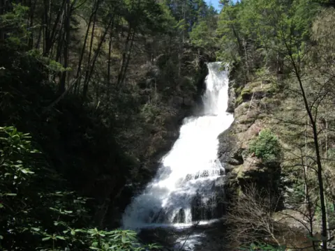
Closed to all visitors since May 2025 for a bridge replacement; no reopening date.
Dingmans Falls63 mi straight-line · EasyClosed130FT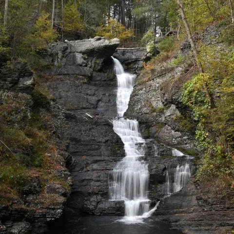
A three-tier fall NPS calls Pennsylvania's tallest, on a short, steep, free trail.
Raymondskill Falls64 mi straight-line · Easy to moderateOpen150FT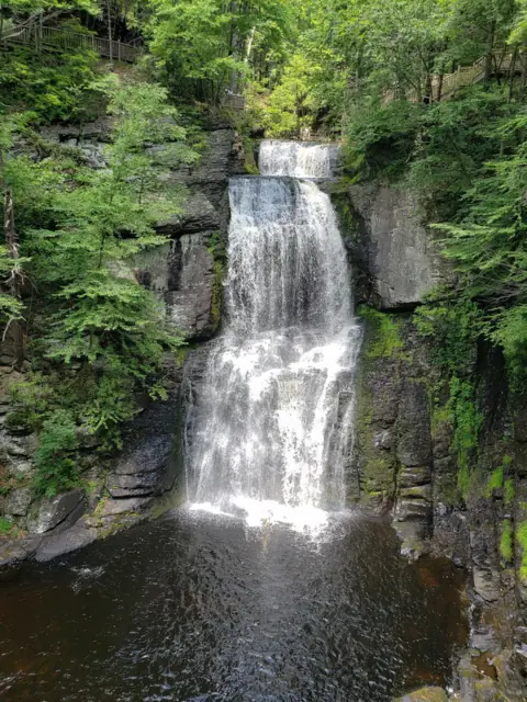
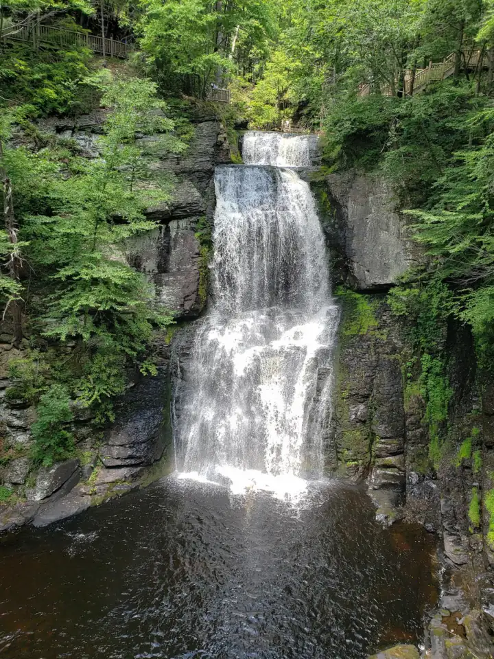
Eight waterfalls on boardwalk trails in a private, ticketed Poconos park.
Bushkill Falls64 mi straight-line · EasySeasonal100FT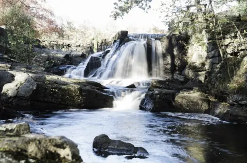
A tiered fall at an old match-factory site, with free parking for all cars.
Southford Falls68 mi straight-line · Easy to moderateUnconfirmed
Map of waterfalls near New York City
Map loads as you scroll. Open in OpenStreetMap
OpenPartly open / seasonalUnconfirmedClosedLarger map
Compare the waterfalls near New York City
| Waterfall | Distance | Status | State | Height | Trail | Difficulty | Fee / permit | Swimming |
|---|---|---|---|---|---|---|---|---|
| Hemlock Falls | 19 mi | Open | NJ | 25 ft | About 5 to 10 min from nearby lots (South Mountain Conservancy) | No official rating | No fee listed | No official swimming rule found |
| Paterson Great Falls | 22 mi | Open | NJ | 77 ft | Urban viewpoints, no hike | Easy (our reading) | Free (NPS) | No rule listed; stay behind barriers |
| Boonton Falls | 30 mi | Open | NJ | about 20 ft | Park path; no official distance | No official rating | No fee listed | Unsafe: drownings reported (Mountain Lakes) |
| Buttermilk Falls | 59 mi | Open | NJ | 75 ft | 1.4 mi one way, 1,104 ft climb, stairs | Moderate-difficult (NPS) | No entrance fee (NPS) | No swimming or wading at the falls |
| Dingmans Falls | 63 mi | Closed | PA | 130 ft | Closed; normally 0.8 mi round trip | Easy | Free (when open) | No (banned) |
| Raymondskill Falls | 64 mi | Open | PA | 150 ft | 0.3 mi loop plus spur | Easy to moderate | Free | No (banned) |
| Bushkill Falls | 64 mi | Seasonal | PA | 100 ft | Green 15 min; Red about 2 mi, 2+ hr | Easy | $24 general admission | No |
| Southford Falls | 68 mi | Unconfirmed | CT | Not listed | 2-mile trail network | Easy to moderate | Free for all cars | None listed |
Where to stay near New York City
Base yourself in New York City, NY for a waterfall day. Open the map to compare hotels, cabins and rentals, or switch to tours and activities.
Or open the full stays map in a new tab
Affiliate links and map: we may earn a commission at no cost to you. The map loads from Stay22 only when you open it. Partners do not see or change our waterfall facts. Disclosure.
How the list breaks down
This page lists the falls within 75 straight-line miles of New York City's Census point, and it counts only falls we have published. Distances are straight-line miles by our math, not driving miles. None of the eight is inside the city: four are in New Jersey, three are in Pennsylvania, and one is in Connecticut.
The two closest have rail options. The NPS says to take the NJ Transit Main Line to Paterson station, then walk about 1 mile. For Hemlock Falls, the South Mountain Conservancy says Millburn station is 100 yards from the Locust Grove entrance. That entrance is about 1.8 miles from the falls in a straight line, by our math, and the walking route is longer.
Farther out, Bushkill Falls is a ticketed private park whose last open day of 2026 is November 25, per its calendar read Oct 28, 2026. Dingmans Falls has been closed since May 12, 2025, and the NPS alerts feed still listed the closure on Oct 29, 2026.
For more falls in the region, see our New Jersey, Pennsylvania, Connecticut and New York guides.
Hemlock, Paterson and Boonton: the three within 31 miles
Hemlock Falls drops 25 feet in South Mountain Reservation, per Essex County Parks. The South Mountain Conservancy says it is about a ten-minute walk from the Tulip Springs lot, or five minutes from a small lot near the Pine Grove Bridge. Essex County still listed the Locust Grove lot and Fairy Trail as closed for construction on Nov 11, 2026. The county pages we read list no entry or parking fee.
Paterson Great Falls needs no hike. The NPS names two viewing spots: Overlook Park at the main lot and the observation deck in Mary Ellen Kramer Park. The NPS fees page says "Free. No entrance pass required." NPS alerts read Nov 8, 2026, warn that parking is extremely limited on weekends and event days, and the main lot closes at dusk.
Boonton Falls drops the Rockaway River "some 20 feet" in Grace Lord Park, per the Borough of Mountain Lakes. It is 30.2 straight-line miles from the city, by our math. A restored 1866 stone arch bridge reopened in July 2024 as an overlook, Morris County says. Do not swim: Mountain Lakes says several people have drowned in the basin. As far as we can tell it was open on Nov 11, 2026.
Delaware Water Gap: Buttermilk, Raymondskill and Dingmans
Buttermilk Falls, 59.5 straight-line miles away by our math, is in New Jersey and is 75 feet tall per an archived 2021 NPS release. A wooden staircase climbs beside it. The NPS lists the trail at 1.4 miles one way with 1,104 feet of elevation change. As far as we can tell it was open on Nov 8, 2026, when no NPS alert named it.
The only car route is Struble Road through Stokes State Forest, because the Main Street bridge in Walpack is closed. The NPS says Struble Road closes from December 15 to April 15. From Dec 15, 2026, the falls will not be reachable by car.
Raymondskill Falls, across the river in Pennsylvania, is a 0.3-mile loop with a short spur and 178 feet of elevation change, per the NPS. Both lots are free. Only service dogs are allowed on the trail, and the NPS bans swimming and wading at the falls. As far as we can tell it is open: the NPS alerts feed listed nothing for it on Oct 29, 2026.
Dingmans Falls has been closed to all traffic, pedestrians included, since May 12, 2025. The NPS is replacing a bridge and rehabilitating the trail and staircase. Its alerts feed still listed the closure on Oct 29, 2026, and NPS has given no reopening date.
Bushkill Falls: ticketed, with a late-November close
Bushkill Falls is a private attraction with eight falls and about 2.5 miles of trails on boardwalks, stairs and bridges, per its official site. The Main Falls are "almost 100 feet," per its 2026 A-to-Z guide. General admission is $24, as listed in October 2026. Parking is free.
As far as we can tell, the park is open for the 2026 season, per its calendar read Oct 28, 2026. The last open day is Wednesday, November 25. From November 1 the park runs 10am to 4pm, weather permitting, with last trail entry at 3pm. It is closed from November 26 through the end of March. Leashed dogs are allowed, but swimming is strictly prohibited for people and pets.
Southford Falls in Connecticut: check before you go
Southford Falls State Park in Southbury is 68.2 straight-line miles from the city, by our math. CT State Parks lists parking as free for all vehicles, including out-of-state cars, and it allows leashed dogs. The park has a two-mile trail network.
We list its status as unconfirmed. CT State Parks showed the park open with no alerts on Oct 29, 2026. On that date, CT Trail Finder still showed the trails as "PARTIALLY OPEN" after flooding. WTNH reported that the August 2024 flood pushed the covered bridge off its foundation. Call CT DEEP at (203) 264-5169 before you go.
Waterfalls near New York City: FAQ
What is the closest waterfall to New York City?
In this guide, Hemlock Falls in South Mountain Reservation, NJ, is 19.3 miles straight-line from the city's Census point, by our math. Paterson Great Falls is next at 21.5 miles. Both were open, as far as we can tell, on our checks of Nov 11 and Nov 8, 2026. This list covers only falls we have published.
Can you reach a waterfall from NYC by train?
Yes, for the two closest. The NPS says to take the NJ Transit Main Line to Paterson station, then walk about 1 mile to Paterson Great Falls. For Hemlock Falls, the South Mountain Conservancy says Millburn station is 100 yards from the Locust Grove entrance. That entrance is about 1.8 miles from the falls in a straight line, by our math. Essex County listed the Locust Grove lot as closed on Nov 11, 2026.
Which waterfalls near NYC are free?
The NPS says Paterson Great Falls is free, with no entrance pass required. The NPS lists both Raymondskill lots as free, and Delaware Water Gap charges no entrance fee. CT State Parks lists free parking at Southford Falls. The Essex County and Mountain Lakes pages we read list no fee for Hemlock or Boonton Falls. Bushkill Falls charges $24 general admission, as listed in October 2026.
Which waterfall near NYC needs no hiking?
Paterson Great Falls. The NPS names two viewing spots: Overlook Park at the main lot and the observation deck in Mary Ellen Kramer Park, beside the falls. Hemlock Falls is about five minutes on foot from a small lot near the Pine Grove Bridge, per the South Mountain Conservancy.
Is Dingmans Falls open?
No. The NPS closed the site to all traffic, pedestrians included, on May 12, 2025, for a bridge replacement and trail and stair work. Its alerts feed still listed the closure on Oct 29, 2026, and NPS has given no reopening date.
Can I bring my dog to waterfalls near NYC?
At some. The NPS allows dogs at Paterson Great Falls on a six-foot non-retractable leash. At Delaware Water Gap, the NPS says pets are allowed almost everywhere, with a leash, and Buttermilk Falls is not on its list of exceptions. Bushkill Falls and CT State Parks allow leashed dogs at their falls. Raymondskill and Dingmans allow service dogs only, per the NPS. We found no official dog rule for the Hemlock or Boonton trails.
Sources
Facts for each waterfall come from its own guide, where every source is listed. The city sources are below.
- Essex County Parks: South Mountain Reservation (alerts; read Nov 11, 2026)
- Essex County Parks: South Mountain Reservation, About (25-foot falls; read Nov 11, 2026)
- South Mountain Conservancy: Hemlock Falls (published March 3, 2025; read Nov 11, 2026)
- South Mountain Conservancy: 2026 Fairy Trail and River Trail improvements project update (Oct 22, 2026)
- South Mountain Conservancy: Directions to South Mountain Reservation (Millburn station; read Nov 11, 2026)
- NPS: Paterson Great Falls National Historical Park home page and alerts (read Nov 8, 2026)
- NPS: Paterson Great Falls Fees & Passes (read Nov 8, 2026)
- NPS: Paterson Great Falls Directions and Transportation (NJ Transit; read Nov 8, 2026)
- NPS: Paterson Great Falls Pets (read Nov 8, 2026)
- Borough of Mountain Lakes: Boonton Falls Trail (read Nov 11, 2026)
- Morris County: Historic Stone Arch Bridge in Boonton Reopens (July 2, 2024)
- NPS: Buttermilk Falls place page (Struble Road closure; last updated July 28, 2025; read Nov 8, 2026)
- NPS: Buttermilk Falls Trail (length, elevation; last updated Aug 18, 2021; read Nov 8, 2026)
- NPS: Delaware Water Gap news release, October 21, 2021 (75-foot height; archived)
- NPS: Delaware Water Gap Current Conditions (Main Street bridge; last updated May 21, 2026; read Nov 8, 2026)
- NPS: Delaware Water Gap Fees & Passes (updated Oct 13, 2026)
- NPS: Delaware Water Gap Pets (read Nov 8, 2026)
- NPS Delaware Water Gap: Raymondskill Creek Trail
- NPS Delaware Water Gap: Dingmans Creek Trail (updated May 28, 2025)
- NPS Delaware Water Gap: Alerts feed (read Oct 29, 2026)
- Bushkill Falls: A to Z information guide and park policies (2026 PDF)
- Bushkill Falls: 2026 operating hours calendar (read Oct 28, 2026)
- Bushkill Falls: Park hours and general information (read Oct 28, 2026)
- Bushkill Falls: Park admission fees (read Oct 2026)
- Connecticut State Parks: Southford Falls State Park (read Oct 29, 2026)
- CT Trail Finder: Southford Falls State Park (partially open)
- WTNH: Historic flooding reveals ruins in Southbury (Sep 4, 2024)
- US Census Bureau TIGERweb: New York city, GEOID 3651000, internal point (read Nov 11, 2026)

State guides: Connecticut waterfalls, New Jersey waterfalls, Pennsylvania waterfalls. More cities.
Photos: Renata3, CC BY-SA 4.0; Tony Fischer, CC BY 2.0; TheTurducken, CC BY 2.0. Photo credits