Right now
Right now as of Oct 29, 2026
- Permit No permit needed. Fee: no fee found.
Status note (Oct 29, 2026): Open. No Burden Falls alert on the Shawnee National Forest alerts page, checked October 29, 2026. What the status labels mean
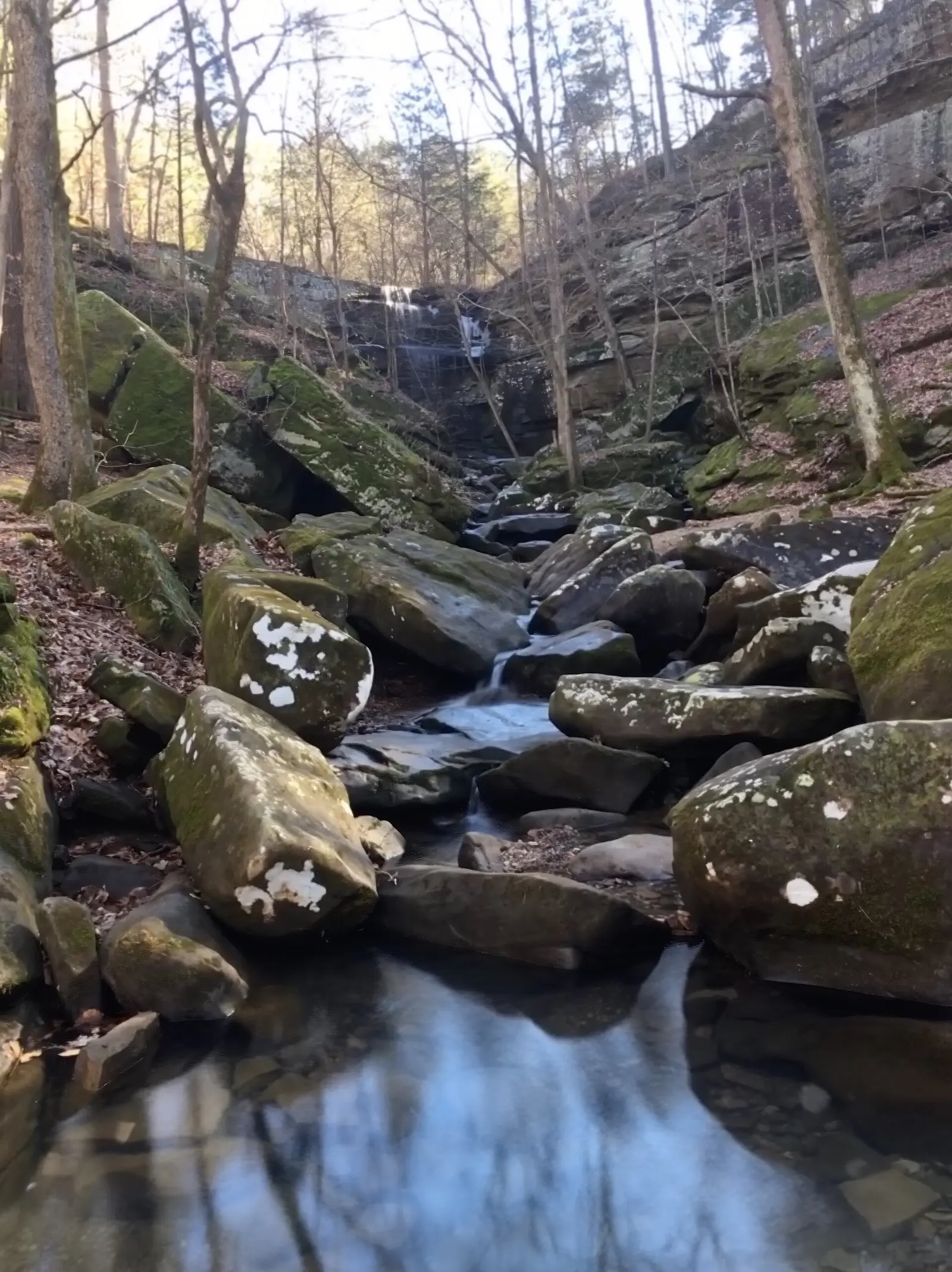
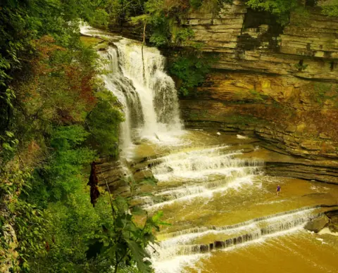
Burden Falls is a seasonal waterfall on Burden Creek in the Burden Falls Wilderness of the Shawnee National Forest, near Stonefort in Pope County, Illinois. It descends about 100 feet in total, but its biggest single drop is about 20 feet, per Wikipedia and Wilderness.net. Upper Burden Falls sits beside a pull-off on gravel Burden Falls Road. There are no restrooms or drinking water. The Shawnee alerts page listed no Burden Falls alert on October 29, 2026.
About Burden Falls
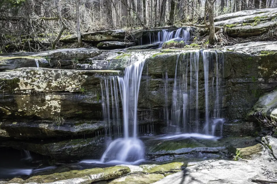
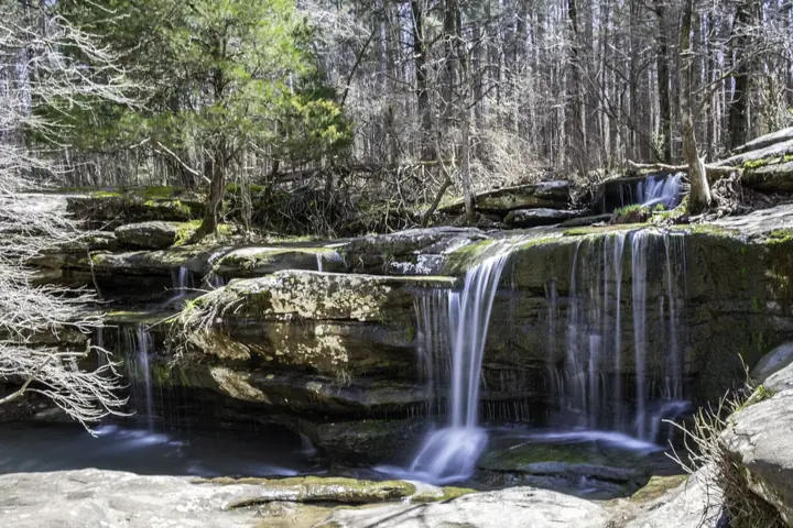
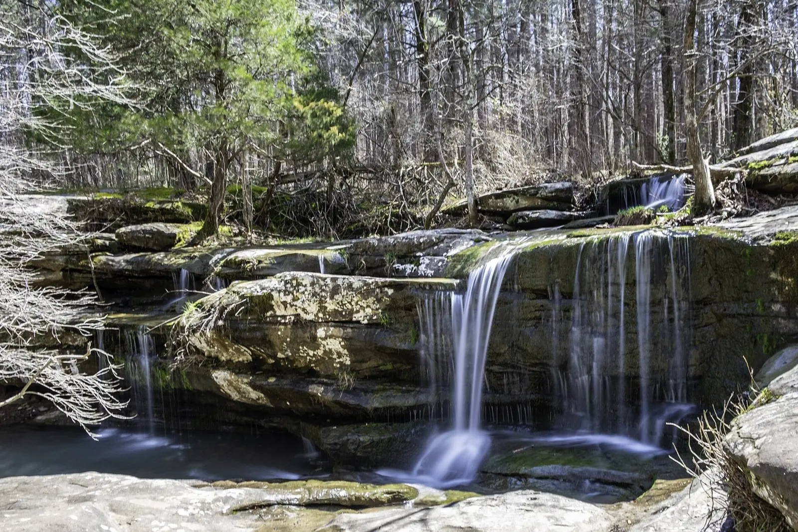
Burden Falls starts with a drop over a sandstone ledge and continues as a run of cascades on Burden Creek. Wikipedia calls it 'one of the highest waterfalls in Illinois.' It describes a 20-foot drop over a ledge, followed by 80 more feet of cascades.
Wilderness.net gives the same picture: about 100 feet of total descent, with a greatest single drop of about 20 feet. So read 100 feet as the whole descent, not one free fall. Online claims of a 100-foot free-falling drop do not match either source.
The falls gives its name to the Burden Falls Wilderness. Congress designated it in the Illinois Wilderness Act of 1990 (Public Law 101-633). The law and Wilderness.net put it at 3,723 acres, while Wikipedia says 3,775.
The wilderness sits next to the Bay Creek Wilderness, near Bell Smith Springs. Wikipedia notes that southern Illinois was not glaciated. Streams there that run between confining sandstone ledges are called 'shut-ins.'
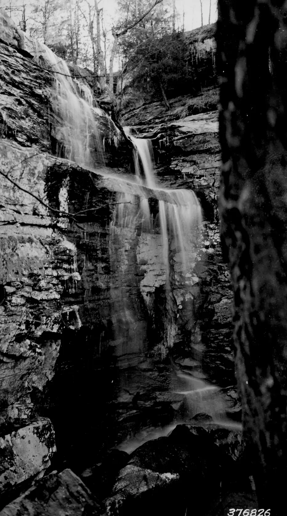
The National Archives holds a historical Forest Service photograph of Burden Falls. A 1965 Forest Service caption archived on Wikimedia Commons says the stream 'is generally dry.'
Getting there and parking
Burden Falls is in Pope County. Enjoy Illinois, the state tourism site, lists a Stonefort address, and Eddyville is also nearby. The map pin uses the federal place-name (GNIS) point for the falls.
The last stretch is gravel Burden Falls Road. Sources disagree on its Forest Road number, so we don't list one. The Burden Creek low-water crossing 'may be impassable' at high water, according to the off-road guide Trails Offroad.
We could not confirm turn-by-turn directions. A Sierra Club page, which we saw only as a search excerpt, gives a route from Harrisburg. It describes about 12 miles south on IL-145, then about 3 miles west at Delwood. Check a current map before you rely on it.
Upper Burden Falls is 'right next to a parking pull-off,' according to a photographer's description on Wikimedia Commons. We found no official parking lot, fee or capacity figure.
We found no fee notice for the site. A Forest Service page, seen as a search excerpt, says 'no permits are required to enter or camp in designated wilderness.'
Bring everything you need. The Forest Service says 'restrooms are not available at this site and potable water is not available,' per a search excerpt. An excerpt lists the Hidden Springs Ranger District at (618) 658-2111, but we could not confirm it covers Burden Falls.
Map and nearby falls
Map loads as you scroll. Open in OpenStreetMap
OpenPartly open / seasonalUnconfirmedClosedLarger map
The walk
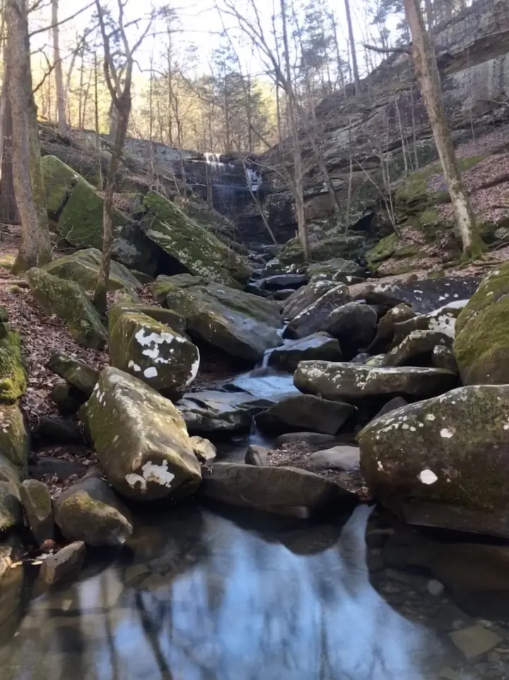
We found no official trail to the lower falls. Trail guides such as Hiking Project show only user trails to it. Wilderness.net lists a 3.5-mile Burden Falls Trail, which runs above the falls.
Upper Burden Falls takes little effort to see, since it sits beside the pull-off. We found no official distance, walking time or difficulty rating for reaching the base of the lower falls.
Wilderness rules apply once you leave the road. The Forest Service bars mechanical and motorized equipment, including bicycles, according to a search excerpt. Leave bikes at the car.
A forest-wide order also applies. The Shawnee alerts page lists Forest Order 09-08-25-03, 'Shawnee Wilderness and Watersheds,' dated September 29, 2025, which restricts use in wilderness and watershed areas. Read its terms on the alerts page before you go.
We found no Forest Service pet rule for this wilderness. Keeping your dog on a leash is the safer choice near the ledges. We found no wheelchair-accessible route to the lower falls.
When to visit
Flow is the big variable at Burden Falls, which is seasonal. A 1965 Forest Service photo caption says the stream 'is generally dry.' We found no official guidance on the best month.
If you aim for wetter weather, plan for the road as well as the falls. High water can make the Burden Creek low-water crossing impassable, Trails Offroad warns.
We found no posted hours for the wilderness and no seasonal closure.
When we checked on October 29, 2026, the Shawnee National Forest alerts page listed no alert for Burden Falls. Conditions change, so check that page again or call the forest's trail conditions line at (618) 658-1312 before a long drive.
Matthiessen State Park Falls and Waterfall Glen Falls are far to the north. See our Illinois waterfalls guide.
| Height | 100 ft (total descent)Note: total descent of a ledge drop and cascades, per Wikipedia and Wilderness.net; the biggest single drop is about 20 ft |
|---|---|
| Trail | Upper Burden Falls is next to a roadside pull-off, per a Commons photo description. There is no official trail to the lower falls; trail guides such as Hiking Project show only user trails. Wilderness.net lists a 3.5-mile Burden Falls Trail that runs above the falls |
| Entry fee | No fee found. A Forest Service search excerpt says 'no permits are required to enter or camp in designated wilderness' |
| Permit / reservation | No permit needed to enter the wilderness (Forest Service search excerpt) |
| Parking | Pull-off on gravel Burden Falls Road |
| Hours / season | We found no posted hours for the wilderness |
| Dogs | No rule found; we found no Forest Service pet rule for this wilderness, so a leash is the safer choice near the ledges |
| Swimming | No Forest Service swimming rule found. Stay off the ledges and out of the pools when the creek is high |
| Wheelchair / stroller | No. We found no accessible route, and the lower falls is reached only by user trails |
| Restrooms | None. A Forest Service search excerpt says restrooms and potable water are not available at this site |
| Best time to visit | Seasonal flow; we found no official best month. A 1965 Forest Service photo caption says the stream 'is generally dry' |
| Managed by | USDA Forest Service, Shawnee National Forest |
Safety and swimming
We could not confirm a Forest Service swimming rule for Burden Falls. Do not jump from the ledges, and stay out of the pools when the creek is high.
Expect uneven footing on the user trails and wet, slick sandstone near the ledges. Keep children well back from the edge of each drop.
Do not drive into the low-water crossing when water covers it. Trails Offroad warns it may be impassable at high water, so turn around instead.
With no restrooms or drinking water on site, carry water and pack out everything you bring. Read our waterfall safety guide before you go.
Where to stay near Burden Falls
Compare hotels, cabins and rentals close to the falls around Stonefort.
See places to stay nearbyAffiliate link: we may earn a commission at no cost to you. Partners do not see or change our waterfall facts. Disclosure.
Photos
Burden Falls FAQ
How tall is Burden Falls?
About 100 feet of total descent, per Wikipedia and Wilderness.net. The biggest single drop is about 20 feet, over a ledge; the rest is cascades.
How do you get to Burden Falls?
Head for gravel Burden Falls Road in Pope County, near Stonefort. Upper Burden Falls is next to a roadside pull-off. We could not confirm directions; a Sierra Club excerpt describes IL-145 south of Harrisburg about 12 miles, then west at Delwood about 3 miles.
Is there a trailhead or trail to the bottom of Burden Falls?
No official one. Trail guides such as Hiking Project show only user trails to the lower falls. Wilderness.net lists a 3.5-mile Burden Falls Trail, but it runs above the falls.
Does Burden Falls have water all year?
Not reliably. Burden Falls is seasonal, and a 1965 Forest Service photo caption says the stream 'is generally dry.' We found no official best month.
Do you need a permit for the Burden Falls Wilderness?
No, according to a Forest Service page seen only as a search excerpt. It says 'no permits are required to enter or camp in designated wilderness,' and we found no fee notice.
Are there restrooms at Burden Falls?
No. A Forest Service search excerpt says restrooms and potable water are not available at this site. Bring your own water.
Nearby waterfalls
No other waterfalls within 75 miles are on the site yet.
More waterfalls to explore


Sources
Some facts credited to the Forest Service come from search-result excerpts of its official pages. Confirm fees and rules on the official site.
- USDA Forest Service: Shawnee National Forest home page (Burden Falls facts seen only as search excerpts)
- USDA Forest Service: Shawnee National Forest alerts (read Oct 29, 2026)
- Wilderness.net: Burden Falls Wilderness
- Trails Offroad: Burden Falls Road
- Trail Run Project / Hiking Project: Burden Falls
- Enjoy Illinois: Burden Falls Wilderness
- Wikipedia: Burden Falls Wilderness
- Wikimedia Commons: Upper Burden Falls (photo description, parking pull-off)
- Wikimedia Commons: Photograph of Burden Falls (National Archives)
Last verified Oct 29, 2026 by The Waterfall Guide editorial team. Conditions change: confirm with USDA Forest Service, Shawnee National Forest before you go. Spotted something out of date? Report a correction.