Right now
Right now as of Oct 29, 2026
- Status IDNR's park page says the Lake Falls bridge/trail 'is closed to all hiking traffic until further notice'.
- Permit None needed.
- Heads-up Dells lot restroom closed for repairs, with porta-potties in its place (IDNR closures page, updated October 2, 2026). The Vermilion River Area has 3 accessible vault toilets.
Status note (Oct 29, 2026): Partly open. IDNR's park page says the Lake Falls bridge/trail 'is closed to all hiking traffic until further notice'. Its Current Closures page, updated October 2, 2026, posts a detour and does not list Cascade Falls as closed. The Dells lot restroom is closed for repairs. The park closes to everyone except hunters on November 20 to 22, December 3 to 6 and December 11 to 13, 2026. We last checked on October 25, 2026. What the status labels mean
Matthiessen State Park, run by the Illinois Department of Natural Resources (IDNR) near Oglesby, is free, needs no tickets and is open 7am to sunset. Its canyon drops 45 feet at Cascade Falls, IDNR says, and the main trail starts at the Dells picnic area off IL-178. IDNR's closures page, updated October 2, 2026, lists the Lake Falls bridge as closed. Hunting closures start November 20, 2026, and swimming, wading and climbing are banned.
About Matthiessen State Park Falls
Matthiessen State Park is a 1,938-acre IDNR park in LaSalle County, about 4 miles south of Utica and 3 miles east of Oglesby. Its main feature is a canyon about a mile long. It runs from Deer Park Lake down to the Vermilion River.
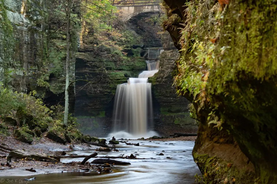
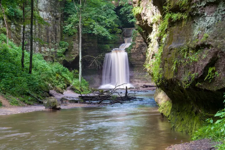
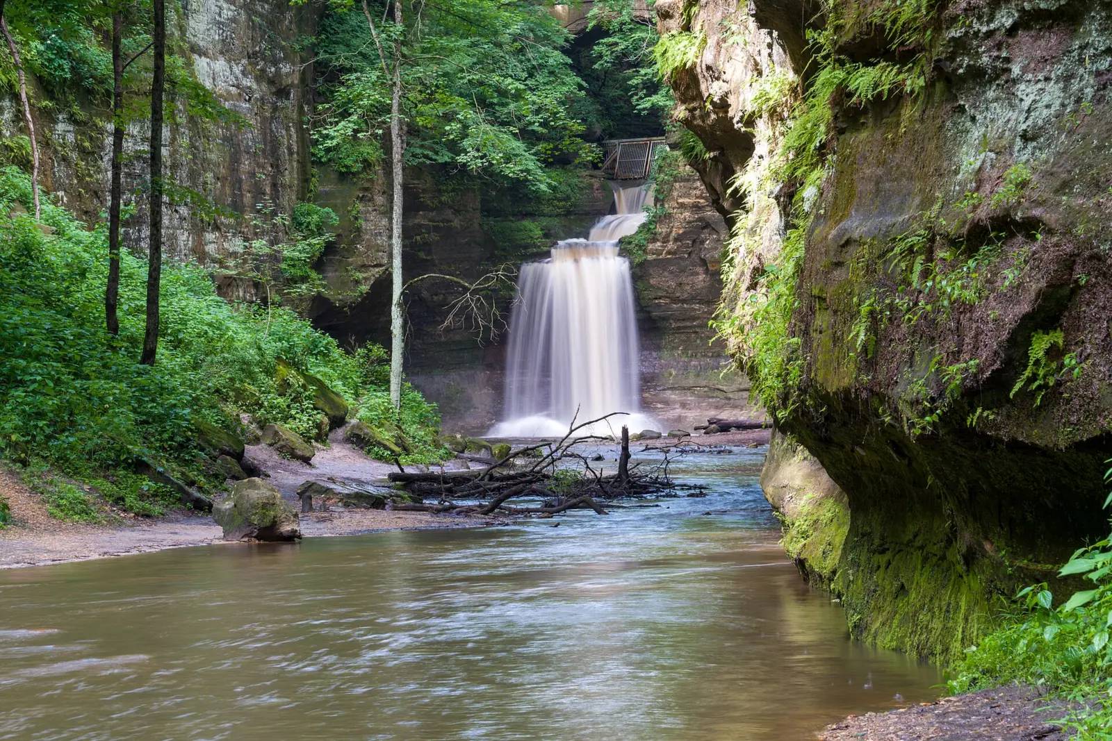
IDNR splits the canyon into two parts. The Upper Dell runs from the lake to Cascade Falls, 'where the canyon drops 45 feet and the Lower Dell begins'. So Cascade Falls is the falls at the head of the Lower Dells. IDNR's trail map places it by a bridge near the Wishing Well.
Lake Falls is the park's other named falls. The trail map shows it at the bridge and dam below Matthiessen Lake. Giant's Bathtub is another named feature, and IDNR gives no height for it or for Lake Falls.
We group Cascade Falls, Lake Falls and Giant's Bathtub under one name, Matthiessen State Park Falls. You may also see them listed as Cascade Falls, Lake Falls or simply the Matthiessen Dells.
The park began as private land. IDNR says F. W. Matthiessen ran it as 'Deer Park' and employed about 50 people to build trails, bridges, stairs and dams. The state renamed the park for him in 1943.
Matthiessen State Park has grown from 176 acres to 1,938 acres, according to IDNR. The department adds that mineral-rich groundwater colors the sandstone walls, and that mosses, liverworts and ferns grow on them.
Getting there and parking
Matthiessen has two parking areas, and both sit off Illinois Route 178. For the canyon and Cascade Falls, use the Matthiessen Dells Area lots, which IDNR says have 4 accessible spaces. The Vermilion River Area lots are just to the south.
IDNR charges no entrance or parking fee here, so there are no tickets to buy.
Large groups have one extra step. IDNR requires an Activity Permit for groups of 20 or more. It costs $25 and is issued at the Starved Rock Visitor Center.
Weekend parking is the main pinch. Shaw Local reported the lots reaching capacity on a May 2023 weekend and a June 2024 Sunday. An IDNR page, seen only as a search excerpt, says weekend lots can fill and close from about 11am to 3pm, May to October. Arrive early or pick a weekday.
Enjoy Illinois, the state tourism site, puts the park 'about 95 miles west of Chicago.' The map pin is IDNR's point for the park, not for either falls. The park office is at Box 509, Utica, IL 61373, and its phone is (815) 667-4726.
Overnight options are limited. The only campground is an equestrian camp with 14 first-come sites at $8 a night, open May 1 to the second weekend of November. Matthiessen has no cabins, but nearby Starved Rock Lodge does.
Map and nearby falls
Map loads as you scroll. Open in OpenStreetMap
OpenPartly open / seasonalUnconfirmedClosedLarger map
The walk
IDNR says 'the main trail to Cascade Falls starts at the Dells picnic area'. The park has 5 miles of hiking trails, which IDNR describes as 'well-marked, well-surfaced'. Its trail map puts the Dells Area trails at 3.2 miles in total and the Vermilion River Area trails at 1.9 miles. A 1-mile horse trail links the two areas.
The map gives no distance to either falls, but it explains the trail markers. Bluff Trail posts are brown, River Trail posts are red, and Interior or Connecting Trail posts are green. White dots point back to the Fort or parking, and yellow dots point away from them.
Expect two kinds of walking. IDNR says the bluff-top trails are easy, while the interior dells 'may be difficult to negotiate, particularly during spring and early summer.'
The Lake Falls side is closed for now. IDNR's park page says 'The Lake Falls bridge/trail is closed to all hiking traffic until further notice'. Its Current Closures page (Region 1, updated October 2, 2026) lists the bridge over Lake Falls as closed. A detour is posted, and Cascade Falls is not listed as closed.
IDNR lists a quarter-mile accessible trail at the Lake Shelter area. It follows a wooden ramp to the Lake Falls bridge, then turns to concrete. With that bridge closed, we could not confirm how much of the route you can use. The canyon floor is not accessible.
Bikes are not allowed on the Dells trails; IDNR permits them only in the Vermilion River Area. The park also has 9 miles of bike and horse trails and 6 miles of ski trails. Horse trails are open from May 1 to the second weekend of November.
Dogs can come along. IDNR's rule is short: 'All pets must be on a leash'. A search excerpt of the state rule, 17 IAC 110.30, caps the leash at 10 feet, but we could not read the rule itself.
When to visit
IDNR lists park hours of 7am to sunset and says 'all users must be off the trails by/before dark'. The park is open year-round, apart from the hunting closures below.
Enjoy Illinois says the falls are best during or after rain. Weigh that against IDNR's warning that the interior dells may be difficult to negotiate, particularly in spring and early summer.
Hunting season changes access. For 2026-27, IDNR says the park is closed to everyone except hunters on November 20 to 22, December 3 to 6 and December 11 to 13, 2026.
On December 31, 2026 to January 3, 2027, and on January 15 to 17, 2027, the trails stay open. The Nature Preserve is closed except to hunters on those dates, IDNR says.
Interior trails can also close after storms or flooding, according to summer 2026 reports we saw only as search excerpts. Check IDNR's Current Closures page on the morning of your visit.
Starved Rock State Park is a few miles away on IL-178. Waterfall Glen Falls near Darien and Burden Falls in the Shawnee National Forest are the state's other falls on this site. Our Illinois waterfalls guide compares all three.
| Height | 45 ft (Cascade Falls)Note: where the canyon drops at Cascade Falls, per IDNR; no official height for Lake Falls or Giant's Bathtub |
|---|---|
| Trail | IDNR says the main trail to Cascade Falls starts at the Dells picnic area. Its trail map puts the Dells Area trails at 3.2 miles in total and the Vermilion River Area at 1.9 miles, linked by a 1-mile horse trail. The map gives no distance to either falls |
| Difficulty | Easy on the bluff tops; harder in the interior dells, especially in spring and early summer (IDNR) |
| Entry fee | Free: IDNR charges no entrance fee at state parks, so there are no tickets to buy. Groups of 20 or more need a $25 Activity Permit |
| Permit / reservation | No tickets or permit for most visitors; groups of 20 or more need a $25 Activity Permit |
| Parking | Free Dells Area lots off IL-178 |
| Hours / season | 7am to sunset; 'all users must be off the trails by/before dark' (IDNR). Closed except to hunters on November 20 to 22, December 3 to 6 and December 11 to 13, 2026. The Nature Preserve is closed except to hunters on December 31, 2026 to January 3, 2027, and January 15 to 17, 2027 |
| Dogs | Allowed on a leash: 'All pets must be on a leash' (IDNR) |
| Swimming | No. IDNR prohibits swimming in the canyon creeks, pools and waterfalls, and in the Vermilion River. Its trail map lists 'Swimming or Wading' as prohibited |
| Wheelchair / stroller | Partly. IDNR lists a 1/4-mile accessible trail at the Lake Shelter area, but the Lake Falls bridge it leads to is closed until further notice. The canyon floor is not accessible |
| Restrooms | Dells lot restroom closed for repairs, with porta-potties in its place (IDNR closures page, updated October 2, 2026). The Vermilion River Area has 3 accessible vault toilets |
| Best time to visit | During or after rain (Enjoy Illinois). IDNR warns the interior dells can be hard going in spring and early summer |
| Crowds | Shaw Local reported the lots reaching capacity in May 2023 and June 2024. An IDNR search excerpt says weekend lots can fill and close about 11am to 3pm, May to October |
| Managed by | Illinois Department of Natural Resources (IDNR) |
Safety and swimming
Stay out of the water. IDNR prohibits swimming in the canyon creeks, pools and waterfalls, and in the Vermilion River. The park's trail map lists 'Swimming or Wading' as prohibited, so do not step into the pools either.
Rock climbing and rappelling are banned anywhere in the park, IDNR says. The trail map also prohibits ice climbing, scrambling on rocks, hiking off marked trails, pets not on a leash, picking or removing anything and hiking after dark. Drones, metal detecting and alcohol are prohibited too, and IDNR says fines 'begin at $195.'
Watch your footing on the canyon floor, especially in spring and early summer. Expect wet, slick rock near the falls, and keep children close.
Follow the posted detour around the closed Lake Falls bridge, and never cross a barrier. Plan to be off the trails before dark, and read our waterfall safety guide before you go.
Where to stay near Matthiessen State Park Falls
Compare hotels, cabins and rentals close to the falls around Oglesby.
See places to stay nearbyAffiliate link: we may earn a commission at no cost to you. Partners do not see or change our waterfall facts. Disclosure.
Photos
Matthiessen State Park Falls FAQ
Do you need tickets for Matthiessen State Park?
No. IDNR charges no entrance fee at its state parks, so there are no tickets or parking fees. Groups of 20 or more need a $25 Activity Permit from the Starved Rock Visitor Center.
How tall is Cascade Falls at Matthiessen?
45 feet. IDNR says the canyon drops 45 feet at Cascade Falls, where the Upper Dell ends and the Lower Dell begins. We found no official height for Lake Falls or Giant's Bathtub.
Is the Lake Falls trail at Matthiessen open?
No. IDNR's park page says the Lake Falls bridge/trail is closed to all hiking traffic until further notice. Its closures page, updated October 2, 2026, posts a detour and does not list Cascade Falls as closed.
Where do you park for Cascade Falls?
Use the Matthiessen Dells Area lots off IL-178. IDNR says the main trail to Cascade Falls starts at the Dells picnic area. News reports describe the lots filling on busy weekends. An IDNR page we saw only as a search excerpt says they can close from about 11am to 3pm, May to October.
Can you swim or climb at Matthiessen State Park?
No to both. IDNR prohibits swimming in the canyon creeks, pools and waterfalls, and in the Vermilion River, and its trail map bans wading too. It also bans rock or ice climbing, rappelling, scrambling on rocks and hiking off marked trails.
Can you camp or rent a cabin at Matthiessen?
Camping is equestrian only. IDNR lists a 14-site horse camp, first come, first served, at $8 a night from May 1 to the second weekend of November. The park has no cabins; nearby Starved Rock Lodge has them.
Which is better, Starved Rock or Matthiessen State Park?
The choice depends on your plans. Both are free IDNR parks a few miles apart off IL-178, with trails open 7am to sunset. Starved Rock has 18 canyons, over 13 miles of trails, a 1930s lodge with cabins, a campground and a visitor center open 9 to 4. Matthiessen has one canyon about a mile long, 5 miles of hiking trails, no lodge and only equestrian camping.
Nearby waterfalls

More waterfalls to explore
 Burden FallsIllinois · 258 mi straight-lineOpen100FT TOTAL DESCENT
 Minnehaha FallsMinnesota · 328 mi straight-lineUnconfirmed53FT
On these lists: Dog-friendly waterfalls · Free waterfalls
Sources
Some facts credited to the Illinois DNR come from search-result excerpts of its official pages. Confirm fees and rules on the official site.
- IDNR: Matthiessen State Park (park page and closure notice)
- IDNR: Matthiessen State Park, about and history
- IDNR: Matthiessen State Park, activities
- IDNR: Matthiessen State Park, camping
- IDNR: Matthiessen State Park trail map (PDF)
- IDNR: Current Closures of DNR Sites and Areas
- IDNR: Camping FAQ (entrance-fee policy)
- IDNR: Matthiessen State Park, accessibility
- Shaw Local: Starved Rock, Matthiessen main parking lots reach capacity (May 27, 2023)
- Shaw Local: Matthiessen State Park reaches capacity Sunday, temporarily closed (June 9, 2024)
- Shaw Local: Summer slowdown at the state parks (July 24, 2026)
- IDNR: Starved Rock State Park
- Enjoy Illinois: Matthiessen State Park
- Wikipedia: Matthiessen State Park
Last verified Oct 29, 2026 by The Waterfall Guide editorial team. Conditions change: confirm with Illinois Department of Natural Resources (IDNR) before you go. Spotted something out of date? Report a correction.