Right now
Right now as of Oct 28, 2026
- Status The park is open, and MPRB says the north-side viewing area and staircase remain open.
- Permit None needed.
Status note (Oct 28, 2026): The park is open, and MPRB says the north-side viewing area and staircase remain open. The south-side viewing areas and stairs were closed as of July 2024 because of deteriorating stairs, walls and slopes. As listed Oct 2026, MPRB's project page shows the project in design, with no reopening date, so check before you go. Staircases also close in winter for safety. What the status labels mean
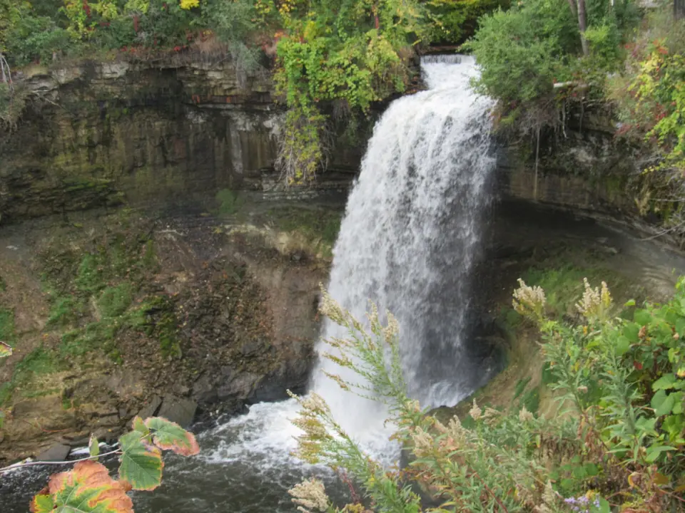
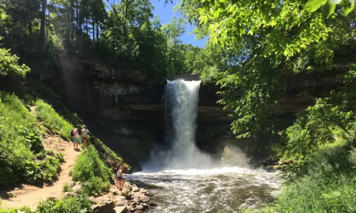
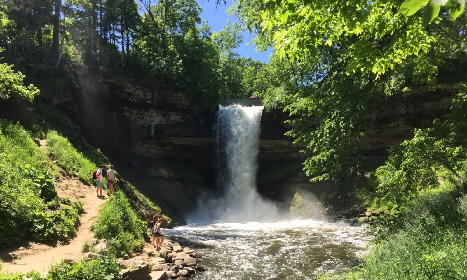
Minnehaha Falls is a 53-foot plunge on Minnehaha Creek inside Minnehaha Regional Park in Minneapolis. Entry is free, and the park board lists a pay lot, a free lot and on-street kiosks. Developed areas are open 6am to midnight. The north-side viewing area and staircase are open, but the south side has been closed for repairs since at least July 2024 and has no posted reopening date.
About Minnehaha Falls
Minnehaha Creek drops 53 feet about three-quarters of a mile above its mouth at the Mississippi River, according to Wikipedia. Below the falls, the creek winds through the lower glen to reach the river.
The creek starts at Lake Minnetonka and runs about 22 miles east, draining a 181-square-mile watershed. That means the falls depend on rain and snowmelt across a wide area. In droughts the flow can nearly or completely stop, and the falls were reported dry in 2022.
The falls became famous through Henry Wadsworth Longfellow's poem The Song of Hiawatha in 1855. The National Park Service notes that Longfellow never saw them. According to Wikipedia, he drew on written accounts and an 1852 daguerreotype by Alexander Hesler.
MNopedia, the Minnesota Historical Society's encyclopedia, says Minneapolis paid for the falls and the land around them in 1889 as a state park. The state then turned the deed over to the park board. Wikipedia calls it one of the first state parks in the country.
One story shows how much the city values the falls. When Lyndon Johnson and Hubert Humphrey visited on June 28, 1964, during a drought, the city opened fire hydrants upstream to keep water flowing, Wikipedia reports.
Sea Salt Eatery, near the falls, is open seasonally for lunch and dinner, according to MPRB. Check its current season before you plan a meal there.
Getting there and parking
Minnehaha Regional Park is in Minneapolis, near where Minnehaha Creek meets the Mississippi River. The Minneapolis Park & Recreation Board (MPRB) runs the park, and entry is free. The NPS lists the address as 4801 S Minnehaha Drive, Minneapolis, MN 55417.
MPRB lists park hours of 6am to midnight in developed areas and 6am to 10pm in undeveloped areas.
Parking rates and lots
MPRB says a pay parking lot, a free parking lot and on-street parking kiosks are available. It doesn't publish the hourly rate online, so check the pay station or posted signs when you arrive.
If you visit often, MPRB's annual patron parking permit costs $50, or $40 for ages 62 and older. It is valid at the Minnehaha lots MPRB lists as 50th St, 52nd St, 53rd St, Dog Park, Main, North and South. The Main lot has 96 spaces.
Light rail
The METRO Blue Line stops at 50th St/Minnehaha Park station, across Hiawatha Avenue on the west side of the park, the Minnesota Historical Society says. Taking the train saves you the parking search on busy days.
Map and nearby falls
Map loads as you scroll. Open in OpenStreetMap
OpenPartly open / seasonalUnconfirmedClosedLarger map
The walk and the Lower Glen Trail
There is no long hike to the falls. The viewing areas above the falls are a short walk from the park's lots, but MPRB doesn't publish a walking distance.
North and south viewing areas
In July 2024, MPRB said the north-side viewing area and staircase remain open and are not part of the repair project. The south-side access and viewing areas were closed after erosion left stairs and walls unsafe.
MPRB's project page had anticipated initial construction in 2025 and, as listed Oct 2026, still shows the design phase with no reopening date. Plan on the north side and check the project page before you go.
Lower Glen Trail
Below the falls, Minnehaha Creek winds about three-quarters of a mile through the lower glen to the Mississippi River. Wikipedia puts the Lower Glen Trail loop at about 2.1 miles. The park closes the staircases in winter for safety, according to Wikipedia, so follow posted signs and fencing.
Dogs and the off-leash area
MPRB allows dogs on a leash. It says the park's off-leash area is in the process of being decommissioned. FOX 9 reported that on June 17, 2026, the park board voted, with all but one member in favor, to close it by December 31, 2026.
Board members cited the land's status as a sacred Dakota site, FOX 9 reported.
When to visit
Flow depends on rain and snowmelt across the creek's large watershed. USGS records for Minnehaha Creek at Hiawatha Avenue (2006 to 2025) show the highest average flows in May and June and the lowest in January and February.
In droughts the falls can nearly or completely dry up. If you are coming mainly for the water, check recent rainfall first.
Winter ice
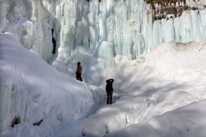
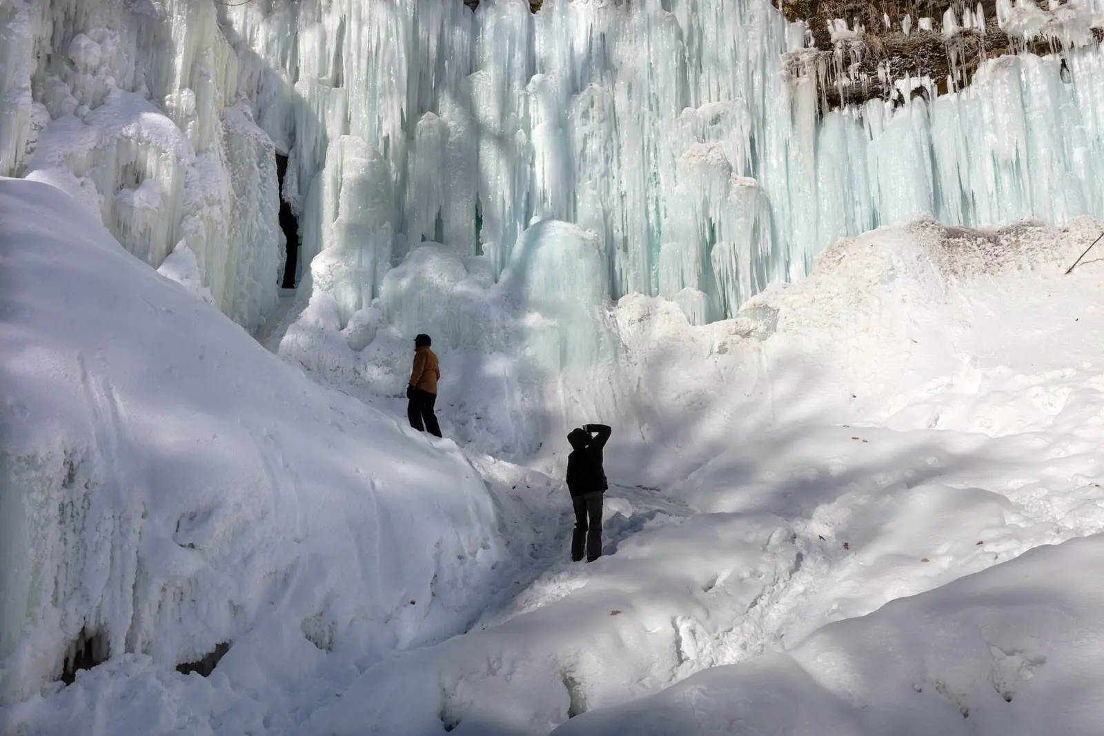
In extreme cold the falls freeze into a tall column of ice that can last into spring, Wikipedia notes. Staircases close in winter, so you will view the ice from the upper areas. For other falls that freeze and the rules at each, see our frozen waterfalls guide.
The park is very busy. Wikipedia cites an estimate of about 2.3 million visits to Minnehaha Park in 2024. With that many visitors, allow extra time for parking, or take the light rail.
For another Midwest falls with a big ice season, see Tahquamenon Falls in Michigan's Upper Peninsula.
When is the water highest?
At a USGS stream gauge right by the falls, the flow averages highest in June and lowest in February, based on 18 complete years of records between 2006 and 2025.
Show the numbers
| Month | Average flow (cfs) |
|---|---|
| January | 6.7 |
| February | 5.4 |
| March | 22 |
| April | 60 |
| May | 106 |
| June | 116 |
| July | 98 |
| August | 80 |
| September | 55 |
| October | 49 |
| November | 29 |
| December | 16 |
| Height | 53 ftNote: single plunge, per Wikipedia |
|---|---|
| Trail | Short walk from the park's lots to the viewing areas above the falls; the Lower Glen Trail loop is about 2.1 mi (Wikipedia) |
| Difficulty | Easy |
| Entry fee | Free entry to the park; a pay lot, a free lot and on-street parking kiosks (MPRB) |
| Permit / reservation | None needed |
| Parking | Pay lot, free lot and street kiosks; rate posted at the pay station |
| Hours / season | 6am to midnight in developed areas, 6am to 10pm in undeveloped areas (MPRB) |
| Dogs | Allowed on a leash; the off-leash dog area is being decommissioned (MPRB), and the board voted to close it by the end of 2026 (FOX 9) |
| Walk behind the falls | No |
| Best time to visit | Wet periods for flow; extreme cold for the ice column. The falls can nearly or completely dry up in drought. |
| Crowds | Very high: about 2.3 million park visits in 2024 (estimate cited on Wikipedia) |
| Managed by | Minneapolis Park & Recreation Board (Minnehaha Regional Park) |
Safety and swimming
Stay out of closed areas. The south-side viewing areas and stairs have been closed since at least July 2024, and MPRB posts no reopening date. Do not go around fences or barricades, even if the area looks fine.
We could not confirm the park board's rules on wading in Minnehaha Creek, so check posted signs or ask the park before you step into the water. Wet rock can be slippery, and winter ice makes paths and edges dangerous. Keep children close at the railings.
Conditions change: confirm closures with the Minneapolis Park & Recreation Board before you go.
For general tips, see our waterfall safety page.
Where to stay near Minnehaha Falls
Compare hotels, cabins and rentals close to the falls around Minneapolis.
See places to stay nearbyAffiliate link: we may earn a commission at no cost to you. Partners do not see or change our waterfall facts. Disclosure.
Photos


Minnehaha Falls FAQ
How tall is Minnehaha Falls?
Minnehaha Falls drops about 53 feet on Minnehaha Creek, according to Wikipedia. It sits about three-quarters of a mile above the creek's mouth at the Mississippi River.
Is Minnehaha Falls free?
Yes, entry to Minnehaha Regional Park is free. MPRB lists a pay lot, a free lot and on-street parking kiosks, so you can visit without paying anything if you find a free space.
How much does it cost to park at Minnehaha Falls?
MPRB doesn't publish the hourly rate online, so check the pay station. A free lot is also available. MPRB's annual patron permit costs $50, or $40 for ages 62 and older, and covers the Minnehaha lots.
What are Minnehaha Falls hours?
MPRB lists 6am to midnight in developed areas and 6am to 10pm in undeveloped areas. Staircases close in winter for safety.
Is Minnehaha Falls open right now?
The park is open, and MPRB says the north-side viewing area and staircase remain open. The south-side viewing areas and stairs have been closed for repairs since at least July 2024. MPRB's project page shows no reopening date, so check it before you go.
How long is the walk to Minnehaha Falls?
Short. The viewing areas are a short walk from the park's lots, though MPRB doesn't publish a distance. The Blue Line's 50th St/Minnehaha Park station sits across Hiawatha Avenue on the park's west side (Minnesota Historical Society).
Does Minnehaha Falls freeze in winter?
Yes. In extreme cold the falls freeze into an ice column that can last into spring, Wikipedia notes. The park closes staircases in winter for safety, so expect to view the ice from above.
Does Minnehaha Falls ever dry up?
It can. In droughts the falls can nearly or completely dry up, and they were reported dry in 2022, according to Wikipedia.
Nearby waterfalls
No other waterfalls within 75 miles are on the site yet.
More waterfalls to explore
 Gooseberry FallsMinnesota · 175 mi straight-lineOpen
 Devil's KettleMinnesota · 251 mi straight-lineOpen50FT
 Falls ParkSouth Dakota · 198 mi straight-lineOpen100FT
On these lists: Dog-friendly waterfalls
Sources
- MPRB: Minnehaha Regional Park (hours, parking, off-leash area, Sea Salt; read Oct 28, 2026)
- MPRB: Annual patron parking permit
- MPRB: Minnehaha Regional Park infrastructure improvements (project page)
- MPRB bulletin: project to repair Minnehaha Falls viewing area
- FOX 9: Minneapolis park board votes to close Minnehaha off-leash dog park (Jun 17, 2026)
- Minnesota Historical Society: Minnehaha Depot directions and parking
- NPS: Minnehaha Falls Regional Park
- MNopedia: Minnehaha Falls
- USGS 05289800: Minnehaha Creek at Hiawatha Ave, Minneapolis (monthly mean flow)
- Wikipedia: Minnehaha Park
- Wikipedia: Minnehaha Falls Lower Glen Trail (2.1-mile loop; winter staircase closures)
Last verified Oct 28, 2026 by The Waterfall Guide editorial team. Conditions change: confirm with Minneapolis Park & Recreation Board (Minnehaha Regional Park) before you go. Spotted something out of date? Report a correction.