Right now
Right now as of Oct 28, 2026
- Permit Minnesota state park vehicle permit.
Status note (Oct 28, 2026): Open. The DNR alerts tab (updated June 3, 2026) posts no closure for the park or the Devil's Kettle Trail. It says the Superior Hiking Trail north of the kettle has high water and flood damage, and day hikes there are not recommended. The campground is closed from mid-October to early May. What the status labels mean
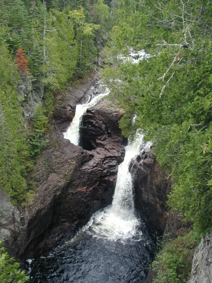
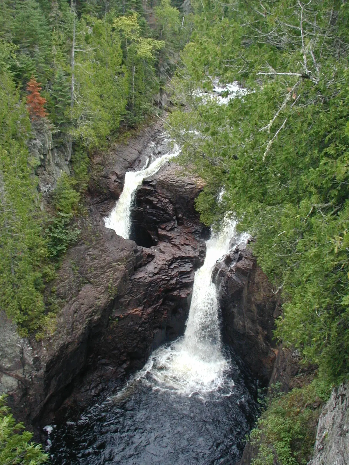
Devil's Kettle is a split waterfall on the Brule River in Judge C.R. Magney State Park, near Grand Marais in Cook County, Minnesota. One channel drops about 50 feet into a pool, and the other pours into a deep pothole. The MN DNR map lists the trail at 1 mile one way with about 175 stairs. The park is open daily from 8am to 10pm, and you need a vehicle permit.
About Devil's Kettle
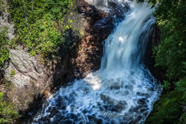
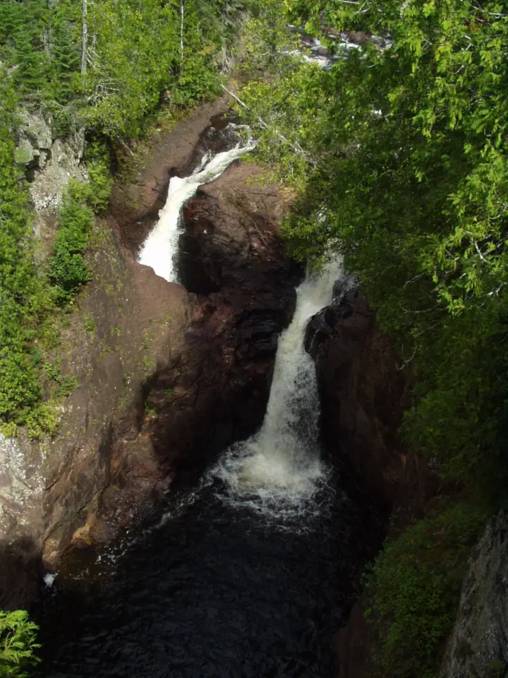
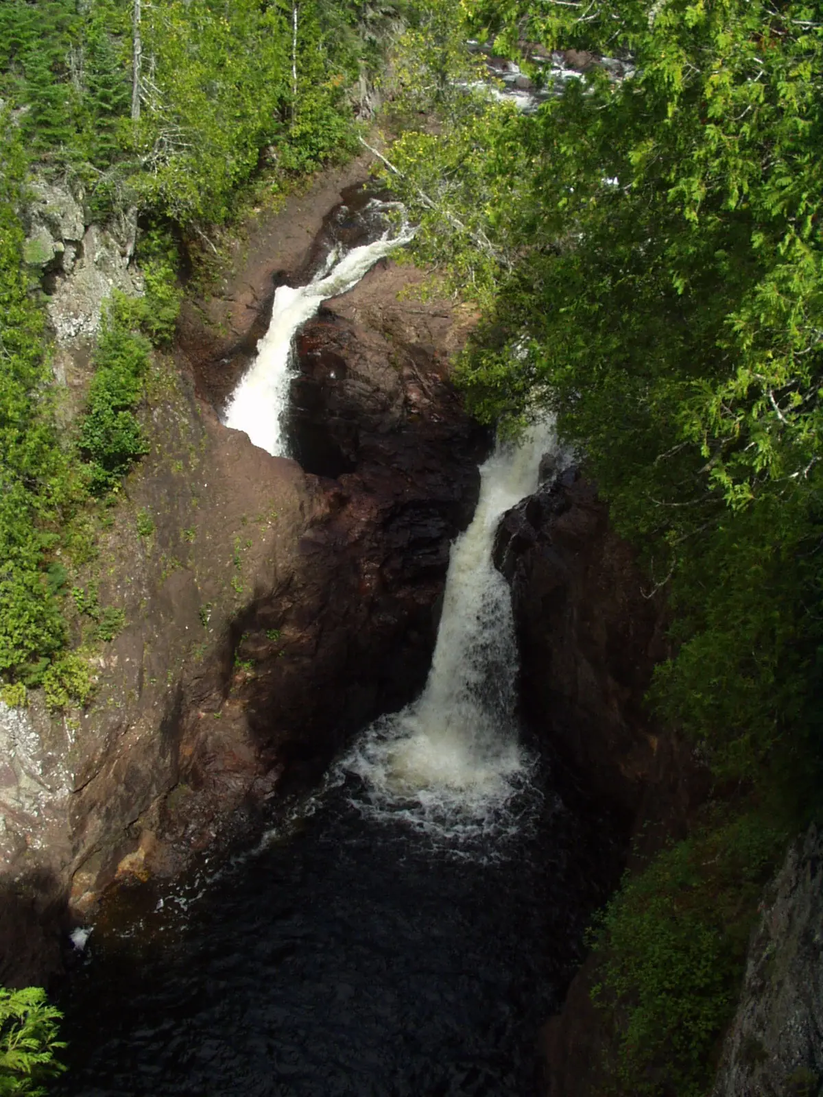
At Devil's Kettle, the Brule River splits in two. Wikipedia says the east channel drops about 50 feet in two steps into a pool. The west channel plunges into a deep pothole, the kettle itself.
Did scientists solve the mystery?
For years, people wondered where the water in the kettle went. In fall 2016, Minnesota DNR hydrologists measured the river's flow above and below the falls to find out.
The DNR hydrologists recorded 123 cubic feet per second above the falls and 121 below. The DNR called those readings "essentially the same" within the tolerance of the equipment.
DNR hydrologist Jeff Green said the readings show no water is lost below the kettle. He said this confirms that the water resurges into the Brule River just downstream. The DNR announced the results on Feb 28, 2017.
Green and Calvin Alexander of the University of Minnesota had planned a dye trace for fall 2017. Wikipedia says the DNR later decided the test was not scientifically necessary, so it was never completed.
How deep is the kettle?
No measured depth has been published that we could find. The DNR describes half the river plunging 50 feet into a pool and the rest pouring into a massive pothole, but it gives no depth for the pothole.
About the park
The Brule River drops about 800 feet in its last 8 miles through the park, according to Wikipedia. Devil's Kettle sits about 1.5 miles above the river mouth.
The park highlights trout fishing, camping, hiking, picnicking, wildlife watching and the Superior Hiking Trail. Fishing in the Brule needs a license and a trout stamp, the DNR map says.
Getting there and parking
The Devil's Kettle Trail starts at the Judge C.R. Magney State Park day-use lot on MN-61, which the DNR map marks 14 miles from Grand Marais. A state park vehicle permit is required.
From Grand Marais on MN-61
The park address is 4051 East Highway 61, Grand Marais, MN 55604. The DNR park map marks Grand Marais 14 miles away and Hovland 5 miles away along MN-61.
The map shows the trailhead lot west of the Brule River on the north side of MN-61, with a pay station and toilets. The trail crosses the river on a footbridge from the lot.
The DNR says the picnic area that was in the day-use lot has been combined with the one across the bridge, toward the Devil's Kettle Trail. WiFi hotspots are at the ranger station, the campground and the day-use lot.
Vehicle permit
Every vehicle needs a Minnesota state park permit. You can buy one online, at the park or before you arrive, the DNR says, and the map points to the pay station at the trailhead.
Minn. Stat. 85.055 sets $7 for one day and $35 for a year-round permit. The full price list is in the box above.
There is no office at the park. Staff are on duty daily from 8am to 4pm from Memorial Day through Labor Day. The rest of the year, the DNR says to contact Cascade River State Park at 218-387-6000. The park phone is 218-387-6300.
Judge C.R. Magney Campground
The park's campground has 27 drive-in campsites, according to the DNR map. Reserve at 866-857-2757 or through the DNR reservation site.
The campground closes, and no services are available, from mid-October to early May. Gathering firewood is against state park rules because it can spread tree-killing insects. Buy firewood at the ranger station or through Yodel.
Map and nearby falls
Map loads as you scroll. Open in OpenStreetMap
OpenPartly open / seasonalUnconfirmedClosedLarger map
Devil's Kettle Trail and the stairs
The Devil's Kettle Trail follows the Brule River. The DNR park map lists it at 1 mile one way, so plan on about 2 miles round trip. The DNR suggests budgeting 1.5 to 2 hours.
Along the way you pass the Upper Falls, 0.71 miles from the trailhead, according to the map. The DNR describes steep terrain, rocky sections and a long, steep stairway of about 175 steps.
Other sources give different numbers. Wikipedia says the trail is 1.1 miles with nearly 200 stairs. Fox 9 quoted the DNR as saying hikers climb nearly 400 feet.
The DNR map warns that the hike can be strenuous because of the elevation changes and the stairway. It is not a wheelchair route. Because it is an out-and-back trail, you cover the stairs in both directions.
The park has about 9 miles of trails in total, Wikipedia says. The DNR says the Devil's Kettle Trail won first place for best hiking trail in the country in the USA Today 10Best Readers' Choice Awards.
North of the kettle, the Superior Hiking Trail continues upriver. The DNR said in June 2026 that this riverside section has high water and some flood damage, and day hikes there are not recommended.
When to visit
The park is open daily from 8am to 10pm, and the trails are open year-round for day use, the DNR says.
In winter the park is minimally staffed, and the entrance road may not be plowed right after a snowfall. The campground is closed from mid-October to early May.
We found no official best season for flow and no DNR crowd figures.
For another Minnesota falls with a short walk from the lots, see Minnehaha Falls in Minneapolis, though its status is unconfirmed while south-side viewing areas are under repair. In Michigan's Upper Peninsula, Bond Falls has an accessible boardwalk, but its vehicle season usually ends in mid-October.
| Height | 50 ftNote: east channel, in two steps into a pool, per Wikipedia and a DNR virtual tour; the west channel pours into the pothole |
|---|---|
| Trail | Devil's Kettle Trail: 1 mi one way (2 mi round trip) with about 175 stairs, per the MN DNR map; Wikipedia says 1.1 mi and nearly 200 stairs |
| Difficulty | Can be strenuous: elevation changes and a long, steep stairway (MN DNR) |
| Time needed | 1.5 to 2 hours (MN DNR map) |
| Entry fee | Minnesota state park vehicle permit: $7 one-day or $35 year-round (MN DNR, 2026) |
| Permit / reservation | Minnesota state park vehicle permit ($7 one-day, $35 year-round in 2026) |
| Parking | Trailhead lot off MN-61; vehicle permit required |
| Hours / season | Park open daily 8am to 10pm; trails open year-round for day use (MN DNR) |
| Dogs | Allowed on a 6-ft leash, attended at all times; not in buildings or at beaches (MN DNR map) |
| Wheelchair / stroller | No: the trail has a long, steep stairway (MN DNR) |
| Walk behind the falls | No |
| Managed by | Minnesota DNR, Judge C.R. Magney State Park |
Safety and swimming
We could not find an MN DNR rule on swimming or wading at Devil's Kettle. Check posted signs, and stay out of the river near the falls and the kettle.
The hazards the DNR lists are the steep terrain, rocky sections and the long stairway. Wear sturdy shoes, take breaks on the climb, and turn back if anyone in your group is struggling.
Stay on the trail, and do not leave it to get a closer look at the pothole. Skip the riverside Superior Hiking Trail section north of the kettle while the DNR advises against day hikes there.
Conditions change: confirm trail status and permit prices with the Minnesota DNR before you go.
For general tips, see our waterfall safety page.
Where to stay near Devil's Kettle
Compare hotels, cabins and rentals close to the falls around Grand Marais.
See places to stay nearbyAffiliate link: we may earn a commission at no cost to you. Partners do not see or change our waterfall facts. Disclosure.
Photos


Devil's Kettle FAQ
Is the Devil's Kettle Trail open?
Yes. The DNR alerts tab (updated June 3, 2026) posts no closure for the park or the trail, and the park is open daily from 8am to 10pm. The DNR advises against day hikes on the flood-damaged Superior Hiking Trail section north of the kettle.
Is the Devil's Kettle real?
Yes. Devil's Kettle is a pothole on the west channel of the Brule River in Judge C.R. Magney State Park, Minnesota. The DNR map describes half the river plunging 50 feet into a pool and the rest pouring into a massive pothole. DNR flow readings in 2016 showed the water rejoins the river just downstream.
Where does the water in Devil's Kettle go?
It rejoins the Brule River just below the falls, according to the MN DNR. In fall 2016, DNR hydrologists measured 123 cubic feet per second above the falls and 121 below, which the DNR called essentially the same.
How long is the hike to Devil's Kettle?
The DNR map lists the trail at 1 mile one way, about 2 miles round trip. The DNR suggests allowing 1.5 to 2 hours. Wikipedia gives 1.1 miles.
How many stairs are on the Devil's Kettle trail?
About 175, according to the DNR park map. Wikipedia says nearly 200.
Do you need a permit for Judge C.R. Magney State Park?
Yes, a Minnesota state park vehicle permit. Minn. Stat. 85.055 sets $7 for one day or $35 for a year-round permit. You can buy one online, at the park or at the trailhead pay station.
Was the Devil's Kettle dye test ever done?
No. DNR hydrologist Jeff Green and Calvin Alexander of the University of Minnesota planned a dye trace for fall 2017. Wikipedia says the DNR later decided it was not scientifically necessary.
Is the Devil's Kettle trail hard?
The DNR says it can be strenuous, with elevation changes, rocky sections and a long, steep stairway. Fox 9 quoted the DNR as saying hikers climb nearly 400 feet.
Nearby waterfalls
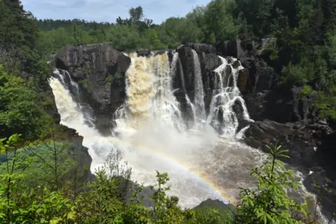 High Falls24 mi straight-line, by our mathOpen120FT
 Hidden Falls43 mi straight-line, by our mathOpen
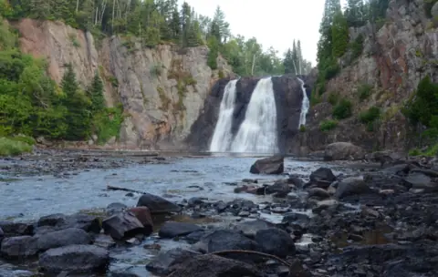 High Falls63 mi straight-line, by our mathPartly open63FT
On these lists: Dog-friendly waterfalls
Sources
Some facts credited to the Minnesota DNR come from search-result excerpts of its official pages. Confirm fees and rules on the official site.
- MN DNR press release: Hydrologists solve mystery of Devil's Kettle waterfall (Feb 28, 2017)
- MN DNR: Judge C.R. Magney State Park map and guide (PDF, Dec 2025)
- MN DNR: Judge C.R. Magney State Park and alerts (page modified Oct 7, 2026; alerts updated June 3, 2026; read Oct 28, 2026)
- MN DNR: State park vehicle permit
- Minnesota Statutes 85.055: State park fees
- MN DNR Minnesota Conservation Volunteer: Devil's Kettle mystery (Mar-Apr 2017)
- Fox 9: Devil's Kettle Trail recognized as top hiking trail (2026)
- Wikipedia: Judge C. R. Magney State Park
- OpenStreetMap: Devil's Kettle map location
Last verified Oct 28, 2026 by The Waterfall Guide editorial team. Conditions change: confirm with Minnesota DNR, Judge C.R. Magney State Park before you go. Spotted something out of date? Report a correction.