Right now
Status note (Oct 29, 2026): Open, as far as we can tell: on October 29, 2026, the DNR alerts tab (updated July 29, 2026) listed no trail closure. It noted construction near the historic buildings and the closed lower shower building. News outlets reported that April 2026 flooding closed the riverside trails, and the DNR has posted no closure since. Call 218-595-7100 before you go. What the status labels mean
Gooseberry Falls is a chain of waterfalls in Gooseberry Falls State Park, on Highway 61 about 13 miles northeast of Two Harbors. The DNR says the Visitor Center lots need no vehicle permit. A paved path reaches the Middle Falls in about 0.1 mile. News outlets reported that April 2026 flooding closed the riverside trails. On October 29, 2026, the DNR alerts tab (updated July 29, 2026) listed no trail closure. Call 218-595-7100 before you go.
About Gooseberry Falls
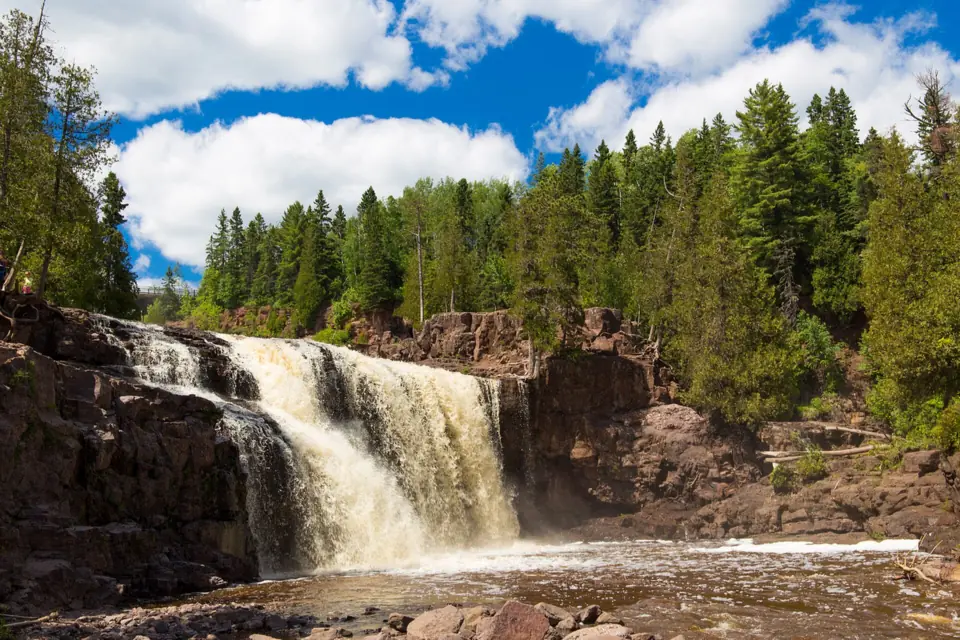
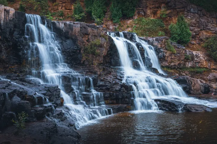
Gooseberry Falls is a run of waterfalls on the Gooseberry River, along Lake Superior's North Shore. The tiers are usually called the Upper, Middle and Lower Falls, and Fifth Falls lies farther upstream. Some sources call the Middle Falls the Main Falls.
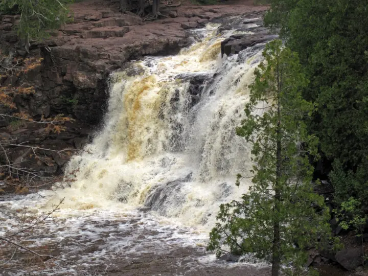
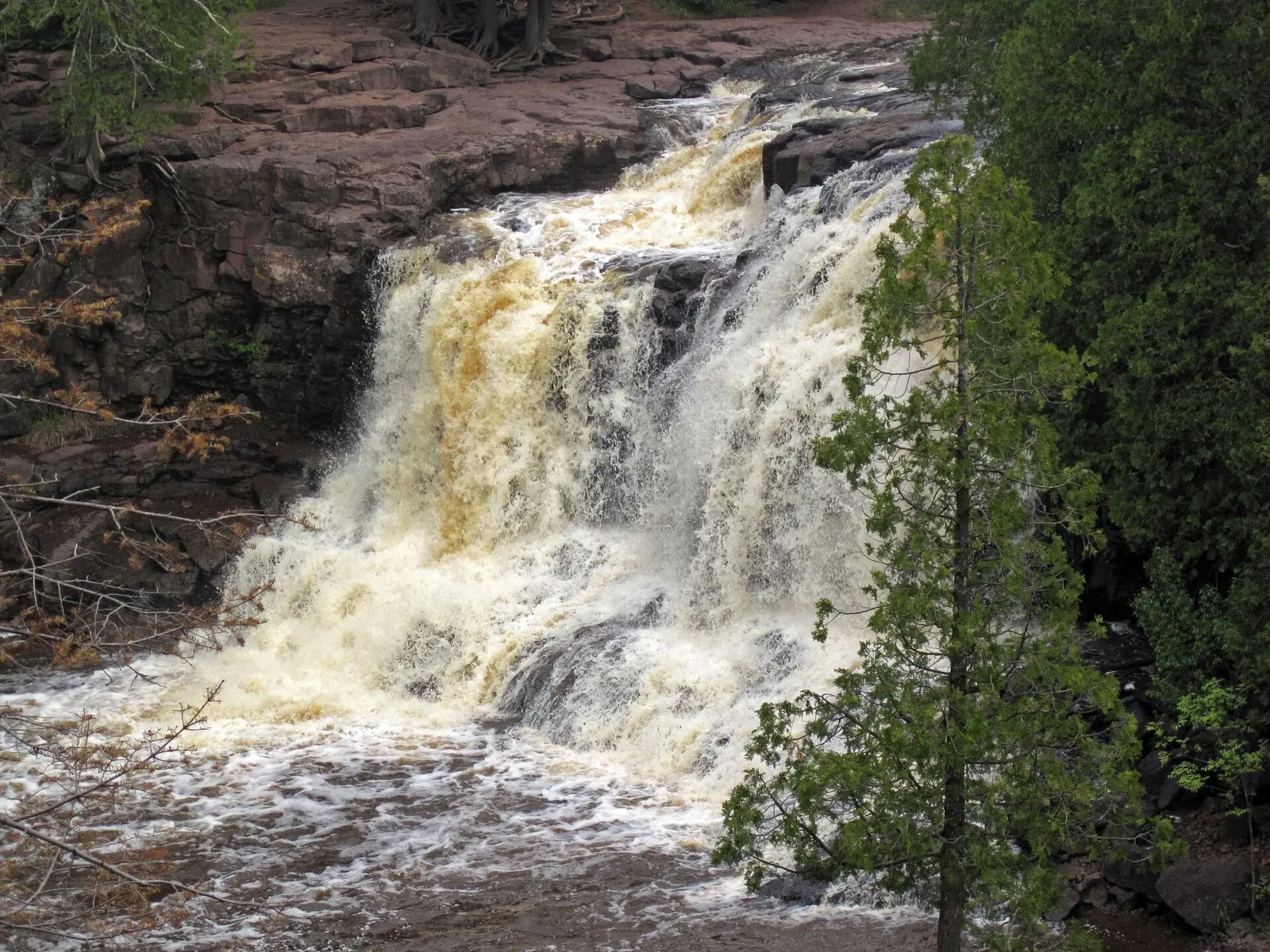
Wikipedia says the Gooseberry River cuts through at least 19 North Shore lava flows, dropping over basalt roughly 1.1 billion years old. Tannins give the water its tea color.
According to Wikipedia, preservation of the site was authorized in 1933, and it became a state park in 1937. The Civilian Conservation Corps built the park's basalt stone structures between 1934 and 1941. The Joseph N. Alexander Visitor Center opened in 1996.
The park covers 1,687 acres, Wikipedia says. The DNR lists 20 miles of hiking trail, and the park links to the Superior Hiking Trail and the paved Gitchi-Gami State Trail.
We found no official height for any of the falls. Per-tier figures you may see online are estimates we could not confirm, so this page lists none.
Getting there and parking
Gooseberry Falls State Park sits on Highway 61 about 13 miles northeast of Two Harbors, according to Wikipedia. North Shore Visitor and CBS Minnesota put it about 39 to 40 miles northeast of Duluth. North Shore Visitor lists the Visitor Center address as 3206 MN-61, Two Harbors.
Park in the Visitor Center lots, which North Shore Visitor says are the closest to the falls and have 2 free EV chargers. The DNR's park map says permits are required in the park except at this Visitor Center and DOT Wayside lot. The DNR says parking for longer than two hours is not always available at the Visitor Center lots.
Driving to the lakeshore or the Picnic Flow areas needs a Minnesota state park vehicle permit. State law prices it at $7 for a day or $35 for a year, and we found no 2026 change to those amounts.
The Directions button goes to the Visitor Center lot. The map pin marks the Middle Falls from OpenStreetMap community data, which is approximate; we could not confirm official coordinates.
Planning more stops? Our guide to waterfalls in Minnesota brings the state's pages together. Devil's Kettle, in Judge C.R. Magney State Park near Grand Marais, needs the state park vehicle permit. Minnehaha Falls, in a Minneapolis city park, has free entry and pay parking. We list Devil's Kettle as open and Minnehaha Falls as status unconfirmed, so check each page before you go.
Two more North Shore state parks have falls. Explore Minnesota describes a 20-foot waterfall on the Split Rock River, on the Superior Hiking Trail section in Split Rock Lighthouse State Park. North Shore Visitor's mileposts place the High Falls of the Baptism River, in Tettegouche State Park, farther along Highway 61.
MPR reported in April 2026 that flooding washed out the bottom of the High Falls viewing steps. We could not confirm whether they have been repaired.
Camping at Gooseberry Falls State Park
You can camp at Gooseberry Falls State Park year-round. The DNR's seasonal update says the park has 69 non-electric sites, plus three group campsites in snow-free months. Reserve at mndnr.gov/reservations or call 866-857-2757.
After snowfall, every site except 42-44 is walk- or ski-in only, because campground roads aren't plowed. Stop at the Visitor Center to arrange camping at an unplowed site. The DNR park map sets campground quiet hours from 10 p.m. to 8 a.m., when only registered campers may be in the campground.
The DNR's camping page lists 3 pull-through sites and a 40-foot RV limit. That length runs from the front of the tow vehicle to the rear of the towed vehicle. Four drive-in sites are accessible, and two of them are near the restrooms.
The three group campsites are tents only, and each holds up to 50 people. Nestor Grade is the accessible group camp. One kayak site is first-come, first-served, and it's only for paddlers arriving on the Lake Superior State Water Trail.
Statewide MN DNR rules also apply. Every Minnesota state park campsite needs a reservation. You can book up to 120 days before you arrive, online or at 866-857-2757. The reservation fee is $8 online or $10 by phone, and it's nonrefundable. There's no fee for a same-day reservation. Campers still need a state park vehicle permit.
The DNR alerts tab (updated July 29, 2026) says the lower campground shower building is closed for construction through the end of the season. Campers may use the showers in the upper campground. An earlier DNR alert said the closure includes the lower building's flush toilets and picnic shelter. WDIO and FOX 9 also reported the closure for the 2026 season.
In a normal year, the DNR says, the shower buildings open the first week of May. The Upper building stays open through the third weekend in October. The DNR says water is turned off and the shower building closes in late October. Other water facilities close early in October.
The dump station is usually open from the first week of May to mid-October; the DNR asks non-campers to use the Two Harbors or Silver Bay stations. By that normal-year schedule, the upper building may already be closed for 2026; we could not confirm its 2026 closing date.
Map and nearby falls
Map loads as you scroll. Open in OpenStreetMap
OpenPartly open / seasonalUnconfirmedClosedLarger map
The hike
The shortest walk at Gooseberry Falls is a paved, accessible path of about 0.1 mile from the Visitor Center to the Middle Falls, per North Shore Visitor. The same source puts the loop to the Upper and Middle Falls, which passes under Highway 61, at about 0.5 mile in total. No single round-trip figure covers every tier.
The DNR's Waterfalls Walk is the short route to the Middle and Upper Falls. A search excerpt of the DNR's self-guided tour says it is ADA accessible if you take the ADA segment instead of the stairs. The DNR map also lists a longer 1-mile Falls Loop Trail. Explore Minnesota's description of the Falls View Loop says it adds the Lower Falls and is not ADA accessible.
The DNR's seasonal update says the park has 20 miles of hiking trail. Those 20 miles include 1 mile of wheelchair-accessible trail in total, starting at the Visitor Center and reaching the main falls area. Park trails connect with the Superior Hiking Trail.
For a longer outing, the DNR map lists the River View Trail at 1.25 miles one way. It runs past the falls and downstream to the river mouth and the Picnic Flow Area. The map calls the Fifth Falls Trail a rugged 2-mile loop up the river, and it invites you to stop and wade along the way. Some other sites give longer figures for that loop, so treat 2 miles as the DNR's number.
We could not confirm elevation gain or walking times for any of these routes. News outlets reported that April 2026 flooding closed all trails beside the river. On October 29, 2026, the DNR alerts tab (updated July 29, 2026) listed no trail closure. It warned that contractors are working on the historic buildings, and construction vehicles may be on or beside trails there. Check the DNR alerts or call 218-595-7100 before you go, even for the paved walk.
If you're riding, the DNR map says the paved Gitchi-Gami State Trail runs 8 miles one way from the Picnic Flow Trailhead to Split Rock Lighthouse State Park.
When to visit
Gooseberry Falls State Park is open year-round, according to Wikipedia and the DNR's Minnesota Conservation Volunteer magazine.
We found no official best month for flow. CBS Minnesota quoted the DNR describing the falls at "their spring high level" in April 2026, during the snowmelt.
The DNR's park map lists park hours of 8 a.m. to 10 p.m. daily. The map says the DOT Wayside at the Visitor Center lot stays open 24 hours, and North Shore Visitor says the same of the wayside restrooms. The DNR's seasonal update says the Visitor Center is open daily from 9 a.m. to 4 p.m.
The DNR says Gooseberry was Minnesota's most-visited state park in 7 of the last 10 years, averaging more than 760,000 visitors a year. In May 2026 the DNR announced that the park had won USA Today's 10Best Readers' Choice award for best US state park.
Winter brings frozen falls in long cold spells. The DNR says the only maintained winter walking trail goes to the Upper Falls, and lower paths can be icy, so cleats are recommended. The DNR's seasonal update lists half a mile of winter hiking trail. Snowshoeing is allowed anywhere except on groomed ski trails.
The DNR's seasonal update also lists 12 miles of groomed cross-country ski trail, including one large loop of about 1 mile for skate skiing. The update lists 2 miles of snowmobile access trail as well. North Shore Visitor says skiers need a Minnesota Ski Pass. The DNR states, "Fat bikes are not allowed at this park."
| Trail | Visitor Center to Middle Falls about 0.1 mi paved; Upper/Middle loop about 0.5 mi (North Shore Visitor); Fifth Falls Trail 2-mi loop, rugged (DNR) |
|---|---|
| Difficulty | Easy on the paved Waterfalls Walk; the DNR calls the Fifth Falls Trail rugged |
| Entry fee | Free in the Visitor Center lots (MN DNR); lakeshore and Picnic Flow areas need a $7 one-day or $35 year-round permit (Minn. Stat. 85.055) |
| Permit / reservation | Not in the Visitor Center lots, the DNR says; a state park vehicle permit is needed to drive to the lakeshore and Picnic Flow areas |
| Parking | Visitor Center lots; no permit needed (DNR) |
| Hours / season | Park 8 a.m.-10 p.m. daily; DOT Wayside at the Visitor Center lot open 24 hours (DNR park map); Visitor Center 9 a.m.-4 p.m. daily (DNR seasonal update) |
| Dogs | Allowed on a leash no longer than 6 ft, attended at all times; pick up after them (DNR park map). Only service animals in buildings, including the Visitor Center, and on beaches (MN DNR) |
| Swimming | Prohibited at the Upper Falls because of deep pools and strong current (DNR park map). We found no rule for the Middle or Lower Falls; the DNR warns wet rocks below the Middle Falls are slippery and unstable |
| Wheelchair / stroller | Partial: the park has 1 mile of wheelchair-accessible trail in total, starting at the Visitor Center and reaching the main falls area (DNR seasonal update). The paved Waterfalls Walk reaches the Middle and Upper Falls if you use the ADA segment instead of the stairs (per a DNR search excerpt). The Lower Falls and Falls View Loop are not ADA accessible (Explore Minnesota) |
| Walk behind the falls | No |
| Restrooms | Flush toilets year-round in the Visitor Center (wheelchair accessible) and vault toilets year-round throughout the park (DNR seasonal update). North Shore Visitor says the wayside restrooms are open 24/7 |
| Best time to visit | No official best month; the DNR described spring high water in April 2026 (CBS Minnesota) |
| Crowds | Very high: the DNR says it is Minnesota's most-visited state park, averaging more than 760,000 visitors a year |
| Managed by | Minnesota DNR (Parks and Trails) |
Safety and swimming
The DNR park map says swimming is prohibited at the Upper Falls because of deep pools and strong current. It also asks you to keep children close in the falls area, citing slippery rocks, cliffs and crowds.
We found no swimming or wading rule for the Middle or Lower Falls. A search excerpt of the DNR's virtual tour says many visitors cool their feet in the shallow water below the Middle Falls in summer. It warns that the wet rocks there are slippery and unstable.
Stay alert to rising water. Northern News Now reported closure signs along the riverside trails during the April 2026 flood, and the DNR told visitors not to cross flooded trails. Never walk past a closure sign, and stay out of the river at high flow.
Watch for construction vehicles. The DNR alerts tab says contractors are working on the park's historic buildings, and vehicles may be on or alongside trails in those areas.
In winter, stick to the maintained trail to the Upper Falls and wear traction cleats if you go farther. Our waterfall safety guide has more advice on moving water and slick rock.
Conditions change: confirm with the Minnesota DNR before you go.
Where to stay near Gooseberry Falls
Compare hotels, cabins and rentals close to the falls around Two Harbors.
See places to stay nearbyAffiliate link: we may earn a commission at no cost to you. Partners do not see or change our waterfall facts. Disclosure.
Photos

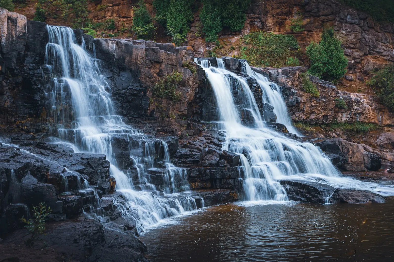

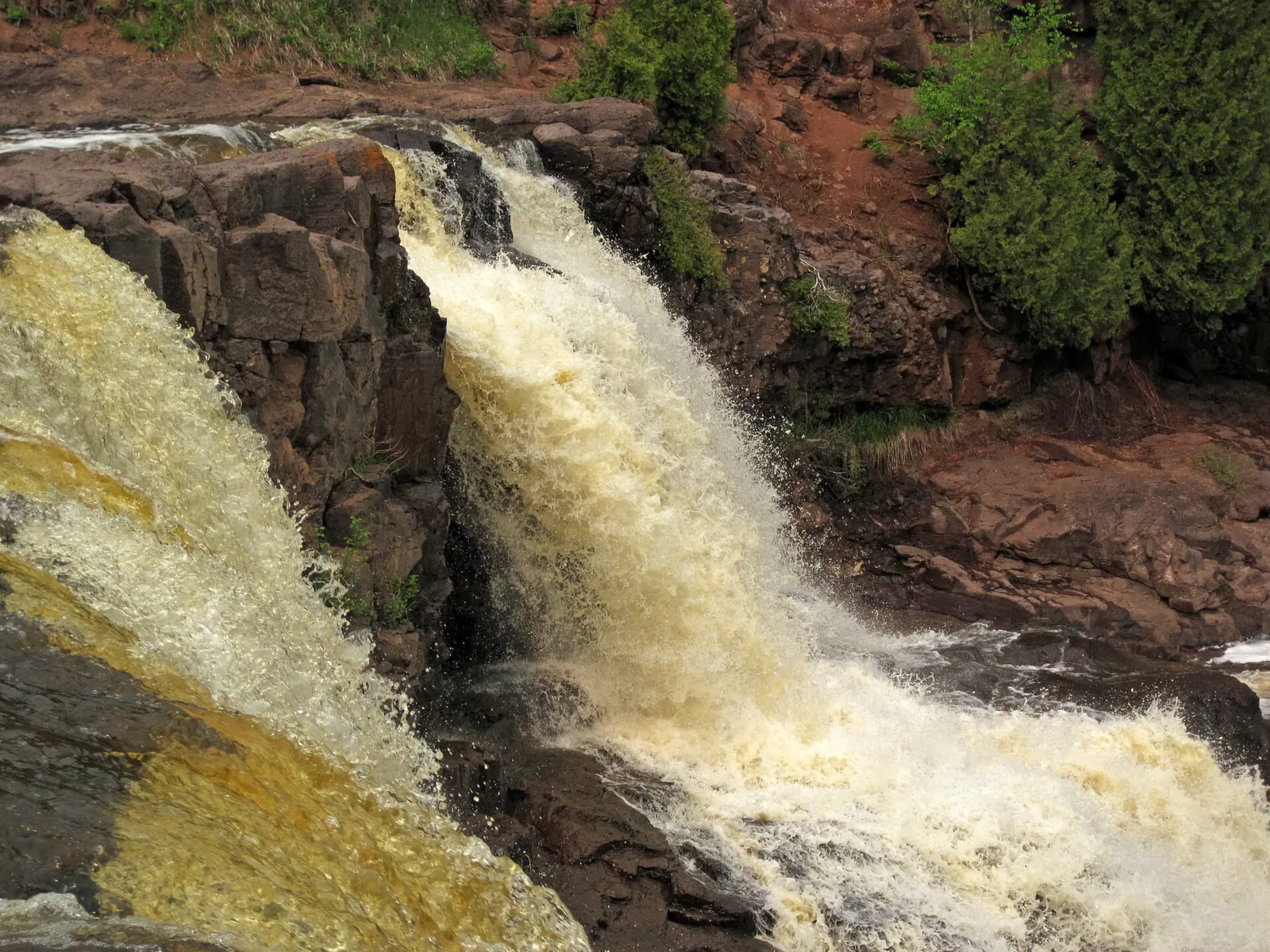

Gooseberry Falls FAQ
Are the trails at Gooseberry Falls open after the 2026 flood?
As far as we can tell, yes. News outlets reported that April 2026 flooding closed all trails beside the Gooseberry River. On October 29, 2026, the DNR alerts tab (updated July 29, 2026) listed no trail closure. We found no report on repairs, so check the alerts tab or call 218-595-7100 before you go.
Do you have to pay to see Gooseberry Falls?
No, not if you park in the Visitor Center lots on Highway 61, where the DNR says no state park vehicle permit is needed. Driving to the lakeshore, the Picnic Flow areas or other park lots needs a permit: $7 for one day or $35 year-round under Minnesota law.
How far is the walk to Gooseberry Falls?
About 0.1 mile to the Middle Falls, on a paved path from the Visitor Center, per North Shore Visitor. The same source puts the Upper and Middle Falls loop at about 0.5 mile. The DNR's Fifth Falls Trail is a rugged 2-mile loop.
Is Gooseberry Falls wheelchair accessible?
Partly. A DNR search excerpt says the Waterfalls Walk to the Middle and Upper Falls is accessible when you use the ADA segment instead of the stairs. Explore Minnesota says the Falls View Loop, which reaches the Lower Falls, is not ADA accessible. The DNR's seasonal update lists 1 mile of wheelchair-accessible trail in total, starting at the Visitor Center.
Can you swim at Gooseberry Falls?
Not at the Upper Falls, where the DNR prohibits swimming because of deep pools and strong current. We found no rule for the Middle or Lower Falls. A search excerpt of the DNR's virtual tour notes that summer visitors cool their feet below the Middle Falls, but it warns of slippery, unstable rocks.
Are dogs allowed at Gooseberry Falls?
Yes, on a leash no longer than 6 feet. You must stay with your dog and pick up after it. The DNR allows only service animals in buildings, including the Visitor Center, and on beaches.
What are Gooseberry Falls State Park hours?
The park is open 8 a.m. to 10 p.m. daily, per the DNR park map. The map says the DOT Wayside at the Visitor Center lot is open 24 hours. The DNR's seasonal update says the Visitor Center is open daily from 9 a.m. to 4 p.m.
Can you camp at Gooseberry Falls, and do you need a reservation?
Yes, year-round. The DNR says the park has 69 sites with no electric hookups, and RVs can be up to 40 feet long. After snowfall, all sites except 42-44 are walk- or ski-in only.
Every Minnesota state park campsite needs a reservation, which you can make up to 120 days ahead online at mndnr.gov/reservations or at 866-857-2757. The DNR alerts tab says the lower campground shower building is closed through the end of the season, and campers may use the upper showers. In a normal year the upper building closes in late October, so check with the park before counting on showers.
Nearby waterfalls
No other waterfalls within 75 miles are on the site yet.
More waterfalls to explore
 Devil's KettleMinnesota · 81 mi straight-lineOpen50FT
 Minnehaha FallsMinnesota · 175 mi straight-lineUnconfirmed53FT
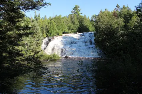 Bond FallsMichigan · 122 mi straight-lineSeasonal50FT
On these lists: Dog-friendly waterfalls · Easy waterfall hikes · Free waterfalls
Sources
Some facts credited to the Minnesota DNR come from search-result excerpts of its official pages. Confirm fees and rules on the official site.
- Minnesota DNR: Gooseberry Falls State Park (park page, read Oct 29, 2026)
- MN DNR: Gooseberry Falls State Park (alerts tab, read Oct 29, 2026)
- MN DNR: Gooseberry Falls State Park (search excerpt)
- MN DNR: Gooseberry Falls Visitor Center (search excerpt)
- MN DNR: Gooseberry Falls State Park, seasonal update (page modified Oct 7, 2026)
- MN DNR: Gooseberry Falls State Park, camping and lodging
- MN DNR: Gooseberry Falls self-guided tour (search excerpt)
- MN DNR: Gooseberry Falls State Park map and guide (summer)
- MN DNR: Gooseberry Falls virtual tour, Middle Falls (search excerpt)
- MN DNR: State park vehicle permit
- MN DNR: State park reservations, common questions
- Minnesota Statutes 85.055: State park fees
- MN DNR: Free entrance days at Minnesota state parks (archived Aug 28, 2026)
- MN DNR news, May 21, 2026: Gooseberry Falls wins Readers' Choice award (archived)
- MN DNR: 2025 Park Access Guide, PDF
- Minnesota Conservation Volunteer (MN DNR), Jan-Feb 2020: Bucket list
- Northern News Now, Apr 24, 2026: Flooding closes trails at Gooseberry Falls State Park
- FOX 9, Apr 24, 2026: Gooseberry flood trail closures and Lower Campground shower rehab
- CBS Minnesota, Apr 27, 2026: Gooseberry Falls trails flooding
- MPR News, Apr 27, 2026: Flooding on Minnesota's North Shore
- WDIO: Gooseberry Falls trails closed and campground shower building
- Explore Minnesota: Best waterfalls in Minnesota
- North Shore Visitor: Gooseberry Falls
- Wikipedia: Gooseberry Falls State Park
- OpenStreetMap: Middle Falls (node 994858729) and Visitor Center parking (way 1506981745)
Last verified Oct 29, 2026 by The Waterfall Guide editorial team. Conditions change: confirm with Minnesota DNR (Parks and Trails) before you go. Spotted something out of date? Report a correction.