Right now
Right now as of Nov 3, 2026
- Permit No permit needed. Entry fee: $5 per vehicle day use.
Status note (Nov 3, 2026): Open, as far as we can tell: on Nov 3, 2026 the BLM Lower Calf Creek Falls Trail page said "Calf Creek is now open!" That notice is dated Sept 27, 2024. The site reopened on Sept 28, 2024, after construction. We found no later closure notice. What the status labels mean
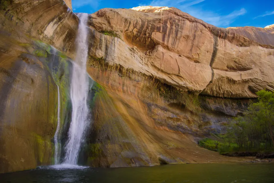
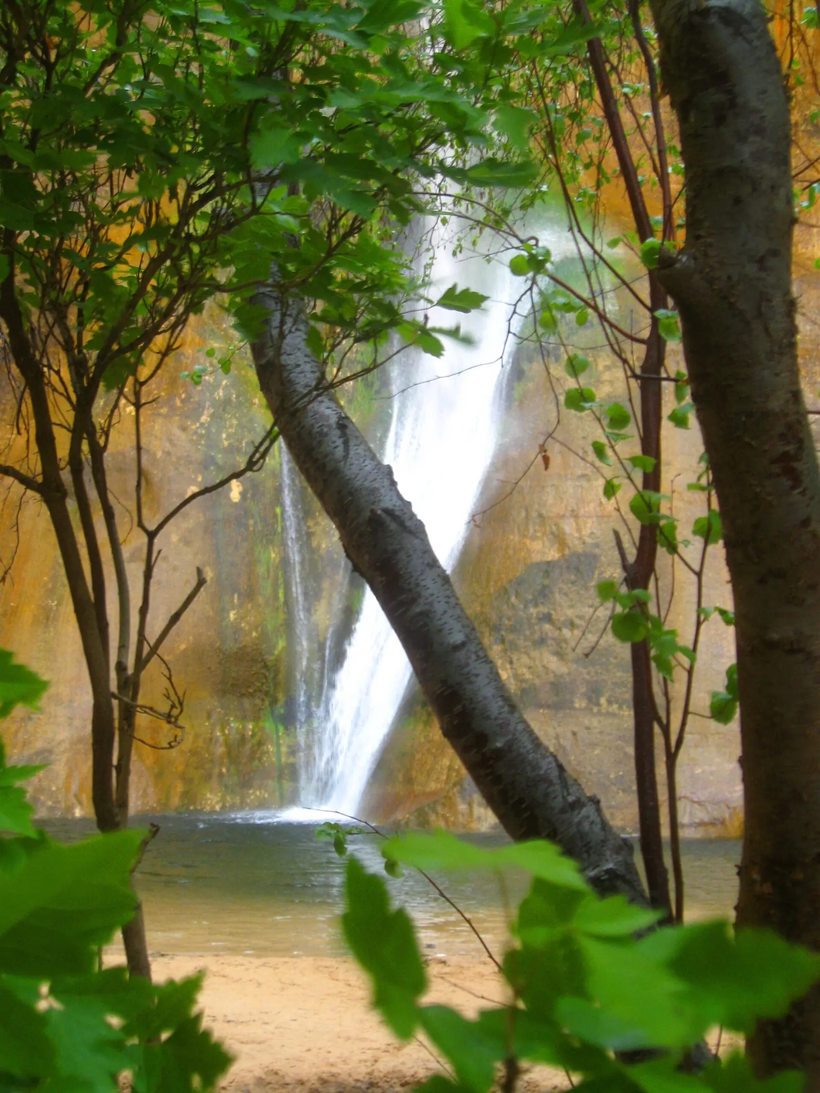
Lower Calf Creek Falls is a 126-foot waterfall in Grand Staircase-Escalante National Monument, per the Bureau of Land Management (BLM), which manages it. The trail is 6.0 miles round trip from Calf Creek Campground on UT 12, BLM says. Hikers pay a $5 day-use fee per vehicle. The site reopened on September 28, 2024, after construction.
About Lower Calf Creek Falls
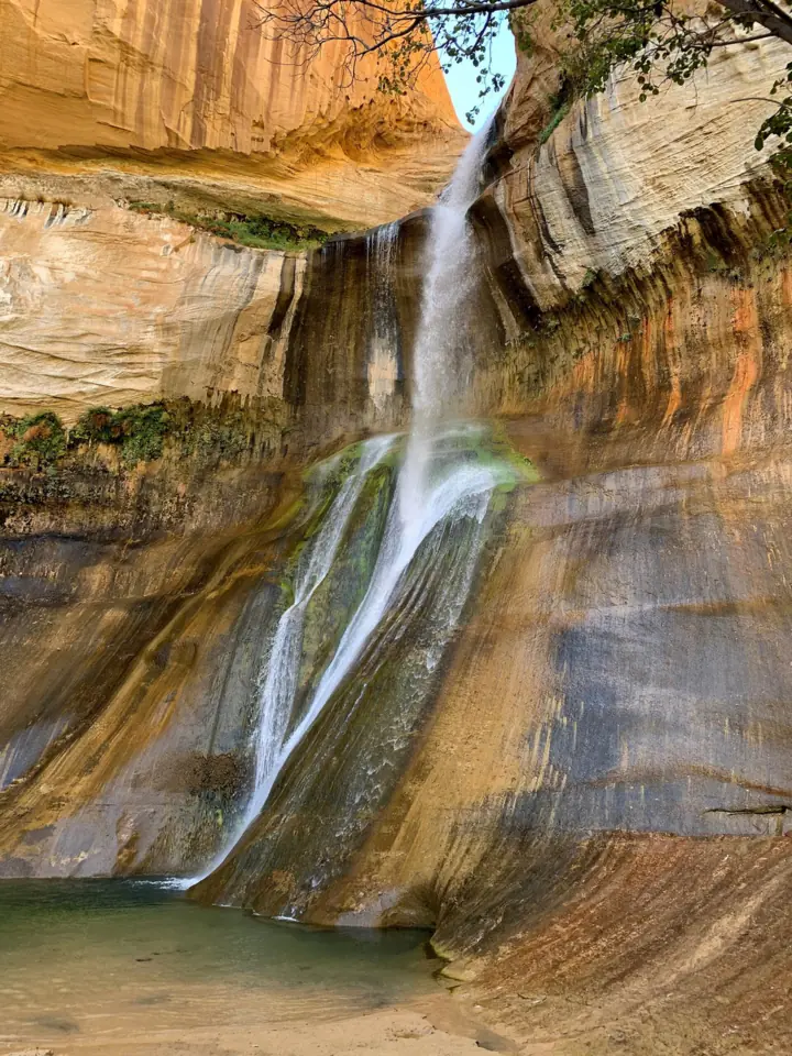
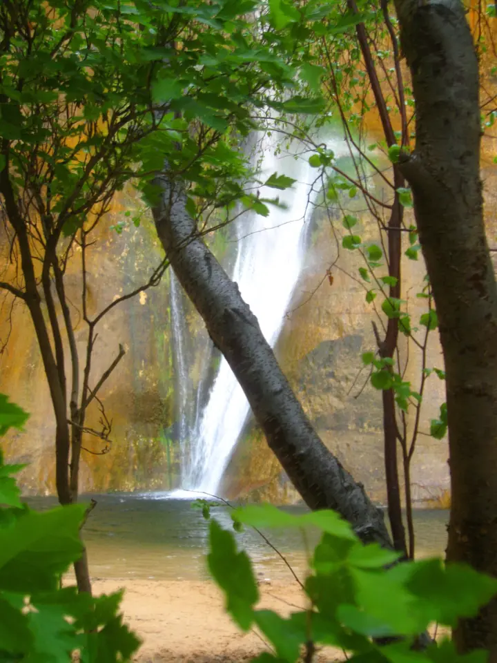
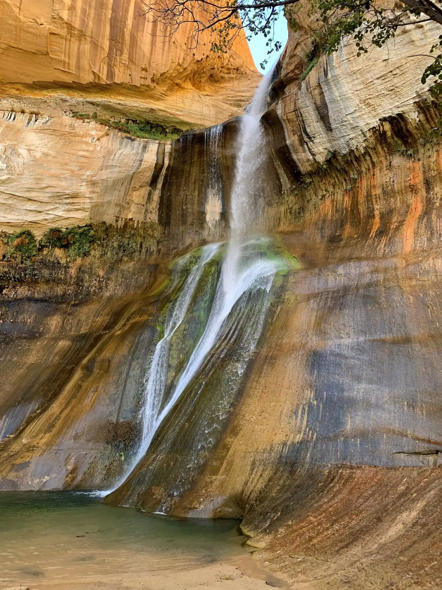
Lower Calf Creek Falls drops 126 feet into a pool, according to BLM and Visit Utah. Wikipedia says the falls flow year-round. It is the main hike at the Calf Creek Recreation Area, between Escalante and Boulder.
A second waterfall, Upper Calf Creek Falls, lies upstream. Wikipedia gives it an 88-foot plunge. It says the two falls are about 2.5 miles apart, with no direct trail between them.
BLM manages the site as part of Grand Staircase-Escalante National Monument, in Garfield County.
The 2024 reopening
BLM closed the recreation site for nearly three months of construction in 2024. It reopened on Saturday, September 28, 2024, BLM announced.
The work renovated campground facilities and added new shade shelters, creek retaining walls and a water play area. It also repaired the swinging pedestrian bridge.
A 2023 BLM decision also covers reconfiguring parking, adding designated parking and adding camp units. BLM gave no schedule for that work.
Getting there and parking
BLM puts the site "15 Miles east of Escalante UT on Highway 12." Visit Utah gives more exact directions: 11.4 miles south of the UT 12 and Burr Trail Road junction in Boulder.
Visit Utah also places the turn 14.4 miles northeast of Escalante and 1.1 miles north of the Escalante River bridge on UT 12. A paved spur road runs about 250 yards below the highway to the day-use lot.
Parking and the day-use fee
BLM says hikers are charged a day-use fee of $5.00 per vehicle. Visit Utah says campground hosts collect it at the entrance to the parking lot. BLM doesn't say whether passes cover the day-use fee.
The lot is inside the campground, and BLM says the site does not accommodate oversized vehicles. If the lot is full, Visit Utah says to park on the narrow UT 12 and hike down into the campground.
Neither BLM nor Visit Utah gives hours for the day-use area. For questions, BLM lists the campground phone as 435-341-0530.
Other Utah falls on the site include Kanarra Falls, Donut Falls and Stewart Falls. See our Utah waterfalls guide for the full list.
Calf Creek Campground
Calf Creek Campground is open year-round, BLM says. Sites cost $15.00 per night. Holders of the Interagency Senior and Access Passes get 50% off camping fees.
Visit Utah lists $10 a night, but BLM's $15.00 is the managing agency's figure.
BLM says sites are first-come, first-served, with no reservations. The campground has toilets, picnic tables and fire rings. There is no group site and no trash collection, so pack out what you bring.
Visit Utah says potable water is available in the campground from April to October. Do not drink creek water. BLM says pets must be leashed in the campground.
Map and nearby falls
Map loads as you scroll. Open in OpenStreetMap
OpenPartly open / seasonalUnconfirmedClosedLarger map
Lower Calf Creek Falls Trail
BLM lists the hike as a 6.0-mile round trip to the falls. Its 2025 safety release calls the trail "moderately difficult with sandy sections" and says it "can be hot, especially in summer." Visit Utah lists 6.2 miles.
Visit Utah estimates 3.5 to 4 hours of hiking time. It calls the trail relatively flat, but says deep sand makes it challenging at times.
Finding the trailhead
From the day-use lot, walk the paved road north through the campground for 0.2 mile, Visit Utah says. Just before the road dips to ford Calf Creek, the signed trail heads left up the canyon's west slope.
Along the way
An interpretive brochure is keyed to 15 numbered posts along the trail, per Visit Utah. Sights include two granaries, beaver dams and a pictograph across the canyon. Wikipedia notes Fremont pictographs near the lower falls.
There are no facilities along the trail. Use the restrooms at the parking area or campground first, and carry plenty of water.
Upper Calf Creek Falls
Upper Calf Creek Falls has its own trailhead off UT 12, not in the campground. BLM has no Upper Calf Creek page, and we found no official mile marker for that trailhead.
Wikipedia describes a 2-mile round trip that scrambles down from the western ridgeline to an 88-foot plunge. Ask the Escalante Interagency Visitor Center for directions and conditions before you try it.
When to visit
Visit Utah calls spring and fall the best seasons: March to June and September to October. To avoid big crowds, it suggests going mid-week.
Summer is hot on the sandy trail, BLM warns. Visit Utah adds that the pool gets crowded on summer weekends.
Wikipedia says the falls flow year-round. The campground is open year-round too, but potable water runs only from April to October, per Visit Utah.
We found no BLM closure notice after the September 2024 reopening. Check the BLM trail page before you go.
| Height | 126 ftNote: Lower falls, per BLM; Wikipedia gives Upper Calf Creek Falls an 88-ft plunge |
|---|---|
| Trail | 6.0 mi round trip from Calf Creek Campground, moderately difficult with sandy sections and hot in summer (BLM). Visit Utah lists 6.2 mi and 3.5 to 4 hours |
| Difficulty | Moderately difficult with sandy sections, and hot in summer (BLM) |
| Entry fee | $5.00 per vehicle day-use fee for hikers (BLM), collected by campground hosts at the lot entrance (Visit Utah). BLM doesn't say whether passes cover the day-use fee. Camping is $15.00 per site per night |
| Permit / reservation | No permit; a $5 per vehicle day-use fee applies |
| Parking | Day-use lot in Calf Creek Campground |
| Hours / season | No hours stated by BLM; the campground is open year-round |
| Dogs | Leashed. BLM requires a leash in Calf Creek Campground; Visit Utah says dogs must be on leash on the trail |
| Swimming | Not prohibited; Visit Utah notes a pool for swimming at the base. BLM warned in June 2025 that rocks can fall without warning into the pool and onto the shore |
| Walk behind the falls | No |
| Restrooms | Toilets at the campground and parking area; no facilities along the trail (BLM; Visit Utah) |
| Best time to visit | March to June and September to October (Visit Utah); BLM warns of summer heat |
| Crowds | The pool gets crowded on summer weekends, Visit Utah says; it suggests going mid-week |
| Managed by | Bureau of Land Management (Grand Staircase-Escalante National Monument) |
Safety and swimming
Rockfall is the main hazard at the falls. On June 25, 2025, BLM warned that "rocks can fall without warning and have the potential to cause serious injury or even death."
Because the cliff overhangs, BLM says rocks can land "a substantial distance away from the base of the cliff." That includes the pool and the shoreline. In the fall that prompted the warning, boulders dropped while family members were swimming.
No one was hurt that time, BLM said, though there have been injuries in the past. BLM geologists and the Garfield County Sheriff planned to assess the site.
Swimming is not banned. BLM's release reminds visitors: "This is not a backyard swimming pool, but rather a remote and natural place." It points to the campground's water play area as a lower-risk option.
Bring enough water, as BLM advises, and do not drink creek water. The BLM pages we read do not address flash floods, so check the National Weather Service forecast before you hike.
Our waterfall safety guide has more tips. Conditions change: confirm with BLM before you go.
Where to stay near Lower Calf Creek Falls
Compare hotels, cabins and rentals close to the falls around Escalante.
See places to stay nearbyAffiliate link: we may earn a commission at no cost to you. Partners do not see or change our waterfall facts. Disclosure.
Photos


Lower Calf Creek Falls FAQ
How long is the hike to Calf Creek Falls?
BLM lists 6.0 miles round trip to Lower Calf Creek Falls, moderately difficult with sandy sections. Visit Utah lists 6.2 miles and estimates 3.5 to 4 hours.
Can you drive to Lower Calf Creek Falls?
No. You park in the day-use lot at Calf Creek Campground on UT 12 and hike about 3 miles each way. BLM puts the site 15 miles east of Escalante.
Is Lower Calf Creek Falls worth it?
It is a 126-foot waterfall (BLM) that Wikipedia says flows year-round. Visit Utah says the trail passes granaries and a pictograph. The tradeoffs are deep sand, summer heat and crowds on summer weekends.
Is there a fee at Lower Calf Creek Falls?
Yes. BLM charges hikers a $5.00 day-use fee per vehicle, and Visit Utah says campground hosts collect it at the lot entrance. BLM doesn't say whether passes cover the day-use fee.
Can you swim at Lower Calf Creek Falls?
Swimming is not prohibited, and Visit Utah notes a pool for swimming at the base. BLM warned in June 2025 that rocks can fall without warning into the pool and onto the shore. It suggests the campground water play area as a lower-risk option.
Should you hike Upper or Lower Calf Creek Falls?
Lower is the main hike: 6.0 miles round trip on a sandy trail to a 126-foot fall (BLM). Upper has a separate trailhead off UT 12. Wikipedia describes a 2-mile round trip with a scramble down to an 88-foot plunge.
Are dogs allowed at Lower Calf Creek Falls?
Yes. BLM requires pets to be leashed in Calf Creek Campground. Visit Utah says dogs must be on a leash on the trail too, and asks you to pick up after your pet.
Is there camping at Calf Creek?
Yes. BLM says sites are first-come, first-served, at $15.00 per night, open year-round. The campground does not accommodate oversized vehicles.
Nearby waterfalls
No other waterfalls within 75 miles are on the site yet.
More waterfalls to explore
 Kanarra FallsUtah · 97 mi straight-lineUnconfirmed
 Stewart FallsUtah · 177 mi straight-lineSeasonal200FT
 Donut FallsUtah · 195 mi straight-lineOpen
On these lists: Dog-friendly waterfalls
Sources
- BLM: Lower Calf Creek Falls Trail (read Nov 3, 2026)
- BLM: Calf Creek Recreation Area Campground (read Nov 3, 2026)
- BLM announcement: Calf Creek Recreation Site scheduled to reopen (Sept 27, 2024)
- BLM announcement: BLM warns of dangerous falling rocks at Lower Calf Creek Falls (June 25, 2025)
- BLM press release: BLM issues decision for Calf Creek Recreation Site (2023)
- Visit Utah (Utah Office of Tourism): Lower Calf Creek Falls (page modified Aug 3, 2026; read Nov 3, 2026)
- Wikipedia: Calf Creek Falls
- USGS National Map GNIS layer: Lower Calf Creek Falls coordinates
Last verified Nov 3, 2026 by The Waterfall Guide editorial team. Conditions change: confirm with Bureau of Land Management (Grand Staircase-Escalante National Monument) before you go. Spotted something out of date? Report a correction.