Right now
Right now as of Oct 29, 2026
- Permit No permit needed. Entry fee: $5 parking per vehicle.
Status note (Oct 29, 2026): Open. When we checked on October 25, 2026, we found no 2025 or 2026 closure for the DeSoto Falls Picnic Area. Alabama State Parks says the area closes at dusk and the falls are sometimes dry in summer and fall. What the status labels mean
DeSoto Falls is a 104-foot plunge on the West Fork of the Little River in DeSoto State Park, near Mentone in DeKalb County, Alabama. It is not the DeSoto Falls near Helen, Georgia. Parking at the picnic area costs $5.00 per vehicle, and about 50 concrete steps lead down to a railed overlook. Alabama State Parks says the falls are sometimes dry in summer and fall. As of October 25, 2026, we found no 2025 or 2026 closure.
About DeSoto Falls
DeSoto Falls in Alabama is near the town of Mentone in DeKalb County. Georgia has a different DeSoto Falls, so check which one your map or search result shows before you drive.
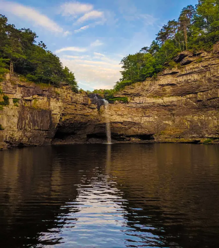
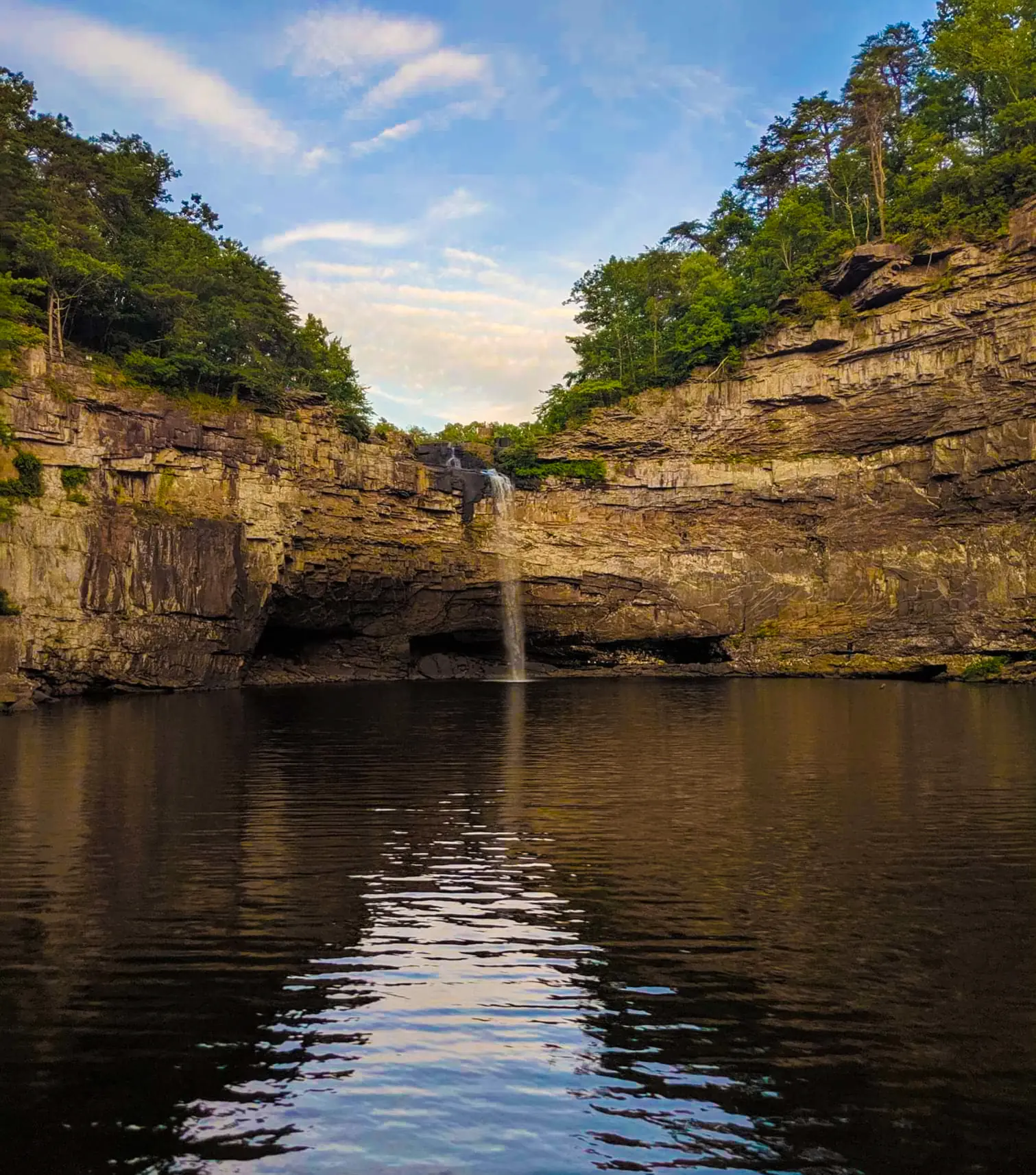
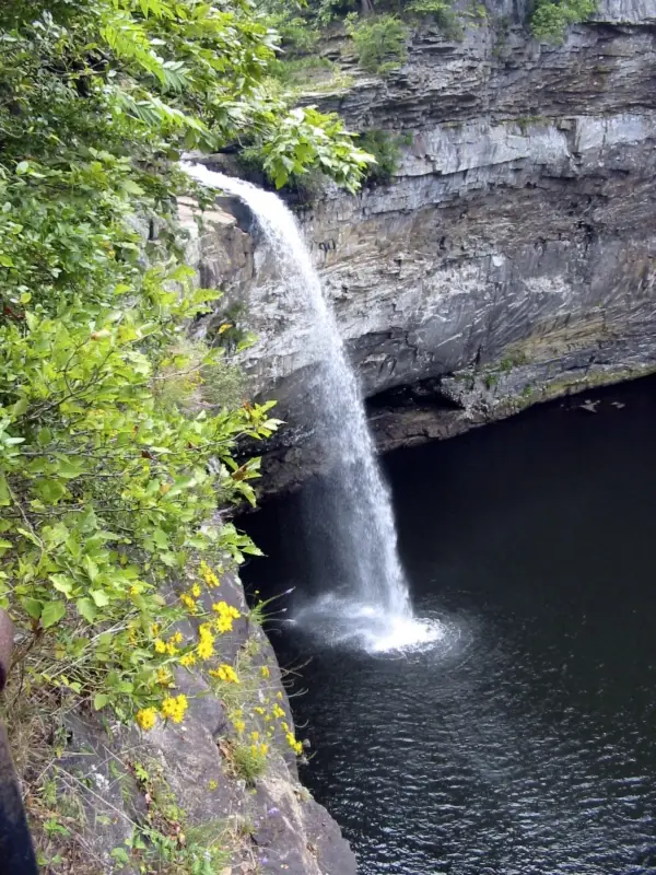
The Alabama falls is a single plunge on the West Fork of the Little River. Wikipedia says the water has carved a small canyon below it. Alabama State Parks calls it one of the state's tallest waterfalls.
Sources differ slightly on the height of DeSoto Falls. Wikipedia, the Encyclopedia of Alabama and the main DeSoto State Park page give 104 feet. A 2021 Alabama State Parks map of the picnic area gives 107 feet.
The falls are named after Hernando de Soto. Alabama State Parks says visitors can also see the historic A. A. Miller Dam and an upper falls at the site.
Alabama State Parks says Arthur Abernathy Miller built the 20-foot dam above the falls in the mid-1920s, first to 10 feet and later 10 feet higher. It fed his hydroelectric generator below the falls, which powered Fort Payne, Mentone, Valley Head, Collinsville and Menlo, Georgia. A square concrete base still marks the generator site. A historical marker at the picnic area says the dam was 'Built in 1925 for the first Hydro Electric power in North Alabama.'
DeSoto Falls sits on its own parcel of DeSoto State Park, about 7 miles from the main park area, per Alabama State Parks. Treat it as a separate stop with its own parking fee.
Wikipedia describes Georgia's DeSoto Falls as an upper falls of 200 feet and a lower falls of 35 feet on Frogtown Creek, near Helen in Lumpkin County. A 2.4-mile round-trip trail in the Chattahoochee National Forest reaches them.
Getting there and parking
Alabama State Parks warns that GPS is not reliable for DeSoto State Park. Use the written directions on the park's website rather than trusting a phone app alone.
The paved path to the main overlook starts at the DeSoto Falls Picnic Area. Parking there costs $5.00 per vehicle, according to Alabama State Parks, and a $50 annual pass covers this picnic area only.
You may find an older figure online. A 2021 park map lists $4.00 'as of March 1, 2020', but the current park page gives $5.00.
Space is tight. The park says parking 'often fills to capacity on weekends.' There is no overflow or roadside parking, so park only in the picnic area or at the trailhead. RVs and trailers are not allowed.
The trailhead for the longer trails is on County Road 613. We could not confirm whether that lot charges a fee.
Alabama State Parks lists the area as open in daylight, closing at dusk. Restrooms are at the picnic area, along with picnic tables, grills and a small boat ramp.
Map and nearby falls
Map loads as you scroll. Open in OpenStreetMap
OpenPartly open / seasonalUnconfirmedClosedLarger map
The walk
You can see part of the site without a real hike. Alabama State Parks says 'the historic A. A. Miller Dam & the upper falls can be seen by visitors of all abilities.'
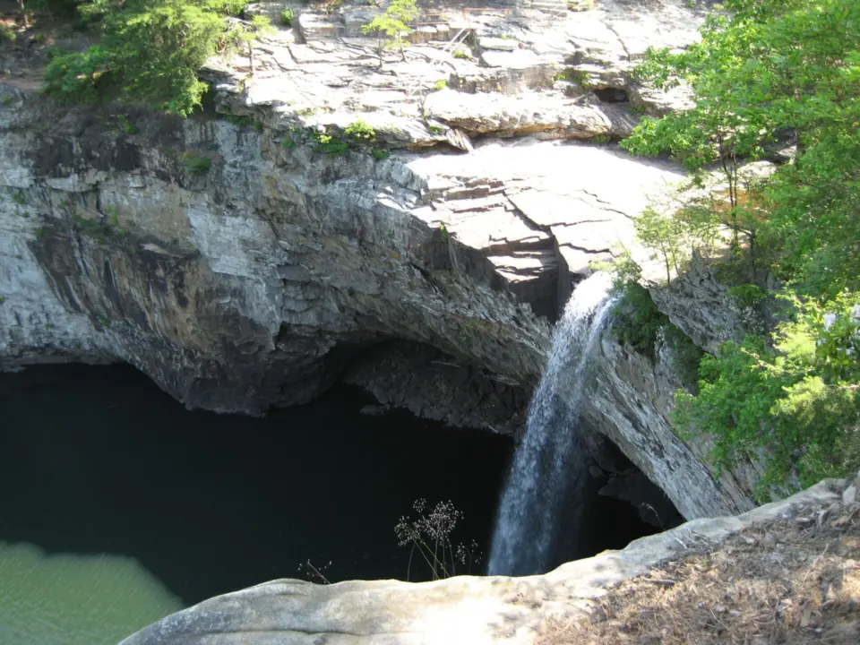
The main falls takes a little more effort. A paved path runs 'a few hundred yards' from the lot. Then about 50 concrete steps lead down to a railed overlook with a side view of the falls.
For other views, three trails start at the County Road 613 trailhead, per the 2021 park map. The Overlook Trail runs 0.45 mile one way to a high view from the front, with no way down to the water.
The River Trail runs 0.70 mile one way, down a steep slope to the basin below the falls. The Bluff Trail, 0.32 mile, branches off the River Trail.
The map rates these trails "moderate to strenuous due to rocky mountainous terrain" and adds, "Hike at your own risk." We found no official hiking time or elevation gain for any of them.
We found no dog rule for DeSoto Falls itself. Statewide Alabama State Parks policy allows leashed, attended dogs in day-use areas and on trails, but not at beaches, pools, stores or food areas.
When to visit
DeSoto Falls runs on rain. Alabama State Parks says the falls are 'sometimes dry' in summer and fall, so check recent rainfall before a trip in those seasons.
Weekends are the busy time for parking. With no overflow lot, a weekday or early arrival gives you the best chance of a space at the picnic area.
As of October 25, 2026, we found no 2025 or 2026 closure for the DeSoto Falls Picnic Area. The area and its trails close at dusk, per Alabama State Parks.
Little River Falls, in Little River Canyon National Preserve, and Noccalula Falls in Gadsden are the other Lookout Mountain falls on this site.
Our Alabama waterfalls guide compares fees, flow and rules at all three falls.
| Height | 104 ftNote: per Wikipedia and Alabama State Parks; an Alabama State Parks map says 107 ft |
|---|---|
| Trail | From the picnic-area lot, a paved path runs 'a few hundred yards', then about 50 concrete steps lead down to a railed overlook (Alabama State Parks). From the County Road 613 trailhead, a 2021 park map lists the Overlook Trail at 0.45 mi and the River Trail at 0.70 mi, each one way. It also lists the 0.32-mi Bluff Trail off the River Trail |
| Difficulty | Dam and upper falls viewable by all abilities; about 50 concrete steps to the main overlook; trailhead trails moderate to strenuous (Alabama State Parks) |
| Entry fee | $5.00 parking per vehicle at the DeSoto Falls Picnic Area, or a $50 annual pass valid for this picnic area only (Alabama State Parks). We could not confirm whether the County Road 613 trailhead lot charges a fee |
| Permit / reservation | No permit; $5.00 per-vehicle parking fee at the picnic area |
| Parking | Picnic-area lot, $5; often full on weekends |
| Hours / season | Daylight hours; the area and trails close at dusk (Alabama State Parks) |
| Dogs | We found no DeSoto Falls rule. Statewide Alabama State Parks policy allows leashed, attended dogs in day-use areas and on trails, but not at beaches, pools, stores or food areas |
| Swimming | We found no official rule for swimming at the base of the falls. Alabama State Parks lists the West Fork at the picnic area, above the dam, for 'boating, swimming, & fishing' |
| Wheelchair / stroller | Partly: Alabama State Parks says the historic A. A. Miller Dam and the upper falls 'can be seen by visitors of all abilities', but the main falls overlook is down about 50 concrete stairs |
| Restrooms | Yes, at the picnic area, along with picnic tables, grills and a small boat ramp |
| Best time to visit | After rain; Alabama State Parks says the falls are 'sometimes dry' in summer and fall |
| Crowds | Alabama State Parks says parking often fills to capacity on weekends |
| Managed by | Alabama State Parks (DeSoto State Park) |
Safety and swimming
We found no official rule for swimming at the base of DeSoto Falls. Alabama State Parks lists 'boating, swimming, & fishing' on the West Fork at the picnic area, which is above the dam, not below the falls.
Reaching the basin means taking the River Trail down a steep slope over rocky terrain. Expect wet, slick rock near the water, and turn back if the footing feels unsafe.
At the overlook, stay behind the railing, and keep children close on the concrete steps.
Wikipedia notes that extreme kayakers paddle over the falls. That is specialist whitewater over a drop of about 104 feet, not something to try from the bank or the picnic area.
The trails close at dusk, and GPS is unreliable in this area, so leave time to walk out and drive back in daylight. Our waterfall safety guide covers slick rock and pools in more detail.
Where to stay near DeSoto Falls
Compare hotels, cabins and rentals close to the falls around Mentone.
See places to stay nearbyAffiliate link: we may earn a commission at no cost to you. Partners do not see or change our waterfall facts. Disclosure.
Photos


DeSoto Falls FAQ
Is DeSoto Falls in Alabama the same as DeSoto Falls in Georgia?
No. Alabama's DeSoto Falls is a single 104-foot plunge on the West Fork of the Little River, in DeSoto State Park near Mentone. Georgia's DeSoto Falls has upper and lower falls on Frogtown Creek near Helen, in the Chattahoochee National Forest.
Can you see DeSoto Falls without hiking?
Partly. Alabama State Parks says the historic A. A. Miller Dam and the upper falls can be seen by visitors of all abilities. The main falls needs a short paved walk and about 50 concrete steps down to the overlook.
Is DeSoto Falls a hard hike?
Not to the overlook: it is a short paved walk and about 50 concrete steps. The longer trails from the County Road 613 trailhead are rated "moderate to strenuous due to rocky mountainous terrain" on an Alabama State Parks map.
How long is the hike to DeSoto Falls?
A few hundred yards from the picnic area, on a paved path to the overlook steps. From the County Road 613 trailhead, the Overlook Trail is 0.45 mile and the River Trail 0.70 mile, each one way. We found no official hiking time.
Can you swim at the bottom of DeSoto Falls?
Not confirmed. We found no official rule for swimming at the base. Alabama State Parks lists swimming on the West Fork at the picnic area, above the dam. The basin is reached by a steep trail over rocky terrain.
Can you drive up to DeSoto Falls?
Yes, to the picnic-area lot, which costs $5.00 per vehicle. From there a paved path leads a few hundred yards to the overlook steps. Alabama State Parks warns that GPS is unreliable, so use its written directions.
How tall is DeSoto Falls?
About 104 feet, per Wikipedia and Alabama State Parks. A 2021 park map gives 107 feet. Alabama State Parks calls it one of the state's tallest waterfalls.
Nearby waterfalls
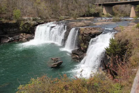 Little River Falls11 mi straight-lineOpen45FT
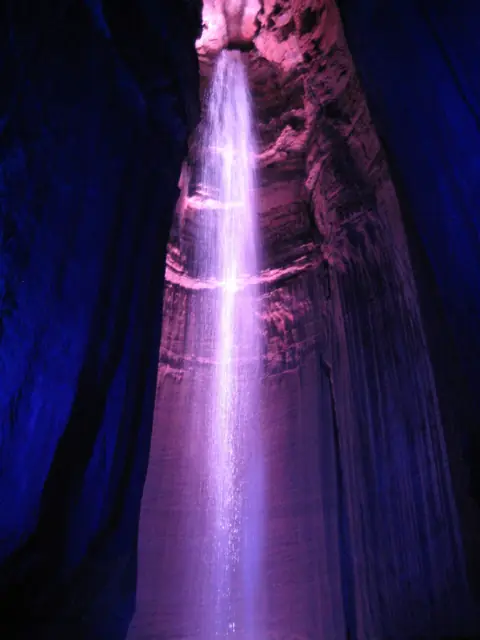 Ruby Falls35 mi straight-lineOpen
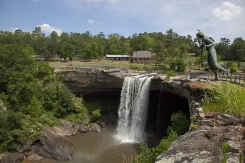 Noccalula Falls43 mi straight-lineSeasonal90FT
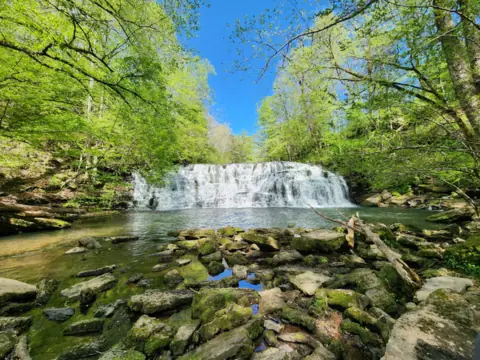 Rutledge Falls68 mi straight-lineOpen
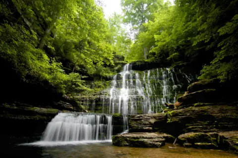 Machine Falls68 mi straight-lineOpen60FT PLUS
City guides: Waterfalls near Atlanta, GA · Waterfalls near Chattanooga, TN
On these lists: Roadside waterfalls
Sources
- Alabama State Parks: DeSoto Falls Picnic Area
- Alabama State Parks: DeSoto State Park
- Alabama State Parks: Dog-friendly policies
- Encyclopedia of Alabama: DeSoto State Park
- Wikipedia: DeSoto Falls (Alabama)
- Wikipedia: DeSoto Falls (Georgia)
- Alabama State Parks: DeSoto Falls Picnic Area & Trailhead Map (PDF, 2021)
- Alabama State Parks: A.A. Miller, Builder of DeSoto Dam (PDF)
- HMDB: The A. A. Miller Dam marker
Last verified Oct 29, 2026 by The Waterfall Guide editorial team. Conditions change: confirm with Alabama State Parks (DeSoto State Park) before you go. Spotted something out of date? Report a correction.