Right now
Right now as of Oct 29, 2026
- Permit None needed.
Status note (Oct 29, 2026): Open. The NPS current conditions page, last updated May 28, 2026, listed only 'Slant Rock Road-No Vehicle Access' when we checked on October 25, 2026. That closure does not affect the falls. Call the preserve at (256) 845-9605 to check. What the status labels mean
Little River Falls drops 45 feet on the Little River at the AL-35 bridge near Fort Payne, Alabama, in the NPS-run Little River Canyon National Preserve. Entry is free, per the NPS. An ADA boardwalk leads to the main overlook. The 100-car lot is often full by 11 a.m. on late-spring and summer weekends. Swimming is not banned, but the NPS warns it can be deadly. As of October 25, 2026, NPS listed no closure affecting the falls.
About Little River Falls
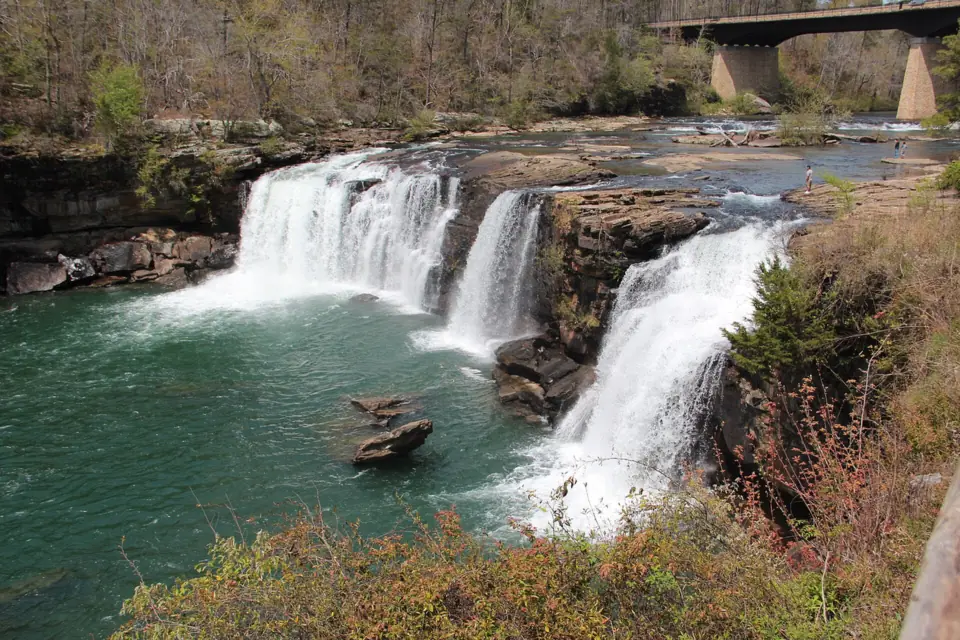
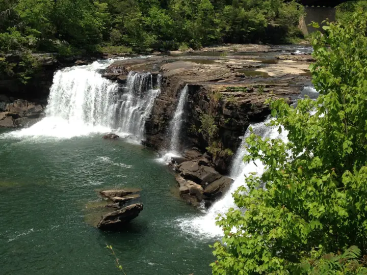
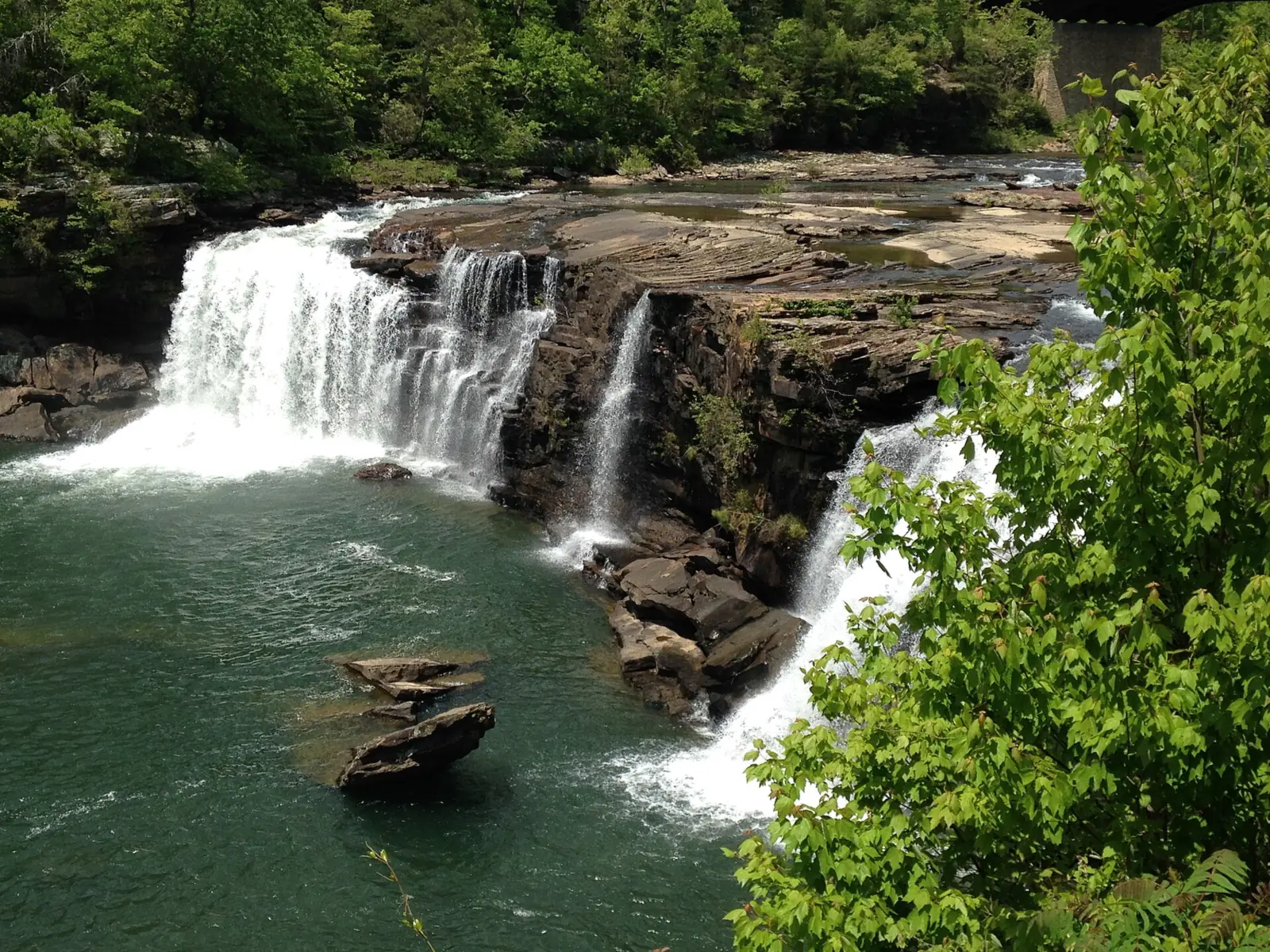
Little River Falls is 45 feet tall, according to both the National Park Service and Wikipedia. It spans the Little River at the Alabama Highway 35 (AL-35) bridge. The NPS says the falls mark the point where Little River Canyon begins.
The falls are part of Little River Canyon National Preserve, which the NPS manages. They lie in DeKalb and Cherokee counties in northeast Alabama, and Fort Payne is the nearest town. The preserve's phone number is (256) 845-9605.
Flow can run very high. On April 8, 2014, the falls ran at more than 11,000 cubic feet per second, beating a record from 1964, according to Wikipedia.
Don't mix up the falls with the 'Little River Falls Boardwalk Overlook' on the Highway 176 scenic drive. That is a separate, distant viewpoint. A 2018 NPS page describes its boardwalk as 100 feet long and 6 feet wide.
Getting there and parking
Drive to the paved parking lot on the west side of the AL-35 bridge. The NPS says it holds 100 cars and includes handicap parking spaces. Restrooms are in the lot, and there is a shaded picnic area with tables and grills.
Timing matters on warm-season weekends. The NPS says the lot 'often is full by 11:00 AM (CST)' on late-spring and summer weekends. Overflow parking is at the Little River Canyon Center, except on Mondays, when the center is closed.
The NPS lists the falls as open daily from sunrise to sunset, and parking is not allowed after dark. Plan to be back at your car before sunset.
You pay nothing to visit. The NPS states, 'There is no charge for this area,' and the fee box above explains the separate $15 Canyon Mouth Park pass.
Map and nearby falls
Map loads as you scroll. Open in OpenStreetMap
OpenPartly open / seasonalUnconfirmedClosedLarger map
The walk
The walk to Little River Falls is short. The NPS says the boardwalk from the parking lot reaches the falls 'in a few minutes.' The NPS gives no length, so we list none.
The boardwalk splits along the way. One branch is a gentler route for people who have trouble with steps. The other is shorter and uses rock steps. Bikes are not allowed on the boardwalk.
Wheelchair users can reach the main view. The NPS accessibility page was updated May 8, 2025. It lists handicap parking spaces and 'a ADA boardwalk to the main falls overlook area.' It adds that the preserve's hiking trails are not ADA accessible.
Little River Falls has more viewpoints than the main overlook. A second boardwalk runs under the AL-35 bridge, and the NPS notes two viewing spots on the bridge itself.
From the same lot, a 0.75-mile trail with 137 stone stairs leads to Little Falls, formerly Martha's Falls. NPS pages differ on its current name. The NPS says 'the last 200 feet is the most difficult.'
Your dog can come along. The NPS allows pets in all areas of the preserve, including trails and the water, on a leash of 6 feet or less.
When to visit
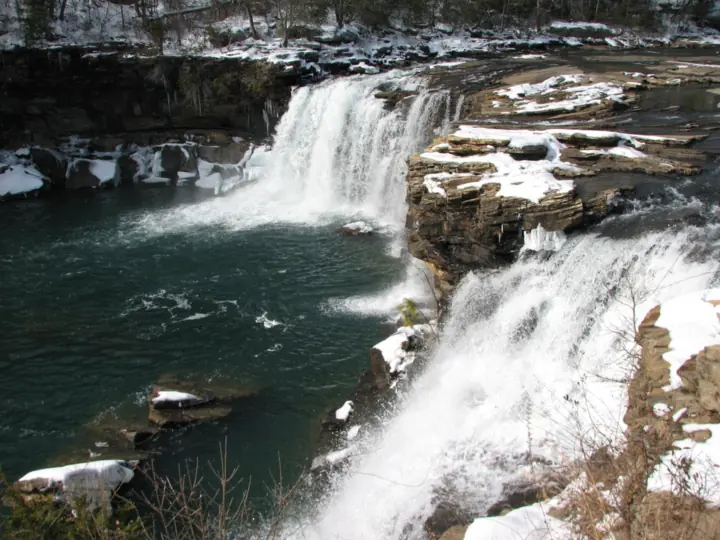
Rain drives the flow at Little River Falls. The NPS says the river runs high in winter and early spring and low in summer and early fall.
High water is when the falls look biggest, and also when the river is most dangerous. The NPS asks visitors to use 'extreme caution when the water is high and swift.' View the falls from the boardwalk on those days.
Parking is the main crunch in the warm months. Because the NPS says the lot is often full by 11 a.m. Central on late-spring and summer weekends, plan a weekday visit or an early start.
The NPS current conditions page was last updated May 28, 2026. As of October 25, 2026, it listed only 'Slant Rock Road-No Vehicle Access.' That closure does not affect the falls.
DeSoto Falls, in DeSoto State Park near Mentone, and Noccalula Falls in Gadsden are nearby on Lookout Mountain.
Our Alabama waterfalls guide compares fees, seasons and rules for all three falls.
| Height | 45 ftNote: per NPS and Wikipedia |
|---|---|
| Trail | A boardwalk from the parking lot reaches the falls 'in a few minutes', per NPS, which gives no length. It splits into a gentler route for people who have trouble with steps and a shorter route with rock steps |
| Difficulty | Easy: ADA boardwalk to the main overlook (NPS); the shorter route has rock steps |
| Entry fee | Free. The preserve's $15 per vehicle per day pass ($35 annual) applies only to the Canyon Mouth Park Day-Use Area, not to the falls. The NPS says, 'There is no charge for this area.' |
| Permit / reservation | No permit, ticket or fee needed |
| Parking | 100-car lot; often full by 11 a.m. on late-spring and summer weekends |
| Hours / season | Sunrise to sunset daily (NPS) |
| Dogs | Allowed in all areas of the preserve, including trails and the water, on a leash of 6 ft or less (NPS) |
| Swimming | Not banned, but dangerous. NPS says many rescues and even deaths have occurred here. It requires you to stay at least 50 ft from the edge and off the railings. It asks for 'extreme caution when the water is high and swift'. It also warns you 'can be carried over the falls in seconds.' Alcohol is prohibited in the preserve |
| Wheelchair / stroller | Yes to the main overlook: NPS lists handicap parking spaces and 'a ADA boardwalk to the main falls overlook area'. The preserve's hiking trails are not ADA accessible |
| Restrooms | Yes, in the parking lot; a shaded picnic area with tables and grills is nearby |
| Best time to visit | Winter and early spring for high flow; low in summer and early fall (NPS) |
| Crowds | NPS says the 100-car lot is often full by 11 a.m. Central on late-spring and summer weekends |
| Managed by | National Park Service (Little River Canyon National Preserve) |
Safety and swimming
Swimming is not banned at Little River Falls, but the NPS warns that it can be deadly. Its falls page warns that you 'can be carried over the falls in seconds' and that 'many rescues and even deaths have occurred here.'
A 19-year-old drowned in the pool beneath the falls on May 19, 2020, the NPS reported in a news release two days later.
Two NPS rules apply at the falls. You must stay at least 50 feet from the edge, and you must not climb the railings. The NPS also warns that the rocks are slippery.
Alcohol is prohibited in the preserve. The NPS water safety page was updated May 21, 2026. It says 'approximately half of all swimming deaths involve alcohol.' It adds that six inches of fast water can sweep an adult off their feet.
The NPS waterfalls page mentions pools above the falls used for wading, and a swimming hole below when water is low in summer and fall. If you enter the water at all, the NPS advises never swimming alone and wearing a life jacket.
Stay out of the river when it is high or fast. Never jump or dive from the rocks. Our waterfall safety guide covers slick rock and moving water in more detail.
Where to stay near Little River Falls
Compare hotels, cabins and rentals close to the falls around Fort Payne.
See places to stay nearbyAffiliate link: we may earn a commission at no cost to you. Partners do not see or change our waterfall facts. Disclosure.
Photos

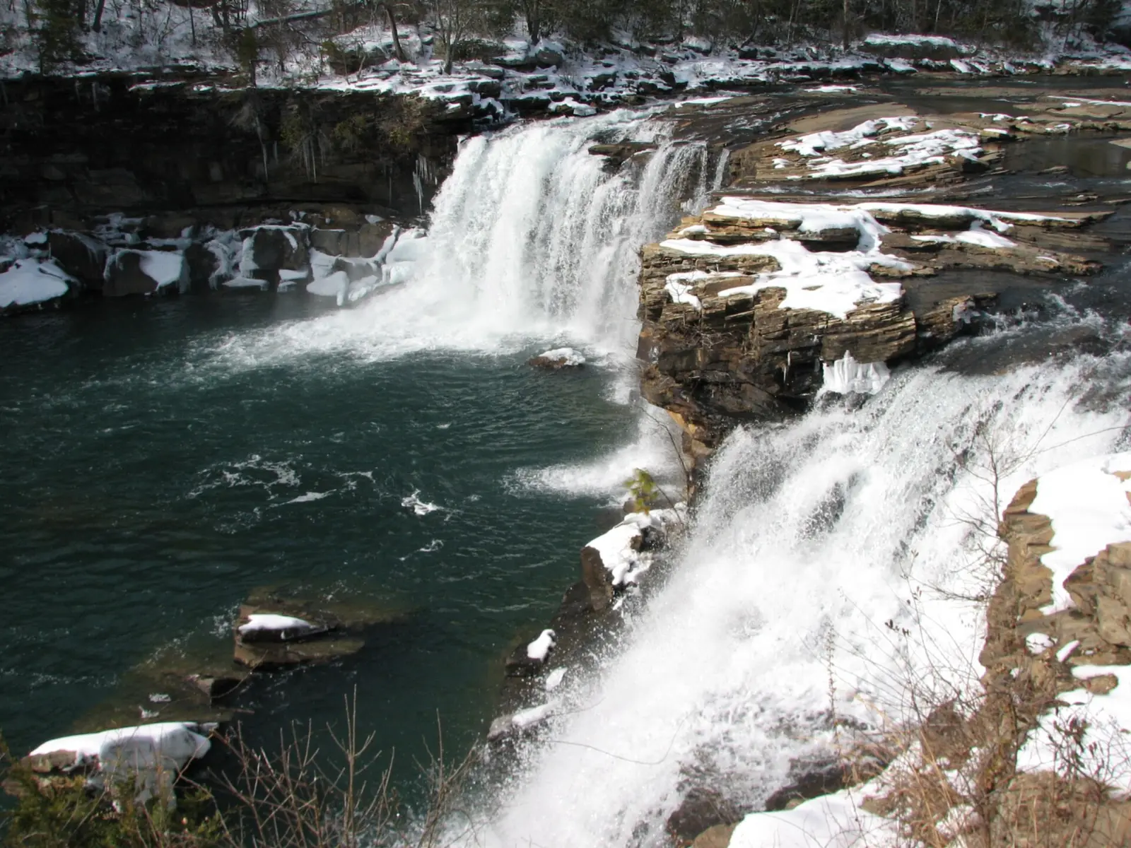

Little River Falls FAQ
Where is Little River Falls?
In Little River Canyon National Preserve in northeast Alabama, at the AL-35 bridge near Fort Payne. The falls sit on the Little River where the canyon begins, in DeKalb and Cherokee counties.
Can you swim in Little River Falls?
Yes, swimming is not banned, but the NPS warns it can be deadly. You can be carried over the falls in seconds, and many rescues and even deaths have occurred at Little River Falls. A swimmer drowned in the pool below in May 2020. You must stay at least 50 feet from the edge, and alcohol is prohibited.
Is Little River Falls free?
Yes. The NPS says, 'There is no charge for this area.' The preserve's $15-per-vehicle day pass applies only at the Canyon Mouth Park Day-Use Area.
How tall is Little River Falls?
45 feet, according to the NPS and Wikipedia.
Is Little River Falls wheelchair accessible?
Yes, to the main overlook. The NPS lists handicap parking spaces and an ADA boardwalk to the main falls overlook area. The preserve's hiking trails are not ADA accessible.
When does the Little River Falls parking lot fill up?
The NPS says the 100-car lot is often full by 11 a.m. Central on late-spring and summer weekends. Overflow parking is at the Little River Canyon Center, except on Mondays.
Are dogs allowed at Little River Falls?
Yes. The NPS allows pets in all areas of the preserve, including trails and the water, on a leash of 6 feet or less.
Nearby waterfalls
 DeSoto Falls11 mi straight-lineOpen104FT
 Noccalula Falls33 mi straight-lineSeasonal90FT
 Ruby Falls46 mi straight-lineOpen
City guides: Waterfalls near Atlanta, GA · Waterfalls near Chattanooga, TN
On these lists: Dog-friendly waterfalls · Free waterfalls · Roadside waterfalls
Sources
- NPS Little River Canyon: Little River Falls
- NPS Little River Canyon: Fees & Passes (updated Dec 22, 2025)
- NPS Little River Canyon: Operating hours and fees by area
- NPS Little River Canyon: Places to go (updated Jun 5, 2026)
- NPS Little River Canyon: Waterfalls
- NPS Little River Canyon: Accessibility (updated May 8, 2025)
- NPS Little River Canyon: Water safety (updated May 21, 2026)
- NPS Little River Canyon: Pets
- NPS Little River Canyon: Current conditions (updated May 28, 2026)
- NPS Little River Canyon: Little River Falls Boardwalk Overlook (Hwy 176)
- Wikipedia: Little River Falls
- NPS news release: Swimmer drowning at Little River Falls (May 21, 2020)
Last verified Oct 29, 2026 by The Waterfall Guide editorial team. Conditions change: confirm with National Park Service (Little River Canyon National Preserve) before you go. Spotted something out of date? Report a correction.