Right now
Status note (Oct 29, 2026): Open, as far as we can tell: on October 29, 2026, the White Mountain National Forest alerts page listed no closure for Diana's Baths. Year-round fee site. The Forest Service page (last updated Feb 19, 2025) lists toilet facilities open and posts no closure. What the status labels mean
Diana's Baths is a series of small cascades and pools on Lucy Brook in the White Mountain National Forest, near North Conway. The Forest Service calls it about a three-quarter-mile walk on an ADA trail with benches. Diana's Baths is a year-round fee site ($5 per vehicle per day), and roadside parking is prohibited. On October 29, 2026, the White Mountain National Forest alerts page listed no closure here.
About Diana's Baths
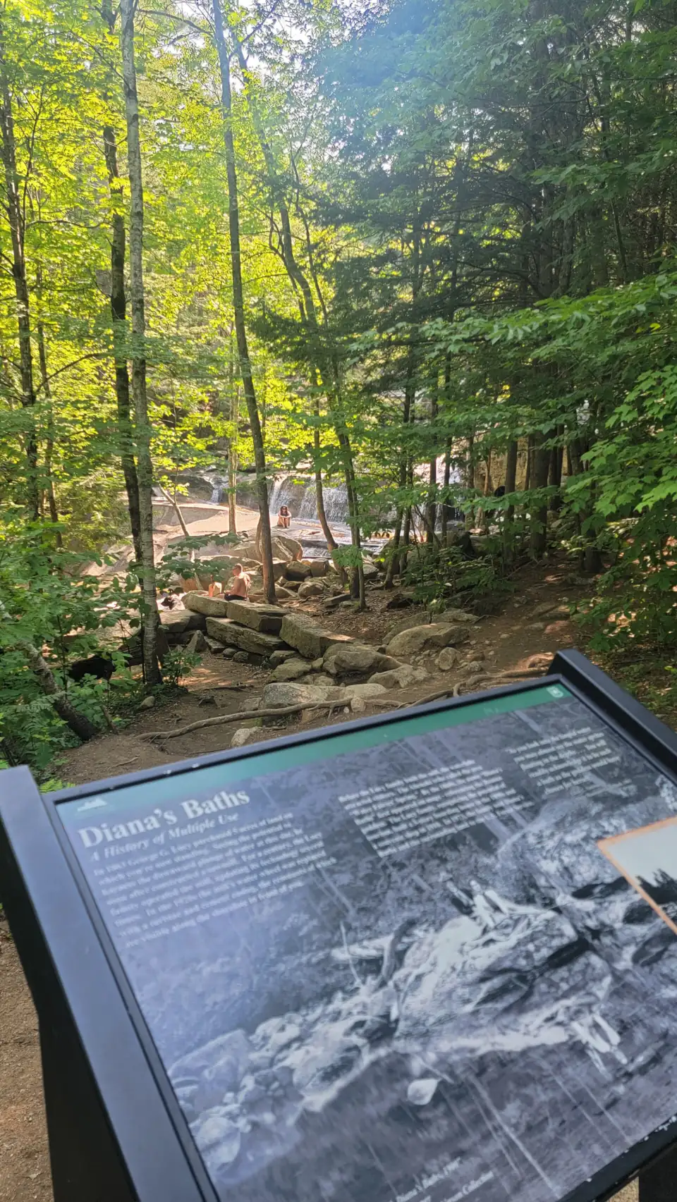
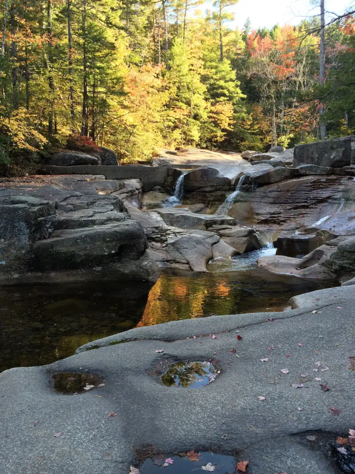
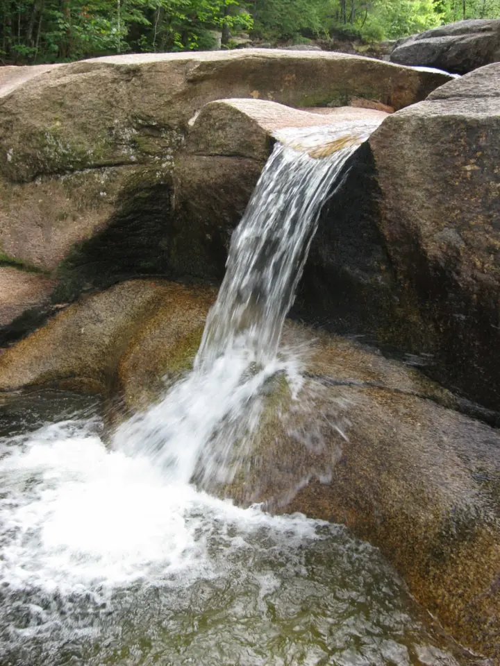
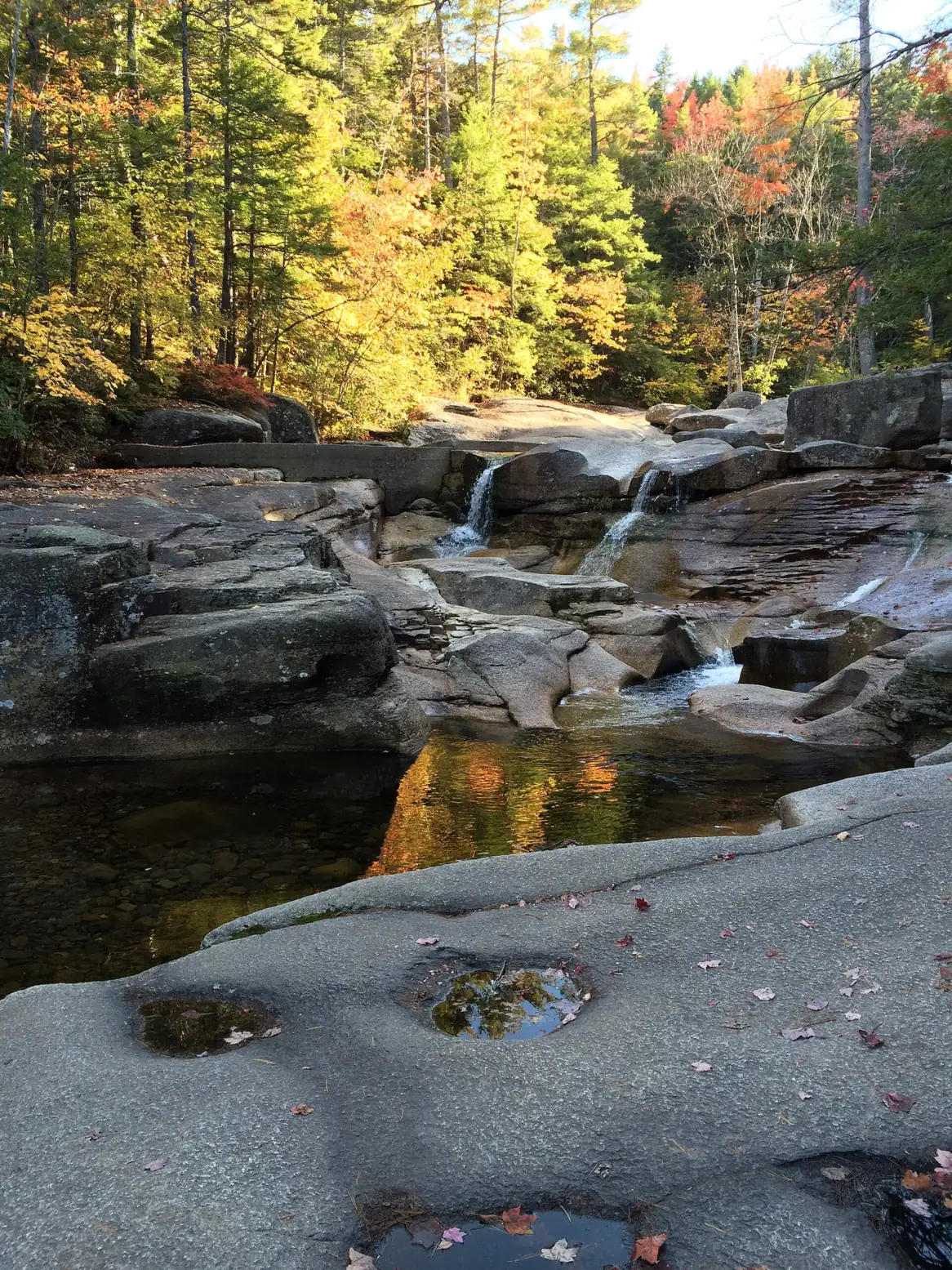
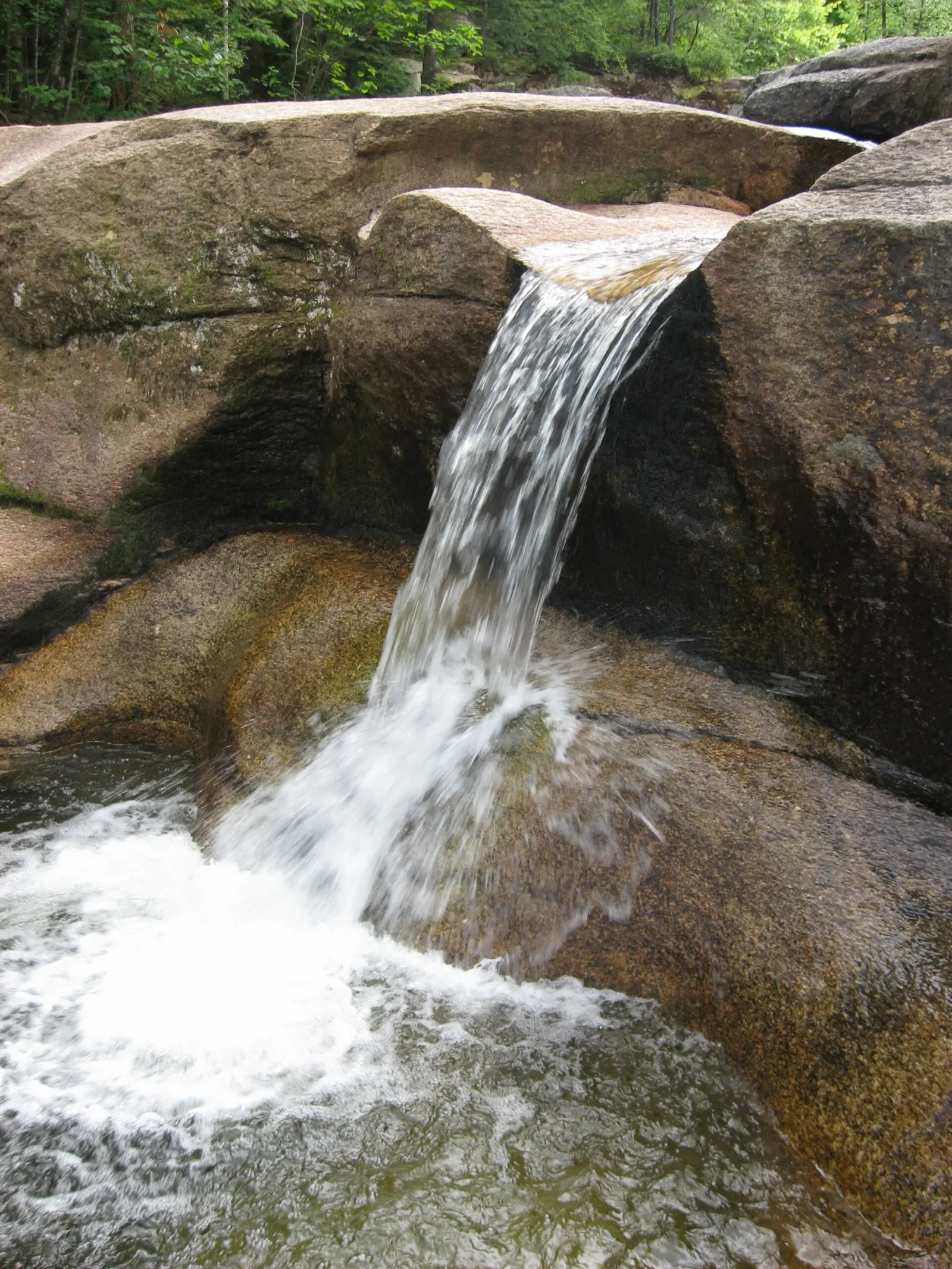
Diana's Baths is a run of small cascades and pools on Lucy Brook, near Bartlett and North Conway. The water drops about 75 feet in total, Wikipedia says, spread across a series of ledges and pools rather than one main fall.
The Forest Service's Saco Ranger District manages the site as part of the White Mountain National Forest. The Forest Service describes Diana's Baths as a series of pools and cascades on Lucy Brook. Trail Finder calls it a popular swimming area and a high-use site.
The pools were once called the 'Home of the Water Fairies,' according to Wikipedia. A Miss Hubbard of Boston renamed them Diana's Baths before 1859. You may also see the name Lucy's Baths.
That second name comes from local history. George Lucy bought the land in 1863, and the Lucy family ran a sawmill among the falls. Hattie C. Lucy ran a gift shop there through the 1940s, Wikipedia says.
Heavy use has shaped the site. After a 2005 Forest Service assessment found heavy waste around Lucy Brook, rangers added toilets and trash collection.
Getting there and parking
The trailhead is on the left side of West Side Road, about 2.5 miles north of North Conway village, the Forest Service says. The lot address is 3872 West Side Rd, North Conway, NH 03860.
The Forest Service describes a large lot with toilets, trash collection and a self-serve pay station. The lot is maintained for winter use.
White Mountain National Forest pass
Diana's Baths is a year-round fee site. Trail Finder lists day use at $5 per vehicle, and Recreation.gov sells the WMNF day pass online. The Forest Service also accepts WMNF annual passes, Interagency passes, and Golden Age and Access passes.
The Forest Service now sells the annual pass in digital form on Recreation.gov. Its passes page lists no prices, so check Recreation.gov for the current rate.
The same WMNF pass also covers Sabbaday Falls on the Kancamagus Highway, a fee site from spring through fall only. A forest order also closes part of the Sabbaday Falls Trail each year from November 1 through April 15.
When the lot is full
The Forest Service says parking along West Side Road is specifically prohibited for safety. Trail Finder suggests having a backup plan if the lot is full.
One White Mountains alternative is Arethusa Falls in Crawford Notch, a longer and steeper hike.
Map and nearby falls
Map loads as you scroll. Open in OpenStreetMap
OpenPartly open / seasonalUnconfirmedClosedLarger map
The accessible trail to the Baths
The Forest Service calls it about a three-quarter-mile walk on the Moat Mountain Trail, from its northern end. Trail Finder lists 0.6 mile each way, or 1.2 miles round trip, and rates it easy.
The section of trail up to the Baths is ADA accessible with benches along the way, the Forest Service says. Trail Finder describes an improved gravel surface about 6 feet wide with interpretive signs. The rocks and pools themselves are not accessible.
Beyond the Baths, the Moat Mountain Trail keeps going toward North Moat Mountain. The accessible section is only the part to the Baths, so plan any longer hike separately.
Trail Finder says pets are permitted. We found no official leash rule, so keep dogs under control near other visitors. In winter, Trail Finder lists snowshoeing as a use.
When to visit
The site is a year-round fee site, and the lot is maintained for winter use. We found no 2025 or 2026 closure, and the Forest Service lists no posted hours.
Summer swimming and spring snowmelt
Flow is strongest during spring snowmelt, and the water is calmer in summer. Summer is also when the site is busiest.
Roadside parking is banned, and Trail Finder warns the lot can fill, so arriving early gives you the best chance at a space.
When is the water highest?
At a USGS stream gauge right by the falls, the flow averages highest in April and lowest in September, based on 27 years of records (1965 to 1991). These are older records from a gauge that no longer reports, so treat them as a rough seasonal guide.
Show the numbers
| Month | Average flow (cfs) |
|---|---|
| January | 6.6 |
| February | 7.2 |
| March | 14 |
| April | 30 |
| May | 22 |
| June | 8.1 |
| July | 4.9 |
| August | 5.0 |
| September | 3.5 |
| October | 9.5 |
| November | 13 |
| December | 10 |
| Height | 75 ftNote: total drop over a series of small falls and pools, per Wikipedia; there is no single main drop |
|---|---|
| Trail | About three-quarters of a mile each way on the Moat Mountain Trail (Forest Service); Trail Finder lists 0.6 mi each way, 1.2 mi round trip. The section to the Baths is ADA accessible with benches. |
| Difficulty | Easy |
| Entry fee | Year-round Forest Service fee site with a self-serve pay station; $5 per vehicle day use (Trail Finder; Recreation.gov day pass); WMNF annual and Interagency passes accepted |
| Permit / reservation | No permit; a White Mountain National Forest recreation pass is required to park |
| Parking | West Side Road lot; no roadside parking |
| Dogs | Pets permitted (Trail Finder); we found no official leash rule |
| Swimming | Trail Finder describes it as a swimming area. We found no Forest Service swimming rule, and no source mentions lifeguards. |
| Wheelchair / stroller | The trail section to the Baths is ADA accessible with benches (Forest Service); Trail Finder describes gravel about 6 ft wide. The rocks and pools are not accessible. |
| Walk behind the falls | No |
| Restrooms | Toilets at the parking lot; the Forest Service lists toilet facilities open |
| Crowds | High-use site; the lot fills on busy days (Trail Finder) |
| Managed by | USDA Forest Service, White Mountain National Forest (Saco Ranger District) |
Safety and swimming
We could not find a Forest Service swimming rule for Diana's Baths, and no source mentions lifeguards. If you wade, expect fast, high water during spring snowmelt and slick rock around the pools.
Do not jump from the ledges or climb wet rock above the pools. Keep children within reach near the water.
Consider New Hampshire's voluntary Hike Safe card. Sales fund NH Fish and Game's search and rescue work, and the 2026 card costs $25 per person or $35 per family. A New Hampshire hunting or fishing license gives the same protection as the card, Fish and Game says. See our waterfall safety guide for more.
Where to stay near Diana's Baths
Compare hotels, cabins and rentals close to the falls around Bartlett / North Conway.
See places to stay nearbyAffiliate link: we may earn a commission at no cost to you. Partners do not see or change our waterfall facts. Disclosure.
Photos
Diana's Baths FAQ
Is Diana's Baths open?
Yes, as far as we can tell. On October 29, 2026, the White Mountain National Forest alerts page listed no closure for Diana's Baths. The Forest Service page (last updated February 2025) lists toilet facilities open and posts no closure. Check for alerts before you go.
How much does it cost to park at Diana's Baths, and do you need tickets?
No tickets. Trail Finder lists a $5 per-vehicle day-use fee, paid at the self-serve pay station or as a WMNF day pass on Recreation.gov. The Forest Service also accepts WMNF annual passes and Interagency passes such as America the Beautiful.
What are Diana's Baths hours?
The Forest Service lists no posted hours. It's a year-round fee site with a self-serve pay station, and the lot is maintained for winter use.
How long is the walk to Diana's Baths?
The Forest Service calls it about a three-quarter-mile walk on the Moat Mountain Trail. Trail Finder lists 0.6 mile each way (1.2 miles round trip) and rates it easy.
Is Diana's Baths wheelchair accessible?
The trail up to the Baths is ADA accessible with benches along the way, the Forest Service says, and Trail Finder describes gravel about 6 feet wide. The rocks and pools themselves are not accessible.
Can you swim at Diana's Baths?
No rule found. Trail Finder describes it as a swimming area, but we found no Forest Service swimming rule and no mention of lifeguards. Water runs fast and high during spring snowmelt and is calmer in summer.
What if the Diana's Baths parking lot is full?
Don't park on West Side Road. The Forest Service says roadside parking is specifically prohibited. Arrive early on busy days or have a backup destination.
Are dogs allowed at Diana's Baths?
Trail Finder says pets are permitted. We found no official leash rule from the Forest Service.
Nearby waterfalls
More waterfalls to explore


All waterfalls in New Hampshire
On these lists: Easy waterfall hikes
Sources
Some facts credited to the White Mountain National Forest come from search-result excerpts of its official pages. Confirm fees and rules on the official site.
- USDA Forest Service: Diana's Baths (updated Feb 19, 2025; read Oct 28, 2026)
- USDA Forest Service: White Mountain NF passes (updated Mar 19, 2026; read Oct 28, 2026)
- USDA Forest Service: White Mountain NF alerts (read Oct 29, 2026)
- Recreation.gov: White Mountain National Forest Site Pass (read Oct 22, 2026)
- Trail Finder (Upper Valley Trails Alliance): Diana's Baths
- NH Fish and Game: Hike Safe card (2026)
- Wikipedia: Diana's Baths
Last verified Oct 29, 2026 by The Waterfall Guide editorial team. Conditions change: confirm with USDA Forest Service, White Mountain National Forest (Saco Ranger District) before you go. Spotted something out of date? Report a correction.