Right now
Right now as of Oct 29, 2026
- Status A portion of the Sabbaday Falls Trail is closed through April 15, 2027, or as posted, under forest order R9-22-19-24.
- Permit No permit needed. Entry fee: WMNF day pass, spring-fall.
Status note (Oct 29, 2026): Seasonal. A portion of the Sabbaday Falls Trail is closed through April 15, 2027, or as posted, under forest order R9-22-19-24. The order closes it from November 1 through April 15 each year. The USFS lists the day-use site as not maintained in winter, with no fee collected then. The order lists fines of up to $5,000 for an individual. On October 29, 2026, the White Mountain National Forest alerts page listed no closure for Sabbaday Falls. What the status labels mean
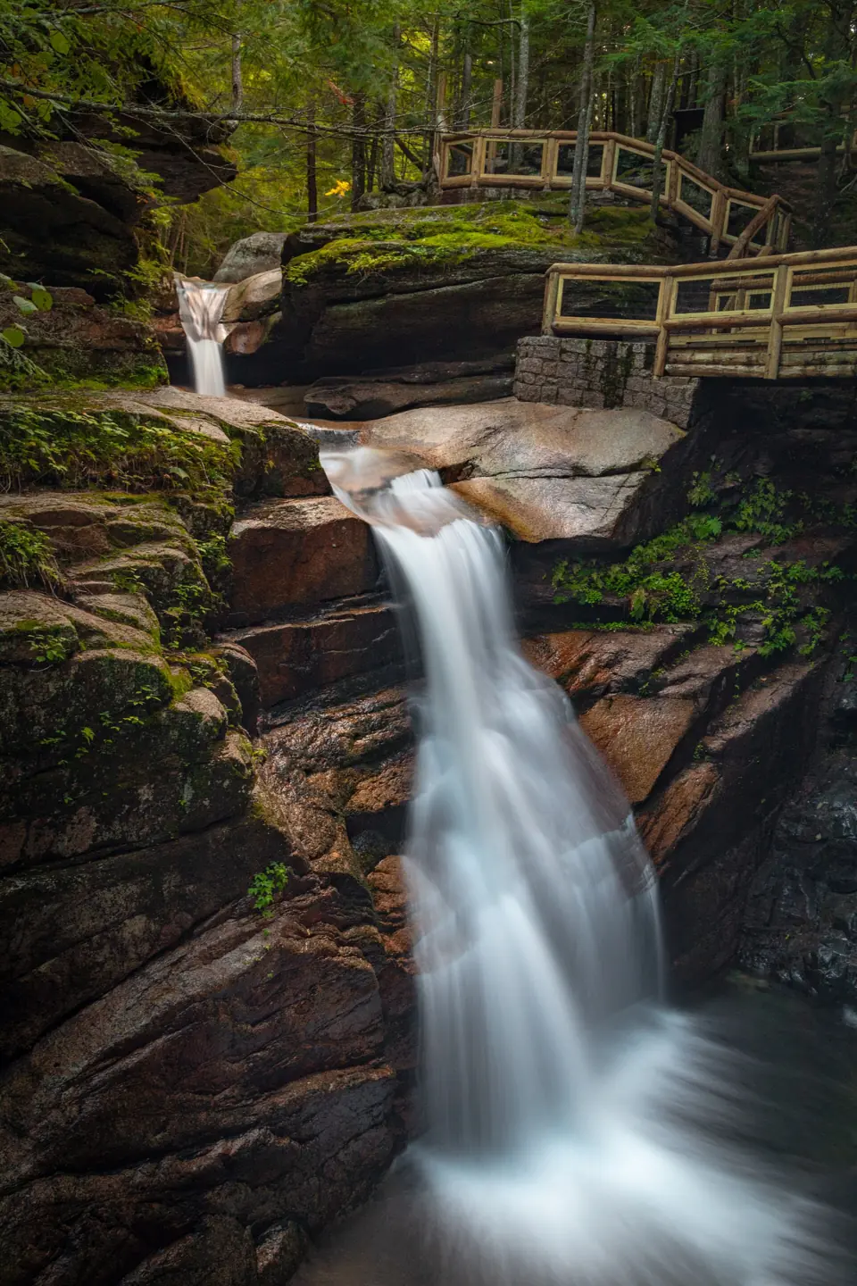
Sabbaday Falls is a series of cascades in a narrow flume on Sabbaday Brook, 15 miles west of Conway on the Kancamagus Highway. The Forest Service describes an easy 15-minute walk on graded gravel from a paved lot, and you need a WMNF parking pass from spring through fall.
Swimming is banned. Under a forest order, a portion of the trail is closed through April 15, 2027, as it is every winter. As of October 29, 2026, we found no other closure notice.
About Sabbaday Falls
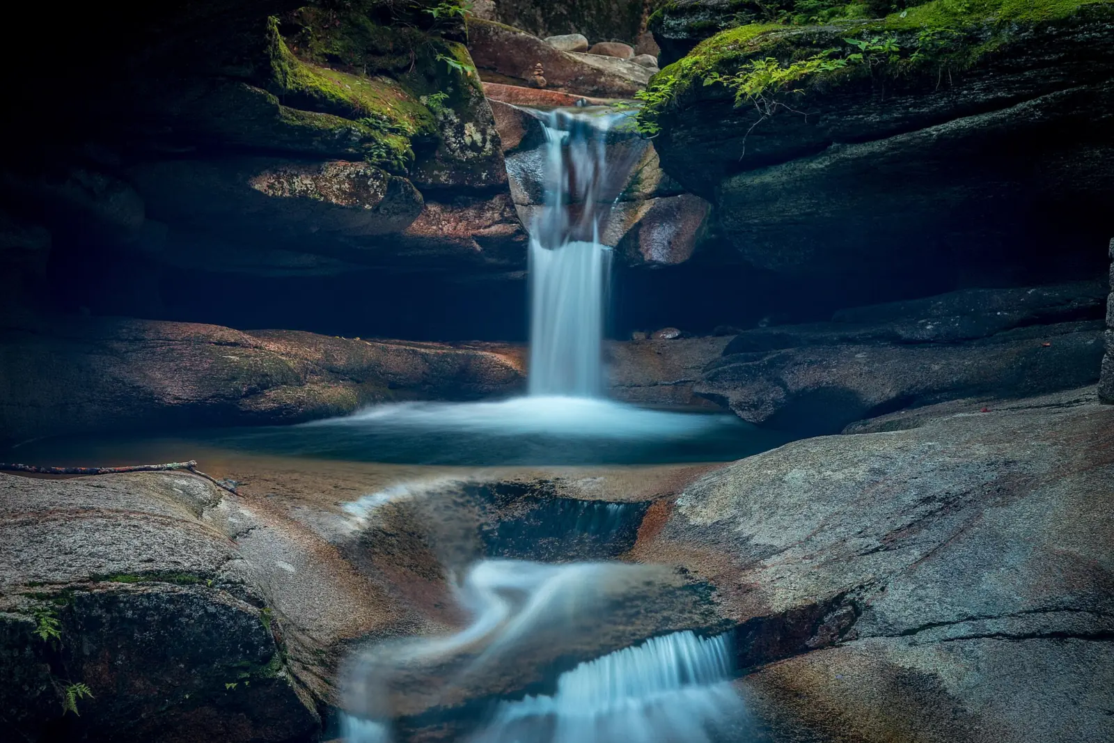
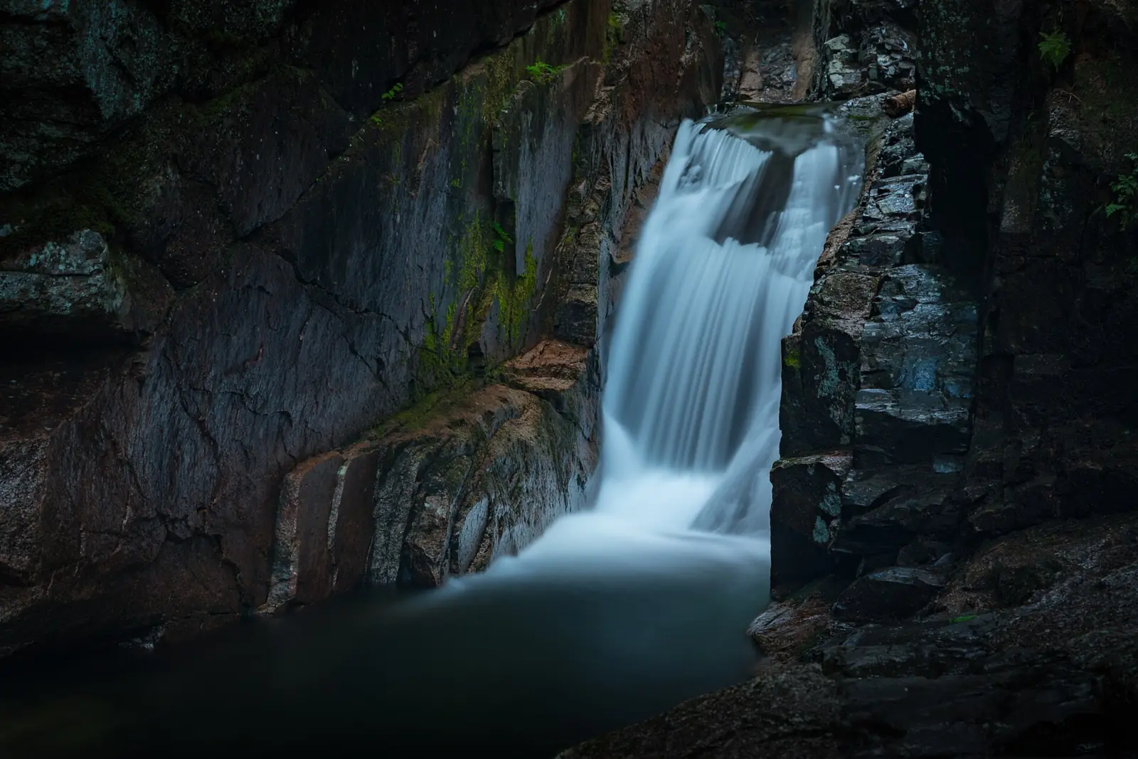
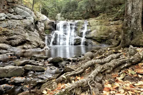
The Forest Service describes Sabbaday Falls as a series of cascades in a narrow flume. The falls are on Sabbaday Brook in Grafton County, inside the White Mountain National Forest. The Saco Ranger District manages the site.
Two legends explain the name. The trailhead's Forest Service marker tells of a crew building a road from Albany Intervale to Waterville. The marker says the crew hid their tools one Saturday night, with winter coming. It says they named the brook Sabbaday Brook, for the Sabbath Day, before leaving Sunday morning. In Passaconaway in the White Mountains, Charles Edward Beals Jr. says early explorers reached the brook on a Sunday. Beals adds that Sweetser called them Church Falls.
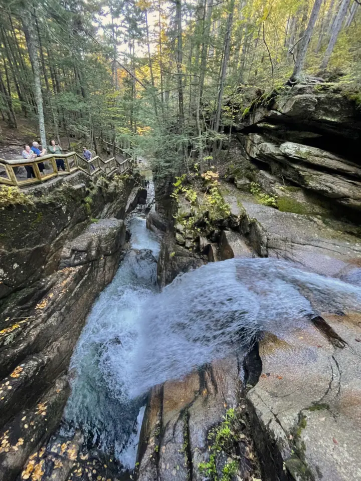
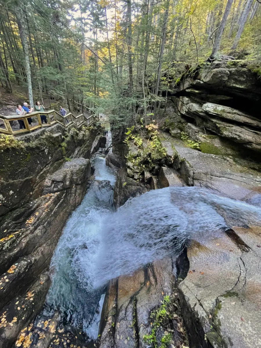
The USFS calls the observation site one of the most popular locations on the Kancamagus Scenic Byway. A stone staircase and gravel walkway run right beside the falls, and interpretive panels explain their geology.
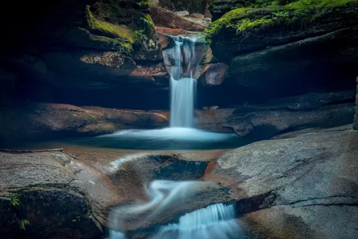
The New England Waterfalls guidebook site breaks the falls into three parts: a small punchbowl, a plunge through the narrow gorge and a final drop.
We found no official height. Visit White Mountains and New England Waterfalls give 35 feet in total, but higher figures also circulate online. Because neither is an agency figure, our key facts show no height.
USGS place-name data put the falls at about 1,404 feet above sea level.
Getting there and parking
The Forest Service places Sabbaday Falls 15 miles west of Conway on the Kancamagus Highway, which is NH 112. The walk starts from a paved parking lot. The Directions button goes to the USFS-listed site point by the parking lot. The map pin marks the falls from USGS place-name data.
From spring through fall, Sabbaday Falls is a Forest Service fee site, and the USFS collects no fee in winter. The WMNF passes page lists Sabbaday Falls among Saco Ranger District sites not maintained in winter. Closing dates for those sites vary with the weather, the USFS says.
The USFS accepts the daily pass, White Mountain National Forest annual passes, Interagency Passes, and Golden Age and Access passes. Buy a day pass at the self-serve pay station or online through Recreation.gov. Display your pass on the windshield or dash. If you buy on Recreation.gov at the site, you get no printed pass; your license plate confirms it. Connectivity is limited, so buying ahead and printing is safer.
A day pass costs $5 on Recreation.gov and is valid only for that date and vehicle. The Forest Service passes page lists no prices. WMNF listings seen in search excerpts put an annual pass at $30 and a household pass at $40, which we could not confirm officially.
Trail Finder warns that the site can get extremely crowded, especially in peak seasons, and suggests a midweek visit. We found no official overflow parking. Recreation.gov says a pass does not guarantee a parking space, and visitors who park illegally may be fined and towed. If the lot is full, come back later.
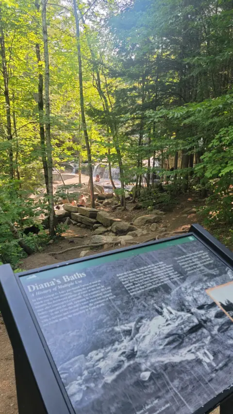
The same WMNF pass covers Diana's Baths near North Conway. The USFS passes page lists Diana's Baths as a year-round fee site maintained for winter use. Arethusa Falls is in Crawford Notch State Park, run by NH State Parks, so the WMNF pass doesn't apply there.
We list Diana's Baths and Arethusa Falls as open, as far as we can tell, but check each page before you go. Our guide to waterfalls in New Hampshire has more of the state's falls.
Map and nearby falls
Map loads as you scroll. Open in OpenStreetMap
OpenPartly open / seasonalUnconfirmedClosedLarger map
The hike
The Forest Service calls the route to Sabbaday Falls an easy 15-minute walk on an evenly graded, gravel-surfaced trail. Trail Finder, which assessed the trail in July 2025, lists 0.7 mile round trip. By its count, the falls are about 0.3 mile from the lot.
Trail Finder describes the first 0.3 mile as crushed gravel about 5 feet wide, with benches. The same assessment notes sections steeper than a 15% grade. In summer 2025, its assessors saw signs of erosion and water damage in some areas.
At the falls, a short stair loop called the Waterfall Trail climbs through the gorge above the falls. The Waterfall Trail rejoins the Sabbaday Brook Trail about 0.1 mile later, according to Trail Finder.
Past the falls, the Sabbaday Brook Trail heads into wilderness toward Mount Tripyramid, a long hike of about 10 to 11 miles round trip (Trail Finder).
Trail Finder says the wide gravel section suits a wide range of users, but the accessible route stops short of the main waterfall viewpoint. Expect stairs at the gorge.
Trail Finder lists dogs as allowed on a leash. We found no Forest Service pet rule for this site.
Don't count on restrooms or drinking water. The USFS site page says there are rest rooms and picnic tables in the parking lot. The facility list on that same page says restrooms are not available and potable water is not available.
When to visit
A portion of the Sabbaday Falls Trail is closed through April 15, 2027, or as otherwise posted. Forest order R9-22-19-24 closes it from November 1 through April 15 each year. We did not review the order's map, so we can't say which section closes.
Breaking the order can bring a fine of up to $5,000 for an individual, up to six months in prison, or both, the order says. Respect any posted closure.
In winter, the USFS lists the day-use site as not maintained and collects no fee. Wikipedia says the Kancamagus Highway is plowed and stays open in winter, apart from short closures while crews clear heavy snow. We could not confirm whether the lot is plowed.
As of October 29, 2026, we found no other 2026 closure notice. On October 29, 2026, the White Mountain National Forest alerts page listed no closure for Sabbaday Falls. Before a late-fall trip, check White Mountain National Forest alerts or call the Saco Ranger District at (603) 447-5448.
The New England Waterfalls guidebook site recommends May through October. We found no official best month for flow.
For fall color, a guest guide on Visit NH's site says peak season typically runs from the first to the third week of October. It adds that peak traffic can stretch the 45-minute Kancamagus drive to 2 to 3 hours one way.
| Trail | Easy 15-minute walk on graded gravel (USFS); 0.7 mi round trip, falls about 0.3 mi from the lot, some grades over 15% (Trail Finder) |
|---|---|
| Difficulty | Easy (Forest Service); some grades steeper than 15% (Trail Finder) |
| Time needed | About 15 minutes from the lot (USFS) |
| Entry fee | Spring-fall fee site, no fee in winter (USFS); $5 day pass (Recreation.gov); annual price unconfirmed; Interagency, Golden Age, Access passes OK |
| Permit / reservation | No permit; a WMNF parking pass is needed spring through fall |
| Parking | Paved lot on the Kancamagus; pass needed |
| Dogs | Allowed on a leash, per Trail Finder; we found no Forest Service pet rule for this site |
| Swimming | Not allowed (USFS); forest order R9-22-19-12 restricts entering the water at Sabbaday Falls and Rocky Gorge |
| Wheelchair / stroller | Partial: the first 0.3 mi is 5-ft-wide crushed gravel, but Trail Finder says access does not reach the main waterfall viewpoint; some grades top 15% |
| Restrooms | Unclear: the USFS site page says restrooms are in the parking lot and also that none are available; no potable water. Don't count on either |
| Best time to visit | May-October, per the New England Waterfalls guidebook site; no official best month |
| Crowds | The USFS calls the site one of the most popular locations on the Kancamagus Scenic Byway; Trail Finder says the site can get extremely crowded in peak seasons |
| Managed by | USDA Forest Service, White Mountain National Forest (Saco Ranger District) |
Safety and swimming
Swimming is not allowed at Sabbaday Falls, the Forest Service says. Forest order R9-22-19-12 also restricts entering the water at Sabbaday Falls and Rocky Gorge. We found no official reason for the rule.
Stay on the stairs and walkway beside the flume. Expect wet, slick rock near the water, and keep children within reach. Do not climb onto the rocks in the gorge.
Rocky Gorge and Lower Falls are other Saco Ranger District day-use sites. The USFS lists both as not maintained in winter, and Rocky Gorge falls under the same water-entry order as Sabbaday Falls.
Our waterfall safety guide has more advice on moving water and slick rock.
Conditions change: confirm with the White Mountain National Forest before you go.
Where to stay near Sabbaday Falls
Compare hotels, cabins and rentals close to the falls around Conway.
See places to stay nearbyAffiliate link: we may earn a commission at no cost to you. Partners do not see or change our waterfall facts. Disclosure.
Photos
Sabbaday Falls FAQ
Do you have to pay to park at Sabbaday Falls?
Yes, from spring through fall. The Forest Service runs Sabbaday Falls as a fee site in those seasons and collects no fee in winter. A WMNF day or annual pass works, and so do Interagency, Golden Age and Access passes. Recreation.gov sells the day pass for $5, and it lists November 11 as the last 2026 fee-free day at White Mountain National Forest.
Can you swim at Sabbaday Falls?
No. The Forest Service says swimming is not allowed, and forest order R9-22-19-12 restricts entering the water at Sabbaday Falls and Rocky Gorge.
How long is the walk to Sabbaday Falls?
About 15 minutes on an easy, graded gravel path, the Forest Service says. Trail Finder lists 0.7 mile round trip, with the falls about 0.3 mile from the lot and some sections steeper than 15% grade.
Where do you park for Sabbaday Falls, and what if the lot is full?
Use the paved lot on the Kancamagus Highway, 15 miles west of Conway. Trail Finder says the site can get extremely crowded in peak seasons and suggests going midweek. We found no official overflow lot. Recreation.gov warns that a pass doesn't guarantee parking and that illegally parked cars may be fined and towed.
Is Sabbaday Falls accessible for wheelchairs and dogs?
Partly. Trail Finder says the first 0.3 mile is wide crushed gravel, but the accessible route does not reach the main viewpoint, and some grades top 15%. Trail Finder lists leashed dogs as allowed.
When is fall foliage at Sabbaday Falls?
Typically from the first to the third week of October across New Hampshire, according to a guest guide on Visit NH's site. The guide adds that peak traffic can stretch the 45-minute Kancamagus drive to 2 to 3 hours one way. Plan around the winter closure: under forest order R9-22-19-24, a portion of the Sabbaday Falls Trail is closed November 1 through April 15.
Can you visit Sabbaday Falls in winter?
Not on the whole trail. A portion of the Sabbaday Falls Trail is closed through April 15, 2027, or as posted, under forest order R9-22-19-24. The USFS doesn't maintain the site in winter. Call the Saco Ranger District at (603) 447-5448.
Why is it called Sabbaday Falls?
Sabbaday Falls is named for the Sabbath Day, and both stories behind the name are legends. A Forest Service marker at the trailhead says road workers hid their tools one Saturday night, with winter coming. Before leaving on Sunday morning, the marker says, they named the brook Sabbaday Brook. Charles Edward Beals Jr.'s history Passaconaway in the White Mountains says early explorers reached the brook on a Sunday.
Nearby waterfalls
More waterfalls to explore


All waterfalls in New Hampshire
On these lists: Dog-friendly waterfalls · Easy waterfall hikes
Sources
- USDA Forest Service: Sabbaday Falls Observation Site (updated Feb 19, 2025)
- USDA Forest Service: White Mountain NF passes (updated Mar 19, 2026)
- USDA Forest Service: White Mountain NF Forest Supervisor's Orders (updated Jul 6, 2026)
- USDA Forest Service: White Mountain NF alerts (read Oct 29, 2026)
- USDA Forest Service: Order R9-22-19-24, Seasonal Trail Closures (2019), PDF (read Oct 29, 2026)
- USDA Forest Service: Order R9-22-19-12, Sabbaday Falls and Rocky Gorge (read Oct 29, 2026)
- Recreation.gov: White Mountain National Forest Site Pass (read Oct 22, 2026)
- Trail Finder (Upper Valley Trails Alliance): Sabbaday Falls, assessed July 2025
- Visit White Mountains: 5 Quick Waterfall Hikes (2022)
- New England Waterfalls: Sabbaday Falls
- Wikipedia: New Hampshire Route 112
- TopoQuest (USGS GNIS): Sabbaday Falls
- Passaconaway in the White Mountains (C. E. Beals Jr.), chapter 10
- Forest Service marker 'How Sabbaday Falls Got Its Name' (transcribed on HMdb)
- Visit NH: Ultimate fall foliage road trip guide (guest guide, 2021)
Last verified Oct 29, 2026 by The Waterfall Guide editorial team. Conditions change: confirm with USDA Forest Service, White Mountain National Forest (Saco Ranger District) before you go. Spotted something out of date? Report a correction.