Right now
Status note (Nov 11, 2026): Open, as far as we can tell. The live DCR page would not load for us, so we read a copy kept by DCR's web host (last modified June 11, 2026). It listed no alerts. The NPS page updated Nov 9, 2026 named no closure. What the status labels mean
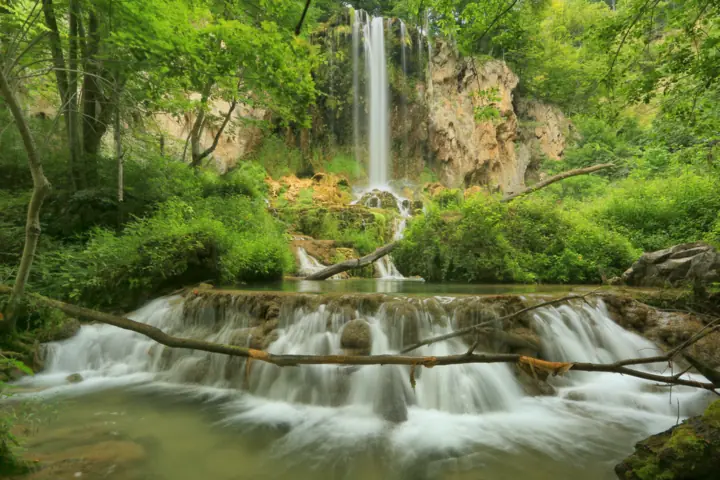
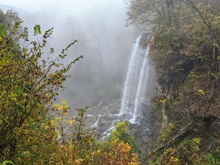
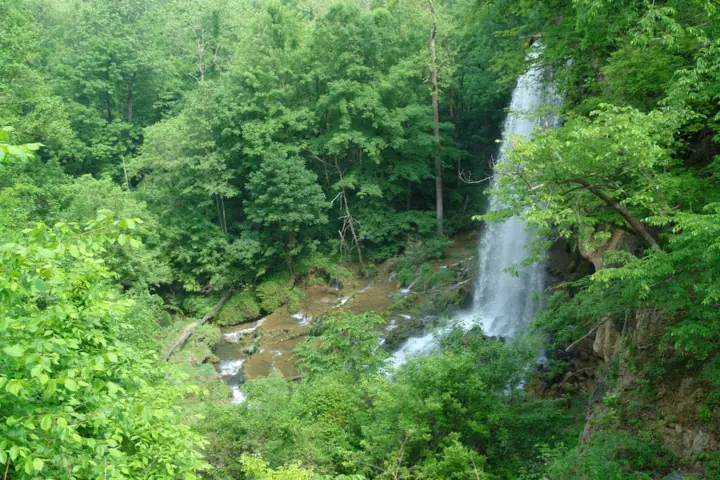
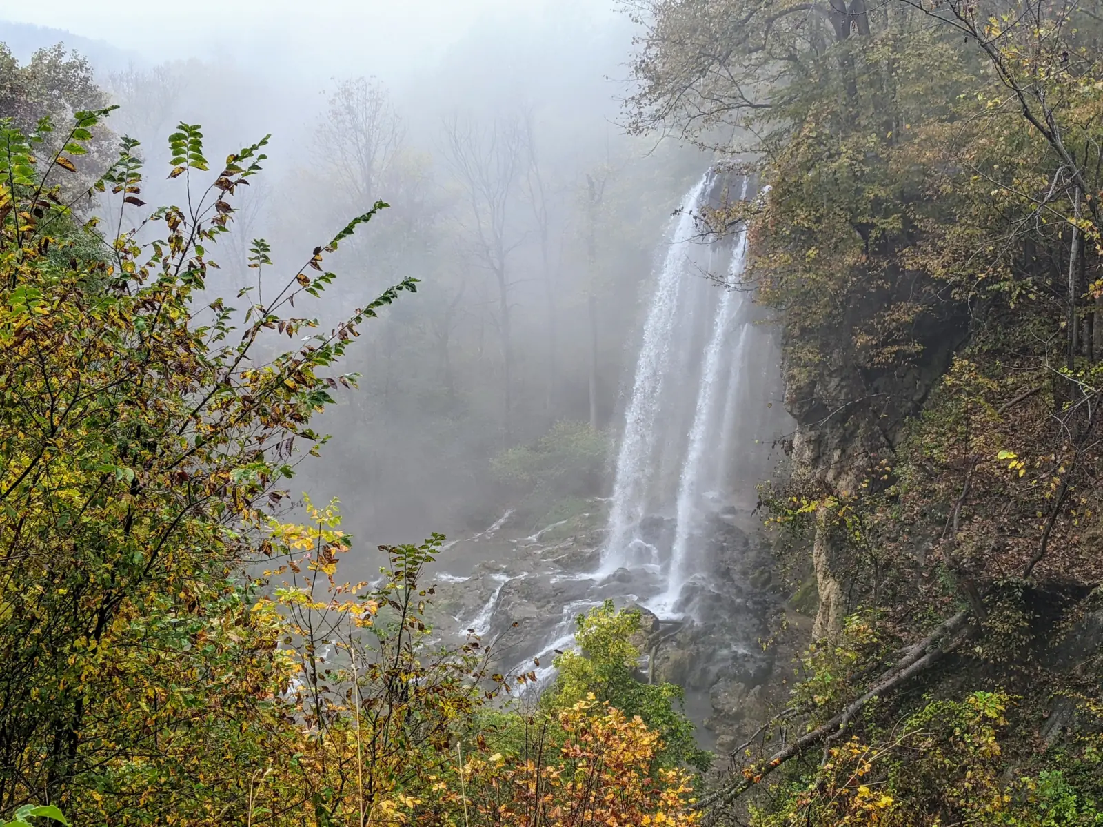
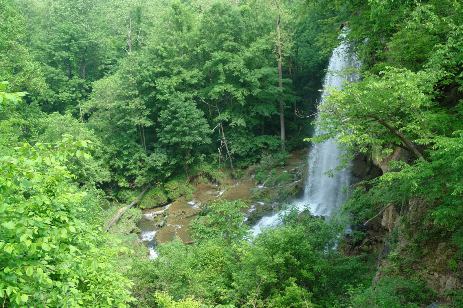
Falling Spring Falls is an 80-foot cascade from an overhanging limestone ledge in Alleghany County, Virginia, per the NPS. Virginia DCR owns the site, and Douthat State Park maintains it. You see it from an overlook a short walk from a pull-off on US 220, about 5 miles north of Covington. Entry beyond the overlook is not allowed.
About Falling Spring Falls
Falling Spring Falls is in Alleghany County, Virginia. The NPS describes "an 80-foot cascade" from "an overhanging limestone ledge." Virginia DCR owns the site, and DCR says Douthat State Park maintains it.
Jefferson's waterfall
Thomas Jefferson wrote about it in his 1781 Notes on the State of Virginia. He called it "The only remarkable Cascade in this country." He wrote that it "falls over a rock 200 feet into the valley below." At the time, the site was in Augusta County.
Moved by mining
The falls you see today are not where Jefferson saw them. DCR and the NPS say travertine mining from 1914 to 1941 moved the falls and reduced their height. Two companies mined here: the Ohio C. Barber Fertilizer Company, then the Falling Spring Lime Company.
From royal grant to state land
In August 1771, King George III granted 82 acres, including the falls, to Gabriel Jones, per DCR and the NPS. Governor Thomas Jefferson later granted the property to Major Thomas Massie. On Nov 28, 2004, Mead Westvaco donated the falls and about 19 acres to the state, per DCR.
About our map pin
Our map pin is the USGS GNIS point for Falling Spring Falls (feature ID 1492929), in Alleghany County.
For other Virginia falls, see Crabtree Falls and Dark Hollow Falls, or browse all Virginia waterfalls.
Getting there and parking
Virginia DCR says to take I-64 Exit 16A onto US 220 North. Drive about 17 miles, through Covington, and the falls are on the left. The NPS puts the site on US 220, 5 miles north of Covington.
These two distances do not match, and we could not confirm which is right. Use our map pin, which is the USGS GNIS point, and watch for the pull-off on the left of US 220 North.
From Douthat State Park, DCR says to take VA 629 north to US 220, turn right, and drive about 15 miles.
Fees
We found no fee for Falling Spring Falls on the DCR pages we read. It is not on DCR's state park parking fee table. The NPS says the America the Beautiful pass is not accepted here and that DCR sets fees.
Facilities
DCR lists "No restrooms" and "No cell service." A 2017 DCR blog post, updated in 2024, describes picnic tables, a security fence, signs and parking. Douthat staff and volunteers built them. The post is older, so check that these are still there.
Contact
Douthat State Park: 540-862-8100.
DCR gives the mailing address as US-220, Hot Springs, VA 24445.
Map and nearby falls
Map loads as you scroll. Open in OpenStreetMap
OpenPartly open / seasonalUnconfirmedClosedLarger map
Falling Spring Falls overlook: a short walk from US 220
There is no hike. DCR says "Guests have a short walk from the parking area to the overlook." A 2017 DCR blog post puts it at about 100 feet. The NPS describes a small pull-off and a paved path to the overlook.
The NPS lists the site as wheelchair accessible.
Stay at the overlook
DCR says "No trespassing is allowed beyond the overlook, and it is strictly enforced." The NPS also says access beyond the overlook is prohibited.
When to visit
No official source we read names a best month or posts hours for the overlook.
Status checks
On Nov 11, 2026, the live DCR page would not load for us, so we read a copy kept by DCR's web host (modified June 11, 2026). It listed no alerts. The NPS page updated Nov 9, 2026 named no closure. Call Douthat State Park at 540-862-8100 to confirm.
| Height | 80 ftNote: About 80 feet today, per Virginia DCR and the NPS; Thomas Jefferson described a 200-foot drop in 1781, before mining moved the falls |
|---|---|
| Trail | No hike. Virginia DCR says guests have a short walk from the parking area to the overlook, and the NPS describes a paved path from a small pull-off. |
| Difficulty | No official rating. Virginia DCR describes a short walk from the parking area to the overlook. The NPS lists the overlook as wheelchair accessible. |
| Entry fee | No fee is listed for Falling Spring Falls on the Virginia DCR pages we read. It is not on DCR's state park parking fee table. |
| Permit / reservation | No permit listed. |
| Parking | Pull-off on US 220 north of Covington (see directions) |
| Dogs | The NPS lists pets as allowed. Virginia DCR's general state park rule is a leash no longer than 6 feet. |
| Swimming | No access. Virginia DCR says "No trespassing is allowed beyond the overlook, and it is strictly enforced." |
| Wheelchair / stroller | The NPS lists the site as wheelchair accessible, with a paved path from the pull-off to the overlook. |
| Walk behind the falls | No |
| Best time to visit | No official best month. |
| Crowds | No official visitor figure found. |
| Managed by | Virginia Department of Conservation and Recreation (maintained by Douthat State Park) |
Safety and swimming
Stay at the overlook. DCR says entry beyond it is not allowed and is strictly enforced.
US 220 is a highway, so watch for traffic when you pull off and walk to the overlook.
There is no cell service at the site, per DCR. In an emergency, drive to where you have a signal and call 911. Our waterfall safety guide has more on staying safe near falls.
Conditions change: confirm with the official source before you go.
Where to stay near Falling Spring Falls
Compare hotels, cabins and rentals close to the falls around Covington.
See places to stay nearbyAffiliate link: we may earn a commission at no cost to you. Partners do not see or change our waterfall facts. Disclosure.
Photos
Falling Spring Falls FAQ
Is Falling Spring Falls open now?
As far as we can tell, yes. The live DCR page would not load for us, so we read a copy kept by DCR's web host (last modified June 11, 2026). It listed no alerts. The NPS page updated Nov 9, 2026 named no closure.
How tall is Falling Spring Falls?
About 80 feet, per the NPS and Virginia DCR. Thomas Jefferson described a 200-foot drop in 1781, but DCR and the NPS say later mining moved the falls and reduced their height.
Do you have to hike to Falling Spring Falls?
No. Virginia DCR describes a short walk from the parking area to the overlook. The NPS lists a paved path and calls the site wheelchair accessible.
Can you go to the bottom of Falling Spring Falls?
No. Virginia DCR says "No trespassing is allowed beyond the overlook, and it is strictly enforced."
Where is Falling Spring Falls?
On US 220 in Alleghany County, Virginia, about 5 miles north of Covington, per the NPS. DCR's directions say about 17 miles from I-64 Exit 16A, which does not match. Our map pin is the USGS GNIS point.
Nearby waterfalls
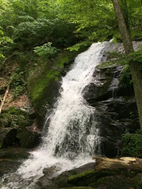 Crabtree Falls47 mi straight-line, by our mathOpenPROMOTED 1,200FT
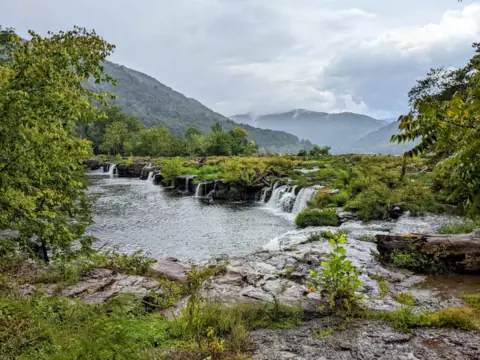 Sandstone Falls52 mi straight-line, by our mathOpenTALLEST SECTION 25FT
More waterfalls to explore



Sources
- Virginia DCR: Falling Spring Falls (read on DCR's web host copy; last modified June 11, 2026)
- Virginia DCR blog: One of the most scenic sites in all of Virginia (posted Aug 28, 2017; updated Nov 26, 2024; read on DCR's web host copy)
- Virginia DCR: State park parking and admission fees (modified Oct 1, 2026; read on DCR's web host copy)
- Virginia DCR: Pets in state parks (modified Aug 31, 2026; read on DCR's web host copy)
- NPS Chesapeake Gateways: Falling Springs Falls (updated Nov 9, 2026)
- Thomas Jefferson, Notes on the State of Virginia (1781), Query V (Avalon Project, Yale Law School)
- USGS GNIS: Falling Spring Falls, feature ID 1492929 (coordinates, Alleghany County)
Last verified Nov 11, 2026 by The Waterfall Guide editorial team. Conditions change: confirm with Virginia Department of Conservation and Recreation (maintained by Douthat State Park) before you go. Spotted something out of date? Report a correction.