Right now
Right now as of Nov 3, 2026
- Permit No permit needed. Entry fee: $5 per vehicle per day.
Status note (Nov 3, 2026): Open, as far as we can tell: on Nov 3, 2026 the USFS Fish Creek Falls Picnic Site page showed "Site Open". USFS closes the footbridge and about four miles of Fish Creek Trail #1102 each year from April 1 to July 1. The 2026 closure window ended July 1. What the status labels mean
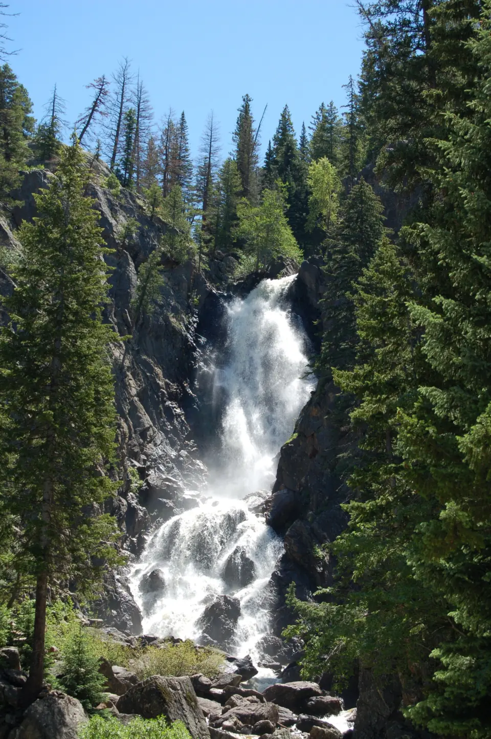
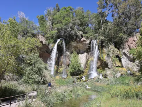
Fish Creek Falls is a nearly 300-foot waterfall in Routt National Forest, per the U.S. Forest Service (USFS), 4 miles up Fish Creek Falls Road from Steamboat Springs. A wheelchair-accessible trail leads to an overlook, and a dirt trail goes down to the base and a historic bridge. Parking costs $5 per vehicle per day. The USFS page showed "Site Open" on November 3, 2026.
About Fish Creek Falls
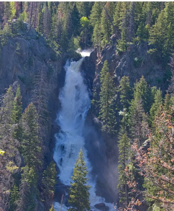
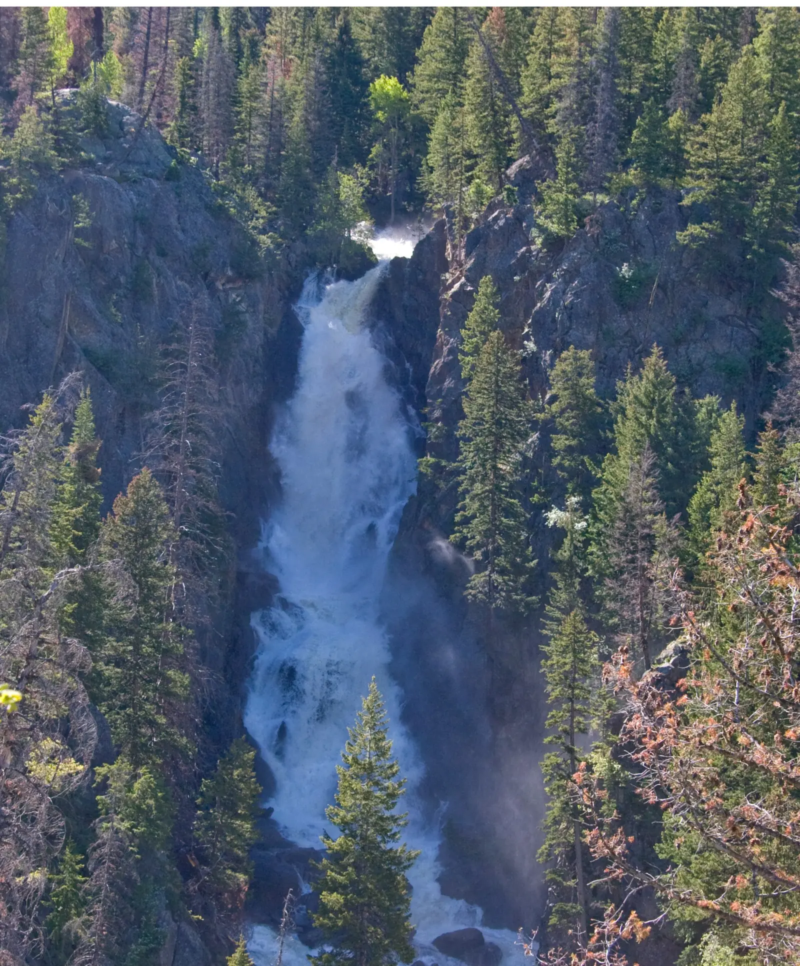
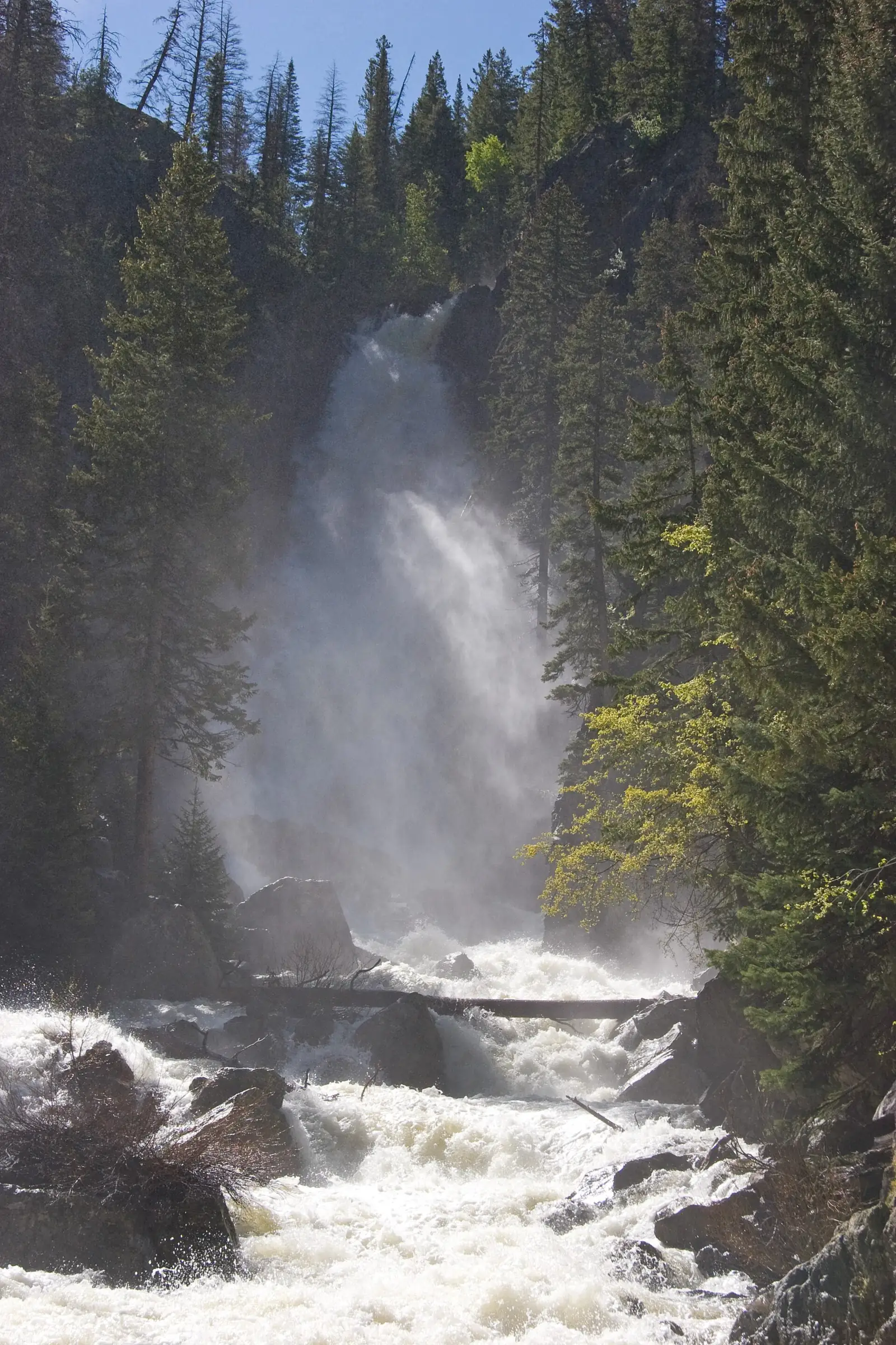
Fish Creek Falls drops nearly 300 feet, according to the U.S. Forest Service (USFS). The Steamboat Springs Chamber lists the height as 283 feet.
The falls are in Routt National Forest, part of the Medicine Bow-Routt National Forests, on the Hahns Peak/Bears Ears Ranger District. The site is a USFS day-use picnic area and trailhead.
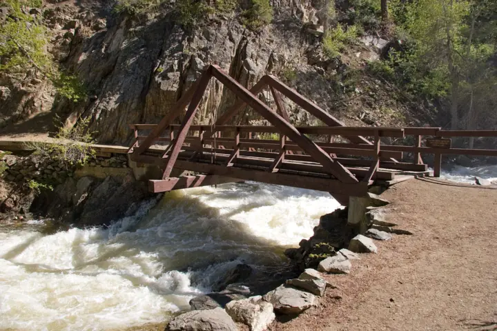
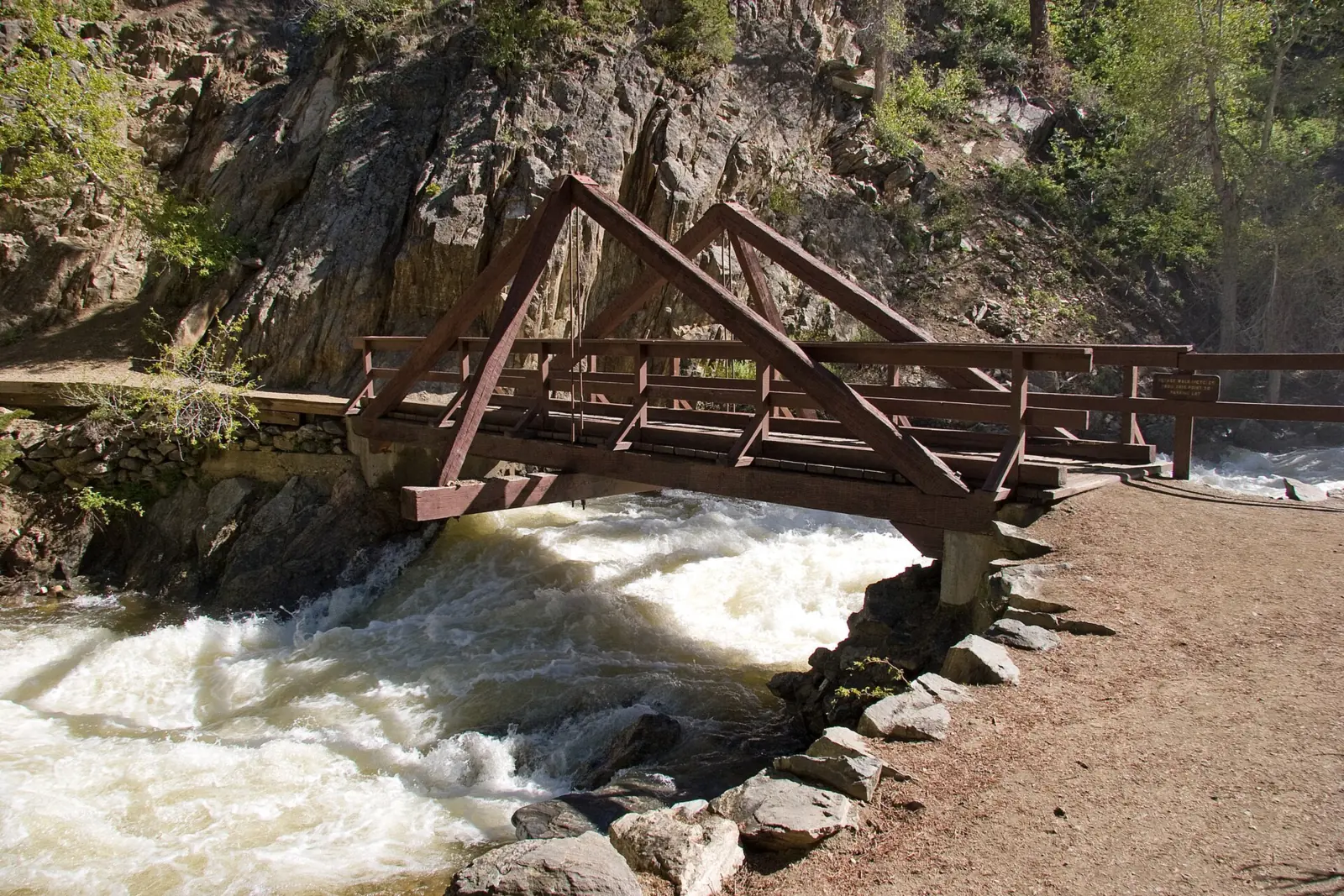
From the parking area, a wheelchair-accessible overlook trail gives a view of the falls, USFS says. A dirt trail goes down to the base of the falls and a historic bridge over Fish Creek.
A ¼-mile accessible walk also leads to a picnic area among aspen and oak brush. USFS provides tables, garbage service and a vault toilet, but no potable water.
Fish Creek Trail #1102 continues past the bridge to Upper Fish Creek Falls and Long Lake. COTREX, Colorado's statewide trail map, lists the whole trail at 7.4 miles.
Getting there and parking
USFS gives these directions: from Steamboat Springs, go north on Third Street, then turn right on Fish Creek Falls Road and drive 4 miles to the trailhead. The Steamboat Springs Chamber starts the route at Lincoln Avenue (US 40).
The site is open January to December, from 6 a.m. to 10 p.m., per USFS.
Parking fee and passes
Fish Creek Falls is a day-use fee area. USFS charges $5 per vehicle per day, payable by credit card or cash on site. It also lists a $30 annual pass, sold in advance on Recreation.gov.
USFS gives no lot capacity. Our map pin marks the falls; the Directions button routes to the picnic site coordinates that USFS lists.
Questions go to the Hahns Peak/Bears Ears Ranger District at (970) 870-2299.
Other Colorado falls on the site include Rifle Falls, Box Canyon Falls and Helen Hunt Falls. See our Colorado waterfalls guide for more.
Map and nearby falls
Map loads as you scroll. Open in OpenStreetMap
OpenPartly open / seasonalUnconfirmedClosedLarger map
Overlook, base bridge and upper falls
Two routes start at the Fish Creek Falls trailhead: a short overlook trail and a longer trail down to the footbridge below the falls.
Overlook trail
USFS describes a wheelchair-accessible overlook trail with a view of the falls. The Steamboat Springs Chamber calls it paved and puts it at about ¼ mile one way, ending at about 7,440 feet.
Trail to the base and bridge
A dirt trail leads down to the base of the falls and the historic bridge, USFS says. The Chamber lists it at about ¼ mile one way, reaching about 7,340 feet.
Upper Fish Creek Falls and Long Lake
Past the bridge, Fish Creek Trail #1102 climbs to Upper Fish Creek Falls. The Chamber puts the upper falls 2.5 miles one way from the base, at about 9,000 feet. Long Lake is 6.5 miles one way, at about 9,800 feet.
COTREX lists hiking, dogs, bikes, horses, Nordic skiing, snowshoeing and snowmobiles as allowed uses on Fish Creek Trail. We found no leash rule on the USFS page.
When to visit
The site is open year-round, but the trail past the bridge is not. Plan around the spring closure.
Spring bridge closure
USFS closes the footbridge and about four miles of Fish Creek Trail #1102 each year from April 1 to July 1, during high water. Its April 2, 2026 release says the closure can be used each year through 2027, depending on the repair schedule.
During the closure, USFS says the picnic site and upper overlook trail stay open to view the falls. You can walk down Fish Creek Trail to the bridge, but not past it.
The 2026 closure window ended on July 1. We found no USFS reopening notice, so check the picnic site page before you plan to cross.
Outside the closure, the temporary repairs are sufficient only during lower creek flows and with limited bridge occupancy, which USFS calls a weight limit. USFS gives no figure.
Winter
USFS says the area is open year-round, with snowshoeing and ice climbing in the winter months. Picnic tables are not accessible in winter.
| Height | about 300 ftNote: USFS calls the falls nearly 300 feet tall; the Steamboat Springs Chamber lists 283 ft |
|---|---|
| Trail | Wheelchair-accessible overlook trail, about ¼ mi one way; dirt trail to the base and historic bridge, about ¼ mi one way (USFS; Steamboat Springs Chamber). Upper Fish Creek Falls is 2.5 mi one way beyond the base |
| Difficulty | Easy and accessible to the overlook; the trail on to Upper Fish Creek Falls climbs to about 9,000 ft |
| Entry fee | $5 per vehicle per day, by credit card or cash on site (USFS). USFS also lists a $30 annual pass, sold in advance on Recreation.gov |
| Permit / reservation | No permit; a $5 per vehicle day-use fee applies |
| Parking | Trailhead lot, 4 mi up Fish Creek Falls Rd |
| Hours / season | 6 a.m. to 10 p.m., January to December (USFS) |
| Dogs | COTREX, Colorado's statewide trail map, lists Fish Creek Trail as open to dogs. The USFS picnic site page gives no pet rule |
| Swimming | The USFS page gives no swimming rule |
| Wheelchair / stroller | Yes to the overlook: USFS describes a wheelchair-accessible overlook trail and a ¼-mile accessible walk to the picnic area. Tables are not accessible in winter |
| Walk behind the falls | No |
| Restrooms | Vault toilet; no potable water (USFS) |
| Best time to visit | No official best month. USFS closes the bridge during the high-water months, April 1 to July 1; snowshoeing and ice climbing in winter |
| Managed by | U.S. Forest Service, Medicine Bow-Routt National Forests (Hahns Peak/Bears Ears Ranger District) |
Safety and swimming
Respect the bridge closure. USFS says the bridge abutments were "structurally compromised due to scouring," and the annual closure is for public safety during high water. The bridge also closed briefly in 2023.
When the bridge is open, the temporary fix holds only at lower flows and with limited occupancy. Follow any posted limits, and do not crowd onto the bridge.
USFS has a design for a permanent replacement and is pursuing funding. It gives no date.
The USFS page gives no swimming rule. Stay on the trail near the base, especially during spring high water.
There is no potable water at the site, so bring your own. In winter, ice climbers use the falls; give them space below the ice.
Our waterfall safety guide has more tips. Conditions change: confirm with USFS before you go.
Where to stay near Fish Creek Falls
Compare hotels, cabins and rentals close to the falls around Steamboat Springs.
See places to stay nearbyAffiliate link: we may earn a commission at no cost to you. Partners do not see or change our waterfall facts. Disclosure.
Photos


Fish Creek Falls FAQ
How long of a hike is Fish Creek Falls?
Short to the overlook: about ¼ mile one way on a paved, accessible trail, per the Steamboat Springs Chamber. The dirt trail to the base bridge is also about ¼ mile one way. Upper Fish Creek Falls is 2.5 miles one way beyond the base.
Why is Fish Creek Falls trail closed?
USFS closes the footbridge and about four miles of Fish Creek Trail #1102 each year from April 1 to July 1. The bridge abutments were damaged by scouring, and the closure protects hikers during high water. The 2026 closure window ended July 1.
Can you drive to Fish Creek Falls?
Yes, to the trailhead lot 4 miles up Fish Creek Falls Road from Steamboat Springs (USFS). From there, a short accessible trail leads to the overlook.
Do you have to pay to park at Fish Creek Falls?
Yes. USFS charges $5 per vehicle per day, by credit card or cash on site. A $30 annual pass is sold in advance on Recreation.gov.
Are dogs allowed at Fish Creek Falls?
COTREX, Colorado's statewide trail map, lists Fish Creek Trail as open to dogs. The USFS picnic site page gives no pet rule, so check with the ranger district at (970) 870-2299.
How tall is Fish Creek Falls?
USFS calls it nearly 300 feet tall. The Steamboat Springs Chamber lists 283 feet.
Can you hike to Upper Fish Creek Falls?
Outside the April 1 to July 1 closure, USFS describes only a weight limit on the bridge. The Chamber puts the upper falls 2.5 miles one way past the base bridge, at about 9,000 feet. Check the USFS page before you plan to cross.
Nearby waterfalls
 Alberta Falls61 mi straight-lineOpen
 Ouzel Falls65 mi straight-lineOpen
 Rifle Falls74 mi straight-lineOpen60FT
On these lists: Easy waterfall hikes · Roadside waterfalls
Sources
- USFS Medicine Bow-Routt NF: Fish Creek Falls Picnic Site (last updated June 24, 2026; read Nov 3, 2026)
- USFS news release: Annual temporary closure of Fish Creek Falls bridge in place (Apr 2, 2026; read Nov 3, 2026)
- USFS Forest Order: Fish Creek Falls bridge and Fish Creek Trail closure (PDF)
- Recreation.gov: Fish Creek Falls annual pass
- Steamboat Springs Chamber: Fish Creek Falls
- COTREX (trails.colorado.gov): Fish Creek Trail
- USGS National Map GNIS layer: Fish Creek Falls coordinates
Last verified Nov 3, 2026 by The Waterfall Guide editorial team. Conditions change: confirm with U.S. Forest Service, Medicine Bow-Routt National Forests (Hahns Peak/Bears Ears Ranger District) before you go. Spotted something out of date? Report a correction.