Right now
Right now as of Nov 8, 2026
- Permit Pictured Rocks entrance pass.
Status note (Nov 8, 2026): Open, as far as we can tell: on Nov 8, 2026, NPS listed no alert for Miners Falls or Miners Castle Road. The only active park alert that day was the Munising Falls Trail closure. Miners Castle Road will close to vehicles on December 1, 2026, and NPS treats it as a snowmobile trail through March 31. In fall, NPS says to check with the visitor center for road updates. What the status labels mean
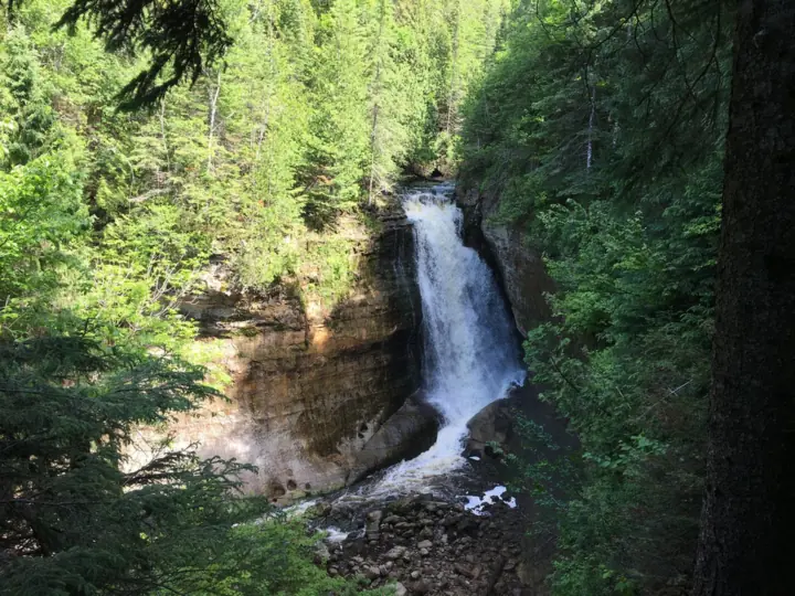
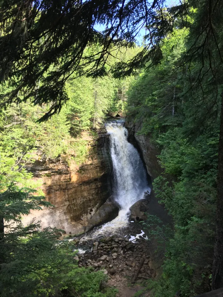
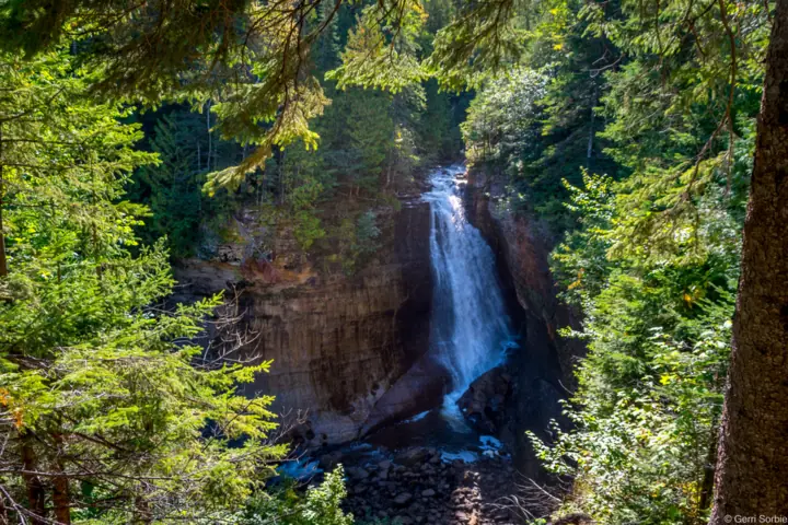
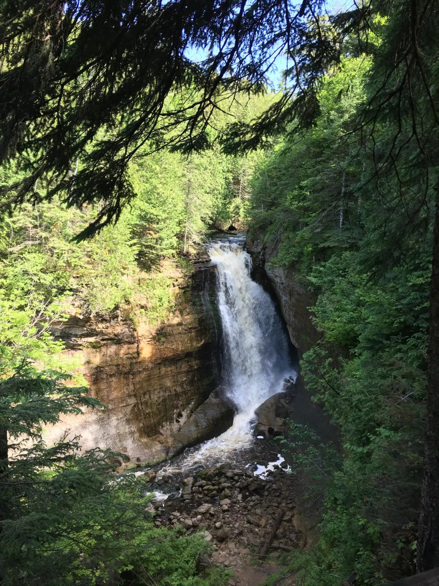
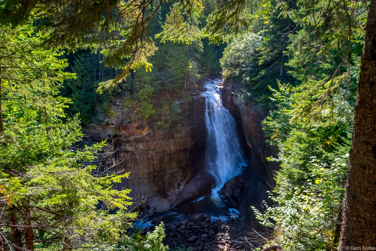
Miners Falls is where the Miners River drops about 50 feet over a sandstone outcrop in Pictured Rocks National Lakeshore, Michigan. NPS calls it the park's most powerful waterfall. An easy 0.6-mile path leads to two viewing platforms. A park entrance pass is required, leashed dogs are welcome, and the access road closes to vehicles from December 1 to March 31.
About Miners Falls
Miners Falls is in Pictured Rocks National Lakeshore, in Alger County, Michigan. The National Park Service manages it. NPS says "The fast-flowing Miners River drops about 50 feet over a sandstone outcrop."
NPS calls it "the park's most powerful waterfall." Wikipedia gives a lower figure: about 40 feet, with a 10-foot crest. We use the NPS height and show both.
What you'll find at the site
A gravel and dirt path leads through the northwoods to an upper and a lower overlook. NPS says you can enjoy views of the Miners Basin along the way.
The small parking lot has a seasonal vault toilet. NPS lists no other facilities at the trailhead.
Our map pin is the NPS place coordinate for Miners Falls. We use the same point for the directions button.
Getting there and parking
NPS places the parking lot 1/2 mile off Miners Castle Road (H-11), 4 miles north of Alger County Road H-58. NPS says to turn right onto the unpaved road and drive 1/2 mile to the lot.
We give no distance or drive time from nearby cities. Munising is the nearest town NPS names.
Vehicle length limit
The lot is small. The place page says vehicles longer than 32 feet "should not try to access this parking lot."
Another NPS page is stricter. It says longer vehicles "are prohibited from driving into the Miners Falls parking lot." Leave big RVs and trailers elsewhere.
Winter road closure
NPS plows only one park road, Sand Point Road. Miners Castle Road is not plowed, so it closes to vehicles from December 1 to March 31.
During those months, NPS treats unplowed roads as snowmobile trails, "CLOSED to ALL vehicles except snowmobiles." Roads reopen only when snow melts in spring.
In fall and spring, NPS says to check with the visitor center for road updates before driving these roads. Call the Munising Falls Visitor Center at 906-387-3700.
Map and nearby falls
Map loads as you scroll. Open in OpenStreetMap
OpenPartly open / seasonalUnconfirmedClosedLarger map
Miners Falls trail: 0.6 mile through the forest
NPS describes "an easy 0.6 mile walk through the forest." The walk from the parking area to the falls is 0.6 mile one way, so plan on about 1.2 miles round trip.
The path is gently rolling gravel and dirt. It ends at two viewing platforms, an upper and a lower one.
The steps to the lower platform
NPS says "There are 64 steps down to the lower viewing platform." You climb them again on the way out, so take your time.
Dogs
NPS lists the Miners Falls Trail as open to leashed pets. Dogs are welcome on the trail and at the viewing platforms.
Keep your pet on a leash no longer than 6 feet. Pets are not allowed in park buildings and should not be left unattended.
Accessibility
The NPS accessibility page, updated Oct 3, 2026, does not list Miners Falls as accessible. The trail is gravel and dirt, and the lower platform needs 64 steps.
Nearby Miners Castle has a short paved wheelchair-accessible trail, per NPS. For other options, call the park at 906-387-3700.
When to visit
NPS calls this an "especially beautiful trail in the springtime with abundant wildflowers." It adds that fall color season is another good time.
Pictured Rocks is open year-round, 24 hours a day, per NPS. Many roads close because of snow in winter, though.
Visiting in winter
From December 1 to March 31, you can't drive to the trailhead. NPS says winter access "requires a 3 mile ski or snowshoe trek in from the end of the plowed road."
That plowed road ends at the junction of Carmody and Miners Castle Roads. NPS says the falls form a 40-foot ice column in the coldest weather.
Check the NPS winter road closures page before a late fall trip. For another falls in the same park, see Munising Falls, whose trail NPS lists as closed.
| Height | 50 ftNote: about 50 feet per NPS; Wikipedia says about 40 feet |
|---|---|
| Trail | An easy 0.6-mile walk each way on a gently rolling gravel and dirt path, per NPS. That is about 1.2 miles round trip, with 64 steps down to the lower platform |
| Difficulty | NPS calls the trail "an easy 0.6 mile walk" through the forest. The 64 steps down to the lower platform mean a climb on the way back |
| Entry fee | Park entrance pass required. NPS says "All visitors must have one of these entrance passes." A private vehicle pass is $25 for 7 days, per person is $15 and the park annual pass is $45. No cash |
| Permit / reservation | A Pictured Rocks entrance pass is required; it covers all areas of the lakeshore, including Miners Falls |
| Parking | Small lot, no vehicles over 32 ft |
| Dogs | Allowed on the Miners Falls Trail and at the viewing platforms on a leash no longer than 6 feet (NPS). Pets are not allowed in park buildings and should not be left unattended |
| Swimming | No swimming rule listed. NPS asks visitors to stay on the trails and watch for uneven footing |
| Wheelchair / stroller | Not listed as accessible by NPS. The trail is gravel and dirt, with 64 steps down to the lower platform. Nearby Miners Castle has a short paved wheelchair-accessible trail |
| Best time to visit | NPS calls it an "especially beautiful trail in the springtime with abundant wildflowers, and also during fall color season" |
| Crowds | No crowd figure is published |
| Managed by | National Park Service, Pictured Rocks National Lakeshore |
Safety and swimming
Stay on the trail. NPS says "Please use caution while hiking to waterfalls. Stay on the trails and watch for uneven footing."
The 64 steps to the lower platform can be tiring on the climb back. Wear shoes with good grip.
NPS lists no swimming rule for Miners Falls. Keep children close at the overlooks.
Cell service is limited in parts of the park, per NPS. Download your pass and any maps before you arrive. Our waterfall safety guide has more tips.
Conditions change: confirm with the official source before you go.
Where to stay near Miners Falls
Compare hotels, cabins and rentals close to the falls around Munising.
See places to stay nearbyAffiliate link: we may earn a commission at no cost to you. Partners do not see or change our waterfall facts. Disclosure.
Photos
Miners Falls FAQ
Is Miners Falls open?
As far as we can tell, yes. On Nov 8, 2026, NPS listed no alert for Miners Falls or Miners Castle Road. Miners Castle Road will close to vehicles on December 1, 2026, until spring.
Can you visit Miners Falls in winter?
Yes, but not by car. From December 1 to March 31, Miners Castle Road is closed to all vehicles except snowmobiles. NPS says winter access takes a 3-mile ski or snowshoe trek.
How long is the Miners Falls trail?
NPS calls it "an easy 0.6 mile walk" one way, about 1.2 miles round trip. The path is gravel and dirt, with 64 steps down to the lower platform.
Do you need a pass for Miners Falls?
Yes. NPS says all visitors need an entrance pass. A private vehicle pass is $25 for 7 days, per person is $15 and the annual pass is $45. No cash.
Are dogs allowed at Miners Falls?
Yes. NPS lists the Miners Falls Trail as open to leashed pets, including the viewing platforms. The leash must be no longer than 6 feet.
How tall is Miners Falls?
NPS says the Miners River drops about 50 feet over a sandstone outcrop. Wikipedia says about 40 feet. In the coldest weather, NPS says the falls form a 40-foot ice column.
Is Miners Falls wheelchair accessible?
NPS does not list it as accessible. The trail is gravel and dirt, with 64 steps to the lower platform. Nearby Miners Castle has a short paved accessible trail.
Nearby waterfalls
Sources
- NPS: Miners Falls, Pictured Rocks National Lakeshore (height, trail, steps, parking, vehicle limit; read Nov 8, 2026)
- NPS: Pictured Rocks Waterfalls (trail, platforms, leashed pets, safety; updated Aug 19, 2026; read Nov 8, 2026)
- NPS: Pictured Rocks Winter Road Closures (December 1 to March 31; read Nov 8, 2026)
- NPS: Ice Climbing at Pictured Rocks (winter ski or snowshoe access, ice column; read Nov 8, 2026)
- NPS: Places to See in One Hour (parking lot directions, 32-ft vehicle rule; read Nov 8, 2026)
- NPS: Pictured Rocks Fees & Passes (updated Sept 12, 2026; read Nov 8, 2026)
- NPS: Pictured Rocks Pets (updated Sept 12, 2026; read Nov 8, 2026)
- NPS: Pictured Rocks Accessibility (updated Oct 3, 2026; read Nov 8, 2026)
- NPS: Pictured Rocks Operating Hours & Seasons (read Nov 8, 2026)
- NPS alert: Munising Falls Trail Closed Until Further Notice (the only active park alert on Nov 8, 2026)
- Wikipedia: Miners Falls (40-foot height figure; read Nov 8, 2026)
Last verified Nov 8, 2026 by The Waterfall Guide editorial team. Conditions change: confirm with National Park Service, Pictured Rocks National Lakeshore before you go. Spotted something out of date? Report a correction.