Right now
Right now as of Nov 13, 2026
- Permit None needed.
Status note (Nov 13, 2026): Open, as far as we can tell (checked Nov 13, 2026). The ODNR park page listed no closure. What the status labels mean
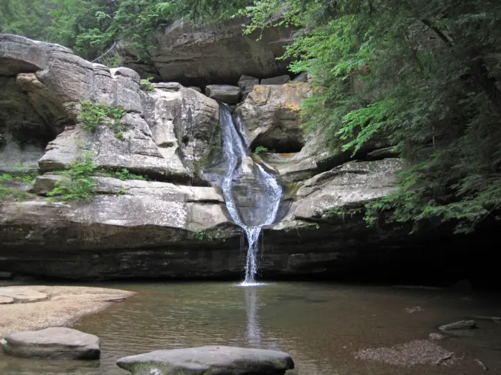
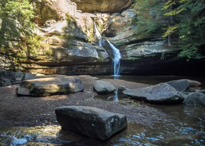
Cedar Falls is a waterfall at the head of a sandstone gorge in Hocking Hills State Park, Ohio. The Ohio Department of Natural Resources (ODNR) rates its trail moderate. ODNR gives two lengths: 1 mile on its park page and 0.4 mile on its trail map. ODNR gives no height. On Nov 13, 2026, ODNR's park page showed no closure.
About Cedar Falls
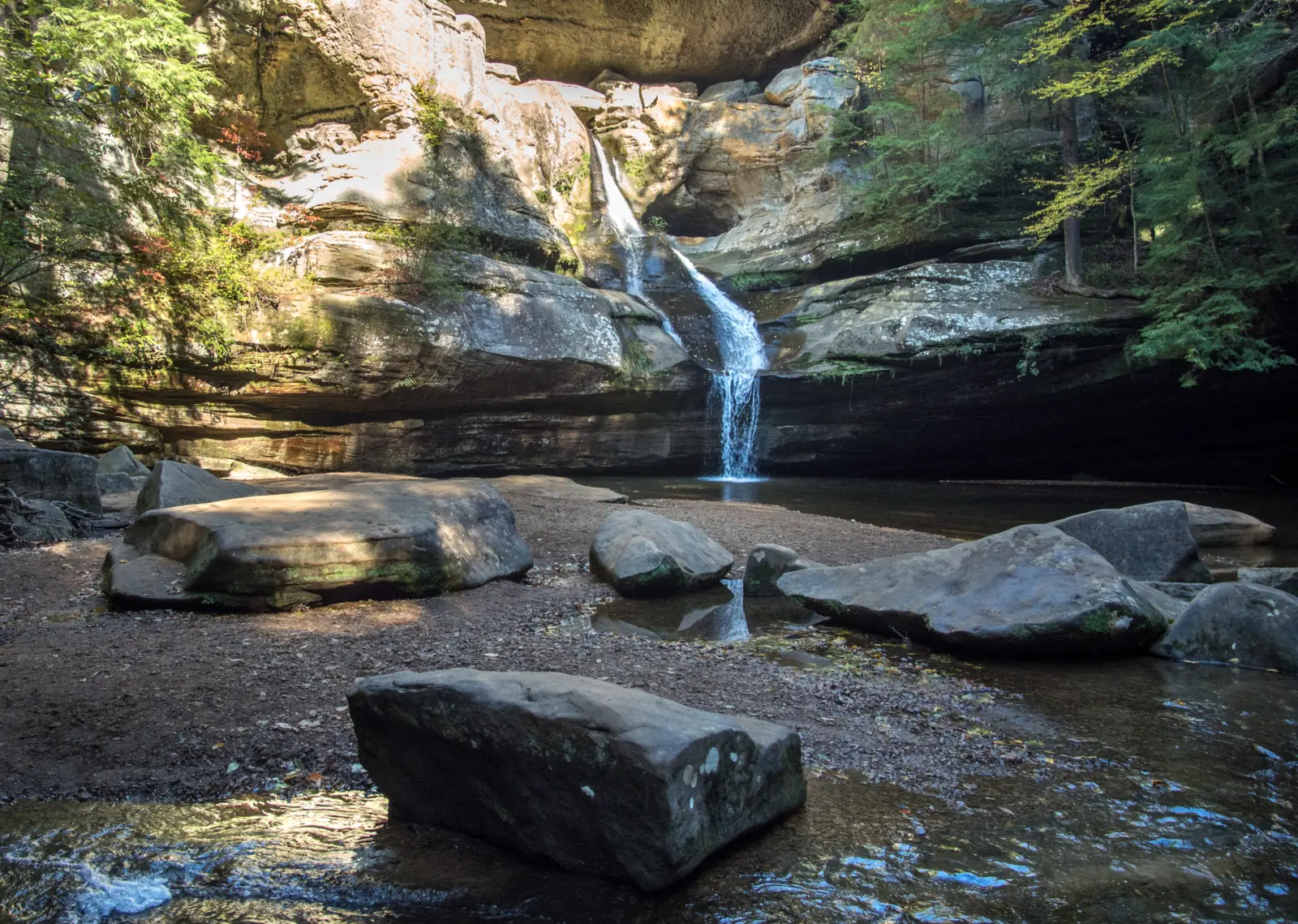
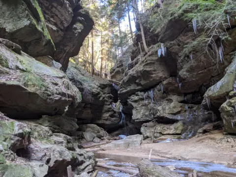
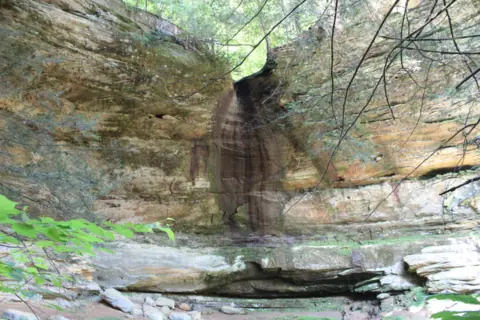
Cedar Falls sits at the head of Queer Creek Gorge, according to a Wikimedia Commons description by geologist James St. John. ODNR's Hocking Hills page praises the park's 'thrilling waterfalls' but gives no height for this one.
Explore Hocking Hills, the county tourism bureau, says the water plunges 50 feet. That is a secondary, unofficial figure, so we leave the height blank in our facts box. The bureau also claims it carries the greatest volume of any falls in Hocking County.
This page covers the Ohio falls in Hocking County. Do not confuse it with the Cedar Falls in Petit Jean State Park, Arkansas.
How the name came about
Explore Hocking Hills says early settlers mistook the gorge's hemlock trees for cedars, which gave the falls its name. We did not find this story on an ODNR page.
Geology
ODNR says the park's rock is Black Hand Sandstone, deposited over 350 million years ago. Its park page notes cross-bedding, honeycomb weathering and slump blocks. It adds that glacial runoff brought eastern hemlocks, Canada yew and birches to the gorges.
Park history
ODNR's park page says two Civilian Conservation Corps companies, 505 and 526, set up camps in the area in 1933. A search excerpt of an ODNR page credits the CCC with the Cedar Falls trails and steps. We could not open that page to confirm the details.
ODNR says the state bought 146 acres in 1924 and created the park in 1949.
About our map pin
Our map pin is the USGS GNIS point for Cedar Falls (feature ID 1075542), in Hocking County. By our math, it lies about 1.4 miles from our Old Man's Cave pin and about 2.0 miles from our Ash Cave pin, in straight lines.
Getting there and parking
The Cedar Falls parking lot is on State Route 374, per the ODNR park map. Street numbers for it conflict across ODNR excerpts and private sites, so we do not list one. Set your map app to the falls pin instead.
ODNR's park page says each trailhead lot has a picnic area with tables, grills and latrines. It also lists a reservable shelter house at Cedar Falls.
Fees
Ohio's Governor's office said on Sep 17, 2025 that all 76 state parks have free entry. We saw no entry or parking fee on ODNR's Hocking Hills park page or its park map, read Nov 13, 2026. We also found no permit or ticket for the trail. Confirm any charges with the park office.
Hours
ODNR says trails and picnic areas are open from half an hour before sunrise to half an hour after sunset. The park map asks visitors to exit trails before the park closes at dark.
Contact
The park office is at (740) 385-6842, 8am to 4:30pm on weekdays, per ODNR. The Visitor Center is not at this lot. ODNR places it at the Old Man's Cave lot off State Route 664, open daily 10am to 4pm, with seasonal changes.
Map and nearby falls
Map loads as you scroll. Open in OpenStreetMap
OpenPartly open / seasonalUnconfirmedClosedLarger map
The walk
ODNR gives two lengths for the walk to the falls. Its park page lists 'Cedar Falls - 1 mile - Moderate.' Its park trail map (Rev 06/2024) lists the Cedar Falls Trail at 0.4 mile, moderate, with a yellow blaze.
The map may measure a shorter segment than the park page does. We found no official walking time or elevation gain for either figure.
The Democracy Steps
ODNR says Akio Hizume designed a staircase in 1997 that descends gently from the parking lot to Cedar Falls. The park trail map also marks steps on the Cedar Falls Trail.
Many park trails have been rerouted for one-way hiking, ODNR says, so follow the directional signs. You must stay on the marked trails at all times.
Longer routes
The Gorge Overlook Trail runs 2.8 miles and is rated moderate on the ODNR trail map. The map shows it linking Cedar Falls with Rose Lake and Old Man's Cave.
The Grandma Gatewood Trail links Old Man's Cave, Cedar Falls and Ash Cave. The trail map lists it at 5.3 miles, rated difficult, with a blue blaze.
ODNR's park page says the Buckeye Trail and American Discovery Trail join it for 6 miles through the park, rated difficult. ODNR publishes no official distances for the segments between the three sites.
Dogs
Dogs are welcome on a leash. The ODNR park map says dogs must be on a 6 ft leash.
When to visit
ODNR gives no best season for Cedar Falls. TheHockingHills.org, a private site, says flow is strongest after rain in spring, fall and winter.
Winter
ODNR warns that park trails are typically covered in ice in winter and recommends ice cleats. Its park page also mentions ice formations as a winter draw.
ODNR lists the 61st Annual Winter Hike at Hocking Hills State Park, in an event page published Nov 11, 2026. Hockinghills.com, a commercial site, describes the route as Old Man's Cave to Cedar Falls to Ash Cave. It gives a January 2027 date, which we did not see from ODNR.
Status checks
On Nov 13, 2026, ODNR's Hocking Hills page showed no alert or closure for Cedar Falls, so we list it as open. Call the park office before a winter trip.
Nearby, Conkle's Hollow is a separate state nature preserve with its own gorge-head falls. See our Ohio waterfalls guide to compare them.
| Trail | ODNR's park page lists the Cedar Falls trail at 1 mile, moderate. ODNR's park trail map (Rev 06/2024) lists the Cedar Falls Trail at 0.4 mile, moderate, yellow blaze, with steps. The two may measure different segments |
|---|---|
| Difficulty | Moderate on the Cedar Falls Trail; difficult on the Grandma Gatewood Trail (ODNR) |
| Entry fee | Ohio state parks charge no entrance fee, per a Sep 17, 2025 Ohio Governor's office bulletin. ODNR's Hocking Hills park page and park map list no entry or parking fee (read Nov 13, 2026) |
| Permit / reservation | No permit or ticket listed by ODNR for the trails |
| Parking | Lot on SR 374; no fee listed |
| Hours / season | Trails 1/2 hour before sunrise to 1/2 hour after sunset (ODNR park page) |
| Dogs | Allowed on a leash. The ODNR park map says 'Dogs must be on a 6ft leash.' |
| Swimming | No. The ODNR park map says 'No swimming or wading in any water.' It also says visitors must remain on the trail at all times |
| Wheelchair / stroller | No official accessible designation. The ODNR trail map shows steps on the Cedar Falls Trail and marks only Ash Cave as wheelchair accessible |
| Crowds | No official visitor figure found. |
| Managed by | Ohio Department of Natural Resources, Division of Parks and Watercraft |
Safety and swimming
Stay out of the water. The ODNR park map says 'No swimming or wading in any water.' It adds that all identified waterfalls can be seen from the trails.
Keep to the marked path. ODNR's park page says visitors must remain on the marked trails at all times, and it asks adults to supervise young children closely.
Do not climb the rock walls. ODNR places the area's rock climbing and rappelling site in the adjacent Hocking State Forest, not at Cedar Falls.
The park map warns hikers to use caution on muddy, wet or icy trails. The steps here can be slick, so wear shoes with grip. Read our waterfall safety guide before you go.
Where to stay near Cedar Falls
Compare hotels, cabins and rentals close to the falls around Logan.
See places to stay nearbyAffiliate link: we may earn a commission at no cost to you. Partners do not see or change our waterfall facts. Disclosure.
Photos
Cedar Falls FAQ
How tall is Cedar Falls in Hocking Hills?
ODNR gives no official height. Explore Hocking Hills, the county tourism bureau, says the water plunges 50 feet. Treat that as an unofficial figure.
How long is the Cedar Falls trail?
ODNR gives two figures. Its park page lists the Cedar Falls trail at 1 mile, moderate. Its 2024 park trail map lists 0.4 mile, moderate, with steps. The two may cover different segments.
What are the Democracy Steps at Cedar Falls?
An ODNR page summary we saw in site search says Akio Hizume designed a staircase in 1997. It descends gently down the hillside from the parking lot to Cedar Falls.
Is Cedar Falls wheelchair accessible?
We found no accessible designation. The ODNR trail map shows steps on the Cedar Falls Trail and marks only Ash Cave as wheelchair accessible in the park.
Can you swim at Cedar Falls?
No. The ODNR park map says no swimming or wading in any water, and visitors must stay on the trail.
Can I bring my dog to Cedar Falls?
Yes. The ODNR park map says dogs must be on a 6 ft leash.
Is there a fee to visit Cedar Falls?
Ohio's Governor's office said on Sep 17, 2025 that all 76 state parks have free entry. We saw no entry or parking fee on ODNR's park page or map, read Nov 13, 2026. Call the park office at (740) 385-6842 to confirm.
How far is Cedar Falls from Old Man's Cave and Ash Cave?
By our math, our Cedar Falls pin is about 1.4 miles from our Old Man's Cave pin and 2.0 miles from our Ash Cave pin, in straight lines. The Grandma Gatewood Trail links all three. ODNR gives no official segment distances.
Nearby waterfalls


Sources
Some facts credited to the Ohio DNR come from search-result excerpts of its official pages. Confirm fees and rules on the official site.
- ODNR: Hocking Hills State Park (trails, hours, picnic areas, history, geology; read Nov 13, 2026; no page date shown)
- ODNR: Hocking Hills trail map PDF (Rev 06/2024; read Nov 13, 2026)
- ODNR: Hocking Hills park map PDF (rules, parking; Rev 08/2024; read Nov 13, 2026)
- ODNR: Democracy Steps for Cedar Falls 1997 (via ODNR site search; published Oct 25, 2021; read Nov 13, 2026)
- ODNR: Winter Hike, Hocking Hills (61st annual; via ODNR site search; published Nov 11, 2026; read Nov 13, 2026)
- ODNR: Cedar Falls Parking Area Trails and Steps (New Deal page; via search excerpt only, not opened; Nov 13, 2026)
- Explore Hocking Hills: Cedar Falls (county tourism bureau; height, volume, name story; undated; read Nov 13, 2026)
- Wikimedia Commons: Cedar Falls (Hocking Hills, Ohio, USA) 7, description by James St. John (read Nov 13, 2026)
- TheHockingHills.org: Cedar Falls (private site; flow notes; last checked July 2026; read Nov 13, 2026)
- hockinghills.com: Winter Hike (commercial site; route and 2027 date; via search result; Nov 13, 2026)
- USGS GNIS: Cedar Falls, feature ID 1075542 (read Nov 13, 2026)
- Ohio Governor's office: free entry to all 76 state parks (Sep 17, 2025; read Nov 13, 2026)

Last verified Nov 13, 2026 by The Waterfall Guide editorial team. Conditions change: confirm with Ohio Department of Natural Resources, Division of Parks and Watercraft before you go. Spotted something out of date? Report a correction.