Right now
Right now as of Nov 7, 2026
- Permit No permit needed. Fee: no fee listed.
Status note (Nov 7, 2026): Open, as far as we can tell: on Nov 7, 2026, no USFS alert named Trail #624, Gold Camp Road or North Cheyenne Cañon. The USFS trail page, updated Aug 14, 2025, lists no closure. The city warns of ice, and during snow events the road may close for snow removal. What the status labels mean
St. Mary's Falls is a cascade on Buffalo Canyon Creek in the Pike National Forest, above North Cheyenne Cañon Park in Colorado Springs. The USFS says it drops 250 to 300 feet down a granite wall. You walk about 1 mile up closed Gold Camp Road, cross over Tunnel #3, then follow Trail #624. The USFS rates it moderate and publishes no total length. No fee is listed.
About St. Mary's Falls
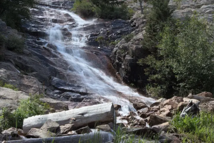
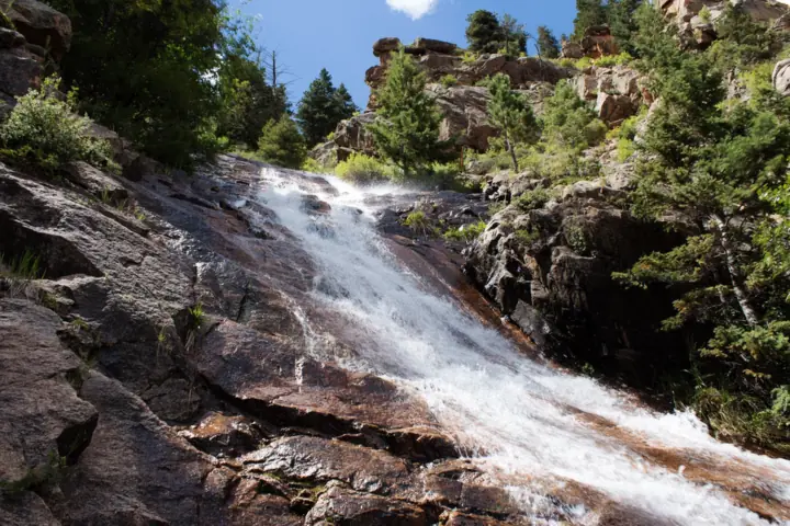
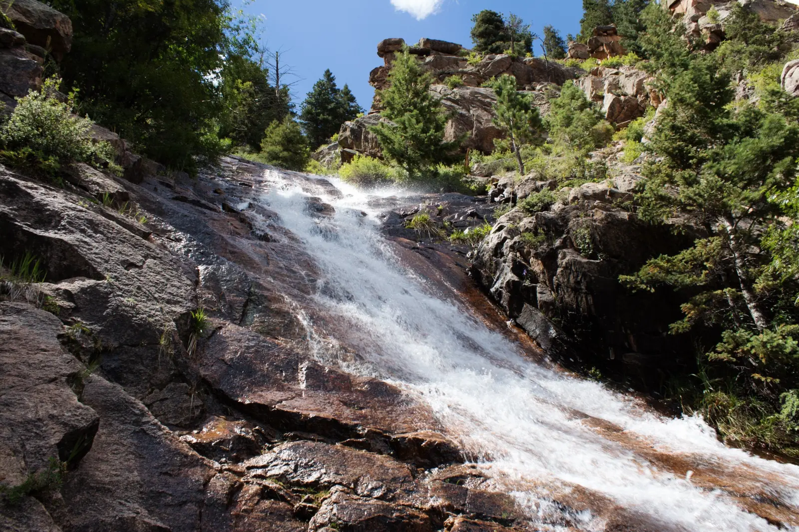
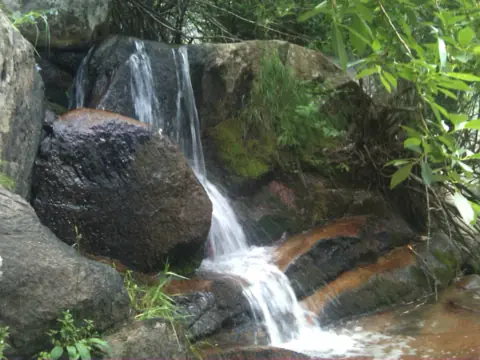
St. Mary's Falls is a cascade on Buffalo Canyon Creek in the Pike National Forest. The USFS says the falls "cascade down a granite wall 250-300 feet." The Pikes Peak Ranger District manages the trail.
You park and start in North Cheyenne Cañon Park, a City of Colorado Springs park. The city's park page calls St. Mary's Falls a U.S. Forest Service trail and points visitors to the USFS page for details.
The USFS describes a view of Colorado Springs from the falls area, with the Broadmoor Hotel in the foreground. It adds that trout may be seen in the creek.
Our map pin marks the falls, using the USGS GNIS point for Saint Marys Falls. We found no published coordinate for the Powell parking area, so the trailhead pin is the falls point too. Our directions button points to the falls, which you can't drive to. Navigate to Helen Hunt Falls and continue up to the Powell lot instead.
Getting there and parking
The USFS directions start in Colorado Springs: take 26th Street or Cheyenne Road to North Cheyenne Canyon Road. We found no official distance or drive time, so we don't give one.
The Powell parking area
Enter North Cheyenne Cañon Park and continue up the canyon. The USFS says to use the main "Powell" parking area, just above Helen Hunt Falls, where Gold Camp Road meets High Drive.
The city says North Cheyenne Canyon Road continues past Helen Hunt Falls to Gold Camp Road, where a large parking area serves hikers, bikers and runners. Our Helen Hunt Falls guide covers the falls just below the lot.
Road rules and gates
The city bans buses, RVs and oversized vehicles on North Cheyenne Canyon Road. Park hours are 5 a.m. to 10 p.m. from May 1 to Oct 31, and 5 a.m. to 9 p.m. from Nov 1 to Apr 30.
Gates lock each evening at closing, on North Cheyenne Cañon Road near Starsmore and at the north end of Gold Camp Road. The city says there is no cell service in the canyon.
Map and nearby falls
Map loads as you scroll. Open in OpenStreetMap
OpenPartly open / seasonalUnconfirmedClosedLarger map
St. Mary's Falls trail: Gold Camp Road, Tunnel #3 and Trail #624
The USFS publishes no total length for Trail #624. Its only distance is the walk of about 1 mile on closed Gold Camp Road before the trail begins.
Along closed Gold Camp Road
From the Powell lot, walk past the locked gate where North Cheyenne Canyon Road, Gold Camp Road and High Drive meet. This closed section of Gold Camp Road is Forest Service Road 370.
Over Tunnel #3
After about 1 mile you reach historic Tunnel #3, which is gated off at both ends. Take the trail on the left that goes up over the old tunnel. On the far side, look for Route Marker #624.
Up Buffalo Canyon Creek to the falls
The trail follows Buffalo Canyon Creek through mature aspen stands and mixed pine and spruce forest. It winds south and west to the St. Mary's Falls scenic area. The USFS rates it moderate.
Past the falls, the trail continues to Forest Service Road 381, near the motorized Nelsons Trail #672. Trail #624 itself is nonmotorized, and the USFS lists biking, hiking and horse riding.
Dogs
The city allows dogs on its park trail system, and they must be leashed. The USFS trail page gives no dog rule for Trail #624.
Accessibility
Neither the USFS nor the city gives accessibility information for this trail. The USFS rates it moderate, and the route climbs up and over a tunnel.
When to visit
The USFS trail page names no season of use and no best month for the falls, so we don't name one either.
Winter
The city warns that ice and wintry conditions may exist in the park. It asks for extreme caution on snow days, and the road may close for snow removal.
Camping and fires
The USFS permits camping along the trail and recommends sites 300 feet from any trail or stream. Use no-impact techniques and pack out everything you pack in.
Fire rules differ by land. The city prohibits fires, charcoal grilling and smoking in North Cheyenne Cañon, where you park and start. The USFS trail page says campfire permits are not required.
The USFS alerts list a Pike National Forest occupancy and use restrictions order dated May 3, 2024; read it for details. Check current fire restrictions before any trip. They also list prescribed fire planned forest-wide through 2026.
The city locks the park gates each evening. For park questions, call the Starsmore Visitor and Nature Center at (719) 385-6086.
Crowds
No visitor count is published for the trail. The city says more than 450,000 people visit North Cheyenne Cañon Park each year.
| Height | 250 ft (to 300 ft)Note: USFS: the falls cascade down a granite wall 250-300 feet |
|---|---|
| Trail | Starts on the closed part of Gold Camp Road (FSR 370), about 1 mile past the locked gate (USFS). It climbs over historic Tunnel #3, then follows Buffalo Canyon Creek on Trail #624. No total length is published |
| Difficulty | The USFS rates Saint Mary's Falls Trail #624 moderate |
| Entry fee | No fee listed on the USFS Trail #624 page or the City of Colorado Springs North Cheyenne Cañon Park page (both read Nov 7, 2026) |
| Permit / reservation | No permit listed for hiking. The USFS says campfire permits are not required, but the city prohibits fires in North Cheyenne Cañon |
| Parking | Powell lot above Helen Hunt Falls |
| Dogs | The city allows dogs on the North Cheyenne Cañon Park trail system, and they must be leashed. The USFS trail page gives no dog rule for Trail #624 |
| Swimming | Not listed. Neither the USFS trail page nor the city park page gives a swimming rule |
| Wheelchair / stroller | No accessibility information on the USFS or city pages. The USFS rates the trail moderate |
| Best time to visit | No official best month; the USFS trail page names no season of use |
| Crowds | No visitor count for the trail; the city says more than 450,000 people visit North Cheyenne Cañon Park each year |
| Managed by | USDA Forest Service, Pike-San Isabel National Forests (Pikes Peak Ranger District) |
Safety and swimming
Store food with bears in mind. The USFS alerts list a food storage order for bears on the Pike-San Isabel National Forests, dated Jun 6, 2023. The city says black bears and mountain lions live in the park.
Plan without a phone. The city says there is no cell service in the canyon, so save a map and tell someone your route.
Take care in winter. The city warns that the road is often icy on snow days.
Stay out of Tunnel #3. The USFS says it is gated off to entry at both ends.
Neither page lists a swimming rule. Wet granite near falling water can be slick, so keep back from the edge. Our waterfall safety guide has more.
Conditions change: confirm with the official source before you go.
Where to stay near St. Mary's Falls
Compare hotels, cabins and rentals close to the falls around Colorado Springs.
See places to stay nearbyAffiliate link: we may earn a commission at no cost to you. Partners do not see or change our waterfall facts. Disclosure.
Photos
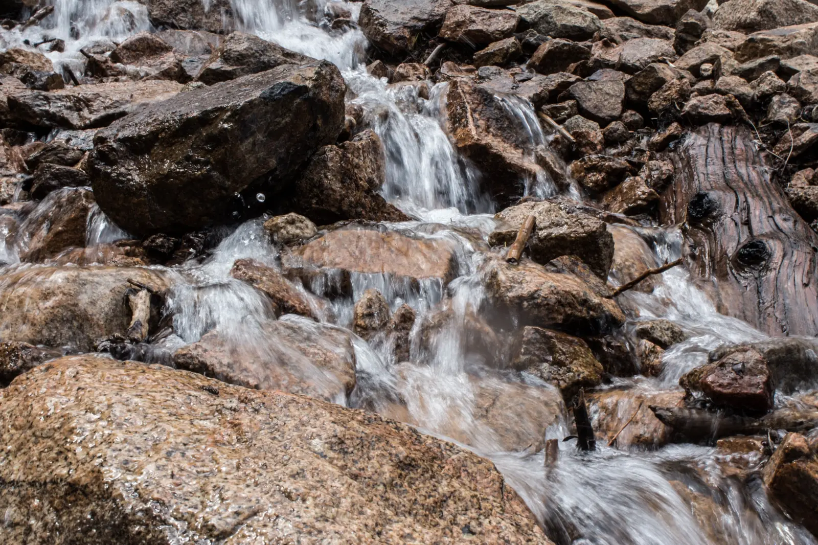
St. Mary's Falls FAQ
Is St. Mary's Falls open now?
As far as we can tell, yes. On Nov 7, 2026, no USFS alert named Trail #624, Gold Camp Road or North Cheyenne Cañon. The USFS trail page, updated Aug 14, 2025, lists no closure.
How tall is St. Mary's Falls?
The USFS says the falls cascade down a granite wall 250 to 300 feet. It gives a range, not a single height.
How long is the St. Mary's Falls hike?
The USFS publishes no total length. Its only figure is about 1 mile on closed Gold Camp Road before Tunnel #3. Route Marker #624 is on the far side of the tunnel.
Where do you park for St. Mary's Falls?
At the main "Powell" parking area just above Helen Hunt Falls, where Gold Camp Road meets High Drive (USFS). Buses, RVs and oversized vehicles are not allowed on North Cheyenne Canyon Road.
Are dogs allowed on the St. Mary's Falls trail?
The city allows leashed dogs on the North Cheyenne Cañon Park trail system. The USFS trail page gives no dog rule for Trail #624.
Can you camp or have a fire at St. Mary's Falls?
Fire rules differ by land. The city prohibits fires in North Cheyenne Cañon, where you park. The USFS trail page says campfire permits are not required on the trail, but check current restrictions first.
Is there a fee for St. Mary's Falls?
No fee is listed on the USFS trail page or the city's North Cheyenne Cañon Park page. Check both before you go.
Can you reach St. Mary's Falls in winter?
Winter park hours are 5 a.m. to 9 p.m., Nov 1 to Apr 30. The city warns of ice, and during snow events the road may close for snow removal. No official source says whether the trail is passable in winter.
Nearby waterfalls
 Helen Hunt Falls1 mi straight-line, by our mathOpen35FT
 Seven Falls2 mi straight-line, by our mathOpen181FT
 Rainbow Falls7 mi straight-line, by our mathSeasonal50FT
 Maxwell Falls60 mi straight-line, by our mathOpen
City guides: Waterfalls near Colorado Springs, CO · Waterfalls near Denver, CO
Sources
- USDA Forest Service, Pike-San Isabel: Saint Mary's Falls Trail #624 (route, height, difficulty, camping, directions; page updated Aug 14, 2025; read Nov 7, 2026)
- USDA Forest Service, Pike-San Isabel: Alerts (closures, occupancy and use restrictions, food storage order, prescribed fire; read Nov 7, 2026)
- City of Colorado Springs: North Cheyenne Cañon Park (hours, gates, road rules, dogs, fire ban, winter notice; read Nov 7, 2026)
- USGS GNIS via The National Map geonames service: Saint Marys Falls, El Paso County (feature 193405)
Last verified Nov 7, 2026 by The Waterfall Guide editorial team. Conditions change: confirm with USDA Forest Service, Pike-San Isabel National Forests (Pikes Peak Ranger District) before you go. Spotted something out of date? Report a correction.