Waterfalls near a city
Waterfalls near Duluth, Minnesota
The closest waterfall to Duluth in this guide is just over the state line in Wisconsin. Amnicon Falls is 16.1 straight-line miles away by our math, and Big Manitou Falls is 16.5.
6 waterfalls within 100 miles of Duluth
Distances are straight-line miles, by our math, from the US Census internal point of Duluth, MN, not driving distances, so check a route before you go. Each card links to a full guide with fees, parking and current status.
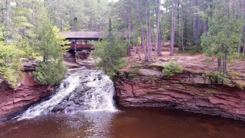
Three falls on the Amnicon River near Superior, seen from a short island trail with a covered bridge.
Amnicon Falls16 mi straight-line · No official ratingOpen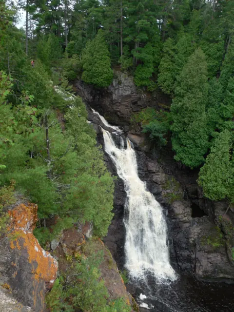
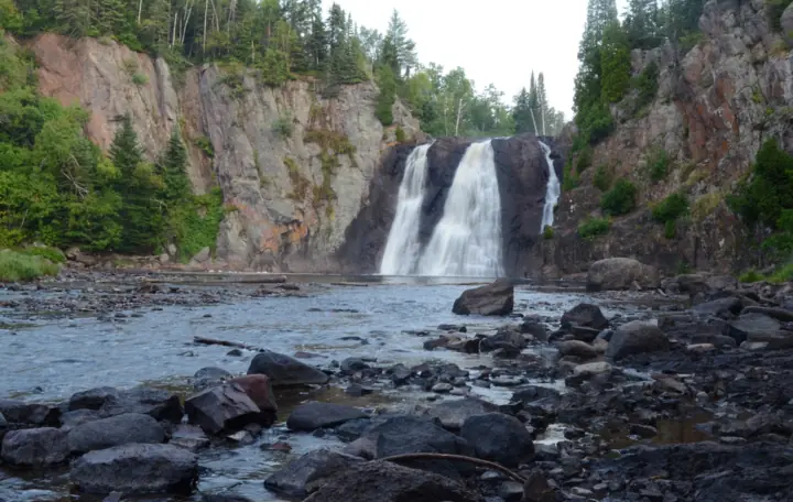
Wisconsin's highest falls, 165 feet on the Black River, seen from accessible overlooks south of Superior.
Big Manitou Falls16 mi straight-line · No official ratingOpen165FT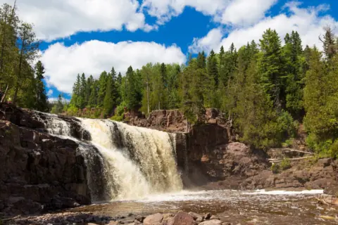
Paved path to the Middle Falls from a permit-free lot; open as of Oct 2026, with historic-building work underway.
Gooseberry Falls40 mi straight-line · EasyOpen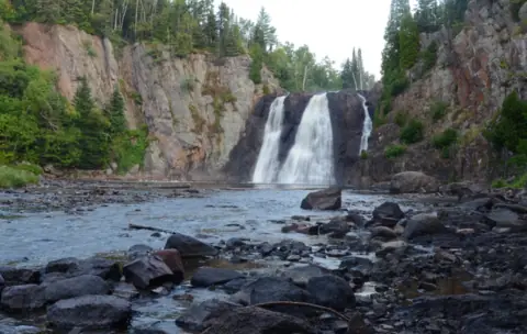
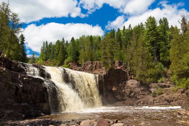
A 63-foot falls on the Baptism River, the highest completely within Minnesota per the DNR, on a 1.5-mile one-way trail.
High Falls59 mi straight-line · No official ratingPartly open63FT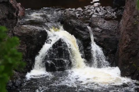
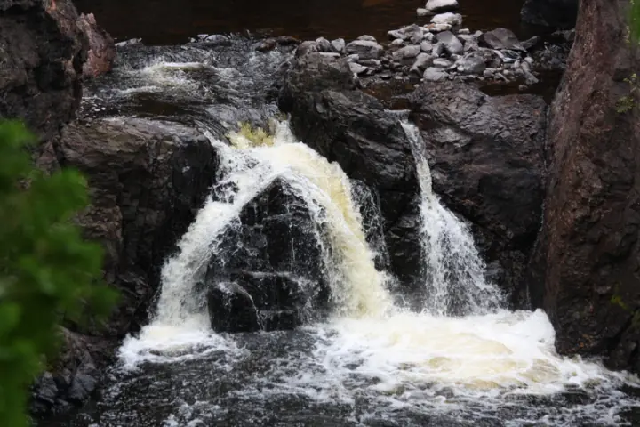
Two falls in a rock gorge near Mellen, seen from the 1.7-mile Doughboys Nature Trail loop.
Copper Falls76 mi straight-line · No official ratingOpen29FT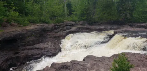
A short Gorge Trail from Highway 61 leads to a deck above Hidden Falls in Temperance River State Park.
Hidden Falls80 mi straight-line · No official ratingOpen
Map of waterfalls near Duluth
Map loads as you scroll. Open in OpenStreetMap
OpenPartly open / seasonalUnconfirmedClosedLarger map
Compare the waterfalls near Duluth
| Waterfall | Distance | Status | State | Height | Trail | Difficulty | Fee / permit | Swimming |
|---|---|---|---|---|---|---|---|---|
| Amnicon Falls | 16 mi | Open | WI | Not listed | 0.25 mi island trail (Wisconsin DNR) | No official rating | Vehicle sticker: $13 a day WI plates, $16 out of state (Wisconsin DNR) | Allowed with caution; no diving or jumping (Wisconsin DNR) |
| Big Manitou Falls | 16 mi | Open | WI | 165 ft | 0.5 mi overlooks trail (Wisconsin DNR) | No official rating | Vehicle sticker: $13 a day WI plates, $16 out of state (Wisconsin DNR) | Not in the river or at the falls; beach only (Wisconsin DNR) |
| Gooseberry Falls | 40 mi | Open | MN | Not listed | About 0.5 mi Upper/Middle loop | Easy | Free at Visitor Center lots; $7 permit elsewhere | No swimming at Upper Falls |
| High Falls | 59 mi | Partly open | MN | 63 ft | 1.5 mi one-way from the visitor center (MN DNR) | No official rating | Vehicle permit: $7 a day or $35 a year (Minn. Stat. 85.055) | DNR warns swimming can be dangerous |
| Copper Falls | 76 mi | Open | WI | 29 ft | 1.7 mi Doughboys loop (Wisconsin DNR) | No official rating | Vehicle sticker: $13 a day WI plates, $16 out of state (Wisconsin DNR) | Swim beach at Loon Lake, no lifeguards (Wisconsin DNR) |
| Hidden Falls | 80 mi | Open | MN | Not listed | 0.25 mi one-way Gorge Trail (MN DNR) | No official rating | Vehicle permit: $7 a day or $35 a year (Minn. Stat. 85.055) | Do not swim in the river (MN DNR) |
Where to stay near Duluth
Base yourself in Duluth, MN for a waterfall day. Open the map to compare hotels, cabins and rentals, or switch to tours and activities.
Or open the full stays map in a new tab
Affiliate links and map: we may earn a commission at no cost to you. The map loads from Stay22 only when you open it. Partners do not see or change our waterfall facts. Disclosure.
How the list breaks down
Our mileages start at the internal point the Census Bureau sets for the city of Duluth. They run in a straight line, so road trips will be longer. The circle reaches 100 miles and holds only falls we have published.
Three falls line Highway 61 on the North Shore. Gooseberry Falls is 40.4 miles out, High Falls at Tettegouche is 59.0, and Hidden Falls on the Temperance River is 80.1.
To the southeast, Copper Falls near Mellen is 76.2 miles away. Two more North Shore falls sit past our circle. Devil's Kettle is about 122 miles out by our math, and High Falls at Grand Portage about 146.
For more falls, see our Minnesota waterfalls and Wisconsin waterfalls guides.
Wisconsin side: Amnicon and Big Manitou near Superior
Amnicon Falls State Park sits about 7 miles east of the Superior city limits, per the Wisconsin DNR. A 0.25-mile island trail shows the Upper, Lower and Snake Pit Falls. The DNR calls its river walks relatively flat and easy.
Big Manitou Falls is in Pattison State Park. The Wisconsin DNR says it is 165 feet high, the tallest in Wisconsin. A 0.5-mile overlooks trail runs from the main picnic area, and the DNR lists accessible overlooks.
As far as we can tell (Nov 11, 2026), Amnicon's trails and the road to the falls are open. The DNR says the campground is closed through May 27, 2027. At Pattison, as far as we can tell (Nov 13, 2026), the DNR listed no trail or overlook closures.
DNR notices updated Aug 7, 2026 say Black River dam work starts in early 2027 and may affect the flow at Big Manitou.
North Shore on Highway 61: Gooseberry, Tettegouche and Temperance
Gooseberry Falls is a chain of drops in Gooseberry Falls State Park. A paved path reaches the Middle Falls in about 0.1 mile, per North Shore Visitor. As far as we can tell, the DNR alerts listed no trail closure on Oct 29, 2026. Call 218-595-7100 first.
High Falls at Tettegouche drops 63 feet on the Baptism River, per a Nov 24, 2025 DNR news release. The 2025 DNR park guide puts the High Falls Trail at 1.5 miles one way from the visitor center.
Tettegouche State Park is only partly open right now, as far as we can tell (Nov 13, 2026). The DNR has closed the inland side of Highway 61 for a special hunt, Nov 7 to 22, 2026. The alert does not name the trail, but by our reading it is closed. Call 218-353-8800.
Hidden Falls is in Temperance River State Park, near Schroeder. The DNR guide lists a 0.25-mile Gorge Trail from the Highway 61 lot, paved to a viewing deck. As far as we can tell (Nov 13, 2026), DNR alerts updated July 13, 2026 list no gorge closure.
Copper Falls to the southeast
Copper Falls State Park is about two miles northeast of Mellen, per the Wisconsin DNR. The DNR gives Copper Falls a 29-foot drop. The 1.7-mile Doughboys Nature Trail loop has overlooks of Copper Falls, Brownstone Falls and the Tyler Forks cascades.
The loop has rock stairs, and about 0.5 mile is universally accessible, per the DNR. Leave pets out of this loop, because the DNR bars them from the Doughboys trail.
As far as we can tell (Nov 13, 2026), the DNR conditions page showed no notices. The park phone is 715-274-5123.
Permits and fees: Wisconsin sticker, Minnesota vehicle permit
The three Wisconsin parks need a vehicle admission sticker, per the Wisconsin DNR. Rates in effect since Aug 19, 2025 are $13 a day for Wisconsin plates and $16 for out-of-state plates. Twelve-month stickers cost $28 and $50.
The Minnesota parks use a state park vehicle permit instead. Minn. Stat. 85.055 (2025) sets it at $7 for one day or $35 for a year. A trip to parks in both states needs both the Wisconsin sticker and the Minnesota permit, by our reading of the two fee pages.
Two Minnesota lots are exceptions. The DNR says you don't need a permit to park in the Gooseberry Falls Visitor Center lots on Highway 61. The Tettegouche guide says permits are required "EXCEPT at the Tettegouche Visitor Center parking lot."
Winter visits
Snow changes the walks. At Gooseberry, the DNR says the only maintained winter walking trail goes to the Upper Falls. It adds that lower paths can be icy, and it recommends cleats.
The Wisconsin DNR allows snowshoeing and winter hiking at Amnicon. At Copper Falls, two DNR pages disagree on whether part of the Doughboys trail closes in winter, so call ahead.
The Temperance River guide does not say whether the Gorge Trail is cleared of snow. Ask each park about ice on stairs and rock before you drive.
Waterfalls near Duluth: FAQ
What is the closest waterfall to Duluth?
Amnicon Falls in Wisconsin is the closest in this guide, 16.1 straight-line miles from Duluth's Census point by our math. Big Manitou Falls is a close second at 16.5 miles.
What is the tallest waterfall near Duluth?
Big Manitou Falls. The Wisconsin DNR puts it at 165 feet and calls it the highest in Wisconsin. On the Minnesota side, the DNR calls 63-foot High Falls at Tettegouche the highest completely within the state.
Do I need a permit to visit waterfalls near Duluth?
Usually. Wisconsin parks need a vehicle admission sticker, and Minnesota parks need a state park vehicle permit. The DNR says the Gooseberry Falls Visitor Center lots and the Tettegouche Visitor Center lot are exceptions.
Can I see High Falls at Tettegouche this month?
Probably not until after Nov 22, 2026. As far as we can tell, the DNR has closed the inland side of Highway 61 for a special hunt from Nov 7 to 22. By our reading that includes the falls. Call 218-353-8800.
Which waterfall near Duluth is easiest to reach?
Several have short walks. Our Gooseberry guide cites a paved path of about 0.1 mile to the Middle Falls. The Wisconsin DNR lists accessible overlooks at Big Manitou, and the DNR guide shows a paved stretch to the Hidden Falls deck.
Sources
Facts for each waterfall come from its own guide, where every source is listed. The city sources are below.
- Wisconsin DNR: Amnicon Falls State Park (read Nov 11, 2026)
- Wisconsin DNR: Amnicon Falls current conditions (campground notice; read Nov 11, 2026)
- Wisconsin DNR: Amnicon Falls recreation (winter use; read Nov 11, 2026)
- Wisconsin DNR: Pattison State Park (falls heights; read Nov 13, 2026)
- Wisconsin DNR: Pattison State Park current conditions (notices updated Aug 7, 2026; read Nov 13, 2026)
- Wisconsin DNR: Copper Falls hiking (Doughboys trail, pet rule, winter note; read Nov 13, 2026)
- Wisconsin DNR: Copper Falls current conditions (read Nov 13, 2026)
- Wisconsin DNR: State park admission rates (effective Aug 19, 2025; read Nov 13, 2026)
- MN DNR: Gooseberry Falls State Park alerts tab (read Oct 29, 2026)
- MN DNR: Gooseberry Falls State Park map and guide (Visitor Center lots, permit; summer edition; read Nov 13, 2026)
- MN DNR: Tettegouche State Park (alerts updated Nov 2, 2026; read Nov 13, 2026)
- MN DNR: Tettegouche State Park map and guide, 2025 (trail, permit; read Nov 13, 2026)
- MN DNR news release: New High Falls pedestrian bridge opens (dated Nov 24, 2025; read Nov 13, 2026)
- MN DNR: Temperance River State Park map and guide (read Nov 13, 2026)
- MN DNR: Temperance River State Park alerts (updated July 13, 2026; read Nov 13, 2026)
- Minnesota Statutes 85.055: State park fees (2025 edition; read Nov 13, 2026)
- US Census Bureau TIGERweb: Duluth city, GEOID 2717000, internal point (read Nov 13, 2026)
- North Shore Visitor: Gooseberry Falls (read Nov 13, 2026)
- Wisconsin DNR: Copper Falls geology (29-foot Copper Falls; read Nov 13, 2026)
- Wisconsin DNR: Copper Falls park information (address, phone, hours; read Nov 13, 2026)
- Wisconsin DNR: Copper Falls winter recreation (read Nov 13, 2026)
- Wisconsin DNR: Pattison State Park hiking (trail lengths, Little Manitou drop; read Nov 13, 2026)
- Wisconsin DNR: Pattison State Park recreation (accessible overlooks; read Nov 13, 2026)
- Wisconsin DNR: Amnicon Falls hiking (trail lengths; read Nov 11, 2026)
- MN DNR: Gooseberry Falls State Park, seasonal update (winter trail note; page modified Oct 7, 2026; read Oct 29, 2026)
State guides: Minnesota waterfalls, Wisconsin waterfalls. More cities.
Photos: Edward Morrissey, CC BY-SA 4.0; Mark Gustafson, CC BY-SA 4.0; Royalbroil, CC BY-SA 3.0. Photo credits