Waterfalls near a city
Waterfalls near Knoxville, Tennessee
From Knoxville, the first falls in this guide is Abrams Falls, 25 miles away as the crow flies at the Cades Cove end of the Smokies. It is a 25-ft ledge on a 5-mile round-trip trail. Laurel Falls, at 28 straight-line miles, has been closed for a full trail rebuild since January 6, 2025. Grotto Falls, 35 straight-line miles out, is open, but cars can use the road to its trailhead only through November 29, 2026.
10 waterfalls within 75 miles of Knoxville
Distances are straight-line miles, by our math, from the US Census internal point of Knoxville, TN, not driving distances, so check a route before you go. Each card links to a full guide with fees, parking and current status.
A 25-ft ledge falls 2.5 miles from Cades Cove; NPS strongly discourages swimming.
Abrams Falls25 mi straight-lineOpen25FT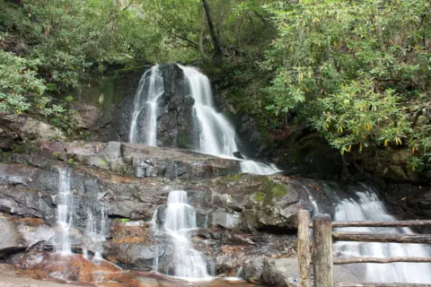
An 80-ft, two-tier falls on a paved trail, closed for rebuilding until 2027.
Laurel Falls28 mi straight-line · Not rated by NPS (paved)Closed80FT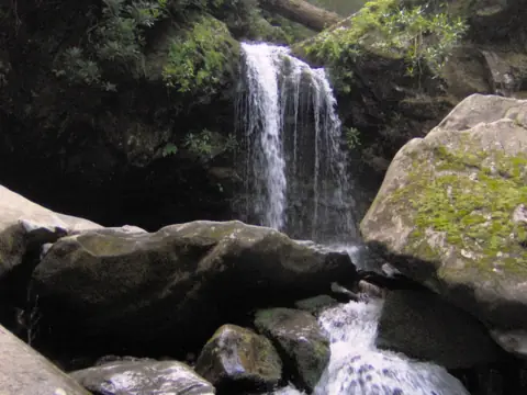
The only waterfall in the Smokies with a trail that runs behind it.
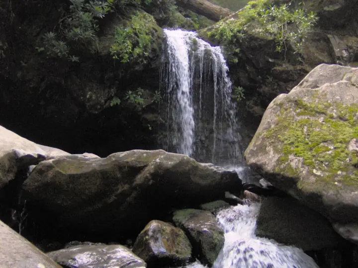
Grotto Falls35 mi straight-line · ModerateOpen25FT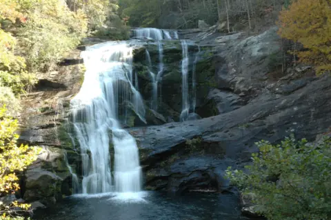
A 90-ft falls you can see from the bridge on Tellico River Road, open again after a long closure.
Bald River Falls46 mi straight-line · Roadside viewOpen90FT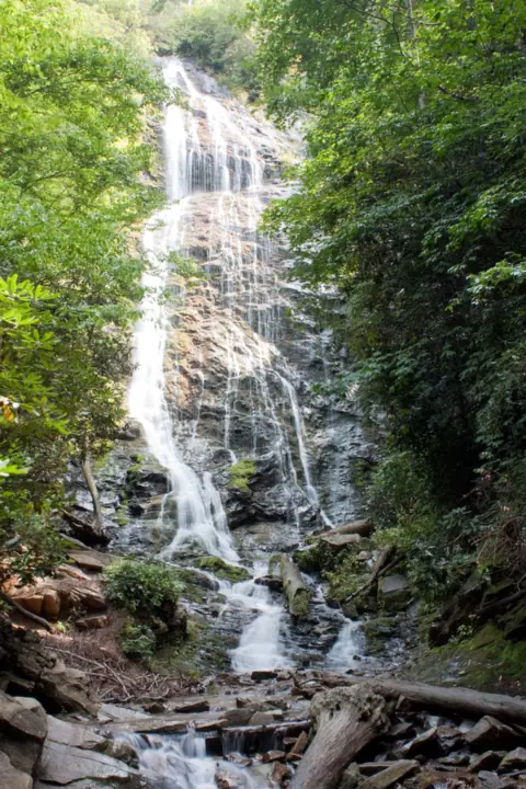
A 120-ft cascade on EBCI land, reached by 161 steep steps; free and open daily.
Mingo Falls48 mi straight-line · ModerateOpen120FT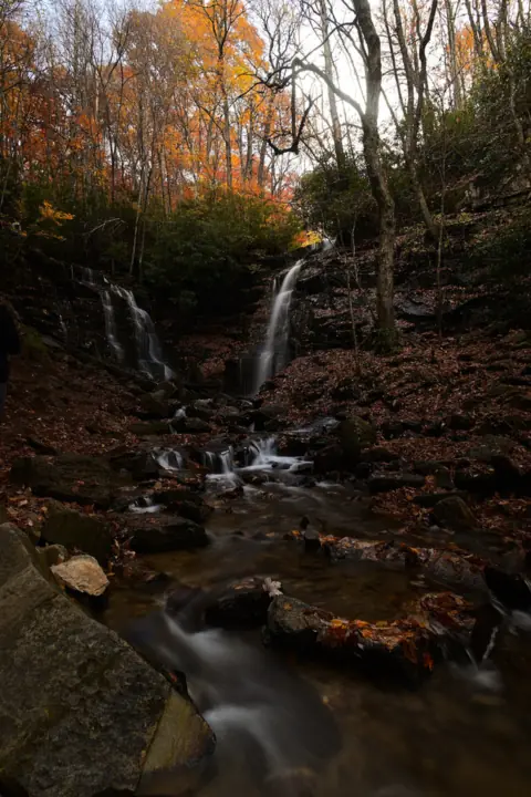
Two creeks meet in one pool on EBCI land; free, with a new lot and decks since 2025.
Soco Falls55 mi straight-line · EasyOpen120FT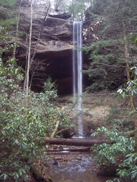
Kentucky's tallest falls, 113 ft per NPS, on a free 1-mile loop that passes behind it.
Yahoo Falls63 mi straight-line · Easy; steep stepsOpen113FT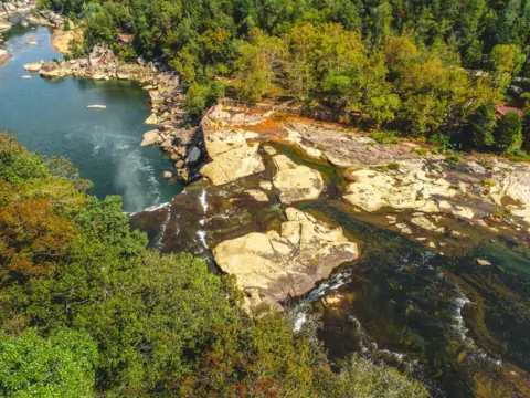
A 125-ft-wide curtain known for its moonbow on clear nights near a full moon.
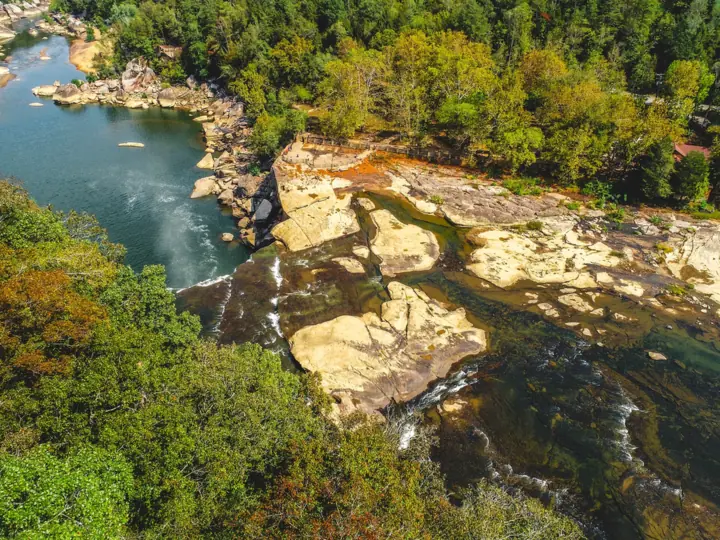
Cumberland Falls64 mi straight-linePartly open68FT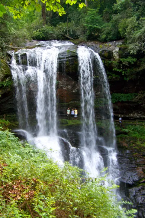
A 75-ft waterfall you can walk behind, steps from US-64 near Highlands.
Dry Falls74 mi straight-line · EasyOpen75FT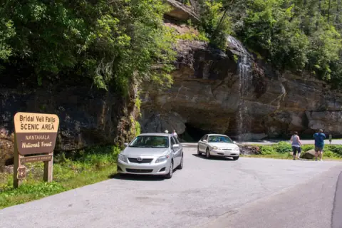
The old drive-under waterfall on US-64; now you walk behind it instead.
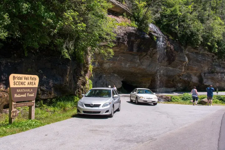
Bridal Veil Falls74 mi straight-line · EasyOpen45FT
Map of waterfalls near Knoxville
Map loads as you scroll. Open in OpenStreetMap
OpenPartly open / seasonalUnconfirmedClosedLarger map
Compare the waterfalls near Knoxville
| Waterfall | Distance | Status | State | Height | Trail | Difficulty | Fee / permit | Swimming |
|---|---|---|---|---|---|---|---|---|
| Abrams Falls | 25 mi | Open | TN | 25 ft | 5 mi round trip | $5 parking tag | Strongly discouraged | |
| Laurel Falls | 28 mi | Closed | TN | 80 ft | 2.6 mi paved | Not rated by NPS (paved) | $5 parking tag | Not recommended |
| Grotto Falls | 35 mi | Open | TN | 25 ft | 2.6 mi | Moderate | $5 parking tag | Not recommended |
| Bald River Falls | 46 mi | Open | TN | 90 ft | Roadside; Trail #88 is 5.6 mi one way | Roadside view | No fee listed | No rule listed |
| Mingo Falls | 48 mi | Open | NC | 120 ft | About 0.5 mi round trip | Moderate | Free | None listed |
| Soco Falls | 55 mi | Open | NC | 120 ft | About 0.2 mi | Easy | Free | No rule found |
| Yahoo Falls | 63 mi | Open | KY | 113 ft | 1 mi loop (NPS) | Easy; steep steps | Free | No NPS rule found |
| Cumberland Falls | 64 mi | Partly open | KY | 68 ft | Short walk to overlooks | Free entry | No | |
| Dry Falls | 74 mi | Open | NC | 75 ft | 0.2 mi | Easy | $3 / vehicle | No |
| Bridal Veil Falls | 74 mi | Open | NC | 45 ft | Roadside | Easy | No fee listed | No |
Where to stay near Knoxville
Base yourself in Knoxville, TN for a waterfall day. Open the map to compare hotels, cabins and rentals, or switch to tours and activities.
Or open the full stays map in a new tab
Affiliate links and map: we may earn a commission at no cost to you. The map loads from Stay22 only when you open it. Partners do not see or change our waterfall facts. Disclosure.
How the list breaks down
Our guide has 10 falls within 75 miles of Knoxville in a straight line, spread over Tennessee, North Carolina and Kentucky. The count covers only falls we have published, not every waterfall near the city. Three are in Great Smoky Mountains National Park. Bald River Falls is in the Cherokee National Forest near Tellico Plains, and two more are on the Qualla Boundary near Cherokee, NC.
North of the city, Kentucky adds Yahoo Falls and Cumberland Falls, 63 and 64 straight-line miles away. Cumberland is partly open: its lodge and restaurant closed for renovation on November 1, 2025, while the falls and park stay open. Two falls near Highlands, NC sit at the very edge of the radius, 74 straight-line miles out. For more, see the Tennessee and Kentucky guides.
Abrams Falls: the Cades Cove hike
The Abrams Falls Trailhead is at the end of Abrams Falls Road, between signposts 10 and 11 on the Cades Cove Loop Road, per NPS. That puts it about halfway around an 11-mile, one-way loop open from sunrise to sunset. NPS suggests allowing 2 to 4 hours for the loop drive alone, so start early.
The trail is 5 miles round trip on natural ground with roots, rocks and footlog bridges. NPS gives no difficulty rating. In 2026 crews replaced four footlog bridges and built new stairs at a steep, slick rock section. That work ended September 30. The trail is open as far as we can tell: the park's closures page, updated October 27, 2026, listed no Abrams closure.
Abrams Creek drops about 25 ft over a sandstone ledge into a deep pool. NPS strongly discourages swimming there because of an undertow and dangerous conditions. Dogs are not allowed on the trail. A pit toilet at the trailhead is open year-round.
Smokies parking tags, Laurel and Grotto
The park charges no entrance fee. Any vehicle parked more than 15 minutes at Abrams or Grotto needs a parking tag: $5 a day, $15 a week or $40 a year. NPS does not accept interagency passes in place of a tag. Daily and weekly tags are sold at the card-only machine at the Cades Cove entrance and on Recreation.gov.
Laurel Falls, 28 straight-line miles from Knoxville, is shut. Its paved 2.6-mile round trip leads to an 80-ft, two-tier falls. The Fighting Creek Gap trailhead on Little River Road is closed during construction. As listed October 27, 2026, NPS anticipates reopening the trail sometime in 2027.
Grotto Falls is open on the 2.6-mile round-trip Trillium Gap Trail, which passes behind the 25-ft falls. You reach its trailhead on the Roaring Fork Motor Nature Trail, open to cars through November 29, 2026. NPS posted a bear warning for the trail on October 27, 2026.
Cherokee National Forest and the Qualla Boundary
Bald River Falls, 46 straight-line miles from Knoxville, is 90 ft by the Forest Service's figure. You see it from the Bald River Falls Bridge on Tellico River Road (FR 210), so no hike is needed. The site was closed from August 2023 for repairs and a bridge replacement. On Nov 3, 2026, the Forest Service page said the falls are "now open."
Parking at Bald River is limited, and the Forest Service suggests weekdays because use is high on weekends and holidays. Its page lists no fee and says potable water is not available. For a longer walk, Bald River Trail #88 starts at the falls parking area and runs about 5.6 miles one way.
Mingo Falls, at 48 straight-line miles, and Soco Falls, at 55, are on Eastern Band of Cherokee Indians land. Visit Cherokee lists both as free and puts each at about 120 ft, though ncwaterfalls.com gives Soco about 50 ft. Mingo is a short, steep climb of 161 steps. Soco is about 0.2 mile from a new EBCI lot, per ncwaterfalls.com.
Across the line in Kentucky
Yahoo Falls, in the Big South Fork National River and Recreation Area, is 113 ft. The National Park Service calls it Kentucky's tallest waterfall. A 1-mile loop passes behind the falls under a large rock shelter, and NPS calls it easy apart from some very steep metal steps. No entrance pass is needed, and dogs are allowed on a 6-ft leash.
Timing matters at Yahoo. Kentucky Tourism says the falls are reduced to a trickle in summer, so plan for spring after rain.
Cumberland Falls, near Corbin, is a curtain about 68 ft high and 125 ft wide. The main overlooks are a short walk from the lots, and Kentucky State Parks charges no general admission fee. Its DuPont Lodge stays closed through spring or summer 2027, though cabins and cottages can still be booked. Swimming is banned in state park waters outside designated areas.
At the edge: two walk-behind falls near Highlands
Dry Falls and Bridal Veil Falls are each 74 miles from Knoxville as the crow flies, on US-64 near Highlands, NC. You can walk behind both. Dry Falls is a 75-ft drop, per the Forest Service, on a paved path of about 0.2 mile with stairs. Day use costs $3 per vehicle. Bridal Veil is a roadside falls with no fee in official sources, and the old roadbed behind it is open to walkers only.
Waterfalls near Knoxville: FAQ
What is the closest waterfall to Knoxville?
Abrams Falls, 25 miles straight-line from Knoxville's Census point, in the Cades Cove area of Great Smoky Mountains National Park. The hike is 5 miles round trip, and parking more than 15 minutes needs a Smokies tag. Laurel Falls, the next nearest at 28 straight-line miles, is closed for a rebuild.
Is Laurel Falls open?
No. NPS closed the trail on January 6, 2025 for a full rebuild. As listed on October 27, 2026, it anticipates reopening sometime in 2027, and the Fighting Creek Gap trailhead is closed during construction. Abrams and Grotto are the open park falls on this list.
Which waterfalls near Knoxville need almost no walking?
Bald River Falls is the nearest roadside stop, 46 straight-line miles away; you view it from a bridge on Tellico River Road. At Cumberland Falls in Kentucky, the main overlooks are a short walk from the parking lots. Bridal Veil Falls near Highlands, 74 straight-line miles out, sits beside US-64.
Which waterfalls near Knoxville are free?
Yahoo Falls is free; NPS says no entrance pass is needed for Big South Fork. Kentucky State Parks charges no general admission at Cumberland Falls, and Visit Cherokee lists Mingo and Soco as free. The Smokies have no entrance fee, but Abrams and Grotto need a parking tag from $5 a day.
Can you swim at waterfalls near Knoxville?
Plan not to. NPS strongly discourages swimming at Abrams Falls because of an undertow and says swimming at Grotto is not recommended. Kentucky rules ban swimming in state park waters outside designated areas, which covers Cumberland Falls. Dry Falls is not a swimming spot. See our waterfall safety guide.
When can you see the Cumberland Falls moonbow?
On clear nights near the full moon. The remaining 2026 windows are November 22 to 26 and December 21 to 25, per WTVF. Cumberland Falls is 64 straight-line miles from Knoxville. For overlook hours on a moonbow night, call the park at 606-528-4121.
Sources
Facts for each waterfall come from its own guide, where every source is listed. The city sources are below.
- NPS: Abrams Falls
- NPS: Cades Cove
- NPS: Current cautions and closures (updated Oct 27, 2026)
- NPS: Park It Forward parking tags
- NPS: Laurel Falls
- NPS: Grotto Falls
- USFS Cherokee National Forest: Bald River Falls (updated June 10, 2025; read Nov 3, 2026)
- Visit Cherokee (EBCI): Waterfalls in Cherokee (Mingo Falls and Soco Falls)
- NC Waterfalls: Soco Falls
- NPS Big South Fork: Kentucky Trails (Yahoo Falls; updated Oct 14, 2026)
- NPS Big South Fork: Fees and passes (updated Mar 3, 2026)
- Kentucky Tourism: Waterfalls, Arches and Wildlife: Hiking Yahoo Falls (Jul 25, 2023)
- Kentucky State Parks: Cumberland Falls State Resort Park
- Kentucky State Parks: FAQs (read Oct 27, 2026)
- WTVF NewsChannel 5: Cumberland Falls moonbow (2026 schedule)
- 304 KAR 1:020 swimming restrictions
- USDA Forest Service: Dry Falls (last updated Sept 11, 2026)
- USDA Forest Service: Cullasaja Gorge (Bridal Veil Falls)
- US Census Bureau: 2024 Gazetteer Files (places)
State guides: Kentucky waterfalls, North Carolina waterfalls, Tennessee waterfalls. More cities.
Photos: Washuotaku, CC BY-SA 4.0; Brian Stansberry, CC BY 3.0; US Forest Service - Southern Region (USDA photo by Ben Childers), Public domain. Photo credits