Waterfalls near a city
Waterfalls near Bend, Oregon
Tumalo Falls is Bend's home waterfall, 13.0 straight-line miles west of town by our math. The Forest Service gives the drive as about 14.2 miles on Skyliners Road and Forest Road 4603.
7 waterfalls within 100 miles of Bend
Distances are straight-line miles, by our math, from the US Census internal point of Bend, OR, not driving distances, so check a route before you go. Each card links to a full guide with fees, parking and current status.
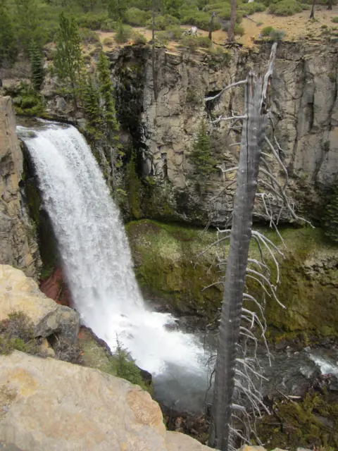
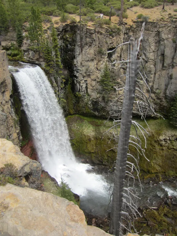
A 97-ft plunge near Bend, steps from the lot when the seasonal road is open.
Tumalo Falls13 mi straight-line · EasySeasonal97FT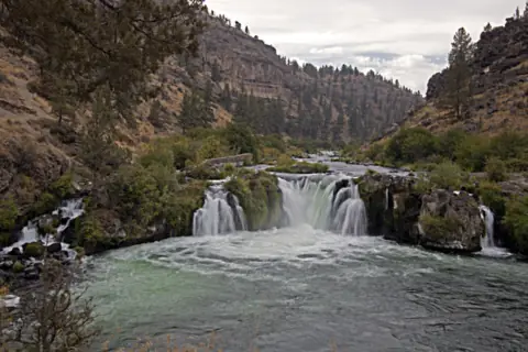
A falls on the Deschutes River below colorful canyon cliffs, about 0.5 mile down a relatively easy BLM trail with no fees.
Steelhead Falls25 mi straight-line · Relatively easy (BLM)Open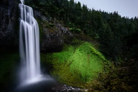
A 286-foot drop with an accessible platform 50 yards from the lot; normally closed in winter.
Salt Creek Falls51 mi straight-line · Easy (platform)SeasonalSINGLE DROP 286FT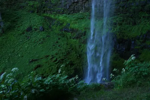
A two-tier falls in columnar basalt on the North Umpqua, 0.4 mi from the trailhead.
Toketee Falls79 mi straight-line · EasyOpen120FT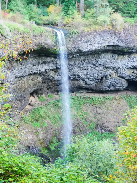
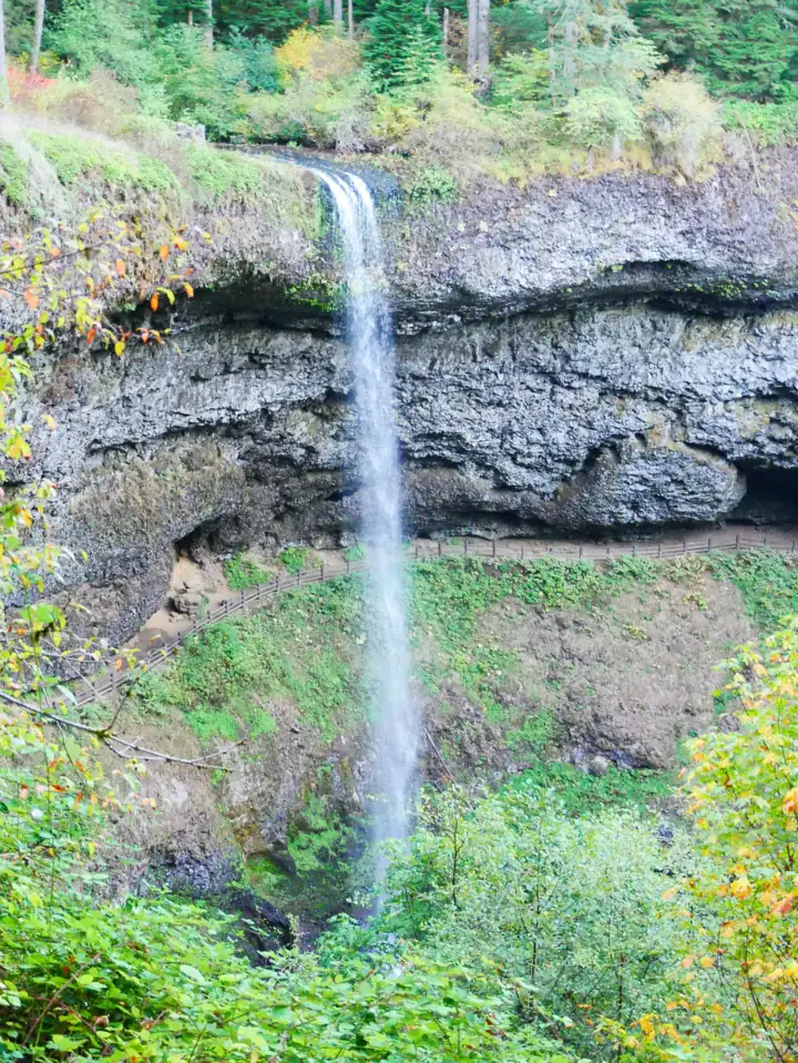
A 177-ft curtain you can walk behind, on Oregon's 7.2-mile Trail of Ten Falls.
South Falls (Silver Falls)88 mi straight-line · ModerateOpen177FT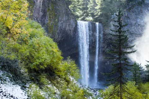
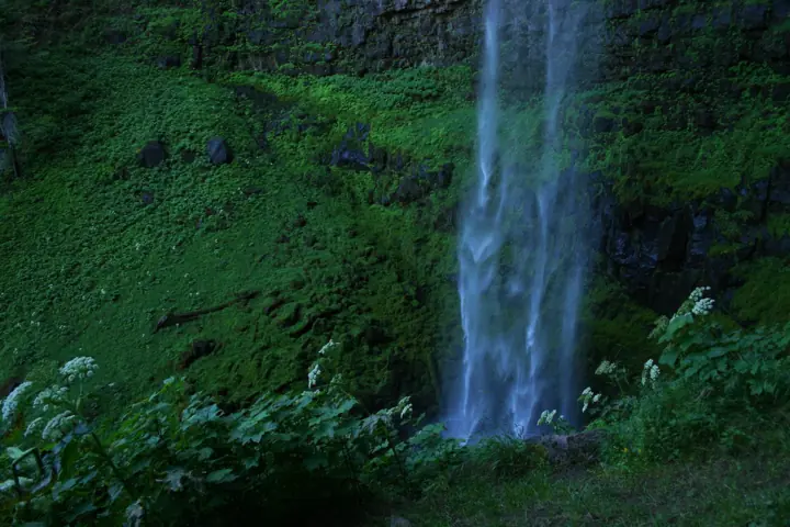
A curtain of about 100 feet on Cold Spring Creek; its usual trail is closed this winter, but Polallie Trailhead still leads there.
Tamanawas Falls94 mi straight-line · Not rated on the USFS pagePartly openABOUT 100FT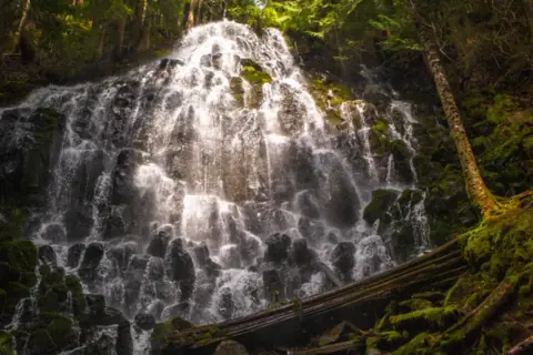
A popular waterfall in the Mount Hood Wilderness, reached by a 7-mile round trip with an unbridged glacial river crossing.
Ramona Falls94 mi straight-line · Challenging (USFS)Seasonal
Map of waterfalls near Bend
Map loads as you scroll. Open in OpenStreetMap
OpenPartly open / seasonalUnconfirmedClosedLarger map
Compare the waterfalls near Bend
| Waterfall | Distance | Status | State | Height | Trail | Difficulty | Fee / permit | Swimming |
|---|---|---|---|---|---|---|---|---|
| Tumalo Falls | 13 mi | Seasonal | OR | 97 ft | Near lot / 0.25 mi to top | Easy | $5 day pass or NW Forest Pass | None listed |
| Steelhead Falls | 25 mi | Open | OR | Not listed | About 0.5 mi to the falls, one short steep section (BLM) | Relatively easy (BLM) | No fees (BLM) | Listed as an activity (BLM) |
| Salt Creek Falls | 51 mi | Seasonal | OR | 286 ft (single drop) | 50 yd to the viewpoint | Easy (platform) | $5 per vehicle or a pass | No rule posted; viewing only |
| Toketee Falls | 79 mi | Open | OR | 120 ft | 0.8 mi round trip | Easy | No fee listed | No |
| South Falls (Silver Falls) | 88 mi | Open | OR | 177 ft | 1.0 mi / 7.2 mi loop | Moderate | $10-12 parking | Designated area only |
| Tamanawas Falls | 94 mi | Partly open | OR | about 100 ft | Usual trail closed; reach the falls from Polallie Trailhead | Not rated on the USFS page | $5 at Polallie Trailhead (USFS Passes page) | No rule listed |
| Ramona Falls | 94 mi | Seasonal | OR | Not listed | 7 mi round trip, about 1,000 ft gain, unbridged river crossing | Challenging (USFS) | $5 trailhead fee (USFS Passes page) | No official rule found |
Where to stay near Bend
Base yourself in Bend, OR for a waterfall day. Open the map to compare hotels, cabins and rentals, or switch to tours and activities.
Or open the full stays map in a new tab
Affiliate links and map: we may earn a commission at no cost to you. The map loads from Stay22 only when you open it. Partners do not see or change our waterfall facts. Disclosure.
How the list breaks down
We take every mileage from the Census Bureau's internal point for the city of Bend and draw a straight line, by our math. Driving routes will be longer. The radius is 100 miles, and we count only falls we have published.
Steelhead Falls on the Deschutes is 24.9 miles north. Over the Cascades, Salt Creek Falls is 51.1 miles away, Toketee Falls 78.5 and Silver Falls 87.5.
Two Mt. Hood falls sit near the edge. Tamanawas Falls is 93.9 miles out and Ramona Falls is 94.3. As far as we can tell (Nov 8, 2026), Tamanawas has a closed trail this winter, and the Forest Service closes the road to Ramona on Dec 1.
Multnomah Falls in the Columbia River Gorge is about 112 miles away by our math. Our Oregon waterfalls guide covers the rest of the state.
Closest to town: Tumalo and Steelhead
Tumalo Falls plunges 97 feet on Tumalo Creek, per Wikipedia. You can see it from near the lot, and a trail climbs about 0.25 mile to a platform above it, per Wikipedia. The North Fork Trail continues to Double Falls and Middle Tumalo Falls.
The lot is small. The Forest Service says it fills early and often overflows, and it bars vehicles over 27 feet. There are vault toilets but no drinking water.
Dog owners should read the map. The Forest Service bans dogs at all times inside the Bend Municipal Watershed, including the Bridge Creek Trail.
Steelhead Falls is a BLM site in the Deschutes canyon, reached through Terrebonne and Crooked River Ranch roads. The BLM puts the falls about 0.5 mile from the trailhead, calling the trail relatively easy with one small, steep section.
The BLM charges no fees there and lists the site as open year round. As far as we can tell (Nov 8, 2026), its pages showed no closure. It warns about rattlesnakes around rocks and brush. There is an outhouse but no potable water.
A long morning west: Salt Creek Falls
Of the falls we list, Salt Creek is the closest to Bend across the crest by our math, near Willamette Pass on Highway 58. The Forest Service gives its single drop as 286 feet.
The observation platform is about 50 yards from the parking lot and is wheelchair accessible, per the Forest Service. Day use costs $5 per vehicle, or you can show a Northwest Forest Pass or an interagency pass.
As far as we can tell (Nov 3, 2026), the Forest Service lists the site open. It also says the site is normally closed in winter. When it is, park at the Salt Creek Sno-Park and walk 0.4 mile along the road.
Full-day drives: Toketee and Silver Falls
Toketee Falls is on the North Umpqua River, reached by Forest Road 34 at OR-138 milepost 58.6, per the Forest Service. The trail is short, 0.4 mile each way, but has nearly 200 steps.
The Forest Service trail page, updated Aug 17, 2026, showed no closure, as far as we can tell (Oct 28, 2026). It lists no fee.
Silver Falls State Park lies farther northwest, near Silverton. Oregon State Parks lists four falls in the park that you can walk behind, South Falls among them. Its 7.2-mile Trail of Ten Falls loop is rated moderate.
Oregon State Parks says the park is open all year. As far as we can tell (Oct 28, 2026), it was open for day use. Check its alerts for trail closures, or call 503-873-8681.
Mt. Hood at the edge: Tamanawas and Ramona
Tamanawas Falls is on Cold Spring Creek on Mt. Hood's east slope. The Forest Service describes it as about 100 feet high and 40 feet wide.
A Forest Service alert dated Nov 4, 2026 closed Trail #650A and its trailhead for the winter. It cites unstable slope from a landslide, and it was still posted when we checked on Nov 8, 2026. The Forest Service says the falls can still be reached from Polallie Trailhead, 25 miles south of Hood River on Hwy 35.
As far as we can tell (Nov 8, 2026), a Grasshopper Fire closure order also covers parts of Hood River and Wasco Counties. Check its map before you go.
Ramona Falls is in the Mount Hood Wilderness, west of the mountain. The Forest Service calls the 7-mile round trip challenging. Hikers must cross the Sandy River, a glacial river with no bridge.
As far as we can tell (Nov 8, 2026), no Mt. Hood alert names the Ramona trail. The Forest Service lists the road to the trailhead, Forest Road 1825, as closed at milepost 0.7 from Dec 1 to Apr 1.
Which pass goes on the dashboard
- Tumalo Falls: a Northwest Forest Pass, a $5 day pass or ePass, or an America the Beautiful pass, per the Forest Service. Passes are sold on site.
- Salt Creek Falls: $5 per vehicle per day, or a Northwest Forest Pass or interagency pass (Forest Service).
- Silver Falls: an Oregon State Parks day-use parking permit, $10 a day for residents or $12 for others. Federal passes are not valid, Oregon State Parks says.
The other four stops follow their own rules.
- Steelhead Falls: "No fees," per the BLM.
- Ramona Falls: the Mt. Hood Passes page lists the trailhead at $5. An undated Forest Service guide also requires wilderness permits from May 15 to Oct 15.
- Toketee and Tamanawas: no fee or pass rule on the Forest Service trail pages we read.
November to April from Bend
Cold months close more of this list than any other season. The Forest Service shuts Forest Road 4603 to Tumalo to motor vehicles from about November to May. The Bend Bulletin reported last winter's gate closed in late November 2025.
The road stays open for skiing, snowshoeing, fatbiking and hiking, per the Forest Service. Expect about 2.5 extra miles each way. As far as we can tell (Oct 28, 2026), the Tumalo page showed no closure. The gate usually shuts in November, so it may already be closed.
On Mt. Hood, the Forest Service alerts require Sno-Park permits at designated winter parking areas from Nov 1 to Apr 30. Steelhead Falls is the reliable cold-season pick, since the BLM lists it open year round.
Waterfalls near Bend: FAQ
How far is Tumalo Falls from Bend?
About 14.2 miles by road, per the Forest Service, via Skyliners Road and Forest Road 4603. In a straight line it is 13.0 miles from Bend's Census point, by our math.
Can you drive to Tumalo Falls in winter?
Usually not. The Forest Service closes Forest Road 4603 to cars from about November to May. You can still walk, ski, snowshoe or fatbike in, adding about 2.5 miles each way.
Which waterfall near Bend has no fee?
Steelhead Falls. The BLM says "No fees" for the site. The Forest Service trail pages for Toketee and Tamanawas list no fee rule. At Tamanawas, Mt. Hood Sno-Park permits may apply from Nov 1 to Apr 30.
Can I bring my dog to Tumalo Falls?
Only on a leash in the day-use area, and not on watershed trails. The Forest Service bans dogs at all times inside the Bend Municipal Watershed, including the Bridge Creek Trail.
Is Tamanawas Falls open?
As far as we can tell (Nov 8, 2026), the usual trail is closed this winter, per a Forest Service alert of Nov 4, 2026. The Forest Service says you can still reach the falls from Polallie Trailhead.
Sources
Facts for each waterfall come from its own guide, where every source is listed. The city sources are below.
- USDA Forest Service: Tumalo Falls Day Use Area (directions, pass, road closure; updated Aug 14, 2026; read Oct 28, 2026)
- USDA Forest Service Deschutes: Seasonal dog leash restrictions (read Oct 28, 2026)
- Bend Bulletin: Last bout at Tumalo Falls (Nov 26, 2025; read Oct 28, 2026)
- Wikipedia: Tumalo Falls (height, platform trail; read Oct 28, 2026)
- BLM: Steelhead Falls Trail (trail, fees, directions, safety; read Nov 8, 2026)
- USDA Forest Service: Salt Creek Falls Observation Site and Picnic Area (Site Open, updated Mar 3, 2026; read Nov 3, 2026)
- USDA Forest Service Umpqua NF: Toketee Falls Trail #1495 (updated Aug 17, 2026; read Oct 28, 2026)
- Oregon State Parks: Silver Falls State Park (read Oct 28, 2026)
- USDA Forest Service, Mt. Hood: Tamanawas Falls Trail #650A (page updated Nov 4, 2026; read Nov 8, 2026)
- USDA Forest Service, Mt. Hood: Tamanawas Falls Trail closed due to instability hazards (alert start Nov 4, 2026; read Nov 8, 2026)
- USDA Forest Service, Mt. Hood: Alerts (Sno-Park permits; Grasshopper Fire closure order #06-06-01-27-01, updated Nov 6, 2026; read Nov 8, 2026)
- USDA Forest Service: Ramona Falls Trail #797 (updated Sept 18, 2026; read Nov 8, 2026)
- USDA Forest Service: Ramona Falls Trail #797 Recreation Opportunity Guide (PDF, undated; read Nov 8, 2026)
- USDA Forest Service: Mt. Hood National Forest Roads (FR 1825 seasonal closure; updated Apr 29, 2026; read Nov 8, 2026)
- USDA Forest Service: Mt. Hood Passes (Ramona Falls Trailhead $5; read Nov 8, 2026)
- US Census Bureau TIGERweb: Bend city, GEOID 4105800, Incorporated Places layer, internal point (read Nov 13, 2026)
State guides: Oregon waterfalls. More cities.
Photos: Rick Obst, CC BY 4.0; Another Believer, CC BY-SA 3.0; Markgorzynski, CC BY-SA 3.0. Photo credits