Waterfalls near a city
Waterfalls near Highlands, North Carolina
US-64 west of Highlands carries two of the town's three nearest falls in this guide. Bridal Veil Falls, 2 miles away as the crow flies, is a roadside stop with no fee listed. Dry Falls, 3 straight-line miles out, is 75 ft by the Forest Service's figure and costs $3 per vehicle. You can walk behind both. Southwest of town, Glen Falls is also 3 straight-line miles away, with a swimming hole at its third cascade, per the Forest Service.
18 waterfalls within 50 miles of Highlands
Distances are straight-line miles from the US Census Gazetteer internal point of Highlands, NC, not driving distances, so check a route before you go. Each card links to a full guide with fees, parking and current status.
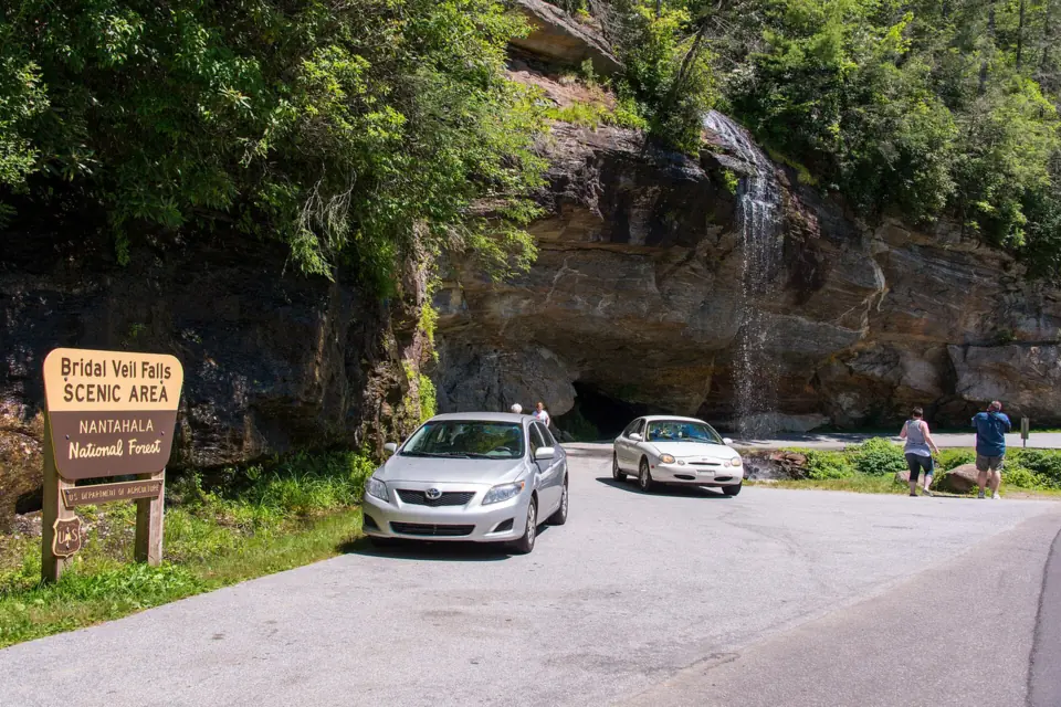
The old drive-under waterfall on US-64; now you walk behind it instead.
Bridal Veil Falls2 mi straight-line · EasyOpen45FT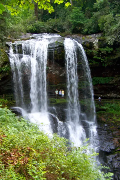
A 75-ft waterfall you can walk behind, steps from US-64 near Highlands.
Dry Falls3 mi straight-line · EasyOpen75FT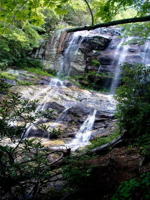
Three cascades southwest of Highlands; downhill on the way in, uphill all the way back.
Glen Falls3 mi straight-line · ModerateOpen70FT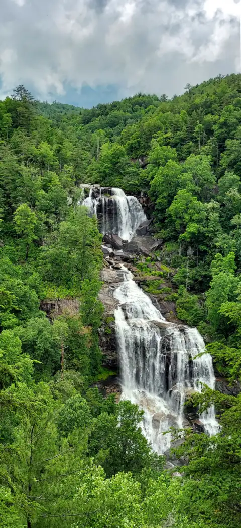
A 411-ft falls with a paved walk to the upper overlook and 154 steps to the lower.
Whitewater Falls11 mi straight-line · EasyOpen411FT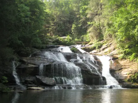
A 3.5-mile trail to a falls with a popular pool; the rec area is closed for Helene.
Panther Creek Falls28 mi straight-line · HardPartly open70FT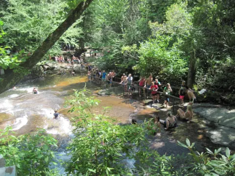
A 60-ft natural water slide into an 8 to 10 ft pool, with lifeguards in summer.
Sliding Rock29 mi straight-line · EasyOpen60FT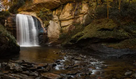
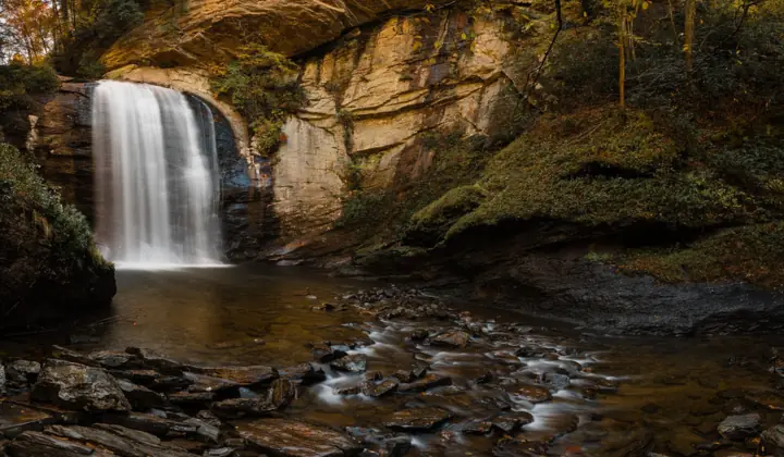
A 60-ft plunge you can see from the road, with stairs to the pool.
Looking Glass Falls29 mi straight-line · EasyOpen60FT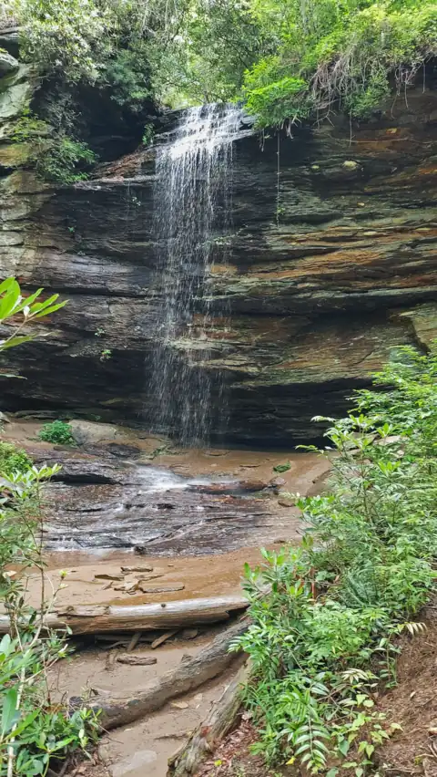
A 50-ft drop over a cave-like ledge, on a 0.7-mile easy trail (USFS) off US 276 near Brevard.
Moore Cove Falls30 mi straight-line · EasyOpen50FT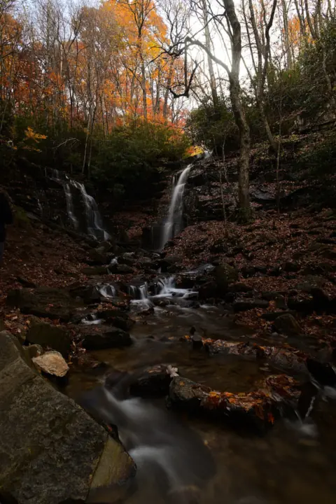
Two creeks meet in one pool on EBCI land; free, with a new lot and decks since 2025.
Soco Falls30 mi straight-line · EasyOpen120FT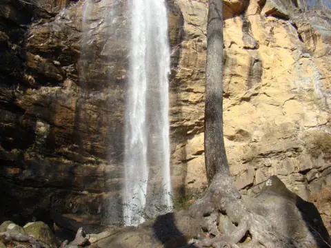
A 186-ft free fall on a university campus, 100 yards from the gift shop.
Toccoa Falls33 mi straight-line · EasyOpen186FT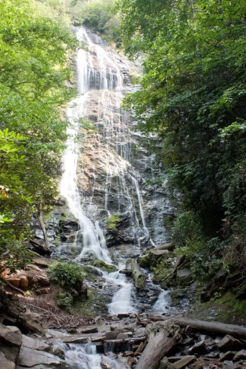
A 120-ft cascade on EBCI land, reached by 161 steep steps; free and open daily.
Mingo Falls33 mi straight-line · ModerateOpen120FT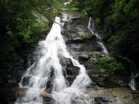
Five falls in a north Georgia scenic area, with decks at two of them.
High Shoals Falls34 mi straight-lineOpen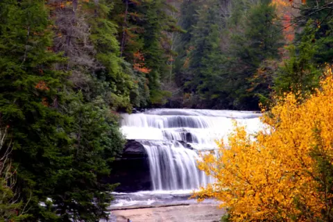
Two big DuPont falls on one trail; the stairs to Triple Falls' base are still closed.
Triple Falls & High Falls34 mi straight-line · Easy to moderatePartly open125FT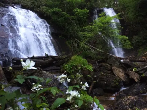
Twin falls of 153 and 50 ft at the end of a short paved trail near Helen.
Anna Ruby Falls36 mi straight-line · Easy, some steep bitsOpen153FT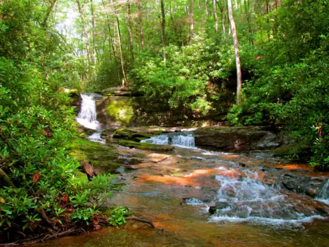
Dodd Creek splits an 80-ft cliff at the end of a 2.6-mile wilderness trail near Helen.
Raven Cliff Falls42 mi straight-line · ModerateOpen60FT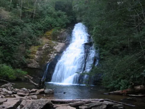
Two falls on Helton Creek near Vogel State Park, a short, easy walk from a roadside pullout.
Helton Creek Falls45 mi straight-line · Easy, abrupt grade changesOpen100FT COMBINED, 100+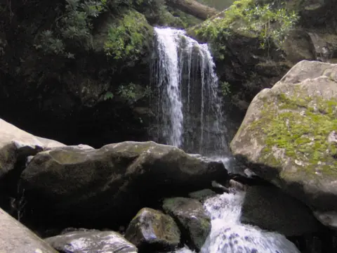
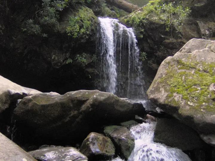
The only waterfall in the Smokies with a trail that runs behind it.
Grotto Falls45 mi straight-line · ModerateOpen25FT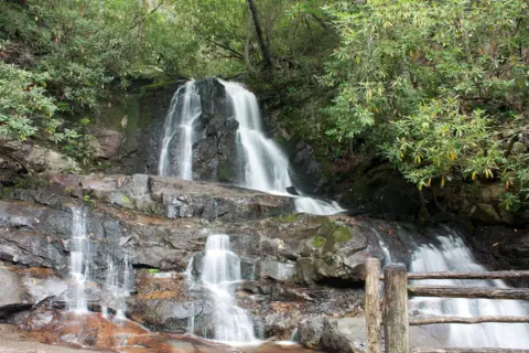
An 80-ft, two-tier falls on a paved trail, closed for rebuilding until 2027.
Laurel Falls49 mi straight-line · Not rated by NPS (paved)Closed80FT
Map of waterfalls near Highlands
Map loads as you scroll. Open in OpenStreetMap
OpenPartly open / seasonalUnconfirmedClosedLarger map
Compare the waterfalls near Highlands
| Waterfall | Distance | Status | State | Height | Trail | Difficulty | Fee / permit | Swimming |
|---|---|---|---|---|---|---|---|---|
| Bridal Veil Falls | 2 mi | Open | NC | 45 ft | Roadside | Easy | No fee listed | No |
| Dry Falls | 3 mi | Open | NC | 75 ft | 0.2 mi | Easy | $3 / vehicle | No |
| Glen Falls | 3 mi | Open | NC | 70 ft | 1-2 mi | Moderate | No fee listed | Swimming hole at the third falls (Forest Service) |
| Whitewater Falls | 11 mi | Open | NC | 411 ft | About 0.5 mi round trip | Easy | $3 / vehicle | Stay on trails |
| Panther Creek Falls | 28 mi | Partly open | GA | 70 ft | About 7 mi round trip (rec area lot closed) | Hard | $4 / vehicle (unconfirmed) | Popular (Recreation.gov) |
| Sliding Rock | 29 mi | Open | NC | 60 ft | Short walk | Easy | $6 / person | Yes (lifeguards in summer) |
| Looking Glass Falls | 29 mi | Open | NC | 60 ft | Roadside | Easy | No fee listed | Not recommended |
| Moore Cove Falls | 30 mi | Open | NC | 50 ft | 0.7 mi, easy (USFS) | Easy | No fee shown (USFS) | No rule found; stay off the top |
| Soco Falls | 30 mi | Open | NC | 120 ft | About 0.2 mi | Easy | Free | No rule found |
| Toccoa Falls | 33 mi | Open | GA | 186 ft | 100 yd | Easy | $2 | None listed |
| Mingo Falls | 33 mi | Open | NC | 120 ft | About 0.5 mi round trip | Moderate | Free | None listed |
| High Shoals Falls | 34 mi | Open | GA | Not listed | 1.2 mi (direction not stated) | Free | No rule found; FS warns of danger | |
| Triple Falls & High Falls | 34 mi | Partly open | NC | 125 ft | 1-2.2 mi | Easy to moderate | No fee listed | No (near falls) |
| Anna Ruby Falls | 36 mi | Open | GA | 153 ft | 0.8 mi round trip | Easy, some steep bits | $6 / person (16+) | No |
| Raven Cliff Falls | 42 mi | Open | GA | 60 ft | 5.2 mi round trip | Moderate | $5 / vehicle | Popular; no rock climbing |
| Helton Creek Falls | 45 mi | Open | GA | 100 ft (combined, 100+) | 0.2 mi, easy (USFS) | Easy, abrupt grade changes | No fee shown (USFS) | No rule found; stay on trail and deck |
| Grotto Falls | 45 mi | Open | TN | 25 ft | 2.6 mi | Moderate | $5 parking tag | Not recommended |
| Laurel Falls | 49 mi | Closed | TN | 80 ft | 2.6 mi paved | Not rated by NPS (paved) | $5 parking tag | Not recommended |
Where to stay near Highlands
Base yourself in Highlands, NC for a waterfall day. Open the map to compare hotels, cabins and rentals, or switch to tours and activities.
Or open the full stays map in a new tab
Affiliate links and map: we may earn a commission at no cost to you. The map loads from Stay22 only when you open it. Partners do not see or change our waterfall facts. Disclosure.
How the list breaks down
Add Whitewater Falls, 11 straight-line miles away toward Cashiers, and you have the four falls close to town. Everything else on the map is 28 to 49 miles from Highlands as the crow flies. That outer ring takes in north Georgia, three Forest Service stops near Brevard, DuPont State Recreational Forest, the Qualla Boundary and the Smokies.
Our count of 18 includes only waterfalls we have researched and published. The Forest Service names other roadside drops in the Cullasaja Gorge, among them Quarry Falls and Cullasaja Falls, that have no page here yet.
Closures reach the outer ring in Georgia, DuPont and the Smokies. Helene repairs have closed the parking area, picnic area and bathrooms at Panther Creek Falls in Georgia (Forest Service, updated April 17, 2026). For now, only intermediate and advanced hikers may use its trail. DuPont's closures page (Oct 27, 2026) still shows the base stairs and Turkey Knob bridge at Triple Falls & High Falls shut.
Over in the Smokies, Laurel Falls has had its whole trail under rebuild since NPS closed it on January 6, 2025. NPS expects it back sometime in 2027, per its listing of Oct 27, 2026.
Bridal Veil and Dry Falls: two walk-behind stops on US-64
Bridal Veil Falls is the nearer of the pair, 2 straight-line miles from Highlands. You park at pull-offs on the old US-64 loop, on either side of the falls. That old roadbed passes behind the water, and it is now closed to cars and open to people on foot. The Forest Service warns the path can be wet or icy and very slippery.
Height figures for Bridal Veil disagree. Wikipedia gives about 45 ft, while a Forest Service page says 120 ft.
Dry Falls, 3 straight-line miles out, has its own Forest Service lot on US-64. The Highlands Chamber lists the paved walk at about 0.2 mile, with several flights of stairs and 49 ft of ascent. If stairs are a problem, the Forest Service describes an accessible walkway from the lot to an overlook.
Plan Dry Falls around crowds and phone signal. The Forest Service reports very heavy use midday and on holidays, and it suggests mornings or evenings. Recreation.gov warns that cell service at the site is limited, so buy the $3 day pass before you head into the gorge. There are no restrooms and no potable water, per the Forest Service.
Glen Falls: three cascades and an uphill return
Glen Falls sits 3 miles southwest of Highlands in a straight line, at the end of a gravel road off NC-106. The trailhead lot is small. Neither the Forest Service nor the Highlands Chamber lists a fee.
The Chamber gives the three drops as about 70, 60 and 15 ft. Turning back at the upper-falls deck makes a walk of about 1 mile round trip. Continuing to the lowest falls doubles that to about 2 miles. The Chamber rates the full hike moderate and lists 784 ft of ascent. The trail descends on the way in, so that climb comes on the walk back to the car.
Of the four falls close to town, this is the only one where the Forest Service names a swimming hole. It sits at the third falls, and the agency calls it family friendly. The same Forest Service page flags very slippery ground around the falls, so keep children close. An undated Laurel Magazine listing says parts of the trail have washed away, though the Forest Service alerts page showed no closure on Oct 28, 2026.
Toward Cashiers: Whitewater Falls at 11 straight-line miles
Whitewater Falls sits 11 straight-line miles east of Highlands. Its upper falls drop 411 ft, a figure the Forest Service and Wikipedia agree on. From the lot, a paved walk to the upper overlook runs about 0.5 mile round trip. Below that, 154 wooden steps lead to a lower overlook, and you climb all of them again on the way back.
The fee ties Whitewater to Dry Falls. The latest official figure we found is $3 per vehicle per day, from a 2024 Forest Service fee proposal. That proposal would raise it to $5, but we found no final approval. A $15 annual pass is good at all three sites that share it: Whitewater, Dry Falls and Whiteside Mountain.
Recreation.gov says parking is not guaranteed, and vehicles left outside designated areas may be fined and towed. Restroom listings conflict between Recreation.gov and the Forest Service, so plan as if there are none.
The outer ring: 28 to 49 straight-line miles
Georgia accounts for six outer-ring falls. Panther Creek, 28 straight-line miles away, is the partly open one: about 7 miles round trip while its rec area lot stays closed. Toccoa Falls, 33 straight-line miles out on a university campus, is a 186-ft plunge at the end of a 100-yard graveled path. Entry is $2, and it may close around holidays and university breaks.
High Shoals Falls, 34 straight-line miles southwest near Hiawassee, GA, is in the High Shoals Scenic Area. Explore Georgia lists a 1.2-mile trail to observation decks at two falls, with free admission and parking. It is open, as far as we can tell, per the Forest Service alerts page of Nov 6, 2026.
Anna Ruby Falls is 36 miles off as the crow flies and charges $6 per person aged 16 and up. The two farthest Georgia stops sit at opposite ends of the effort scale. Raven Cliff Falls (42 straight-line miles) takes a 5.2-mile round trip and $5 per vehicle. Helton Creek Falls, 45 straight-line miles out, needs only a 0.2-mile stroll that the Forest Service rates easy.
Toward Brevard, three Forest Service stops lie 29 to 30 straight-line miles away. Looking Glass Falls is a roadside view with no fee listed. Moore Cove Falls takes 0.7 mile of trail by the Forest Service's figure, and the agency grades it easy. Sliding Rock is a natural water slide whose 2026 staffed season ended on Labor Day, so it has no lifeguards now.
DuPont's Triple Falls & High Falls, 34 straight-line miles away, are partly open, as noted above. Tree work was also set to close the High Falls kiosk path for a day on Nov 6, 2026, with Nov 10 as the rain date.
Visit Cherokee lists two falls on Eastern Band of Cherokee Indians land as free: Soco Falls at 30 straight-line miles and Mingo Falls at 33. In the Smokies, Grotto Falls, 45 straight-line miles out, needs a $5-a-day parking tag. Drive in soon: the Roaring Fork Motor Nature Trail, which reaches its trailhead, shuts to vehicles after November 29, 2026. Closed Laurel Falls sits at 49 straight-line miles.
Our North Carolina waterfalls guide maps the state's other falls, including those past the 50-mile straight-line radius.
Waterfalls near Highlands: FAQ
Is there one best waterfall to see in Highlands?
We don't rank falls, but the facts point different visitors to different stops. Dry Falls lets you walk behind a 75-ft falls for $3 per vehicle. Bridal Veil is a roadside walk-behind with no fee listed. Glen Falls suits a short hike of 1 to 2 miles round trip, with a swimming hole at its third falls, per the Forest Service.
How hard is the Soco Falls hike?
Not very. ncwaterfalls.com puts it at about 0.2 mile from the new EBCI lot and calls it easy, with one steep section. Wheelchair users are reported to reach the upper overlook, but not the lower deck beside the falls. Soco is 30 miles from Highlands as the crow flies, and Visit Cherokee lists it as free.
Where can I find a map of the Highlands waterfalls?
On this page. The map above plots all 18 falls by straight-line distance from the Census point for Highlands, and the table compares fees, trails and status. On the ground, Bridal Veil and Dry Falls are on US-64 west of town, with Bridal Veil the closer of the two. Glen Falls is off NC-106, and Whitewater is toward Cashiers.
Which falls near Highlands could claim to be the prettiest in North Carolina?
Looks are personal; height is not. Whitewater Falls drops 411 ft in its upper falls, per the Forest Service and Wikipedia. Triple Falls & High Falls are 125 ft each per Wikipedia, but the base stairs were closed as of Oct 27, 2026. Mingo and Soco are each about 120 ft, per Visit Cherokee.
How much does parking cost at the falls close to Highlands?
Of the four within 11 straight-line miles, two charge. Dry Falls is $3 per vehicle per day through Recreation.gov. Whitewater matches that $3 rate for now; a 2024 Forest Service proposal seeks $5, and we found no approval. Official sources list no fee for Bridal Veil, and neither the Forest Service nor the Highlands Chamber lists one for Glen Falls.
Is there anywhere to swim near Highlands?
Within 11 straight-line miles, only Glen Falls has a swimming hole named by the Forest Service, at its third falls. The two US-64 falls are for looking, not swimming. Farther out, Sliding Rock allows swimming if you can swim, but its 2026 lifeguard season ended on Labor Day. Recreation.gov calls Panther Creek's pool popular, though its rec area is partly closed.
Sources
Facts for each waterfall come from its own guide, where every source is listed. The city sources are below.
- USDA Forest Service: Cullasaja Gorge (Bridal Veil Falls)
- Wikipedia: Bridal Veil Falls (Macon County)
- USDA Forest Service: Dry Falls (last updated Sept 11, 2026)
- Recreation.gov: Dry Falls, Whitewater Falls and Whiteside Mountain day-use pass
- Highlands Chamber of Commerce: Dry Falls trail listing
- USFS: Glen Falls Trail #8 (updated Aug 15, 2025; read Oct 28, 2026)
- Highlands Chamber of Commerce: Glen Falls (directions and distances)
- Highlands Chamber of Commerce: Glen Falls trail listing
- The Laurel Magazine: Glen Falls listing (undated; washout caution)
- USFS National Forests in North Carolina: Alerts (read Oct 28, 2026)
- USDA Forest Service: Whitewater Falls (last updated Jan 5, 2026; Site Open)
- Recreation.gov: Whitewater Falls Pass
- USDA Forest Service: Panther Creek Recreation Area (updated Apr 17, 2026)
- Recreation.gov: Panther Creek Falls Picnic Area and Trailhead Pass
- University of Toccoa Falls: Visiting Toccoa Falls
- FIND Outdoors: Anna Ruby Falls (hours, admission, phone)
- Recreation.gov: Raven's Cliff Wilderness Trailhead Pass
- USFS Chattahoochee-Oconee National Forests: Helton Creek Falls (updated Apr 17, 2026; read Nov 3, 2026)
- USDA Forest Service: Looking Glass Falls Scenic Area (last updated Jan 20, 2026)
- USFS National Forests in North Carolina: Moore Cove Trail TR318 (updated Jan 21, 2026; read Nov 3, 2026)
- USDA Forest Service: Sliding Rock Recreation Area (last updated June 24, 2026)
- N.C. Forest Service: DuPont closures (last modified Oct 27, 2026)
- Visit Cherokee (EBCI): Waterfalls in Cherokee (Soco Falls and Mingo Falls)
- NC Waterfalls: Soco Falls
- NPS: Grotto Falls
- NPS: Laurel Falls
- Explore Georgia: High Shoals Falls (read Nov 4, 2026)
- USDA Forest Service: Chattahoochee-Oconee National Forest alerts (read Nov 6, 2026)
- US Census Bureau: 2024 Gazetteer Files (places)
State guides: Georgia waterfalls, North Carolina waterfalls, Tennessee waterfalls. More cities.
Photos: Washuotaku, CC BY-SA 4.0; LTreadwell, CC BY-SA 4.0; Brian Stansberry, CC BY 3.0. Photo credits